
Frankfort Kentucky stock illustrations
Browse 460+ frankfort kentucky stock illustrations and vector graphics available royalty-free, or search for frankfort kentucky skyline to find more great stock images and vector art.
Most popular
Frankfort City skyline black and white silhouette. Simple flat illustration for tourism presentation, banner, placard or web site. Cityscape with landmarks.

Frankfort Kentucky USA City Skyline in Paper Cut Style with Snowflakes, Moon and Neon Garland. Vector Illustration. Christmas and New Year Concept. Santa Claus on Sleigh.

Frankfort City skyline golden silhouette. Vector illustration. Simple flat illustration for tourism presentation, banner, placard or web site. Cityscape with landmarks.
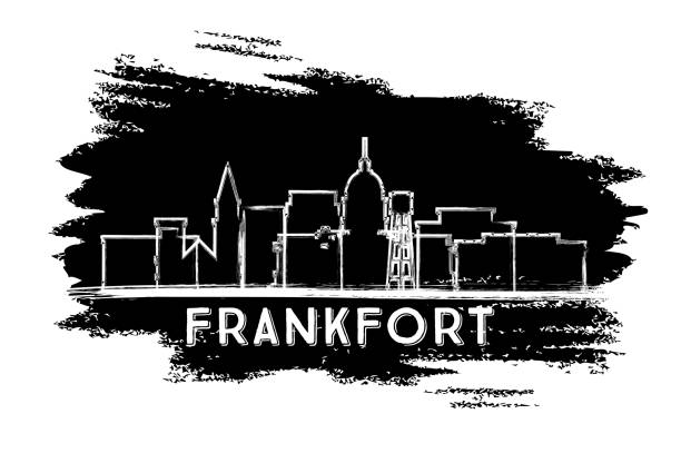
Frankfort Kentucky USA City Skyline Silhouette. Hand Drawn Sketch. Business Travel and Tourism Concept with Historic Architecture. Vector Illustration. Frankfort Cityscape with Landmarks.

Frankfort Kentucky city skyline vector silhouette illustration
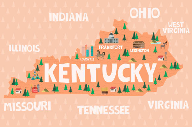
Illustrated map of the state of Kentucky in United States with cities and landmarks. Editable vector illustration

Frankfort Kentucky USA City Skyline with Gray Buildings Isolated on White. Vector Illustration. Business Travel and Tourism Concept with Modern Architecture. Frankfort Cityscape with Landmarks.
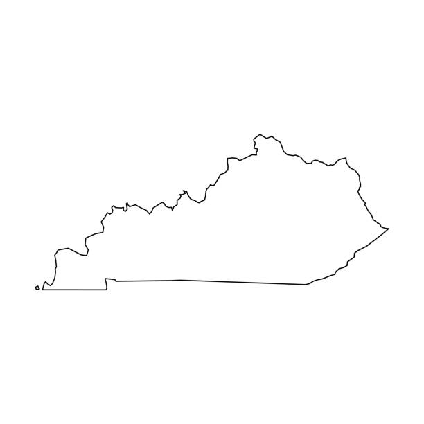
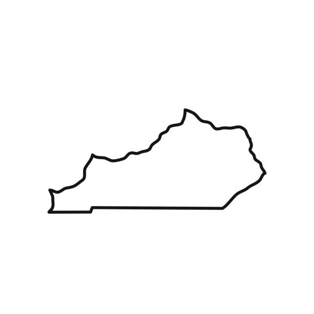
Kentucky, state of USA - solid black outline map of country area. Simple flat vector illustration.
kentucky state map concept
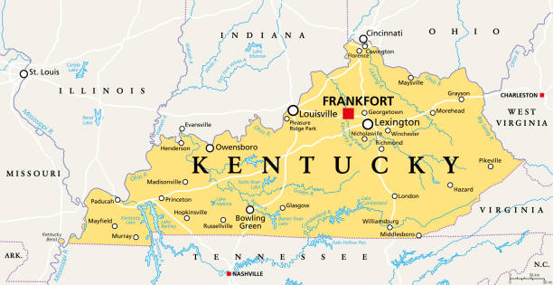
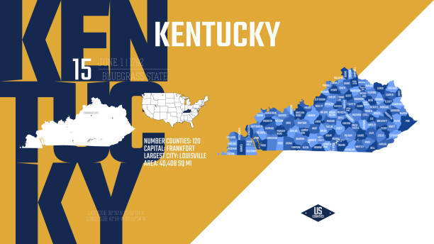
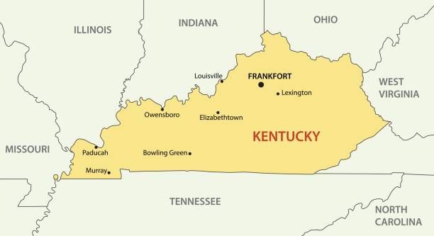
Kentucky, KY, political map with capital Frankfort and largest cities. Commonwealth of Kentucky. State in the Southeastern region of the United States of America. Bluegrass State. Illustration. Vector

vector illustration of Kentucky map
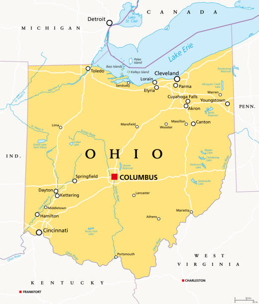
Ohio, OH, political map. State in East North Central region of Midwestern United States of America. Capital Columbus. The Buckeye State. Birthplace of Aviation. Heart of It All. Illustration. Vector.

Map of Kentucky for your own design. Three maps with editable stroke included in the bundle: - One black map on a white background. - One line map with only a thin black outline in a line art style (you can adjust the stroke weight as you want). - One map on a blank transparent background (for change background or texture). The layers are named to facilitate your customization. Vector Illustration (EPS file, well layered and grouped). Easy to edit, manipulate, resize or colorize. Vector and Jpeg file of different sizes.

Kentucky state USA map glowing silhouette outline made of stars lines dots triangles, low polygonal shapes. Communication, internet technologies concept. Wireframe futuristic vector illustration

blue abstract outline of Kentucky map
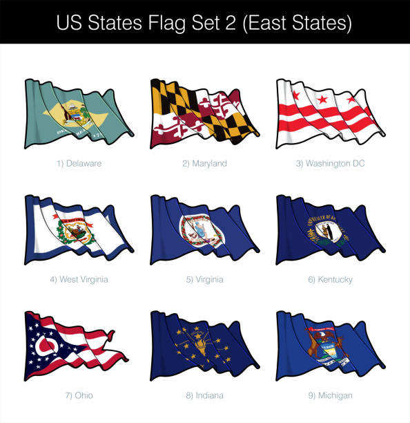
US East States Flag Set. The set includes the waving flags of Washington DC, Maryland, Delaware, West Virginia, Virginia, Kentucky, Ohio, Indiana n Michigan. Vector Icons all elements neatly on Layers

Frankfort Kentucky USA City Skyline with Color Buildings, Blue Sky and Copy Space. Vector Illustration. Tourism Concept with Modern Architecture. Frankfort Cityscape with Landmarks.
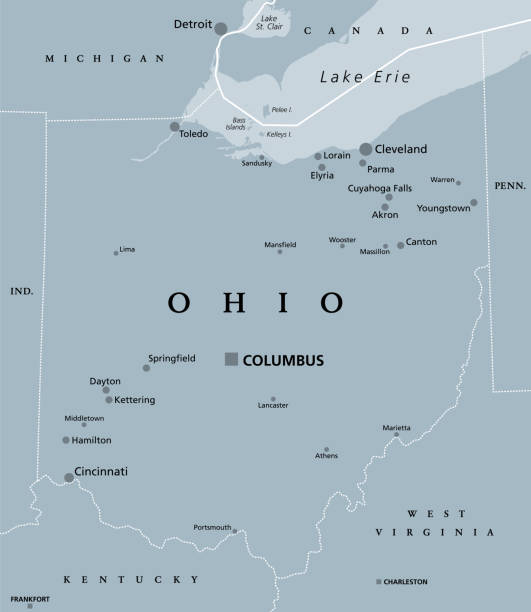
Ohio, OH, gray political map. State in the East North Central region of Midwestern United States. Capital Columbus. The Buckeye State. Birthplace of Aviation. The Heart of It All. Illustration. Vector

Map of Kentucky on a realistic wooden wall with a natural light.

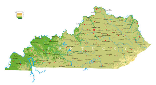
Highly detailed physical map of the Kentucky, in vector format,with all the relief forms,regions and big cities.

White map of Kentucky isolated on a trendy color, a blue green background and with a dropshadow. Vector Illustration (EPS10, well layered and grouped). Easy to edit, manipulate, resize or colorize.

United states Kentucky State Map

Map of Kentucky hand drawn on notebook. Top view of a wooden desk with office supplies, notebook, ruler, pencil color, pen, various pencil, ballpoint pen, highlighter, sticky note.

Map of Kentucky in a trendy vintage style. Beautiful retro illustration with old textured paper and a black long shadow (colors used: blue, green, beige and black). Vector Illustration (EPS10, well layered and grouped). Easy to edit, manipulate, resize or colorize.


Frankfort Skyline with Gray Buildings, Blue Sky and Reflections. Vector Illustration. Business Travel and Tourism Concept with Modern Architecture. Image for Presentation Banner Placard and Web Site.
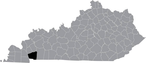
Black highlighted location map of the Trigg County inside gray map of the Federal State of Kentucky, USA

Map of Kentucky.
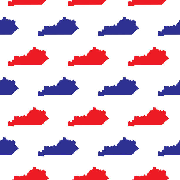
Vector illustration of blue and red Kentucky symbols on a white background.

White map of Kentucky isolated on a gray background with a long shadow effect and in a flat design style. Vector Illustration (EPS10, well layered and grouped). Easy to edit, manipulate, resize or colorize.

Vector silhouette of Kentucky in white with a drop shadow.

vector illustration of Kentucky map
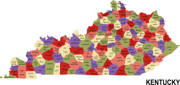
colorful flat map of the state Kentucky USA with counties, capital and cities

Made in Kentuky icon. Gray stamp with a round state flag.

vector illustration of Circle state flag of US federal state of Kentucky

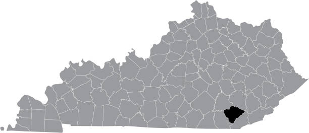
Downloadable county map of Kentucky state of United States of America. The map is accurately prepared by a map expert.
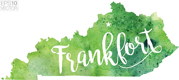
A highly detailed vector map of Frankfort, Kentucky with a multicoloured green hand painted watercolour texture. Map is isolated on a white background. "Frankfort" stylized text is added overtop with a star to indicate the location of the capital city.

Outline Frankfort Skyline with Blue Buildings and Copy Space. Vector Illustration. Business Travel and Tourism Concept with Modern Architecture. Image for Presentation Banner Placard and Web Site.
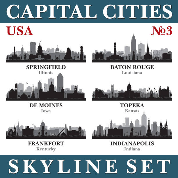
Capital cities skyline set. USA. Vector silhouette background illustration.

Frankfort Kentucky USA City skyline black and white silhouette. Simple flat illustration for tourism presentation, banner, placard or web site. Frankfort Cityscape with landmarks.

vector illustration of Kentucky map

Kentucky. Silhouette state. Kentucky map with text script. Vector outline Isolated illustratuon on a white background. Kentucky state map for poster, banner, t-shirt, tee.
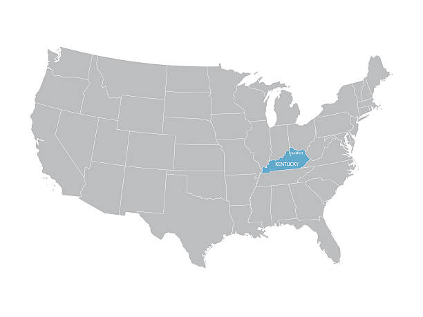
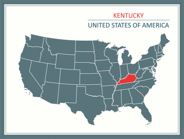
vector map of United States with indication of Kentucky

Stamp of "welcome to Kentucky" isolated on a blank background. The stamp is composed of the map in the middle with the name below and "Welcome to" at the top, separated by stars. The stamp is available in different colors (Multi color choice: black, red, orange, yellow, green, blue, purple, pink, brown and gray). Vector Illustration (EPS10, well layered and grouped). Easy to edit, manipulate, resize or colorize.

Black highlighted location map of the Knox County inside gray map of the Federal State of Kentucky, USA

Black highlighted location map of the Harlan County inside gray map of the Federal State of Kentucky, USA
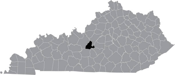
Black highlighted location map of the LaRue County inside gray map of the Federal State of Kentucky, USA

Kentucky, state of USA - solid black silhouette map of country area. Simple flat vector illustration.
Downloadable outline vector map of Kentucky state of United States of America.

vector illustration of Kentucky map
vector illustration of Badge of the State of Kentucky in colors of USA flag
Vector illustration of a red and blue ballot box with a white map of Kentucky on it.

Map of Kentucky created with thin black lines diagonally and a slight shadow, isolated on a blank background. Vector Illustration (EPS10, well layered and grouped). Easy to edit, manipulate, resize or colorize. Vector and Jpeg file of different sizes.