
Gulf Of Mexico Pictures, Images and Stock Photos
Browse 31,700+ gulf of mexico stock photos and images available, or search for gulf of mexico map or gulf of mexico fire to find more great stock photos and pictures.
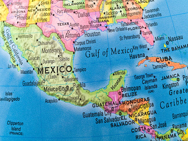
gulf of mexico map
gulf of mexico fire
gulf of mexico shrimp
gulf of mexico fishing
gulf of mexico oil platform
gulf of mexico oil
hurricane gulf of mexico
texas gulf of mexico
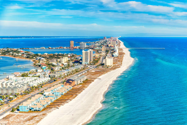
gulf of mexico aerial
the gulf of mexico
gulf of mexico water
gulf of mexico oil rig
oil rig gulf of mexico
gulf of mexico florida
gulf of mexico texas
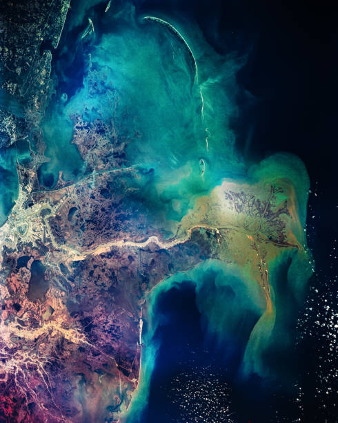
gulf of mexico satellite
gulf of mexico beach
gulf of mexico rig
gulf of mexico drilling
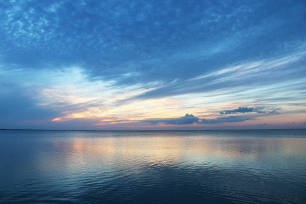
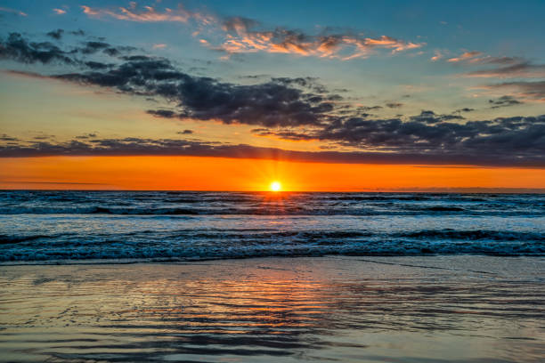
gulf of mexico sunset
gulf of mexico storm
dead zone gulf of mexico
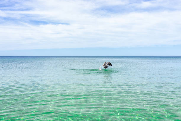
dolphin gulf of mexico
algal bloom gulf of mexico
gulf of mexico map vector
gulf of mexico recent fire
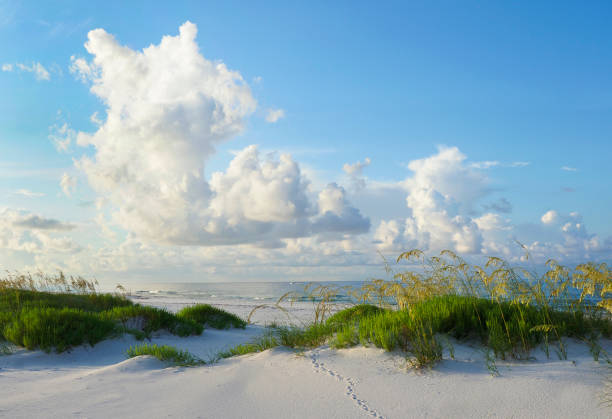
gulf of mexico grass
gulf of mexico oil spill
gulf of mexico fish
gulf of mexico diving
Most popular
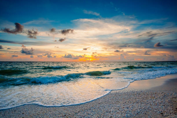
Marco Island in Florida has beautiful sunsets. The waters of the Gulf of Mexico roll in over seashells deposited on the beach.
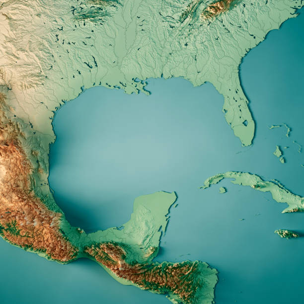
3D Render of a Topographic Map of the Gulf of Mexico, Central America. All source data is in the public domain. Color texture and Rivers: Made with Natural Earth. http://www.naturalearthdata.com/downloads/10m-raster-data/10m-cross-blend-hypso/ http://www.naturalearthdata.com/downloads/10m-physical-vectors/ Relief texture: SRTM data courtesy of USGS. URL of source image: https://e4ftl01.cr.usgs.gov//MODV6_Dal_D/SRTM/SRTMGL1.003/2000.02.11/ Water texture: HIU World Water Body Limits: http://geonode.state.gov/layers/?limit=100&offset=0&title__icontains=World%20Water%20Body%20Limits%20Detailed%202017Mar30
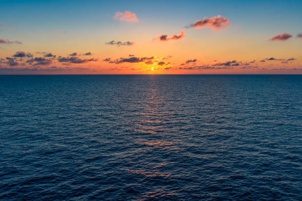
Idyllic sunset over the open ocean
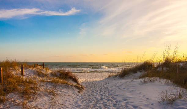
Pathway to the Gulf of Mexico at Sunset

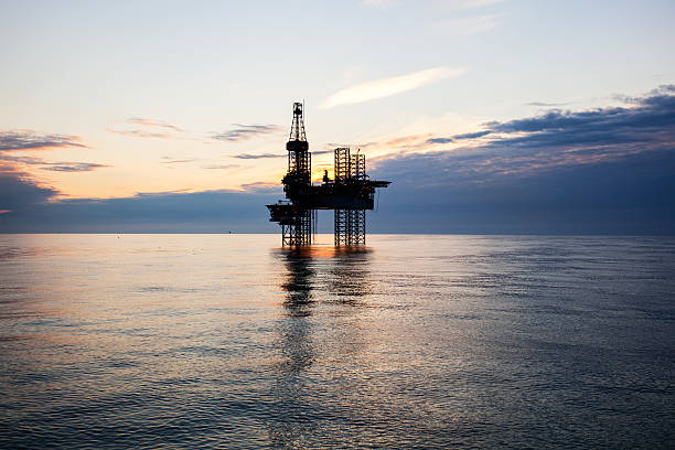
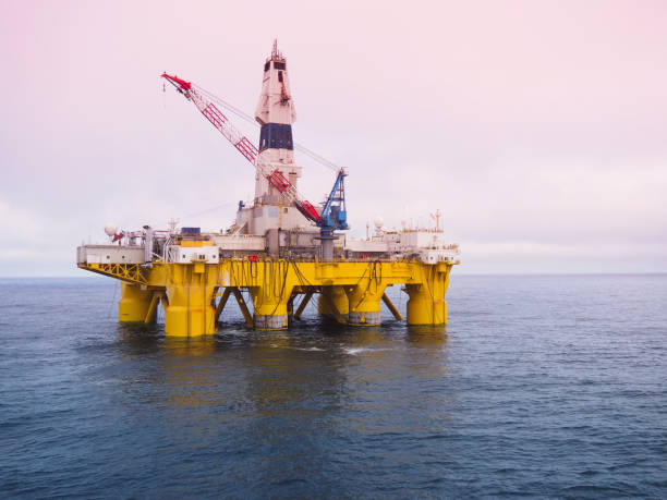
Jackup moveable oil platform at sunset in Gulf of Mexico
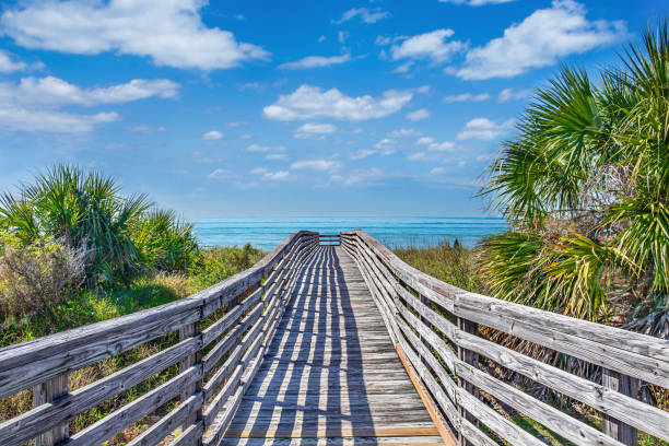
Wooden footpath to the beach surrounded by palm trees. Barrier island on Gulf Coast. Honeymoon Island State Park, Florida, USA.
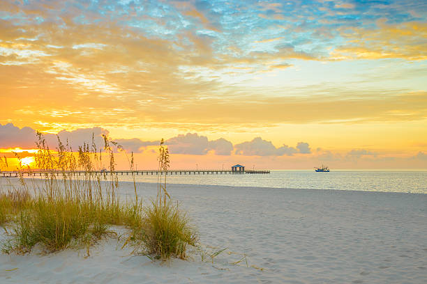
Gulfport Mississippi beach, dramtic golden sunrise, pier, shrimp boat, on the Gulf of Mexico
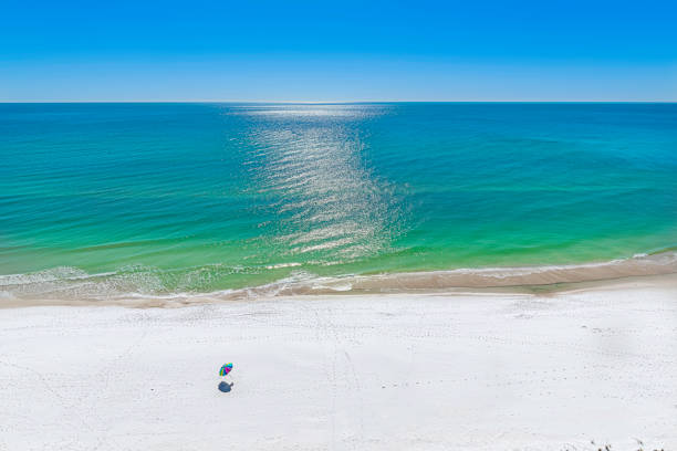
The emerald waters of the gulf of mexico at panama city beach, deserted except for colorful beach umbrella.


gulf of mexico road vector map
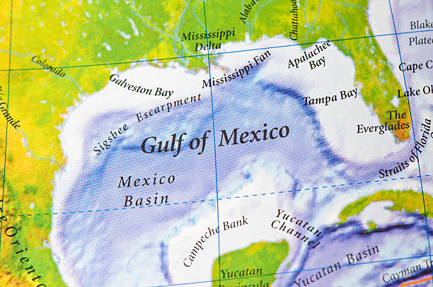
Gulf of Mexico on map. Source: Concise Atlas of the World
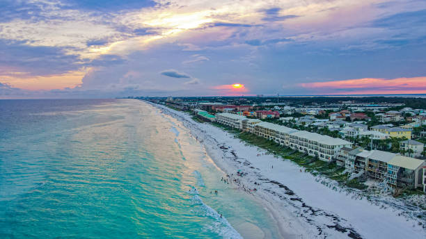
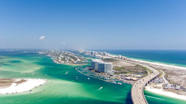
Destin and Miramar Beaches 2022 Florida July Drone Aerial Beach Gulf of mexico
The pier along the beach at Pensacola Beach, Florida shot from an altitude of about 500 feet during a helicopter photo flight.

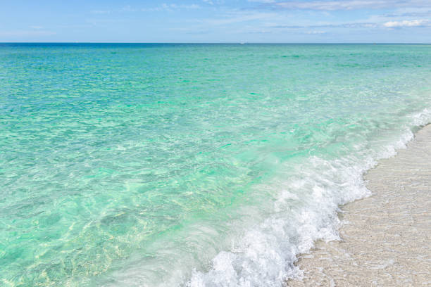

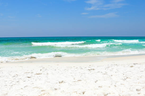
Waves hitting the sugar white beaches in Florida on a windy day. Vivid sky colors and emerald colored Gulf of Mexico waters.
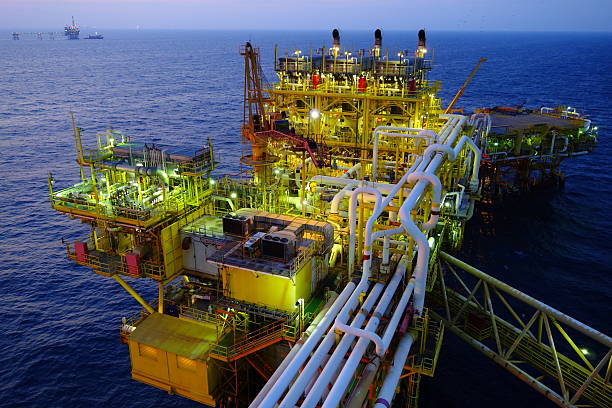
offshore platform in gulf of mexico
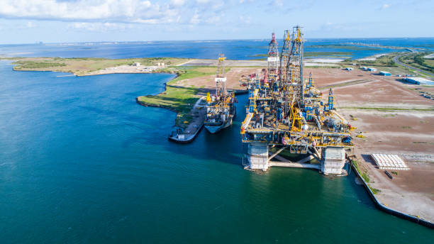
Construction of Oil Rig in Texas Gulf Coast aerial drone view of Deep Sea Off Shore Oil Rig used for Drilling Oil in the Gulf of Mexico , the Same type of Oil rig that caused the oil spill of Deep Sea Horizon. One of the Biggest Problems of Pollution and Climate Change Today.
A crane takes flight in Mobile, Alabama. On the horizon is one of many oil rigs in the Gulf of Mexico.
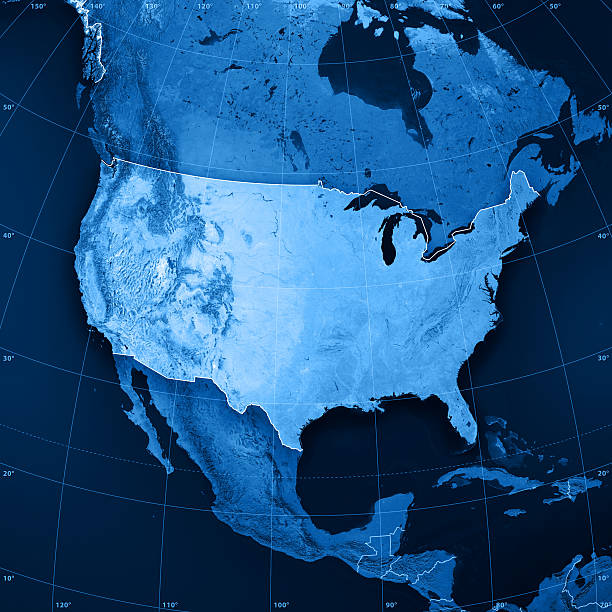
3D rendering and image composing: Topographic Map of the United States of America. Including country borders, rivers and accurate longitude/latitude lines. High resolution available! High quality relief structure!

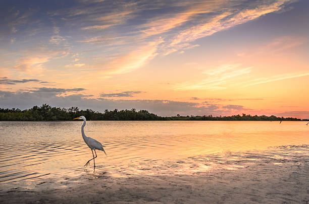
Closeup of a Great Blue Heron Taking Off From a Beautiful White Sand Beach with Sea Oats on a Cloudy Day
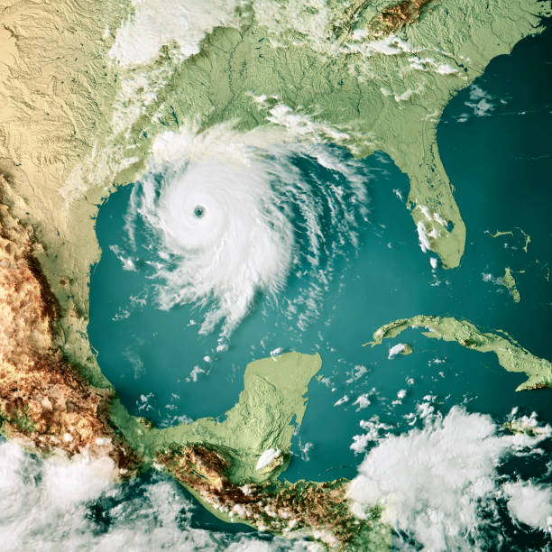
3D Render of a Topographic Map of the Gulf of Mexico with the clouds from August 26, 2020. Category 4 Major Hurricane Laura near the US State of Louisiana. All source data is in the public domain. Cloud texture: VIIRS, SNPP courtesy of NASA. https://neo.gsfc.nasa.gov/view.php?datasetId=VIIRS_543D Color texture: Made with Natural Earth. http://www.naturalearthdata.com/downloads/10m-raster-data/10m-cross-blend-hypso/ Relief texture: SRTM data courtesy of NASA JPL (2020). https://e4ftl01.cr.usgs.gov//DP133/SRTM/SRTMGL3.003/2000.02.11 Water texture: SRTM Water Body SWDB: https://dds.cr.usgs.gov/srtm/version2_1/SWBD/

Offshore Production PlatformMore oil field images


A tranquil drone shot above Grayton Beach, FL along 30A. The crystal blue waters washing against the white sands… nothing more peaceful!
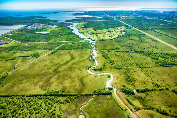
A river known as The Moses Bayou cutting into the rural farmland of East Texas near the Gulf of Mexico coastline near Texas City just north of Galveston.
Aerial view of Robinson Island in Saint John Bayou and Perdido Pass at Orange Beach, AL.
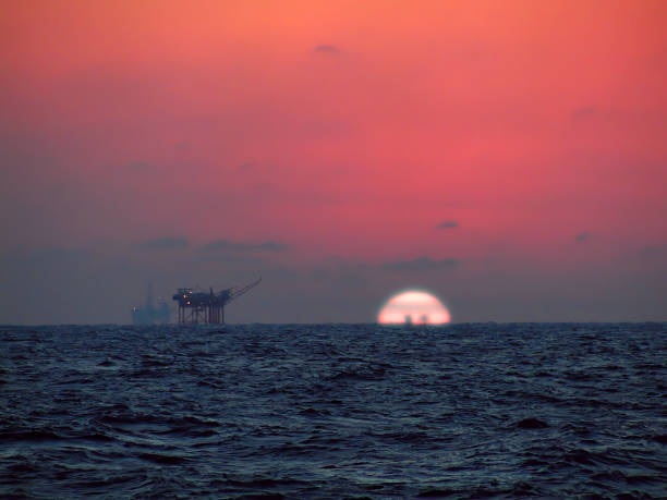
With oil rigs in the distance, the sun sets, turning the skies red over the choppy waters of the Gulf of Mexico.
3D Render of the clouds of Hurricane Ida (Aug 28, 2021) on a Topographic Map of the Gulf of Mexico. All source data is in the public domain. Cloud texture: VIIRS, NOAA-20 courtesy of NASA. https://worldview.earthdata.nasa.gov Color texture: Made with Natural Earth. http://www.naturalearthdata.com/downloads/10m-raster-data/10m-cross-blend-hypso/ Relief texture: SRTM data courtesy of NASA JPL (2020). https://e4ftl01.cr.usgs.gov//DP133/SRTM/SRTMGL3.003/2000.02.11 Water texture: SRTM Water Body SWDB: https://dds.cr.usgs.gov/srtm/version2_1/SWBD/

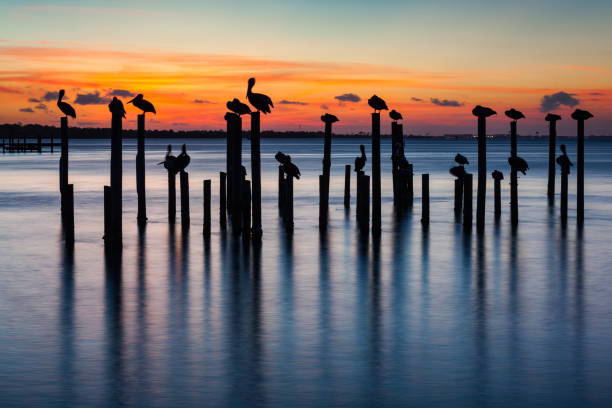
Sunset silhouettes of pelicans on old pier pilings in Destin Harbor, Florida, USA.
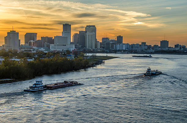
Barges traveling up the Mississippi River towards New Orleans, Louisiana.
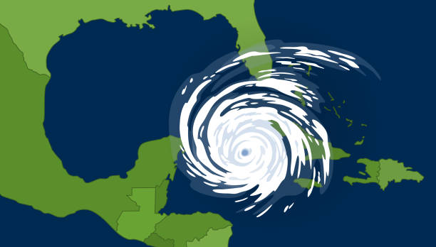
Tropical cyclone in the gulf of Mexican. Huge hurricane, view from space.
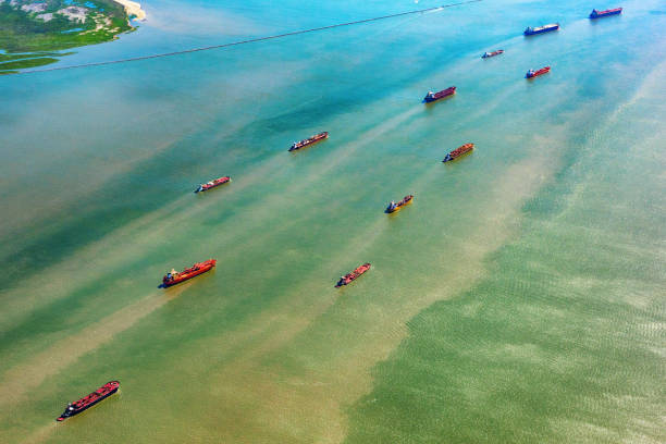
Large group of oil tankers entering Galveston Bay from the Gulf of Mexico approaching a refinery in Texas City, Texas located south of Houston near the city of Galveston.
offshore drilling rig or platform in Gulf of Mexico
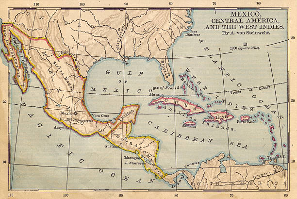
Color image of old color map of Mexico, Central America, and the West Indies, from the 1800's.

Sand dunes and vegetation on the Galveston Beach. Dunes in Galveston are very valuable and protected. They protect Galveston Island from disappearing.
Sunrise on the Gulf of Mexico near Corpus Christi, Texas

The riser and slip joint of a semisubmersible oil rig which carries oil and gas to the surface while drillingMore oil rig images at:

A dictionary map of the Southeast US. The photo was taken out of a one hundred + year old dictionary.
Sunset at Tigertail beach, Marco Island, Florida
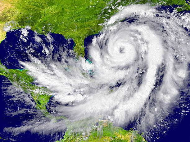
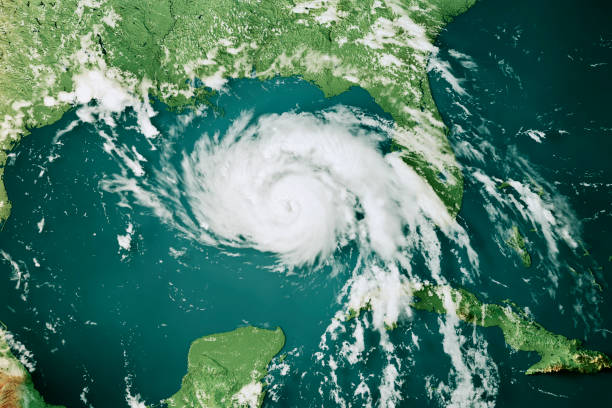
Huge hurricane between Florida and Cuba. Elements of this image furnished by NASA

Sea Grass in Florida's Gulf of Mexico.
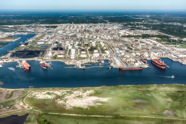
Aerial view of tankers docked at an American oil refinery in Texas City, Texas, located just south of Houston on Galveston Bay.
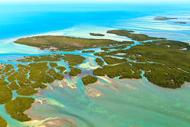
Florida Keys Aerial View (shot from aeroplane)
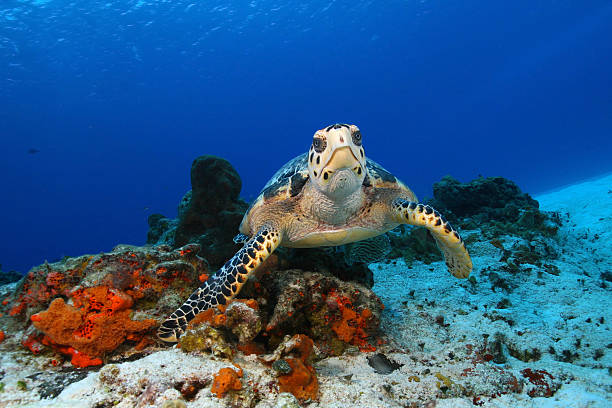
Hawksbill Turtle (Eretmochelys imbricata) pausing to look at the camera in the clear blue water of Cozumel Mexico

Adirondack Beach Chairs on a Sun Beach in front of a Holiday Vacation Travel house

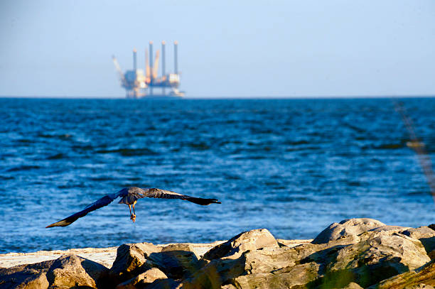
A Great Blue Heron Flies Over the Beautiful White Sand Beaches of the Northern Gulf Coast of Florida
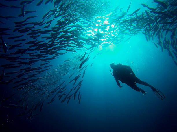
Diving the incredible Sipadan dive site near Mabul Island in Borneo, Malaysia.
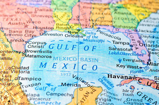
Gulf of Mexico on map.
Early Morning Light on a Beautiful White Sand Beach of the Florida Gulf Coast