 within North America. This map also shows surrounding countries and capital cities if present. This map has text labels for the countries, states, capital cities and major bodies of water. ZOOM IN on this highly detailed map, it is a great addition to the collection. This file will work well for your print or web based project. This file is layered and grouped (labeled in ai v10 file), making it a very easy file to work with. This download contains an editable ai v10 and eps file, as well as a large JPG file. Canada stock vector")
Description
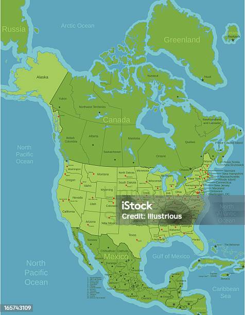
This file is a map highlighting the United States (as well as it's states and capital cities) within North America. This map also shows surrounding countries and capital cities if present. This map has text labels for the countries, states, capital cities and major bodies of water. ZOOM IN on this highly detailed map, it is a great addition to the collection. This file will work well for your print or web based project. This file is layered and grouped (labeled in ai v10 file), making it a very easy file to work with. This download contains an editable ai v10 and eps file, as well as a large JPG file.