
Cape Verde stock vectors
Browse 2,900+ cape verde stock illustrations and vector graphics available royalty-free, or search for cape verde beach or hydra to find more great stock images and vector art.
cape verde beach
hydra
clock
cape verde islands
sal cape verde
praia cape verde
mindelo cape verde
cape verde flag
cape verde people
santa maria cape verde
club cape verde
cape verde santiago
sao vicente cape verde
cape verde homes
cape verde turtles
cape verde night
cape verde loggerhead turtle
santo antao cape verde
fontainhas cape verde
cape verde food
cape verde house
cape verde africa
boa vista cape verde
cape verde volcano
cape verde mountains
cape verde turtle
sal rei cape verde
cape verde boa vista
Most popular
Cape Verde Flag

Map of Cape Verde for your own design. Three maps with editable stroke included in the bundle: - One black map on a white background. - One line map with only a thin black outline in a line art style (you can adjust the stroke weight as you want). - One map on a blank transparent background (for change background or texture). The layers are named to facilitate your customization. Vector Illustration (EPS file, well layered and grouped). Easy to edit, manipulate, resize or colorize. Vector and Jpeg file of different sizes.
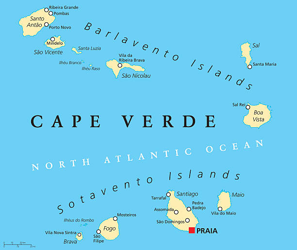
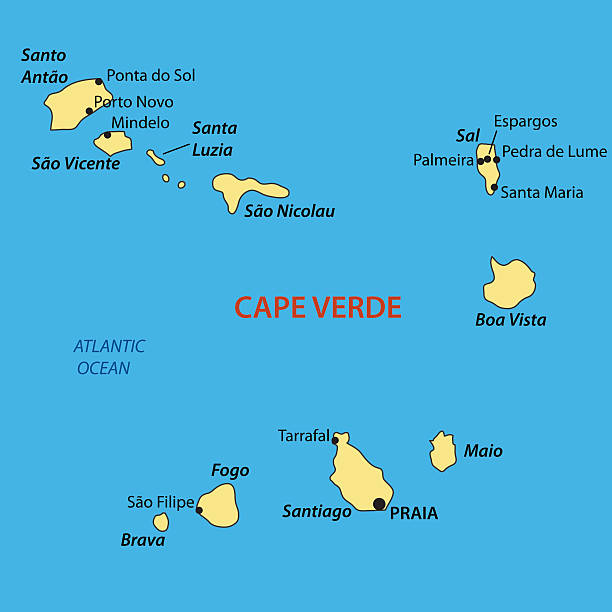
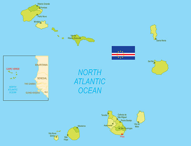
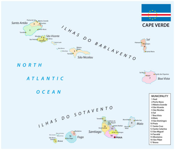
Cape Verde Political Map with capital Praia and important cities. English labeling and scaling. Illustration.
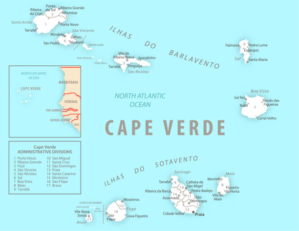
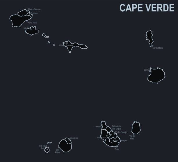
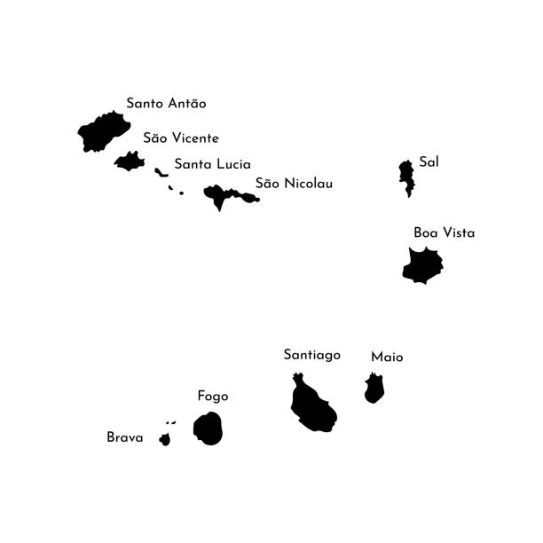
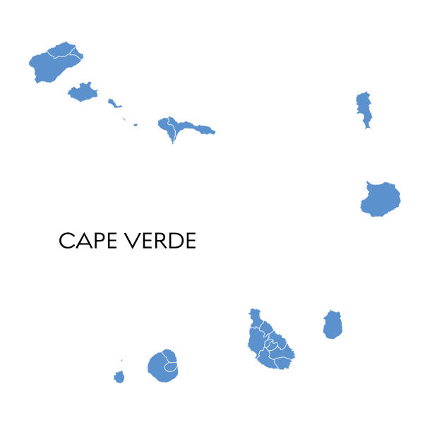
Cape Verde detailed map with regions and cities of the country. Vector illustration
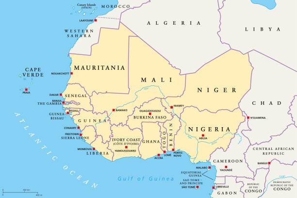
West Africa region, political map. Area with capitals and borders. The westernmost countries on the African continent, also called Western Africa. English labeling. Illustration. Vector.

Macaronesia political map. Azores, Cape Verde, Madeira and Canary Islands. Collection of four archipelagos in the North Atlantic Ocean, off the coast of Africa. English labeling. Illustration. Vector.
Vector logo for Republic of Cabo Verde, fridge magnet with cape verdean state flag, original brush typeface for words cabo verde and national symbol - church in Sao Filipe on cloudy sky background.

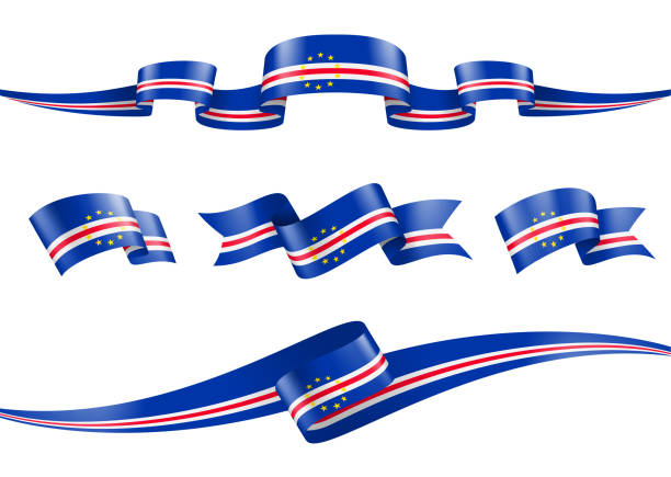
Vector illustration of the flag of Cape Verde. Horizontal format. Flag file is in official RGB color space for accurate representation on digital and rgb based print media. Fully editable and scalable vector eps 10 format and high resolution jpg.

3D Realistic waving Flag of Cape Verde on transparent background

Macaronesia political map. Azores, Cape Verde, Madeira, Canary Islands. Collection of archipelagos in the Atlantic Ocean off the coast of Africa. English labeling. Gray illustration over white. Vector
http://s017.radikal.ru/i424/1301/64/5ba464e7acd2.jpg


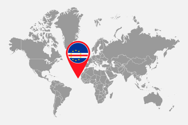
Cape Verde flag map pointer abstract layout. Vector illustration.


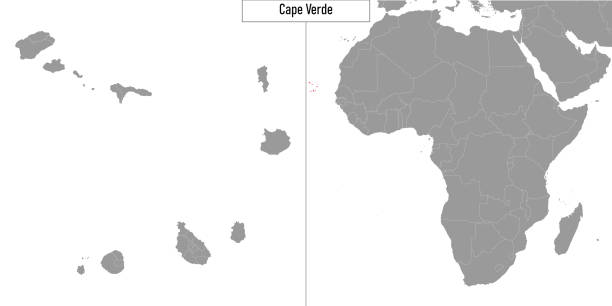
Cape Verde political map with capital Praia. Republic and island country in the central Atlantic Ocean off the coast of West Africa. Gray illustration on white background. English labeling. Vector.

Map of Cabo Verde political world map with magnifying glass. Highly detailed map with borders and countries.
http://dikobraz.org/map_2.jpg
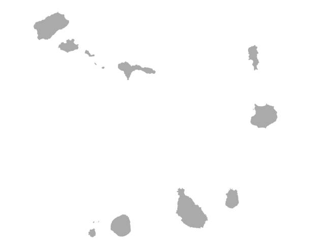
Vector isolated illustration of political map African state - Cabo Verde. Black silhouette. White background
Full Collection of World Flags in Alphabetical Order
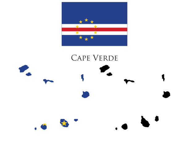
cape verde flag and map illustration vector. Black and white map and map with flag.
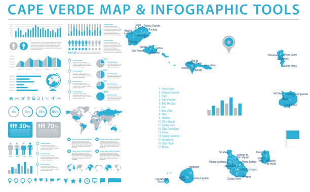
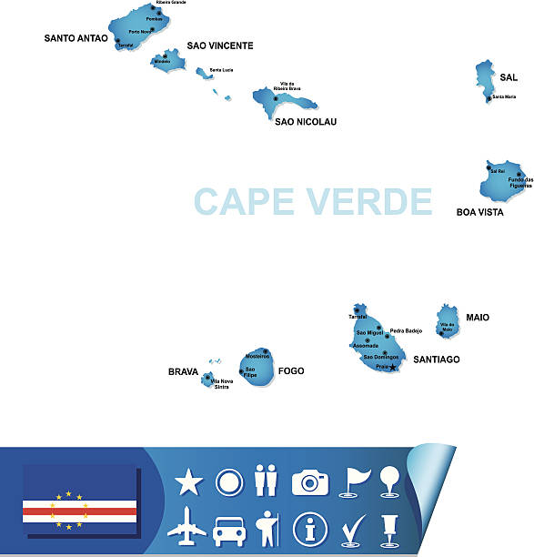
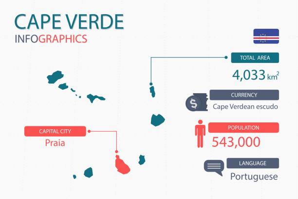
Cape Verde Map - Detailed Info Graphic Vector Illustration
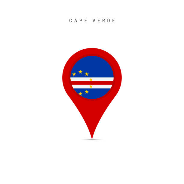
Teardrop map marker with flag of Cape Verde. Cabo Verde flag inserted in the location map pin. Flat vector illustration isolated on white background.
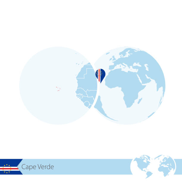
Cape Verde on world globe with flag and regional map of Cape Verde. Vector Illustration.
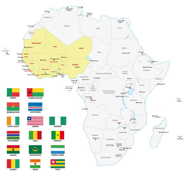
western africa vector map with flags

Map of Cape Verde - Highly Detailed Vector illustration
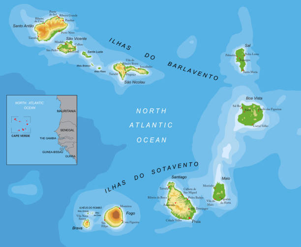
Highly detailed physical map of Cape Verde in vector format,with all the relief forms,regions and big cities.

Vector illustration of the map of Cape Verde

World map with a magnifying glass pointing at Cape Verde. Map of Cape Verde with the flag in the loop. Vector illustration.

Flag of Cape Verde in the form of a big heart. Vector illustration on a white background. Brush strokes are drawn by hand. Independence Day.
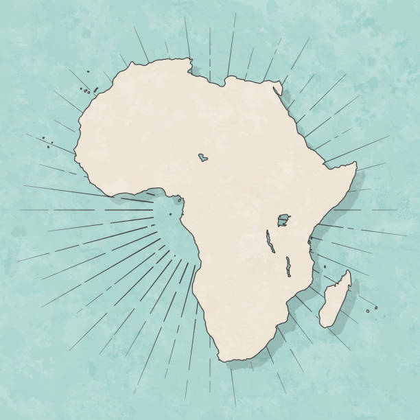
Map of Africa in a trendy vintage style. Beautiful retro illustration with old textured paper and light rays in the background (colors used: blue, green, beige and black for the outline). Vector Illustration (EPS10, well layered and grouped). Easy to edit, manipulate, resize or colorize.
Cape verde administrative, political and vector map with flag
Full Collection of World Flags in Alphabetical Order


Map of Africa made with round blue dots on a blank background. Original mosaic illustration. Vector Illustration (EPS10, well layered and grouped). Easy to edit, manipulate, resize or colorize. Please do not hesitate to contact me if you have any questions, or need to customise the illustration. http://www.istockphoto.com/portfolio/bgblue

Map of Africa with a realistic paper cut effect isolated on white background. Vector Illustration (EPS10, well layered and grouped). Easy to edit, manipulate, resize or colorize. Please do not hesitate to contact me if you have any questions, or need to customise the illustration. http://www.istockphoto.com/bgblue/

Africa map created with a mesh of thin black lines and a light shadow, isolated on a blank background. Conceptual illustration of networks (communication, social, internet, ...). Vector Illustration (EPS10, well layered and grouped). Easy to edit, manipulate, resize or colorize.

Waving flag of Cape Verde on flagpole. Template for independence day poster design
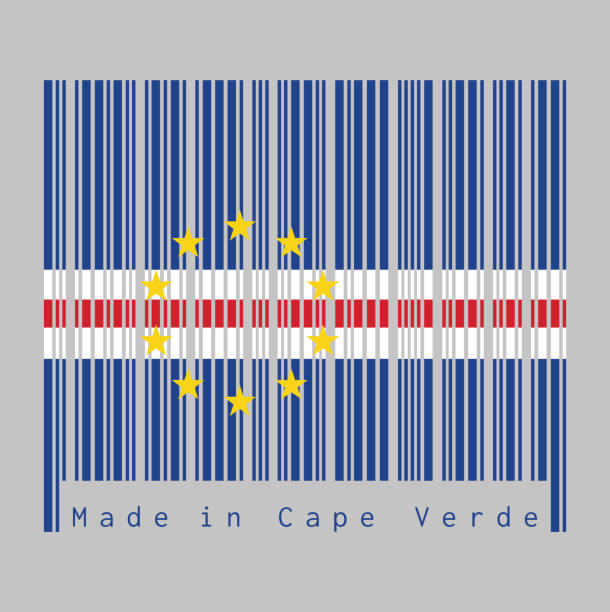
Barcode set the color of Cape Verde flag, blue white and red with the circle of ten star on grey background, text: Made in Cape Verde. concept of sale or business.

Flag as a heart "I Love Cap Verde" with a cord string, Vector illustration isolated on white background


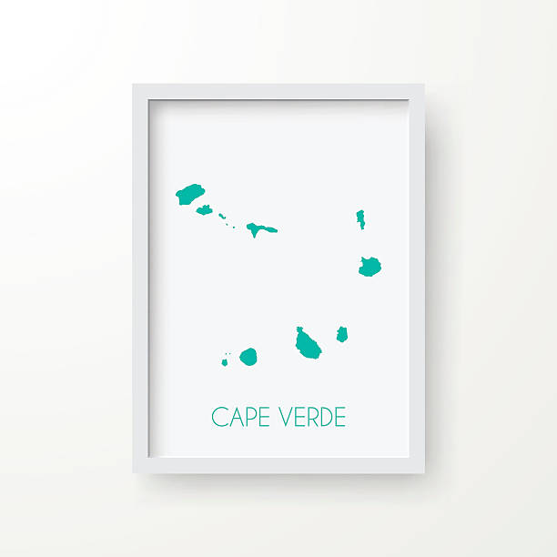
Map of Cape Verde in realistic blank frame isolated on white background.

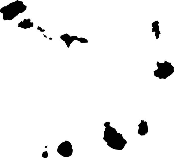
Vector. Black map


3D map of Africa isolated on a blank and gray background, with a dropshadow. Vector Illustration (EPS10, well layered and grouped). Easy to edit, manipulate, resize or colorize.

map of Cape Verde and location on Africa map. Vector illustration