00:29
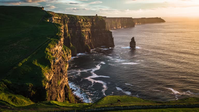
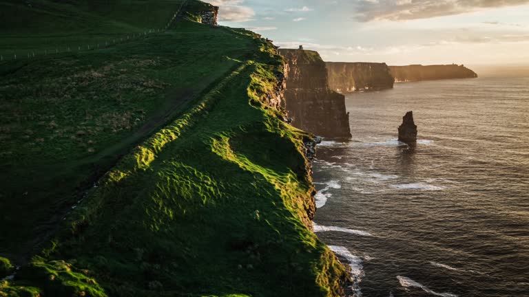
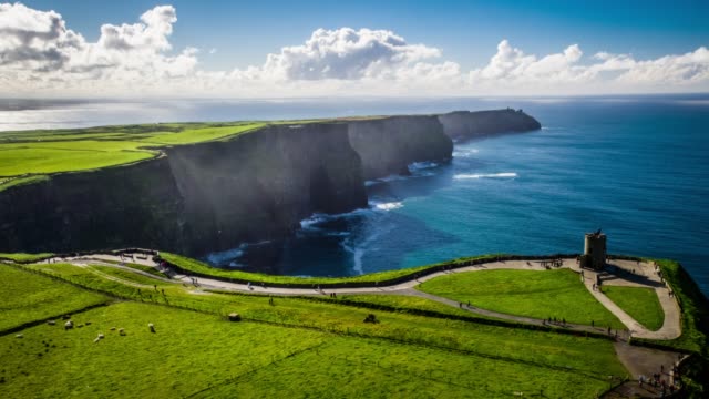
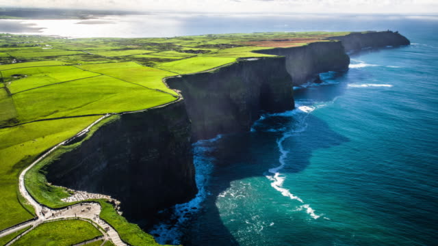
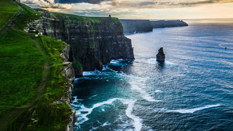
Flight over the famous Cliffs of Moher one of Ireland's top touristic attractions. Moody sky at dusk. The maximum height of the Cliffs is 214 m, lenght 8 km. Ireland, Europe.
Flight over the Cliffs of Moher illuminated by bright sunset light. Stunning Landscape in the County Clare in Ireland.
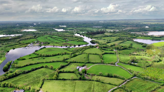
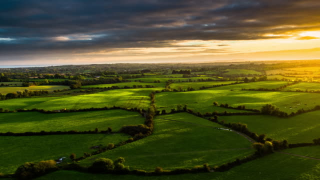
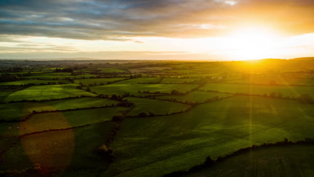
Flight over idyllic rural landscape in Ireland. Fields and farms in beautiful sunset light. Warm evening light highlights the topography of the landscape.
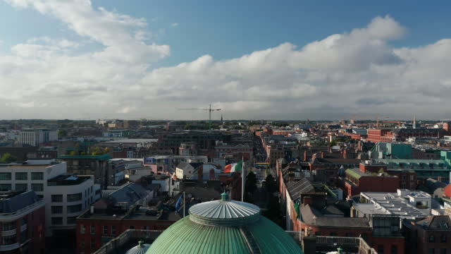
Forwards fly above Dublin castle complex and City Hall building. City lit by bright afternoon sunshine. Dublin, Ireland.
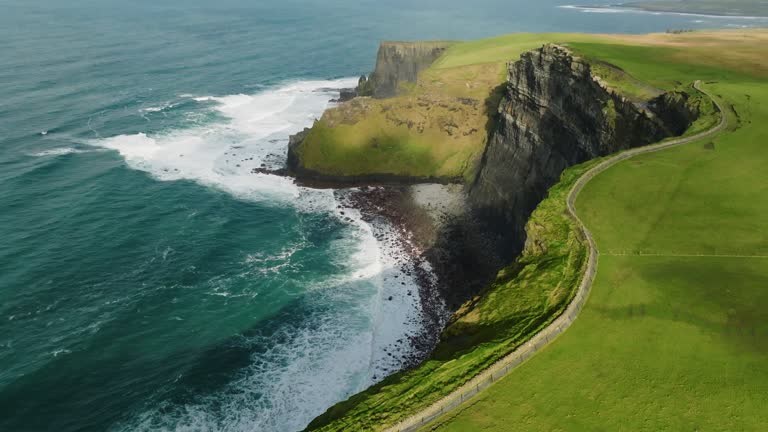
Aerial shot of famous Cliffs of Moher in Ireland at sunst. Camera is flying over the edge of the cliff. Located in the County Clare the Cliffs of Moher are Ireland's most visited natural attraction.
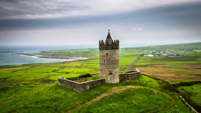
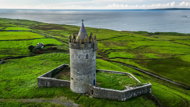
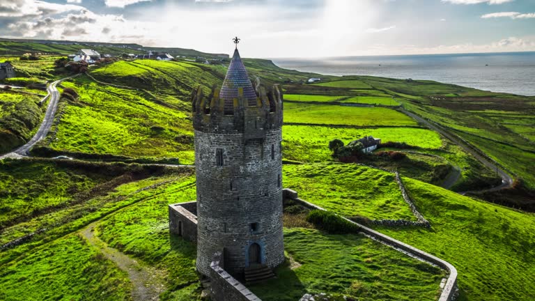
Aerial shot of famous Doonagore Castle in the County Clare. Old tower is surrounded by lush green meadows. Beautiful Irish landscape. Doolin, County Clare in Ireland.
Time lapse shot of rocky coastline with famous Fanad Head Lighthouse in Ireland. County Donegal, Ulster region, Ireland, Europe.
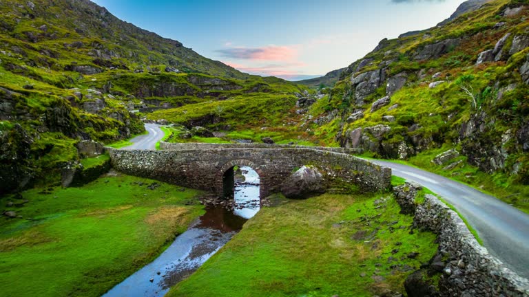
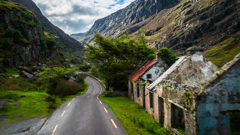
Aerial shot of nn old stone bridge carrying a narrow road across the winding Serpent River in the rocky terrain near the Gap of Dunloe, famous tourist destination near Killarney, County Kerry, Ireland.
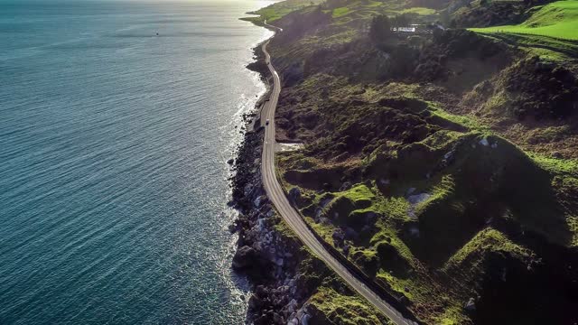
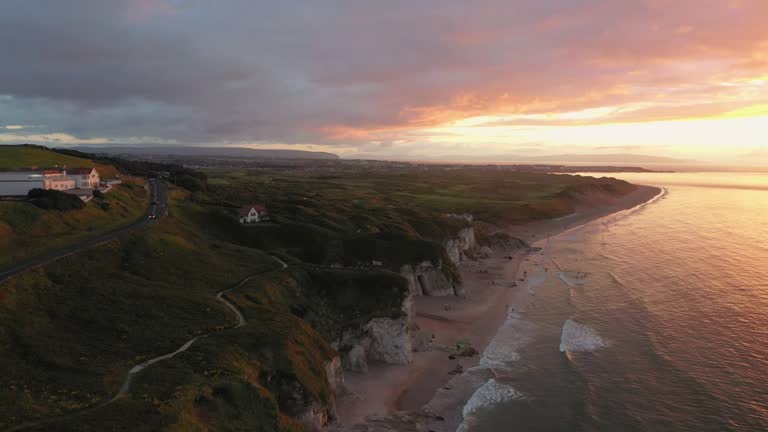
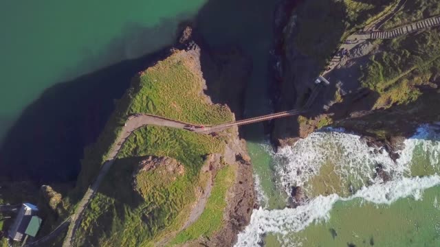
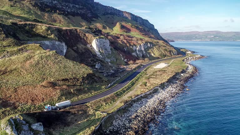
Northern Ireland, UK, Atlantic coast with cliffs. Causeway Coastal Route a.k.a Antrim Coast Road. One of the most scenic coastal roads in Europe. Aerial 4K video. Winter, against the sunrise light
Real time shot in 4K/Ultra High Definitiion
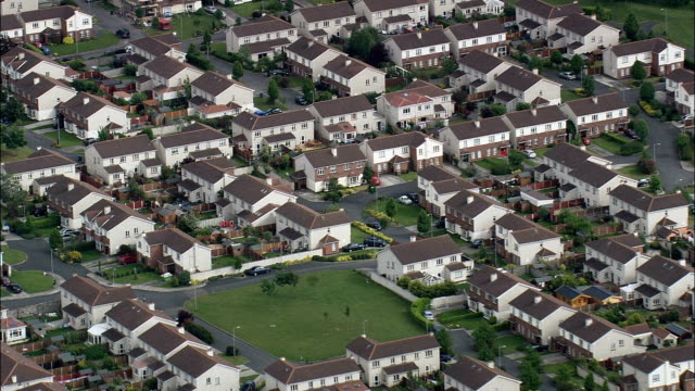
Large housing estate on Dublin's outskirts. Ireland
Aerial shot of the Cliffs of Moher at the County Clare. Ireland's most visited natural attraction. O’Brien’s Tower in the foreground . Ireland - Europe
Flight around Doonagore Castle located on the beautiful atlantic coastline of the Republic of Ireland. County Clare
Aerial shot of Irish landscape with old ruined farmhouses. Camera flying up. Country road in the foreground. Valley with beautiful lake is surrounded by the Macgillycuddy's Reeks mountains near the Gap of Dunloe. County Kerry in Ireland.
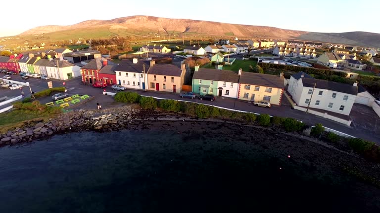
County Kerry Ireland aerial view of a small town called Portmagee
an amazing rock formation million os years old
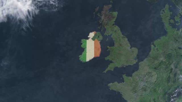
Epic photo real map animation, World Map Credits To NASA : https://visibleearth.nasa.gov
The Cliffs of Moher are sea cliffs located at the southwestern edge of the Burren region in County Clare, Ireland. The cliffs rank among the most visited tourist sites in Ireland, with around 1.5 million visits per year.
Flight over the Cliffs of Moher at the coastline of Ireland. Beautiful summer day with clear sky and lush green fields. County Clare in Ireland.
Flight over Irish coastline with lonely beach. Moody sky after sunset. County Donegal at Fanad, Ulster region, Ireland, Europe
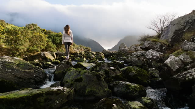
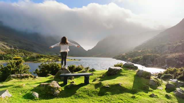
Flight over an old stone bridge at the Gap of Dunloe in Ireland. Beautiful valley with Loe River.
Flight over an valley with an old stone bridge at the Gap of Dunloe in Ireland. Macgillycuddy's Reeks mountains and Loe River.
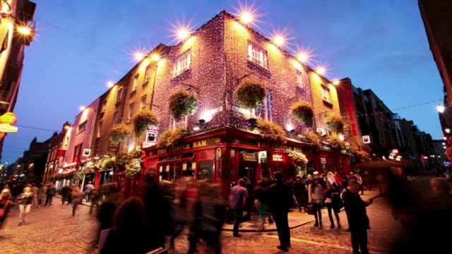
people, toast, leisure, friendship and celebration concept - happy male friends drinking beer and clinking glasses at bar or pub
Forwards tracking of vehicle on road near sea coast. Farming and breeding livestock in countryside. Beautiful natural scenery. Ireland.
Epic photo real globe animation
Fly above historic park of city. Aerial view of old buildings and street in bright afternoon sun. Dublin, Ireland.
Images of Dungarvan: a coastal town and harbor in County Waterford, on the south-east coast of Ireland. Flyover of churches, homes, and residential districts.
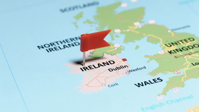
tracking to Ireland with pin
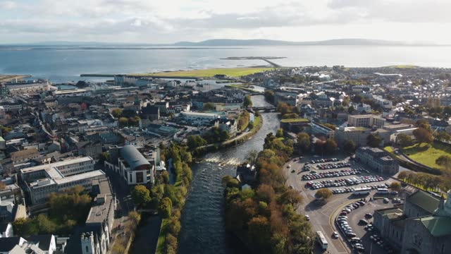
Dublin Sandymount area Ireland from air
Aerial shot of famous Doonagore Castle in the County Clare. Old tower is surrounded by lush green meadows. Beautiful Irish landscape. Doolin, County Clare in Ireland.
Cute farm domestic animals on green pasture grazing. Countryside landscape in rural Ireland. Concept of farming, livestock agriculture, work on a farm, organic eco farm. Farm animal portrait.
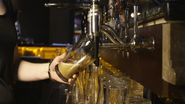
pouring a pint of guinness from a beer tap in a pub
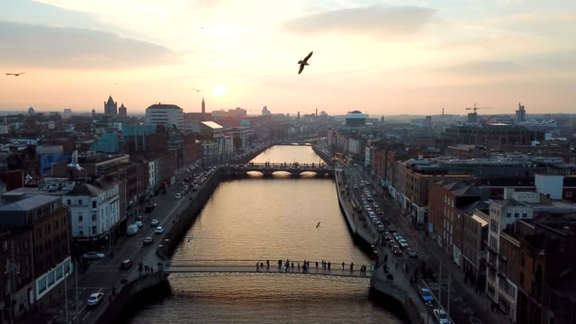
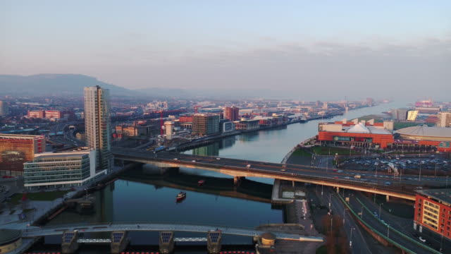
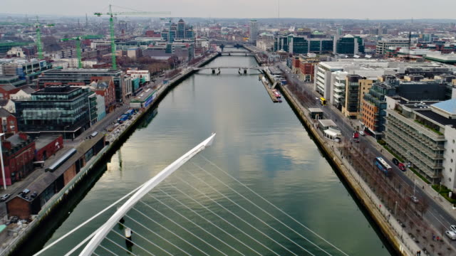
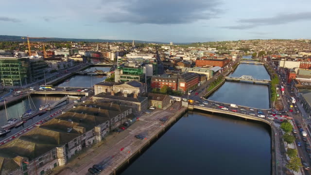
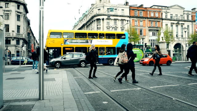
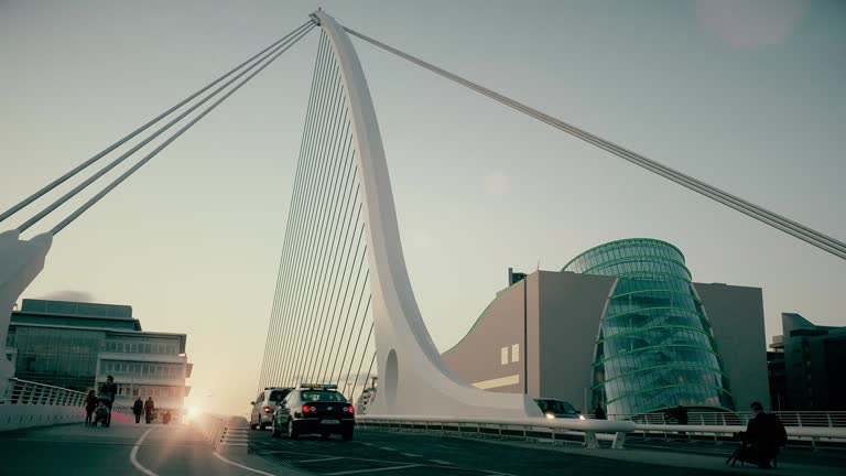
Dublin, pronounced is the capital and largest city of Ireland. On a bay at the mouth of the River Liffey, it is in the province of Leinster, bordered on the south by the Dublin Mountains, a part of the Wicklow Mountains range. At the 2016 census it had a population of 1,173,179, while the preliminary results of the 2022 census recorded that County Dublin as a whole had a population of 1,450,701, and that the population of the Greater Dublin Area was over 2 million, or roughly 40% of the Republic of Ireland's total population.
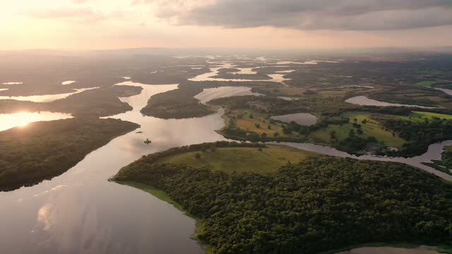
Irish Waterways at Northern Ireland Border Lough Erne, Lakelands
This is an aerial of flying over green fields in Ireland. The footage was taken with a drone in county, Donegal in the north west of Ireland
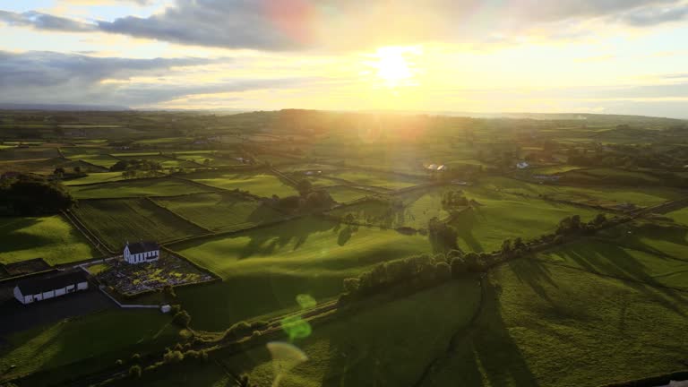
Drone flight over the green fields and countryside at Dromona, County Antrim, Northern Ireland, at sunset on a summer evening, with lush foliage and rolling hills in agricultural land below
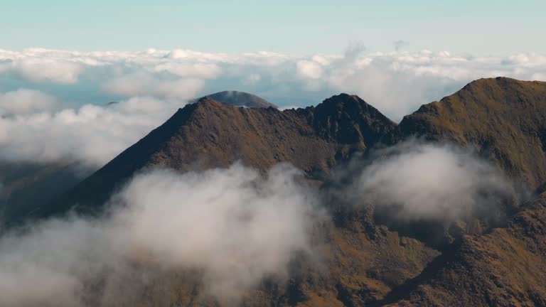
Scenic 4K Timelapse video of Mountain peak with moving clouds, McGillycuddy Reeks, Co. Kerry, Ireland
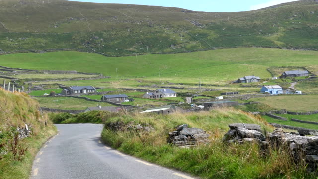
High angle view of road winding through village with sparse housing development. Tilt up reveal of countryside panorama. Ireland.
Aerial shot of Of Agricultural fields back lit by bright sunlight at sunset. Patchwork landscape in Ireland.
The Gap of Dunloe (from Irish: Dún Lóich, meaning 'Lóich's stronghold'), also recorded as Bearna an Choimín (meaning "gap of the commonage" or "gap of the little hollow"), is a narrow mountain pass running north-south in County Kerry, Ireland, that separates the MacGillycuddy's Reeks mountain range in the west, from the Purple Mountain Group range in the east. It is one of Kerry's most popular tourist destinations on account of its scenery.
The Gap of Dunloe (from Irish: Dún Lóich, meaning 'Lóich's stronghold'), also recorded as Bearna an Choimín (meaning "gap of the commonage" or "gap of the little hollow"), is a narrow mountain pass running north-south in County Kerry, Ireland, that separates the MacGillycuddy's Reeks mountain range in the west, from the Purple Mountain Group range in the east. It is one of Kerry's most popular tourist destinations on account of its scenery.
Car passenger view driving through picturesque remote Irish Dunquin village on a hillside in county Kerry.
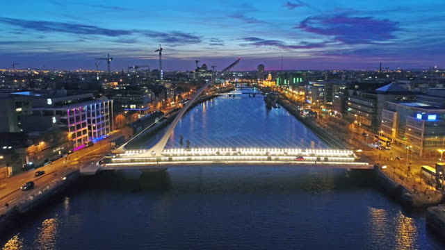
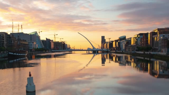
A Time Lapse Video of a breath taking sunrise over the Liffey River in downtown Dublin, Ireland. The sky goes from dark to purple to pink and finishes with a beautiful gold. The colorful clouds and the buildings along the banks of the river reflect perfectly in the river below.
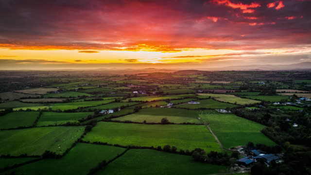
Flight over idyllic patchwork landscape under dramatic sunset sky in Ireland. Rural landscape with fields and farmland. Ireland - Europe
Lismore Duke of Deveonshire's house. Munster, County Waterford, Ireland
Real time shot in 4K/Ultra High Definition
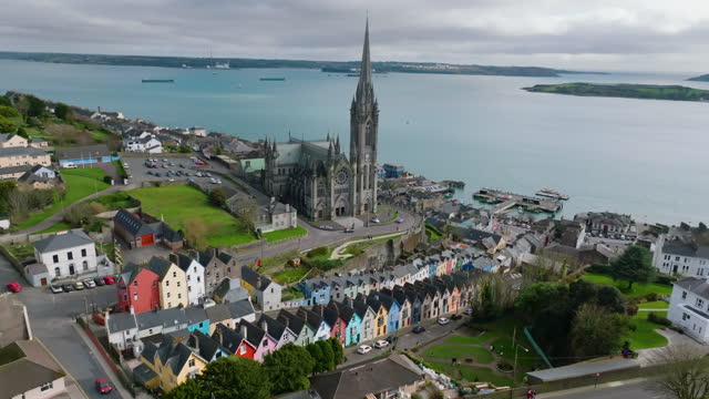
Cobh, known from 1849 until 1920 as Queenstown, is a seaport town on the south coast of County Cork, Ireland. With a population of around 13,000 inhabitants, Cobh is on the south side of Great Island in Cork Harbour and home to Ireland's only dedicated cruise terminal. Tourism in the area draws on the maritime and emigration legacy of the town. Facing the town are Spike and Haulbowline islands. On a high point in the town stands St Colman's, the cathedral church of the Roman Catholic Diocese of Cloyne. It is one of the tallest buildings in Ireland, standing at 91.4 metres.
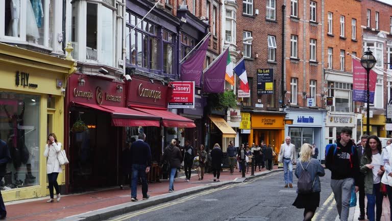
Grafton Street (Irish: Sráid Grafton) is one of the two principal shopping streets in Dublin city centre — the other being Henry Street. It runs from St Stephen's Green in the south (at the highest point of the street) to College Green in the north (the lowest point).
Northern Ireland, UK, Atlantic coast with cliffs. Causeway Coastal Route with riding cyclists and a truck. One of the most scenic coastal roads in Europe. Aerial 4K video. Winter, sunrise light
Flight around Fanad Head lighthouse in the County Donegal, in Ireland, Europe at dusk.
Aerial view flying into a sunset over Glarryford by drone, in the beautiful countryside of County Antrim, Northern Ireland, on a summer evening at sunset, with green grass agricultural fields below and Killymurris church visible
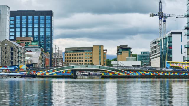
Business district at Grand Canal
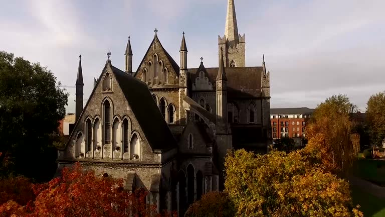
The view of St Patrick Cathedral and the Garden around it from above
wave smashing giant causeway stone,Northern Ireland
© 2024 iStockphoto LP. The iStock design is a trademark of iStockphoto LP. Browse millions of high-quality stock photos, illustrations, and videos.