Israel Egypt Border stock illustrations
Browse 270+ israel egypt border stock illustrations and vector graphics available royalty-free, or start a new search to explore more great stock images and vector art.
Most popular
Empty Dark Gray Map of Middle East Asia - illustration
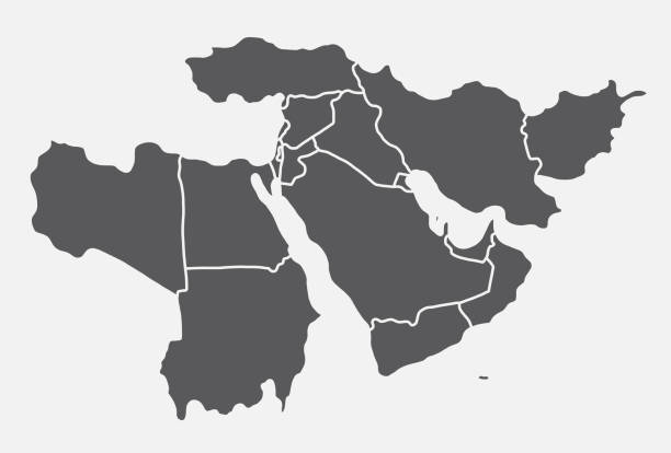
Vector illustration with simplified map of Asian countries. Middle East. States borders of Turkey, Georgia, Armenia, United Arab Emirates, Saudi Arabia, Qatar, Oman, Iran, Israel. Grey silhouette

Neom, gray political map. Saudi megacity being built in the Tabuk Province of northwestern Saudi Arabia, North of the Red Sea and across Gulf of Aqaba. Planned as a smart city and tourist destination.

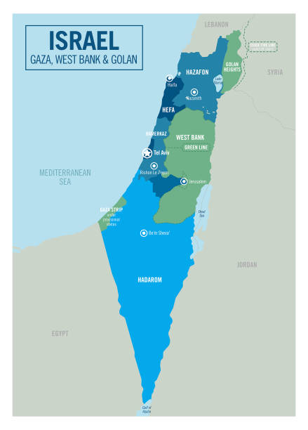
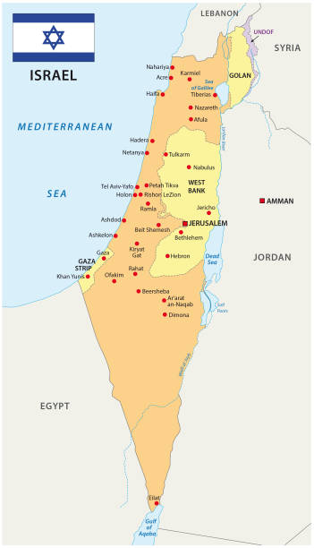
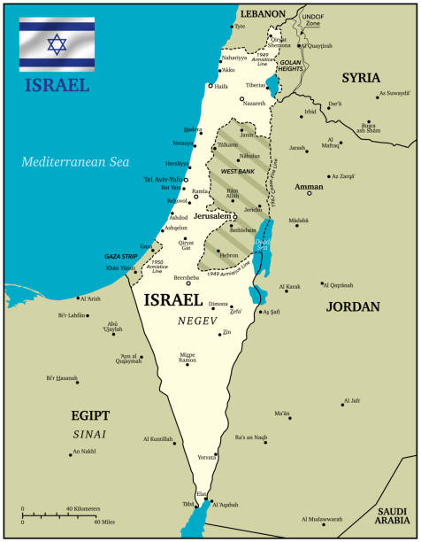
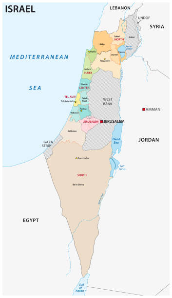
Blue-green detailed map of Israel administrative divisions with country flag and location on the globe. Vector illustration
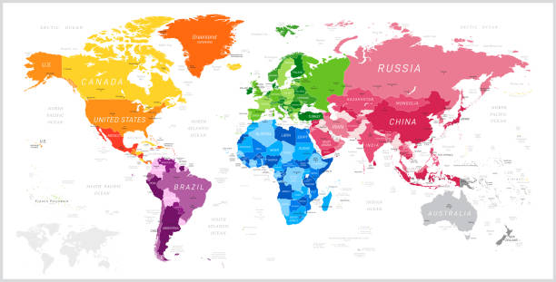
World Map North America, South America, Africa, Europe, Asia, Oceania Continents and Oceans on white background
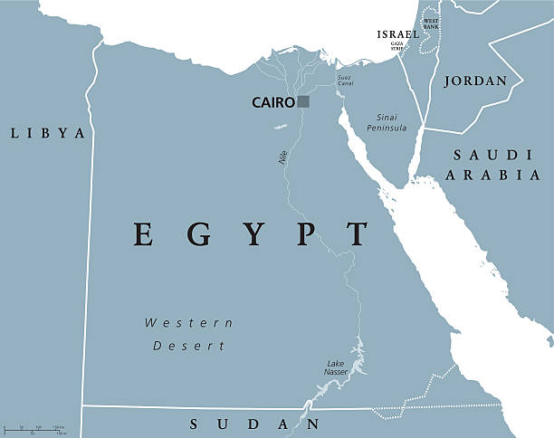
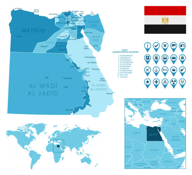
Egypt political map with capital Cairo, with Nile, Sinai Peninsula and Suez Canal. Arab Republic of Egypt with international borders and neighbor countries. Gray colored illustration. English labeling.
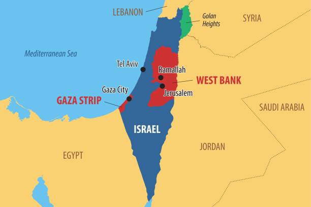
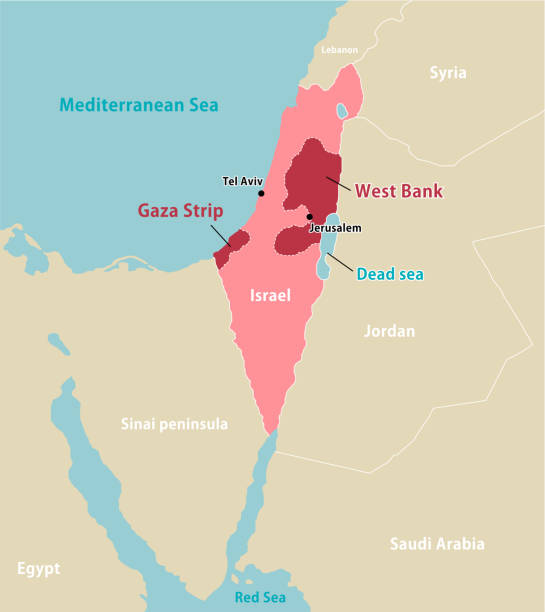
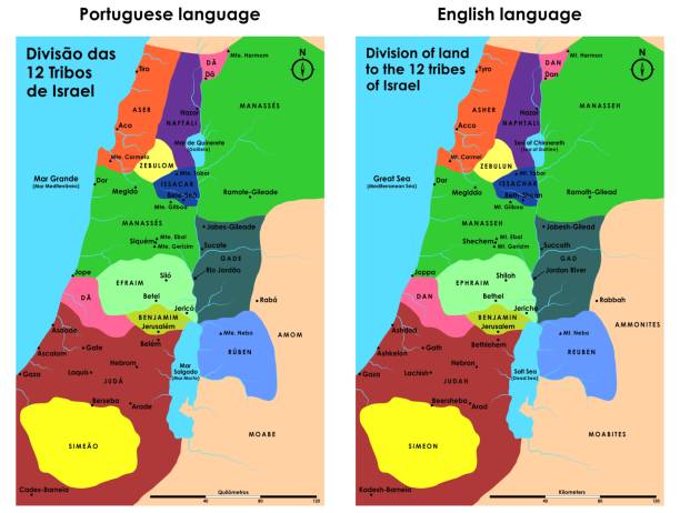
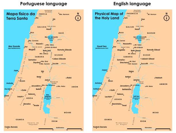
Vector map of Israel and Palestine, showing the areas of the West Bank and the Gaza strip
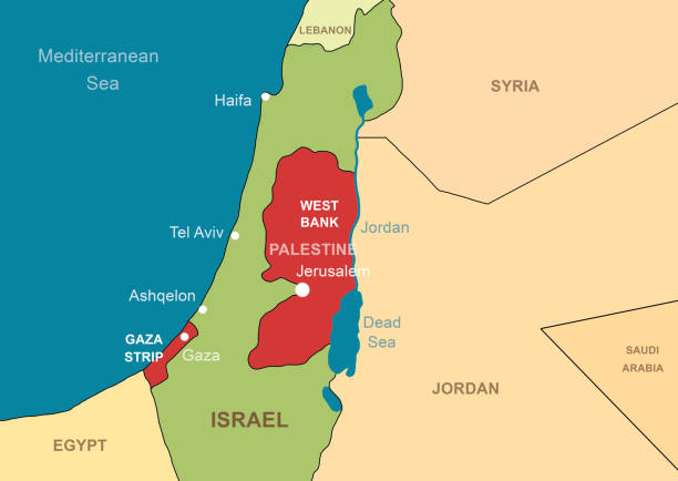
Israel and Palestine in Middle East on contour map. Palestinian territories of Gaza and West Bank. Jerusalem and Jordan River on outline map. Theme of Israel, war, conflict.
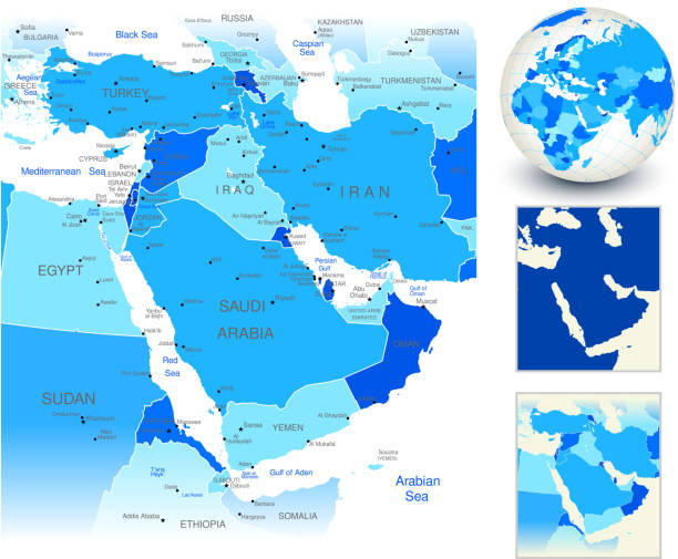
High detail map of the Middle East Zone, with a 3D Globe centered on Middle East.
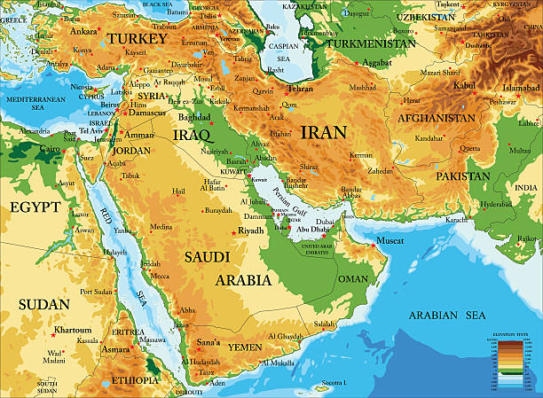
Highly detailed physical map of Middle East in vector format,with all countries, major cities and all the relief forms .
Vector illustration of the policital map of The Middle East Reference map was created by the US Central Intelligence Agency and is available as a public domain map at the University of Texas Libraries website. https://www.cia.gov/library/publications/resources/the-world-factbook/graphics/ref_maps/political/pdf/middle_east.pdf
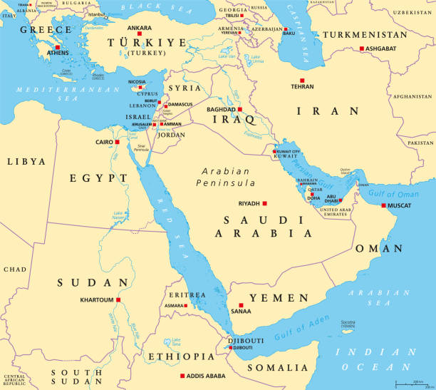
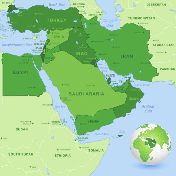
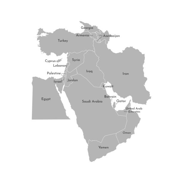
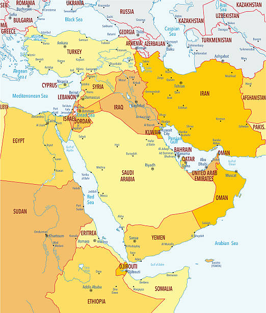
The Middle East, political map with capitals and international borders. Geopolitical region encompassing the Arabian Peninsula, the Levant, Turkey, Egypt, Iran and Iraq. Formerly called Near East.
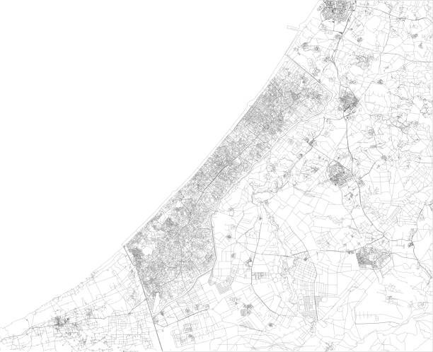
Satellite view of the Gaza Strip is a self-governing Palestinian territory on the eastern coast of the Mediterranean Sea. Map, streets of the area
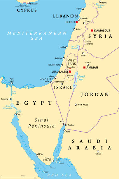
Israel and the Sinai Peninsula, political map. The Southern Levant, an arid geographical and historical region, encompassing Israel, Palestine, Jordan, Lebanon, southern Syria and the Sinai Peninsula.
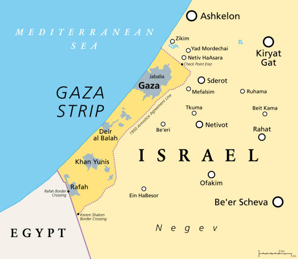
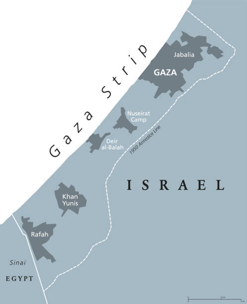
The Gaza Strip and surroundings, political map. Gaza is a self-governing Palestinian territory and narrow piece of land located on the coast of the Mediterranean Sea, bordered by Israel and Egypt.
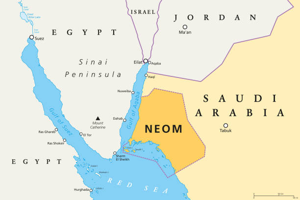
NEOM political map of the 500 billion dollar megacity project in Saudi Arabia along the Red Sea coast. Location of the smart and tourist city with autonomous judicial system. English labeling. Vector.
gaza strip vector map
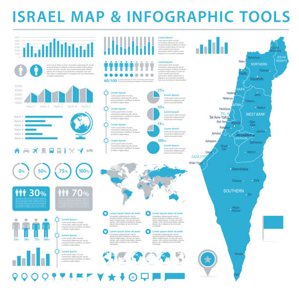
Israel Map - Detailed Info Graphic Vector Illustration

World Map with Borders, Cities, Oceans on white background
doodle freehand drawing of middle east map. vector illustration.

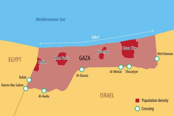
Vector map of the Gaza Strip with the main cities and border crossings
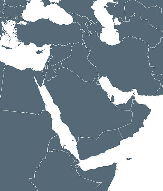
Vector illustration map of Asian countries. Middle East. States borders of Turkey, Cyprus, Jordan, United Arab Emirates, Saudi Arabia, Qatar, Iraq, Iran, Israel. Grey silhouette. White background

Part of the Southern District of Israel, political map, with the Gaza Strip, bottom half of West Bank, Dead Sea, and with borders and most important cities in this region. Illustration. Vector.
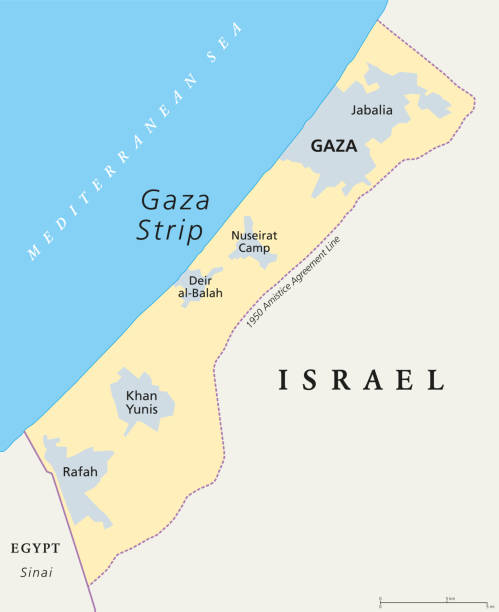
Gaza Strip political map. Self governing Palestinian territory on the coast of Mediterranean Sea that borders to Israel and Egypt. Claimed by State of Palestine. English labeling. Illustration. Vector
Map link URL: https://legacy.lib.utexas.edu/maps/world_maps/united_states_foreign_service_posts-september_2011.pdf. Some urban locations were taken from: https://legacy.lib.utexas.edu/maps/world_maps/txu-oclc-264266980-world_pol_2008-2.jpg. The image was created in Adobe Illustrator in eps10 format
Vector art.
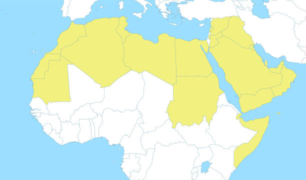
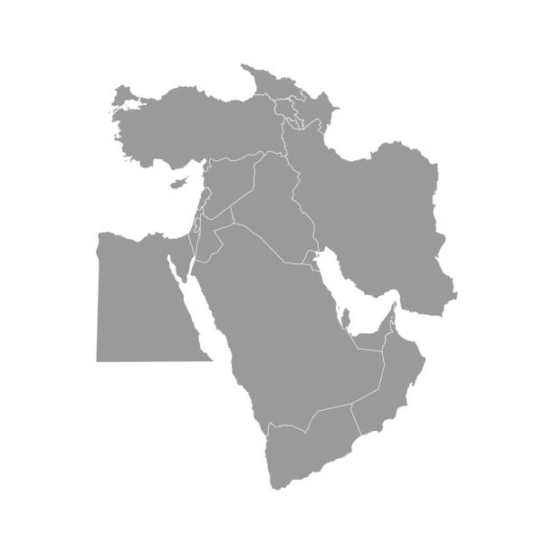
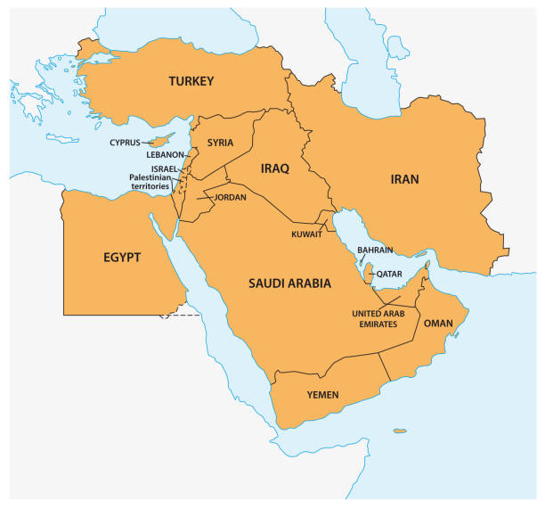
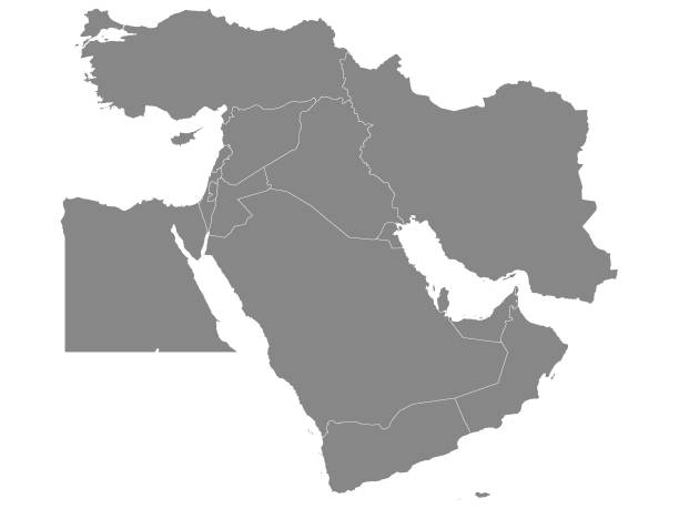
Political color map of Arab World with borders of the states
Israel vector map with flag
Highly detailed vector map of Middle East..
Vector Illustration of a Drawning Hand Traced Map of Israel and Flag
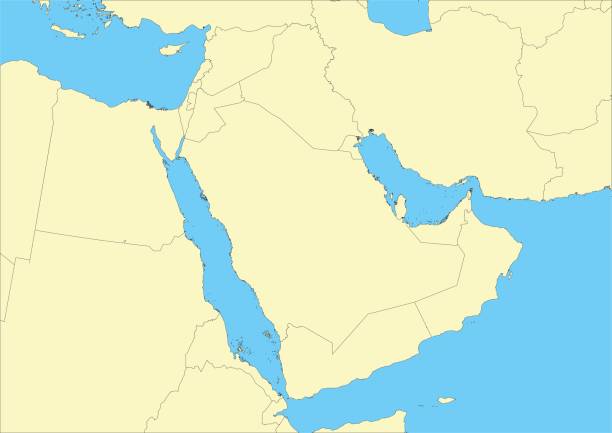
Vector map of the arabian peninsula. This map was traced using as reference NASA public domain Hi-res pictures from http://visibleearth.nasa.gov/view.php?id=74092 and treated in Illustrator and specialized GIS software (Qgis, mapublisher, global mapper...) on nov.-23-2009. Illustration has one layer
Sinai Peninsula region, political map. A peninsula in Egypt, located between the Mediterranean Sea and the Red Sea, land bridge between Asia and Africa. With parts of Israel, Jordan and Saudi Arabia.
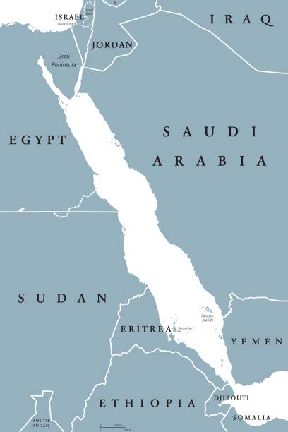
Red Sea political map. English labeling. Also called the Erythraean Sea. Seawater Inlet of the Indian Ocean between Horn of Africa and Arabian Peninsula. Gray illustration on white background. Vector.

middle east countries vector map
World Map with Borders, Cities, Oceans on white background
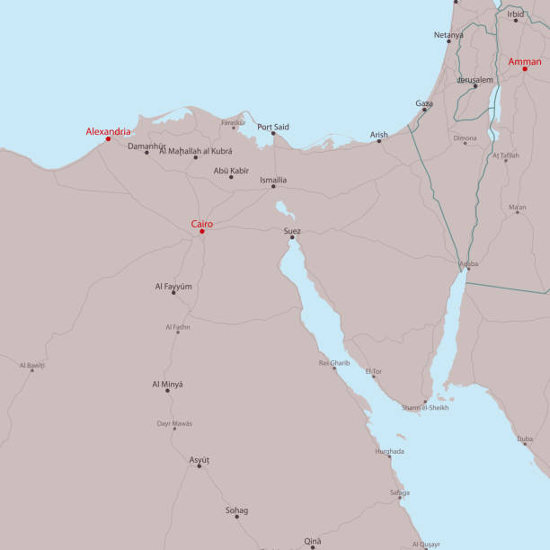
Travel Vector Map Alexandria Sharm El Sheikh. All source data is in the public domain. Made with Natural Earth. http://www.naturalearthdata.com/about/terms-of-use/
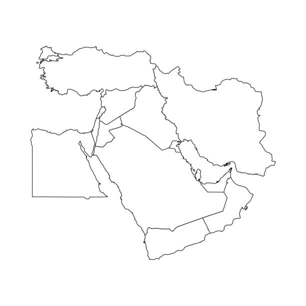
Vector Illustration of the Gray Political Map of Middle East - With Country Borders
Vector art.
Vector art.
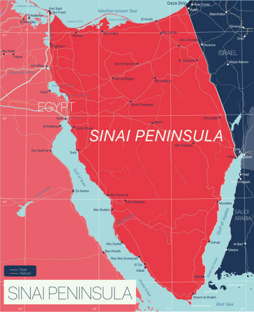
Sinai Peninsula detailed editable map with regions cities and towns, roads and railways, geographic sites. Vector EPS-10 file
Gaza Strip political map. Self governing Palestinian territory on coast of Mediterranean Sea. Borders to Israel and Egypt. Claimed by State of Palestine. English labeling. Gray illustration. Vector.
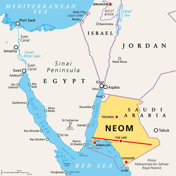
NEOM and the Sinai Peninsula, political map. Neom, a planned smart city in Tabuk Province in northwestern Saudi Arabia, north the Red Sea, east of Egypt, across the Gulf of Aqaba, and south of Jordan.
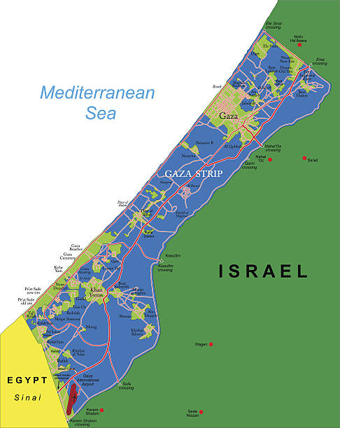
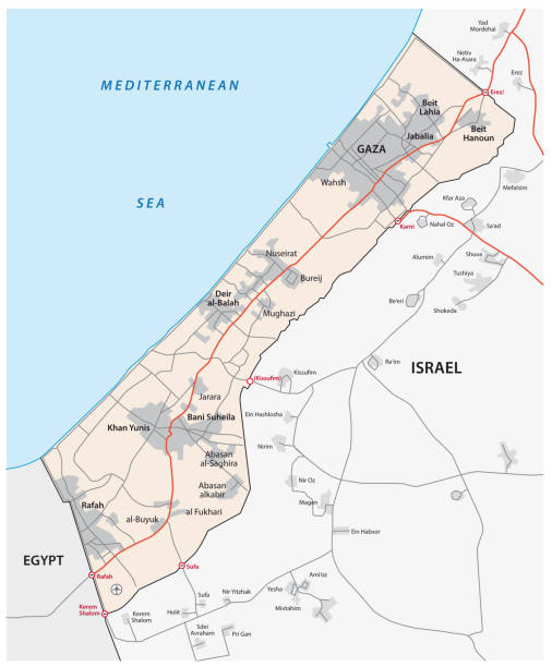
Detailed map of Gaza Strip.
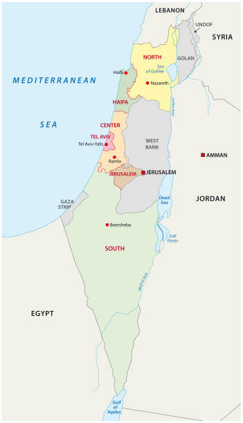
Israel administrative and political vector map
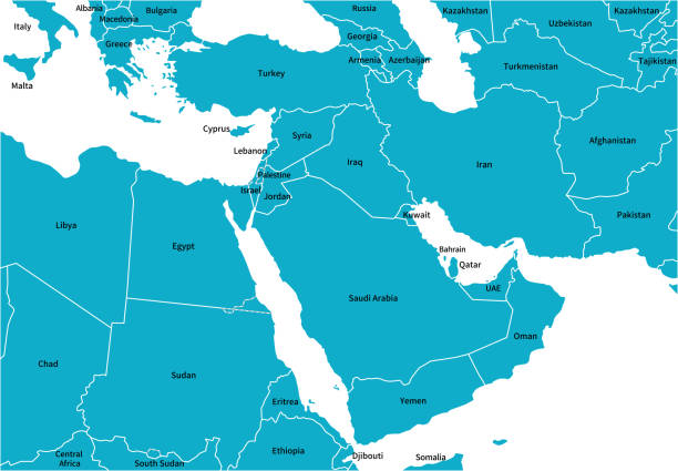
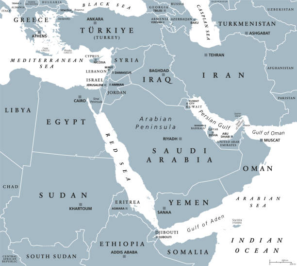
The Middle East, gray political map with capitals and international borders. Geopolitical region encompassing the Arabian Peninsula, the Levant, Turkey, Egypt, Iran and Iraq. Also called Near East.
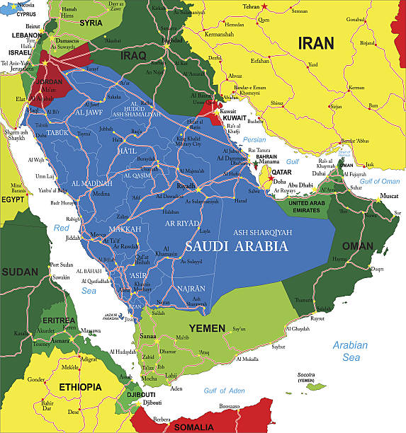
Detailed map of Saudi Arabia.

Vintage painting shows a panoramic view of Gaza in the State of Palestine, 1839.
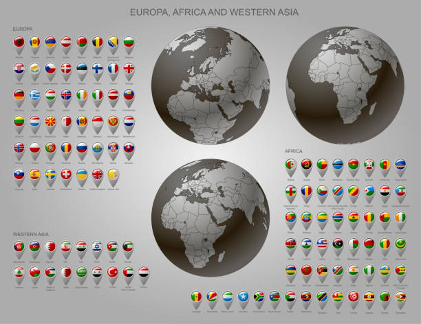
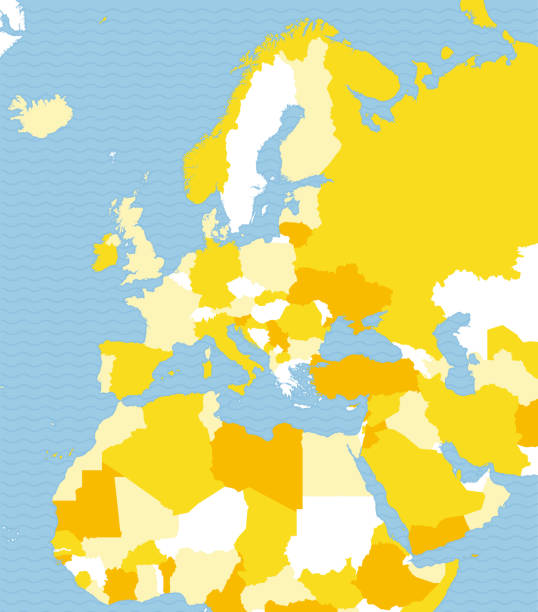
Globes with Europe, Africa and Western Asia with borders of Sovereign states and map marker set with state flags of continents with captions in alphabet
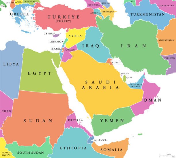
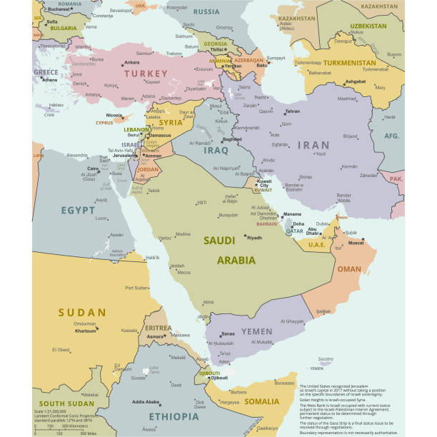
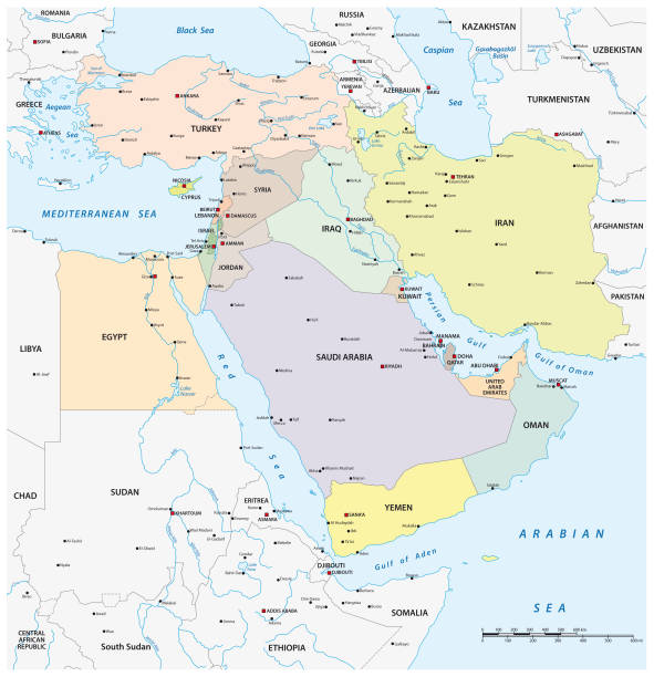
Middle East, colored countries, political map with international borders. Geopolitical region encompassing the Arabian Peninsula, the Levant, Turkey, Egypt, Iran and Iraq. Formerly known as Near East.