Banjul Pictures, Images and Stock Photos
Browse 1,500+ banjul stock photos and images available, or search for banjul gambia to find more great stock photos and pictures.
Most popular
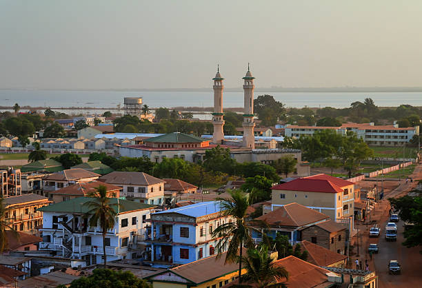
Banjul, The Gambia: skyline of the low-rise Gambian capital with the River Gambia as Background - minarets of King Fahad Mosque on the right
Aerial panorama view to city of Banjul and Gambia river

Banjul is the capital and largest city of Gambia

Boats on the shoreline of Barra in Gambia, West Africa
Serekunda is a sprawling urban area in the Gambia, a small West African country bordered by Senegal.

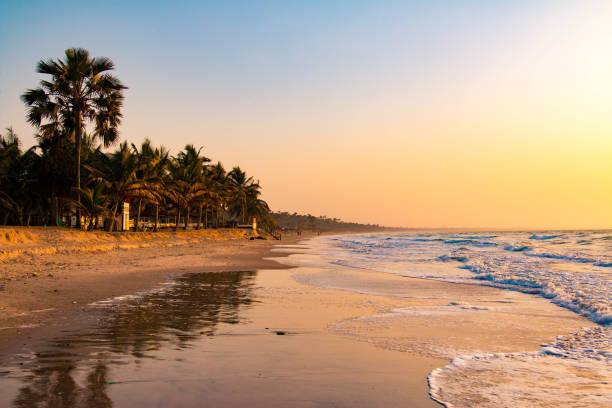
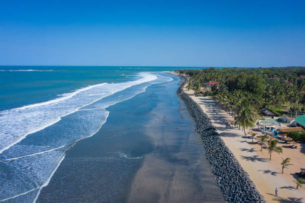
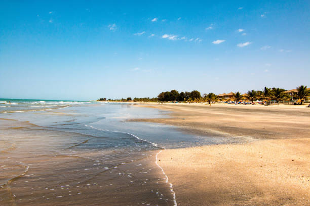
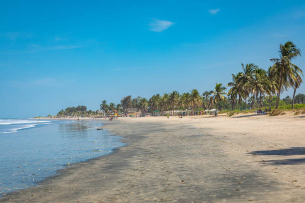
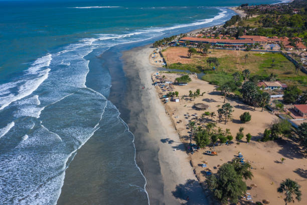
Beach in Banjul, Gambia

Banjul, The Gambia: minarets, roof-tops and the river - King Fahad mosque (Great Mosque, Jammeh Mosque) - accommodates 6000 worshippers - Sunni mosque - Box Bar Road, former Wallace Cole Road - photo by M.Torres
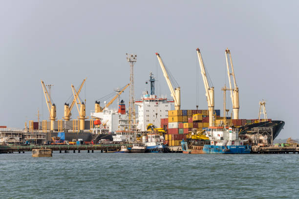
Banjul, The Gambia - May 07, 2017: Cranes boats and containers in the commercial port of the city
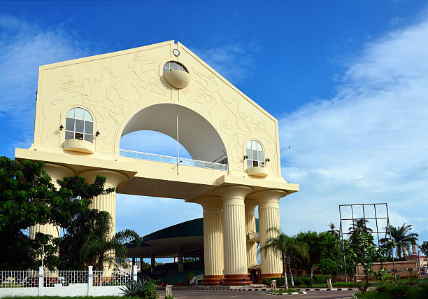
Banjul, The Gambia: triumphal arch at the entrance to the capital - Arch 22, the gate to Banjul, façade facing the Banjul-Serrekunda Highway roundabout - behind the arch the start of Independence Drive with its parade stand
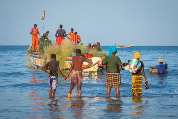
Tanji, The Gambia - November 21, 2019: People carrying fish from the boats to the beach on Tanji, Gambia, West Africa.

Banjul, The Gambia - February 21, 2011: Local men loading a carriage with different goods that came from ferry or pirogue boats.

Arch 22 is the main symbol of Banjul - 19.11.2012 in the center of Banjul, Gambia

Banjul, The Gambia - may 09, 2017: Main entrance to the Albert Market in the urban center of the city

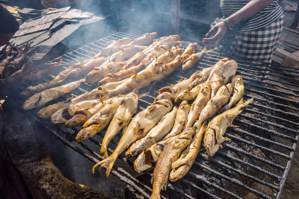
Smoking fish on a grill using charcoal in the port of Banjul in The Gambia
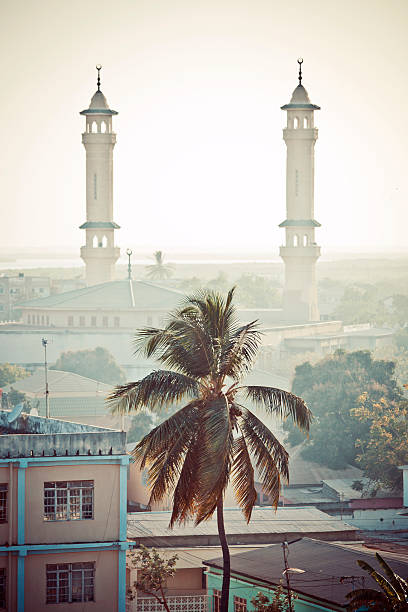
west african town view with palm tree and minarets of mosque.

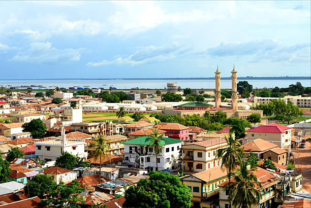
Banjul, The Gambia: city panorama - skyline of the low-rise Gambian capital with the River Gambia estuary and the harbor as background, minarets of the King Fahad Mosque on the right, Atlantic Ocean on the left. The city was built on a shallow sandbar island (St. Mary's Island) that had formed in the estuary over time, it is connected to the mainland via the Denton Bridge. It was mentioned for the first time by Portuguese sailors in the 15th century.
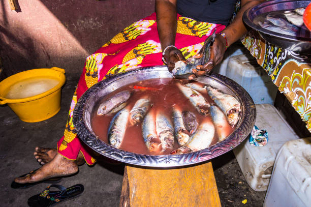
Gambian woman uses her hands to empty and clean fish for meal preparation on a Banjul market.

The Gambia Political Map with capital Banjul, national borders, important cities and rivers. English labeling and scaling. Illustration.

Banjul, Gambia - may 11, 2017: Cook preparing food on a sightseeing boat docked at the port of Oyser Creek Marina, at the entrance of the city

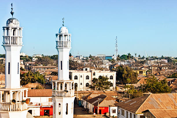
Aerial view of the city and mosque of Banjul, capital of The Gambia

The coastline of Cape Point in The Gambia taken from a drone
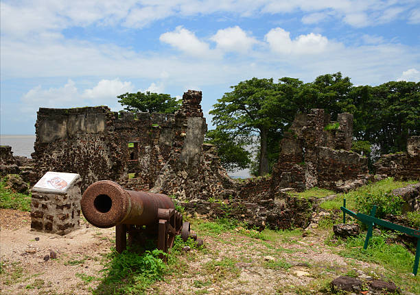
James Island / Kunta Kinteh island, The Gambia: 18h century gun and the ruins of Fort James - a UNESCO world heritage site, occupied by the Portuguese in 1456. In 1651 the Duchy of Courland, in modern Latvia, built a fortress, Fort James, formerly Jacob Fort after Jacob Kettler, the Duke of Courland - it became famous after Alex Haley's book "Roots" for its later role in the triangular slave trade - photo by M.Torres

Banjul, Gambia: National Assembly of the Gambia, the Gambian parliament - photo by M.Torres

Mosque and city of Banjul, capital of Gambia


Banjul, Gambia - May 11, 2014: Fulani Women wearing traditional costume for Roots Festival

Banjul, The Gambia - May 09, 2017: Commercial atmosphere on the outskirts of the Albert Market in the urban center of the city
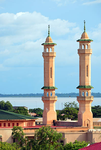
Banjul, The Gambia: minarets of the King Fahad mosque seen against the River Gambia - Box Bar Road, former Wallace Cole Road - photo by M.Torres
Banjul, Gambia - May 09, 2017: People and taxi rank in the urban center of the city
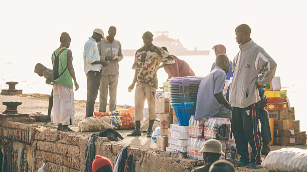
Barra, The Gambia, 3rd March 2011: Local people trading different goods on river port. This main crossing point over river Gambia to capital city Banjul a is always busy.
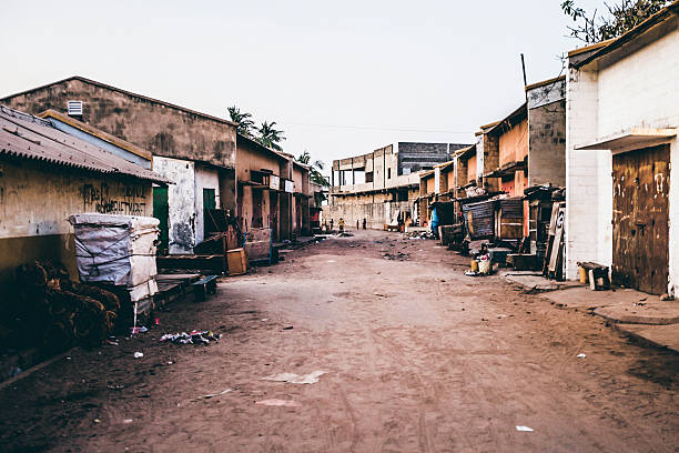
West African town. Empty markets street at evening time.
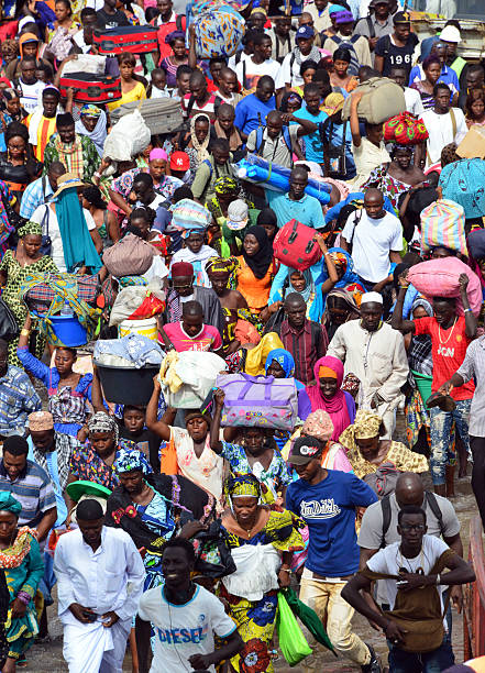
Banjul, The Gambia: large crowd with luggage enters the ferry to Barra - many people, many logos - rush hour at the ferry terminal - photo by M.Torres
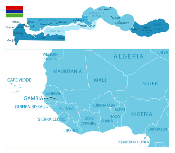
Gambia - highly detailed blue map. Vector illustration

Arch 22 is a commemorative arch on the road into Banjul in the Gambia.

Banjul, Gambia - May 09, 2017: Shops and old colonial house in a central street of the city

Banjul, Gambia - may 11, 2017: Boarding and disembarking of passengers and vehicles on the ferry that travels from the port of Banjul to Barra

Banjul, officially the City of Banjul, is the capital of The Gambia in West Africa
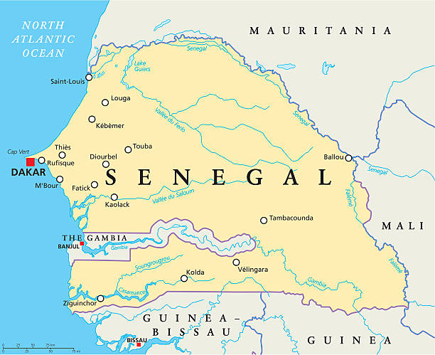
Senegal Political Map with capital Dakar, national borders, important cities, rivers and lakes. English labeling and scaling. Illustration.

Vector flag of The Gambia. Proportion 2:3. Gambian national flag. Republic of The Gambia. Vector EPS 10

Barra, Gambia – August 30, 2018: A vertical shot of a Ferry ride from Banjul to Barra

Small flags of Gambia on a blurry background of the city.

Banjul, The Gambia: triumphal arch at the entrance to the capital - Arch 22, the gate to Banjul, between the Banjul-Serrekunda Highway and the North-East end of Independence Drive - photo by M.Torres
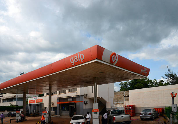
Banjul, The Gambia - September 2, 2015: people refuel their cars at a Galp Petrol Station on Independence drive

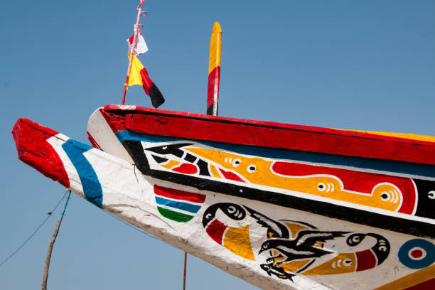
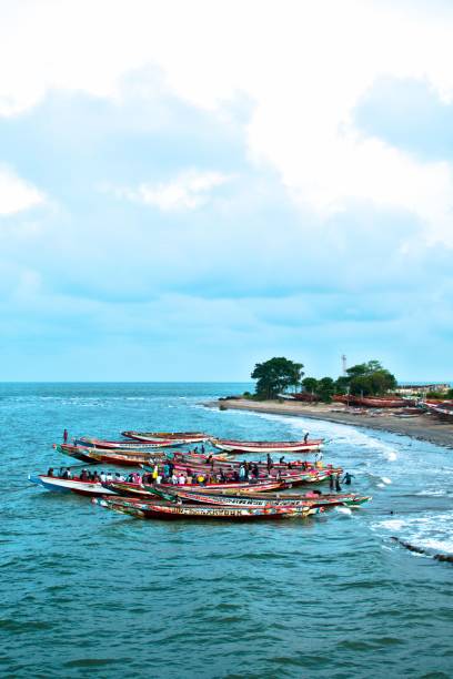
Banjul, The Gambia - August 31, 2015: fishermen preparing traditional wooden fishing boats for a day's work in the Atlantic Ocean and the River Gambia estuary

Banjul, The Gambia: triumphal arch at the entrance to the capital - Arch 22, the gate to Banjul, 35 m high structure between the Banjul-Serrekunda Highway and Independence Drive - photo by M.Torres

Gambia national flag in exact proportions - Vector illustration

http://dikobraz.org/map_2.jpg
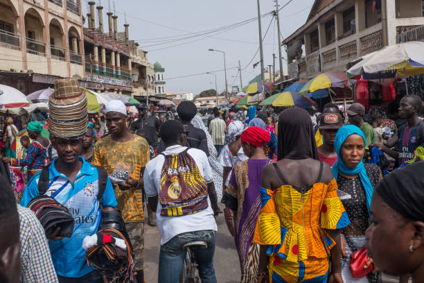
Serekunda, Gambia - June 10, 2018: Numerous people visit the market of Serekunda on June 10, 2018
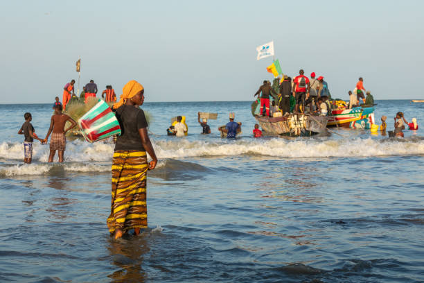
Tanji, The Gambia - November 20, 2019: Fishing village. People carrying fish from the boats to the beach on Tanji, The Gambia, West Africa.

Banjul, The Gambia - February 21st 2011: Local wooden fishing boat full of passengers is crossing river Gambia from Barra to Banjul.