Hartford, Connecticut, USA downtown skyline at sunset.
Browse 37,200+ connecticut stock photos and images available, or search for hartford connecticut or connecticut map to find more great stock photos and pictures.
Hartford, Connecticut, USA downtown skyline at sunset.

Skyline of downtown Hartford, Connecticut from above Charter Oak Landing at sunset.

Hartford, Connecticut, USA downtown cityscape.
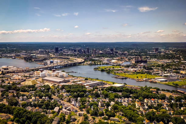
A stunning aerial stock photo of New Haven, Connecticut, showcasing the city's layout, architecture, and surrounding landscape from above. The image captures the urban and natural elements of the area, making it ideal for use in cityscapes, travel, and regional projects
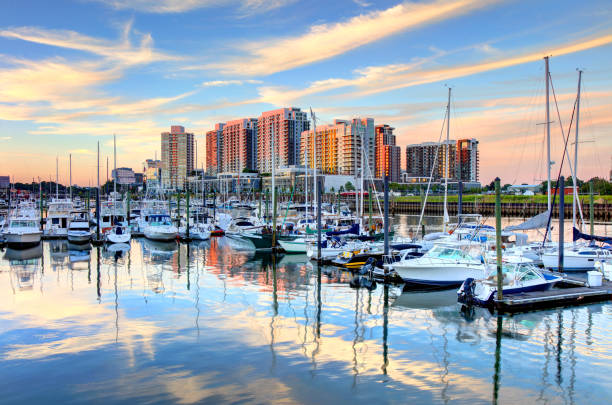
Stamford is a city in Fairfield County, Connecticut, 34 miles outside of New York City.

Hartford is the capital of the U.S. state of Connecticut. Hartford is known for its attractive architectural styles and being the Insurance capital of the United States

Skyline of Hartford, Connecticut with park and autumn colors.

Five Mile Point Lighthouse or Old New Haven Harbor Lighthouse, is a lighthouse in New Haven, Connecticut, United States, on the harbor entrance to Long Island Sound. Photo taken from the shores of Lighthouse Point Park at high tide. New Haven is the second-largest city in Connecticut after Bridgeport.

Aerial view of the Connecticut State Capitol Building and Bushnell Park in Hartford

Norwich is a city in New London County, Connecticut

A beautiful sunset at Fayerweather Island Lighthouse in Connecticut.

Downtown Hartford Connecticut skyline at dusk. Hartford is the capital of the U.S. state of Connecticut. Hartford is known for its attractive architectural styles and being the Insurance capital of the United States.

Greenwich is a town in Fairfield County, Connecticut, United States. The town is part of the New York City Metropolitan Area

Mystic is a village and census-designated place in Groton and Stonington, Connecticut.

Connecticut State Capitol in Hartford, Connecticut, USA during autumn.

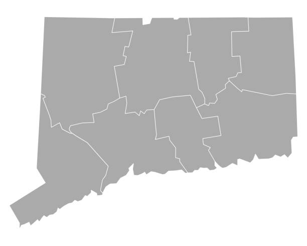
Blue map of Connecticut isolated on white background. Vector illustration eps10.

Greenwich is a town in Fairfield County, Connecticut, United States. The town is part of the New York City Metropolitan Area

The Connecticut State Capitol building with the Corning Fountain in the foreground. The fountain was dedicated in 1899.

Stamford is the largest financial district in the New York metropolitan region outside New York City itself and one of the largest concentrations of corporations in the United States.

Norwalk is a city located in Western Connecticut. Norwalk lies within both the New York metropolitan area and the Bridgeport metropolitan area
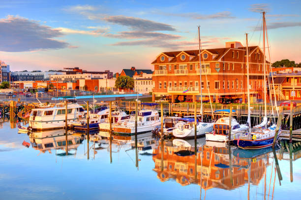
Norwalk is a city located in Western Connecticut. Norwalk lies within both the New York metropolitan area and the Bridgeport metropolitan area

Hartford, Connecticut, USA downtown city skyline on the river.
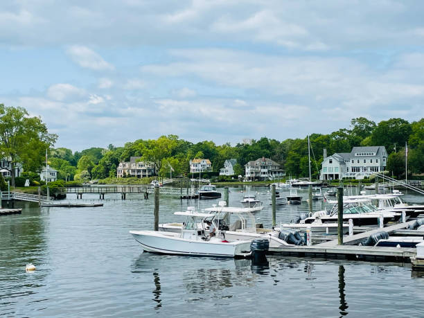
Sailboats and motorboats rest in the calm, protected waters of Rowayton's waterfront harbor on the Five Mile River in Fairfield County, Connecticut. A picturesque New England coastal village on Long Island Sound renowned for its maritime character.

Aerial shot of a residential neighborhood in Stamford, Connecticut on a sunny day in Fall, looking down on houses and vibrant autumn leaf color on the trees.

A Sunset overlooking Mohegan Sun in Uncasville, Connecticut

Illustrated map of the state of Connecticut in United States with cities and landmarks. Editable vector illustration

Waterbury is a city in the U.S. state of Connecticut. The city is 33 miles southwest of Hartford and 77 miles northeast of New York City.

New England Seascape over Fishing Pier Boardwalk in New Haven Harbor in Connecticut at Sunrise: A tranquil beach walk spot with curving street light lamps and safety railing

Stamford is a city in Fairfield County, Connecticut. Stamford has one of the largest concentrations of corporations in the nation. Stamford is in the Bridgeport-Stamford-Norwalk Metro area which is a part of the Greater New York metropolitan area.

Downtown of beautiful modern Hartford, Connecticut, the USA at daytime. View on the river floating through the city at backdrop. Aerial perspective..

Skyline of downtown Hartford, Connecticut from above Charter Oak Landing.

Connecticut US State Blank Vector Map Isolated on White Background. High-Detailed Black Silhouette Map of Connecticut.

Stamford is a city in Fairfield County, Connecticut, 34 miles outside of New York City.

New Haven Landmark Lighthouse at the beachfront of Morgan Point Park, built in 1847 in Connecticut. Winter coastal landscape of New England with dramatic clouds, glacial rocks, and sand dune.

Connecticut, U.S. state, subdivided into 8 counties, gray political map with borders and county names. State in the New England region of Northeastern United States nicknamed The Constitution State.

Aerial view of Bridgeport, Connecticut on a clear sunny dayAuthorization was obtained from the FAA for this operation in restricted airspace.

Connecticut state of United States flag on flagpole textile cloth fabric waving on the top sunrise mist fog

Danbury is a city in northern Fairfield County, Connecticut, United States, approximately 70 miles from New York City

Bristol is a suburban city located in Hartford County, Connecticut, United States, 20 miles southwest of Hartford

American traditional Colonial house front view in summer
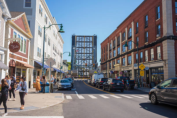
Mystic, CT, USA - Oct 5, 2025: Tourists watch the rising of the Mystic River Bascule Bridge to allow sailboats and yachts pass under. The seaport village is known for its rich maritime history.
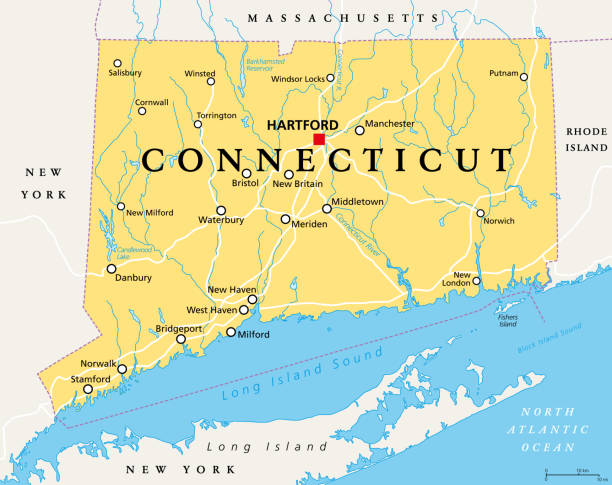
Connecticut, political map with capital Hartford. State of Connecticut, CT, the southernmost state in the New England region of the northeastern United States of America. English. Illustration. Vector

New Canaan, CT, USA - October 27, 2023: New Canaan view from Elm Street in autumn morning with colored trees in October

New Haven is the second-largest city in Connecticut after Bridgeport and the sixth-largest in New England. New Haven is known for its established theaters, museums, music venues and New Haven-style pizza

Aerial shot of New Haven, Connecticut at sunrise on a Fall morning. Authorization was obtained from the FAA for this operation in restricted airspace.

Lynde Point Lighthouse (also known as the Inner Light) and its adjacent keeper's house are viewed from an aerial perspective at sunset in Old Saybrook, Connecticut, New England, USA. The historic octagonal brownstone tower stands on a short breakwater at the mouth of the Connecticut River, where it meets Long Island Sound, with the Saybrook Breakwater Light (Outer Light) visible far out in the channel.