Dominican Republic Map Pictures, Images and Stock Photos
Browse 2,400+ dominican republic map stock photos and images available, or search for dominican republic map vector to find more great stock photos and pictures.
Most popular
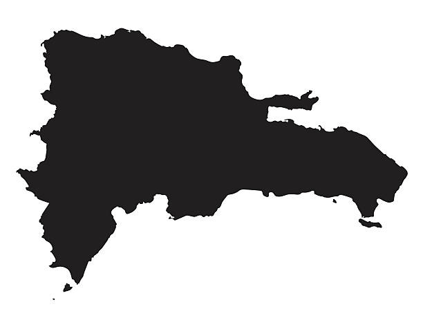
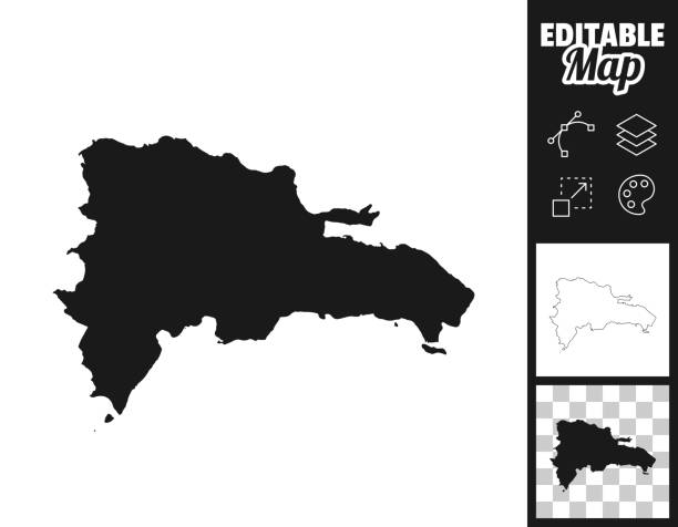
black vector map of Dominican Republic
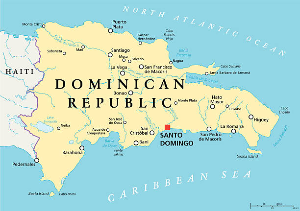
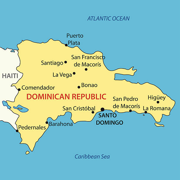
Dominican Republic Political Map with capital Santo Domingo, with national borders, important cities, rivers and lakes. English labeling and scaling. Illustration.
vector illustration of Dominican Republic map
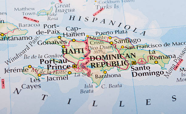
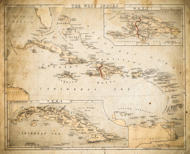
Haiti and Dominican Republic map on the World's Atlas

Dominican Republic vector map. Editable template with regions, cities, red pins and blue surface on white background.
Map of Dominican Republic for your own design. Three maps with editable stroke included in the bundle: - One black map on a white background. - One line map with only a thin black outline in a line art style (you can adjust the stroke weight as you want). - One map on a blank transparent background (for change background or texture). The layers are named to facilitate your customization. Vector Illustration (EPS file, well layered and grouped). Easy to edit, manipulate, resize or colorize. Vector and Jpeg file of different sizes.
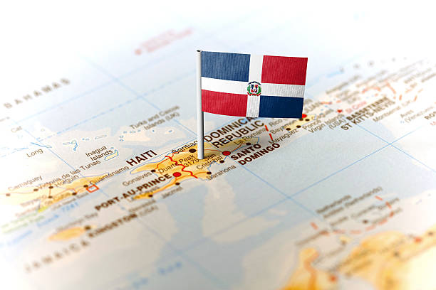
The flag of Dominican Republic pinned on the map. Horizontal orientation. Macro photography.


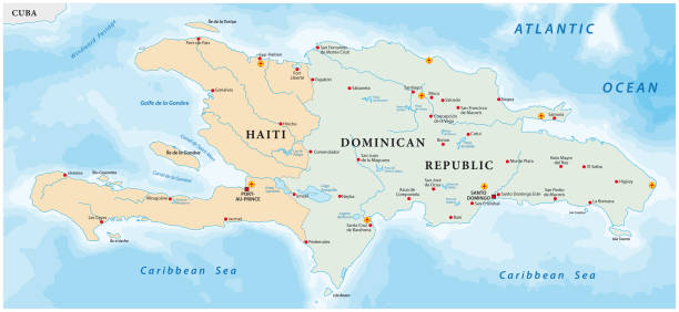
Hispaniola political map, also San Domingo. Haiti and Dominican Republic with capitals Port-au-Prince and Santo Domingo, in the Caribbean island group. Gray illustration with English labeling. Vector.

Map of Dominican Republic with national flag. Highly detailed editable map of North America country territory borders. Political or geographical design vector illustration on gray background
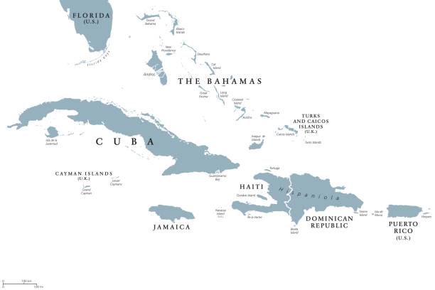
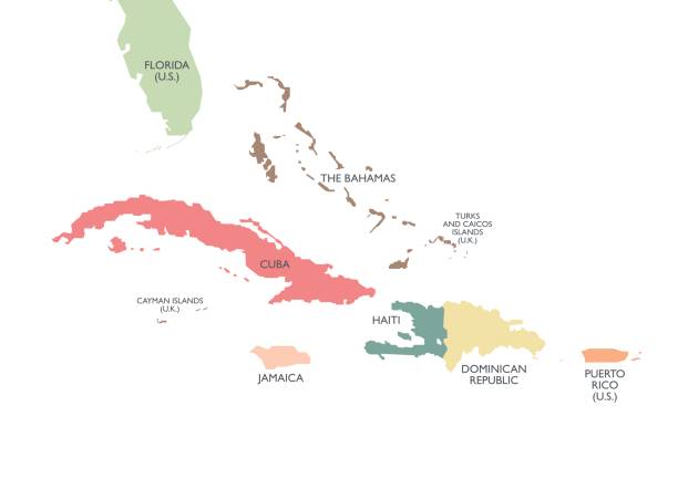
Greater Antilles political map with English labeling. Grouping of the larger islands in the Caribbean Sea with Cuba, Hispaniola, Puerto Rico, Jamaica and the Cayman Islands. Gray illustration. Vector.
Vector map of the Caribbean island of Hispaniola
Greater Antilles political map. Vector illustration
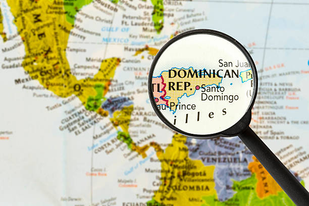
map of Dominican Republic through magnifying glass
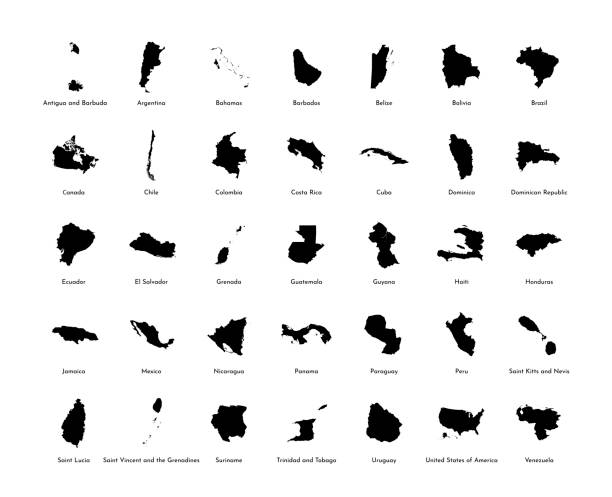
Vector illustration set with simplified maps of all South, North and American states (countries). Black silhouettes, white background
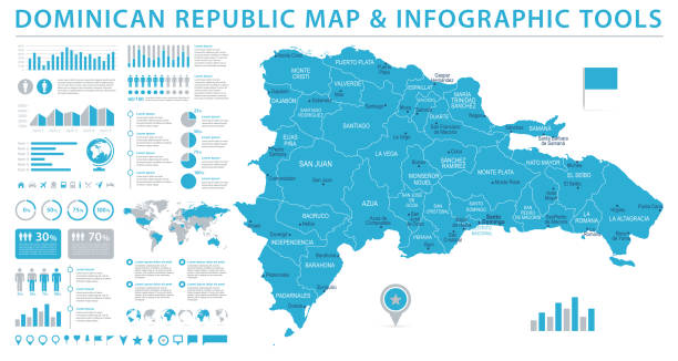
Dominican Republic Map - Detailed Info Graphic Vector Illustration

3D Render of a Topographic Map of the Dominican Republic. All source data is in the public domain. Color texture: Made with Natural Earth. http://www.naturalearthdata.com/downloads/10m-raster-data/10m-cross-blend-hypso/ Boundaries Level 0: Humanitarian Information Unit HIU, U.S. Department of State (database: LSIB) Relief texture and Rivers: SRTM data courtesy of USGS. URL of source image: Water texture: SRTM Water Body SWDB: https://dds.cr.usgs.gov/srtm/version2_1/SWBD/
vector illustration of Haiti and Dominican Republic map
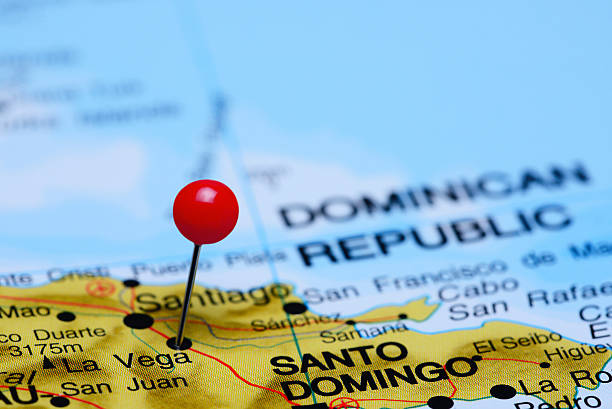
Photo of pinned La Vega on a map of North America. May be used as illustration for traveling theme.
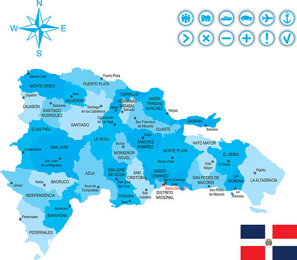
High quality map with borders of the regions

Map of Dominican Republic for your own design. With space for your text and your background. Four maps included in the bundle: - One black map on a white background. - One blank map on a black background. - One white map with shadow on a blank background (for easy change background or texture). - One blank map with only a thin black outline (in a line art style). The layers are named to facilitate your customization. Vector Illustration (EPS10, well layered and grouped). Easy to edit, manipulate, resize or colorize. Please do not hesitate to contact me if you have any questions, or need to customise the illustration. http://www.istockphoto.com/portfolio/bgblue
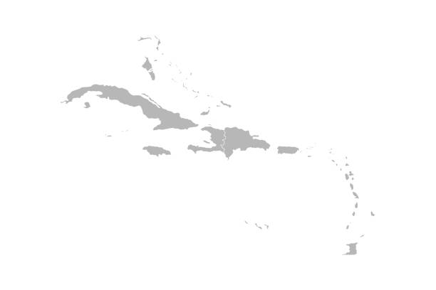
Caribbean island map vector graphics design. Gray background. Perfect for business concepts, backgrounds, backdrop, banner, poster, sticker, label and wallpapers.
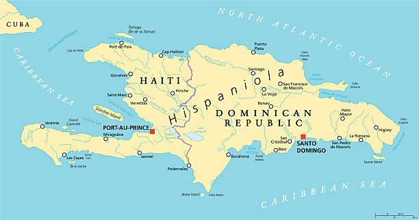
Hispaniola Political Map with Haiti and Dominican Republic, located in the Caribbean island group, the Greater Antilles. With capitals, national borders, important cities, rivers and lakes. English labeling and scaling. Illustration.
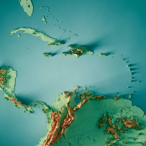
3D Render of a Topographic Map of the Caribbean Sea, Central America. All source data is in the public domain. Color texture and Rivers: Made with Natural Earth. http://www.naturalearthdata.com/downloads/10m-raster-data/10m-cross-blend-hypso/ http://www.naturalearthdata.com/downloads/10m-physical-vectors/ Relief texture: SRTM data courtesy of USGS. URL of source image: https://e4ftl01.cr.usgs.gov//MODV6_Dal_D/SRTM/SRTMGL1.003/2000.02.11/ Water texture: HIU World Water Body Limits: http://geonode.state.gov/layers/?limit=100&offset=0&title__icontains=World%20Water%20Body%20Limits%20Detailed%202017Mar30
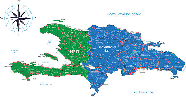
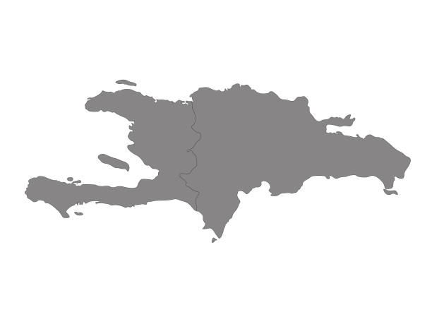
Detailed map of Haiti and the Dominican Rep..
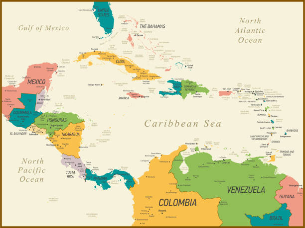
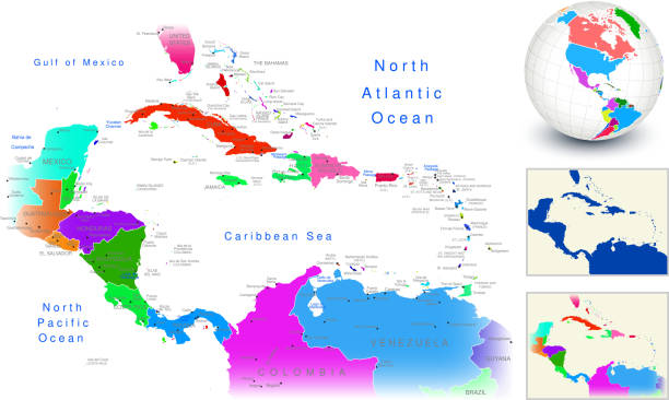
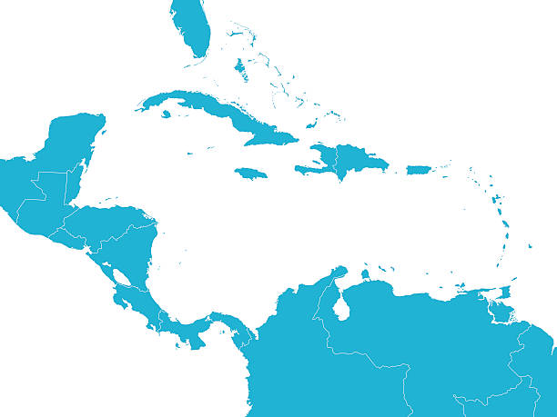
Central America and The Caribbean Map with Geographical Borders
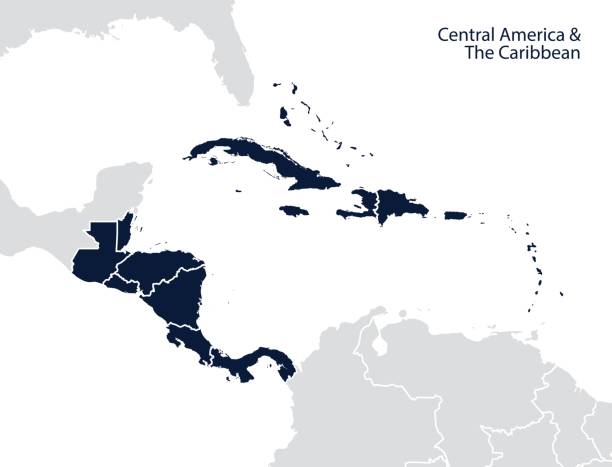
Central America and the Caribbean map. Vector
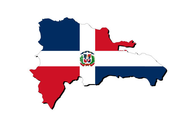
Outline map of Dominican Republic with the national flag superimposed over the country. 3D graphics casting a shadow on the white background
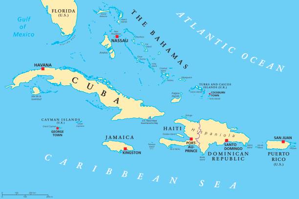
Greater Antilles political map. Caribbean islands. Cuba, Jamaica, Haiti, Dominican Republic, Puerto Rico, Cayman Islands, The Bahamas, Turks And Caicos Islands. Illustration. English labeling. Vector.
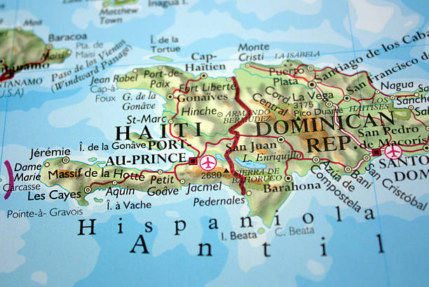
Map with selective focus on Haiti and the Dominican Republic - source: Oxford New Concise World Atlas
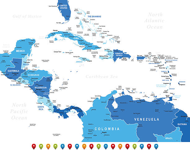
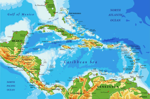
High detailed Map of Central America with national borders, countries and navigational icons
Dominican Republic - detailed country outline and location on world map. Vector illustration

Dominican Republic infographic map and flag - High Detailed Vector Illustration

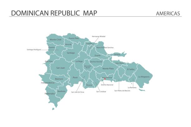
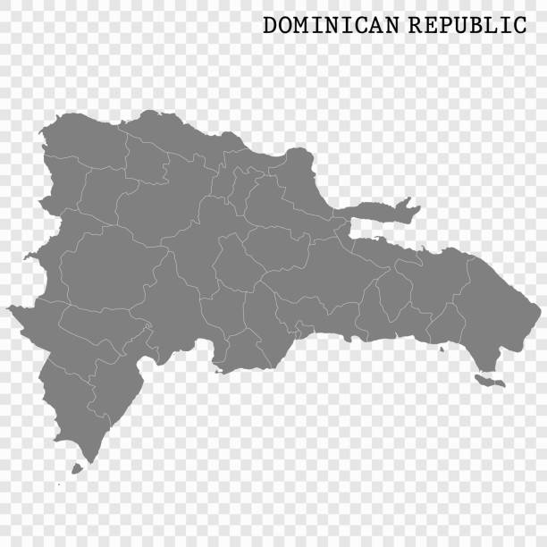
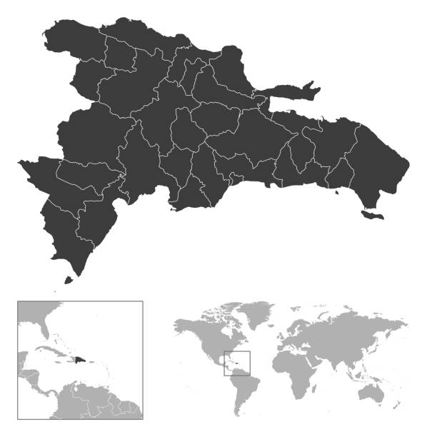
Vector isolated illustration of simplified administrative map of Dominican Republic. Borders of the provinces. Grey silhouettes. White outline.

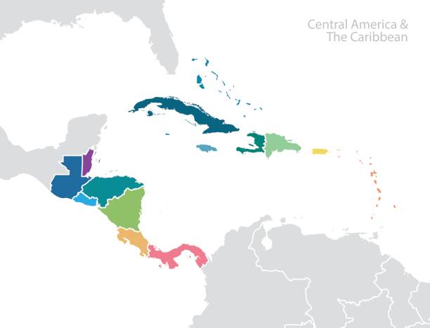
Central America and the Caribbean map. Vector

Highly detailed vector map of Dominican Republic Detailed map of Haiti and the Dominican Rep..
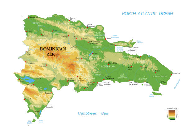
Highly detailed physical map of Dominican Republic, in vector format,with all the relief forms,regions and big cities.

Dominican Republic editable outline map. Republica Dominicana red border. Country name. Adjust line weight. Change to any color. Vector illustration.
Dominican Republic - vector map.

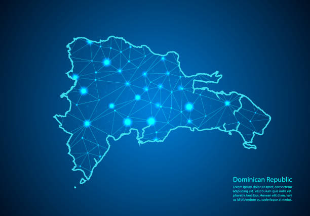
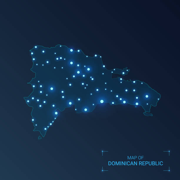
Abstract image Dominican Republic map from point blue and glowing stars on a dark background. vector illustration.

Encyclopedia Britannica 9th Edition New York Samuel L. Hall 1883 Vol XI
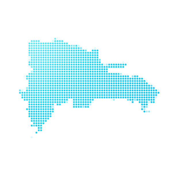
Map of Dominican Republic made with round blue dots on a blank background. Original mosaic illustration. Vector Illustration (EPS10, well layered and grouped). Easy to edit, manipulate, resize or colorize. Please do not hesitate to contact me if you have any questions, or need to customise the illustration. http://www.istockphoto.com/portfolio/bgblue

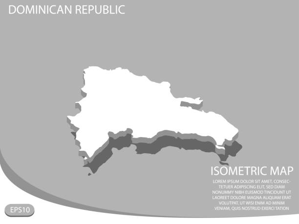
Map of Dominican Republic with provinces.Digitally generated 3d image. Isolated on white background.
http://dikobraz.org/map_2.jpg
Highly detailed physical map of Central America and Caribbean Islands,in vector format,with all the relief forms,regions and big cities.
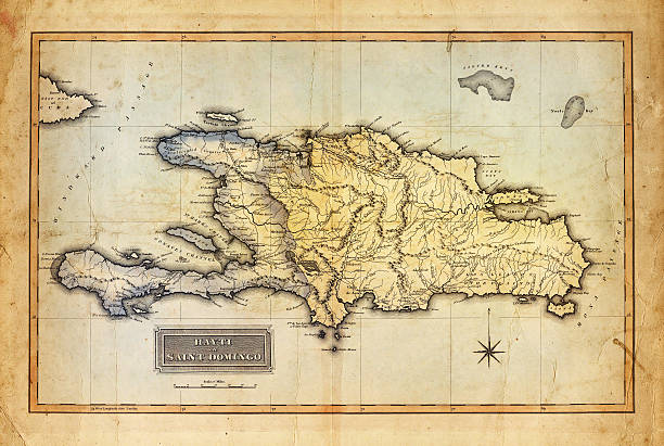
Map of Haiti and Saint Domingo 1823. overlay with old sepia paper
Cornell's Grammar School Geography By S.S. Cornell - New York 1869


Pastel vector map of the Dominican Republic with black borders and names of it's provinces
Empty Blue Map of Central America

Map of Cuba and Jamaıca.

![Dominican Republic Santo Domingo map. Source: "World reference atlas"
[url=/search/lightbox/5890567][IMG]http://farm4.static.flickr.com/3574/3366761342_e502f57f15.jpg?v=0[/IMG][/url] dominican republic map stock pictures, royalty-free photos & images](https://media.istockphoto.com/id/110925386/photo/dominican-republic.jpg?s=612x612&w=0&k=20&c=3-hUFPGlXfIMXwewM27u4WuVyGD1lHOcBbujOQLXoFE=)
Santo Domingo map. Source: "World reference atlas" [url=/search/lightbox/5890567][IMG]http://farm4.static.flickr.com/3574/3366761342_e502f57f15.jpg?v=0[/IMG][/url]

very old map of Hispaniola (Nowadays Dominican Republic and Haiti ) and Puerto Rico from 1747