Karakoram Highway Pictures, Images and Stock Photos
Browse 410+ karakoram highway stock photos and images available, or search for karakoram highway china to find more great stock photos and pictures.
Most popular

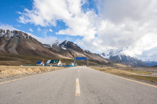
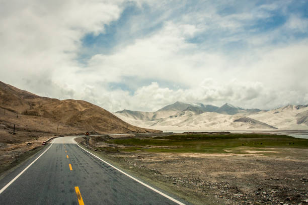
The Karakoram Highway is a 1,300 km national highway which extends from Hasan Abdal in the Punjab province of Pakistan to the Khunjerab Pass in Gilgit-Baltistan, where it crosses into China and becomes China National Highway

Hussaini Hanging Bridge known as the most dangerous bridge in the world, northern Pakistan.
This is the Karakoram Highway is a 1300 km national highway in Pakistan which extends from Hasan Abdal in Punjab province of Pakistan to the Khunjerab Pass in Gilgit-Baltistan, where it crosses into China and becomes China National Highway 314.
The grand Karakoram highway connect to the China and Pakistan passing through the Gilgit-Baltistan
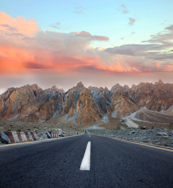
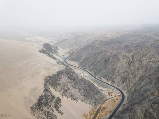
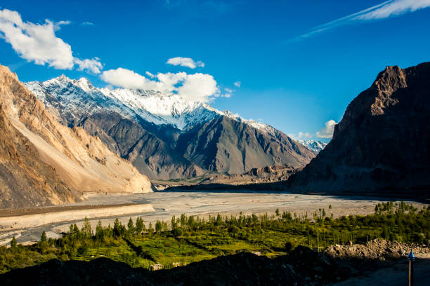
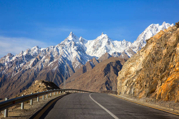
Karakoram highway and glacial Rocky mountains near the China Pakistan border
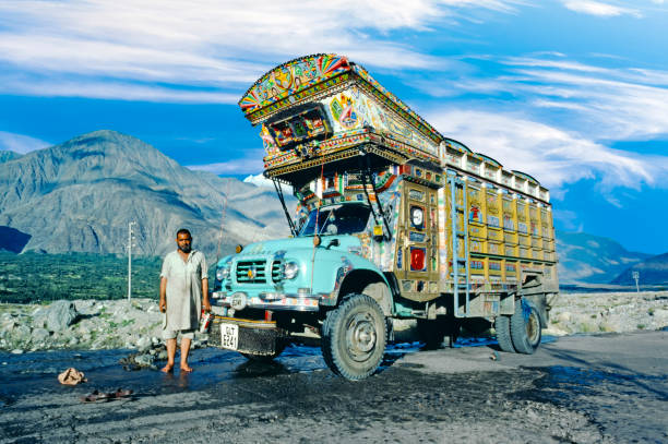
Gilgit: proud truck driver presents his painted truck at the karacorum highway in Pakistan. The Karakoram highway connects Pakistan with China.
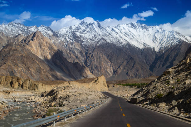
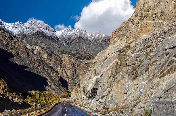
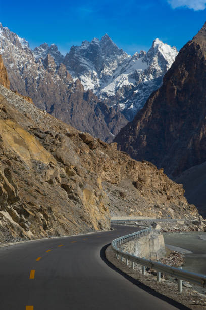
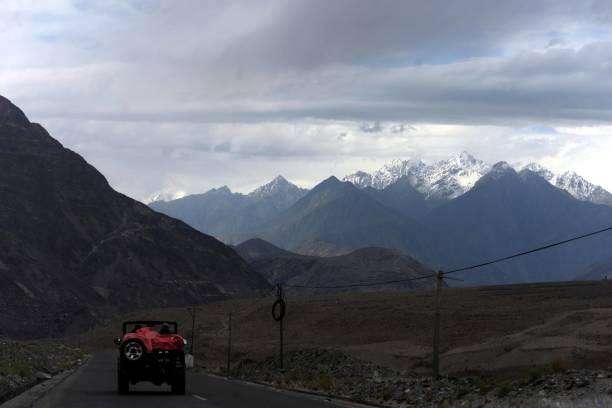
Rough landscape along the Karakoram Highway in Pakistan. This road links Pakistan with China via the Khunjerab pass
View of historical Hunza River and Karakoram Highway from Altit Fort.
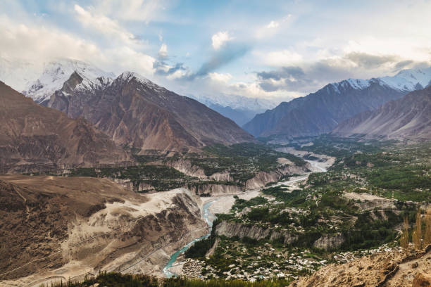
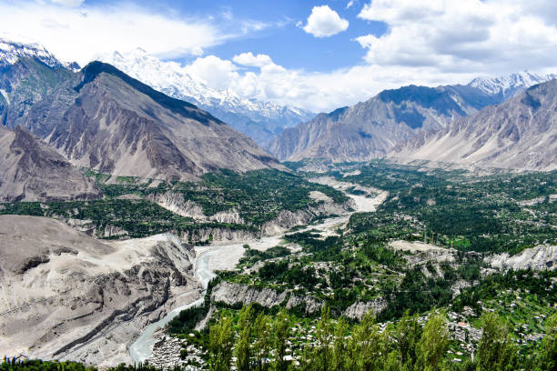
View of the Karakoram mountain range in northern Pakistan and western China
Picture taken toward the Pak-China and Pak Afghan border near Sost, last town of Hunza valley of Pakistan Border. The grey line shows Karakorum High Way leading toward China, built by the People of Pakistan and China as a symbol of friendship. At the right side are the whitish color showing tall Poplar and willow trees famous in Pakistan.
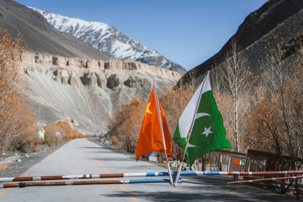
Chinese and Pakistani flag on entrance to Karakoram Highway
View of the Karakoram mountain range in northern Pakistan and western China
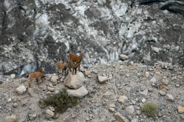
A high angle shot of wild goats at Passu Glacier, Karakoram Highway, Pakistan
he Karakoram Highway is a 1,300-kilometre national highway which extends from Hasan Abdal in the Punjab province of Pakistan to the Khunjerab Pass in Gilgit-Baltistan, where it crosses into China and becomes China National Highway
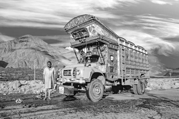
Gilgit, Pakistan - August 6, 1987: proud truck driver presents his painted truck at the karacorum highway in Pakistan. The Karakoram highway connects Pakistan with China.

Xinjiang, China - August 15, 2012: A woman leading cows along the Karakoram Highway with the mountains on the background , Xinjiang, China

The Korakoram highway, connecting the Gilgit–Baltistan region to the ancient Silk Road, runs approximately 1,300 km (810 mi) from Kashgar, a city in the Xinjiang region of China, to Abbottabad, of Pakistan. An extension of the highway southwest from Abbottabad, in the form of the N-35 highway, meets the Grand Trunk Road, N-5, at Hasan Abdal, Pakistan.
Karakoram
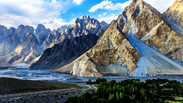
Tupopdan 6,106 metres also known as 'Passu Cones' or 'Passu Cathedral', lies to the north of the Gulmit village in Gojal Valley alongside the karakoram highway on the way to China Pakistan border
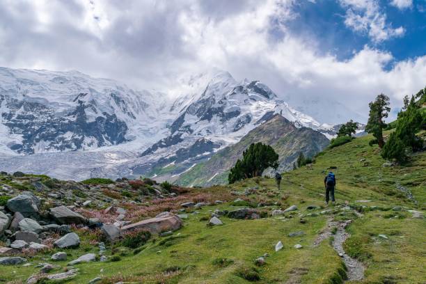
A scenic view of people hiking to Rakaposhi glacier in Minapin, Karakoram highway, Pakistan
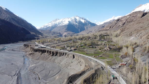
Panoramic view from Attabad lake, Karakoram highway passing through tunnel and bridge and high mountains
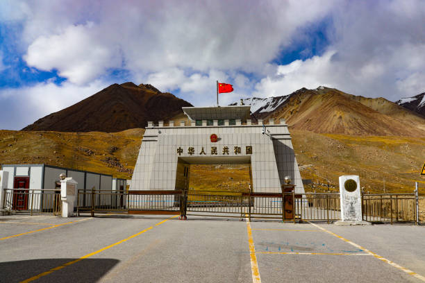
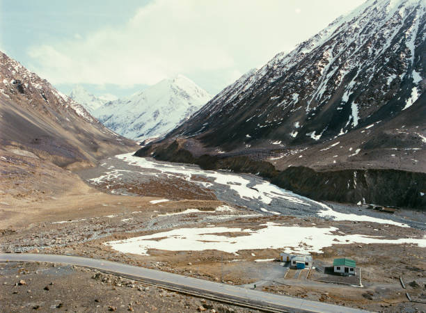
Khunjerab Pass, border of China and Pakistan, at 4,714 meters above sea level. The Karakoram Highway connects Pakistan with China.

Karakuram Highway
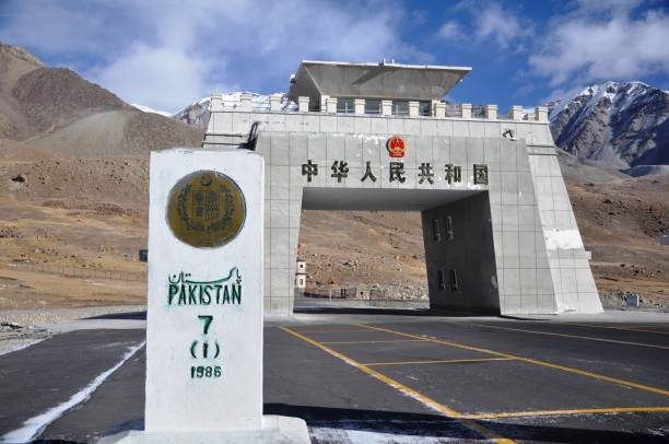
Khunjerab Pass, border of China and Pakistan, at 4,714 meters above sea level. The Karakoram Highway connects Pakistan with China.

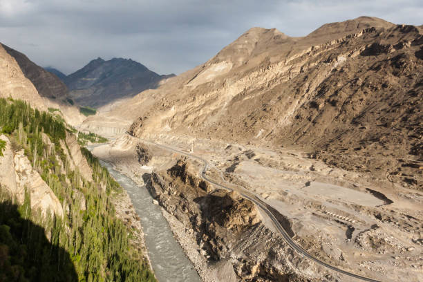
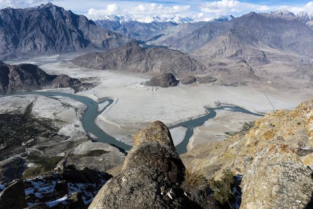
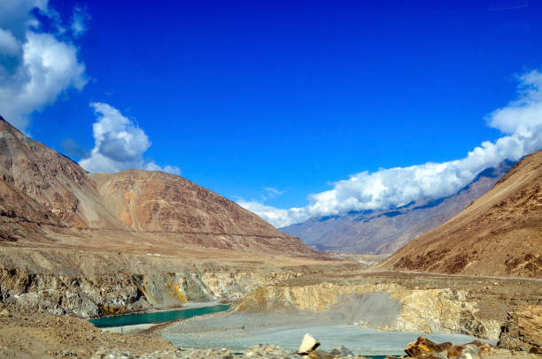
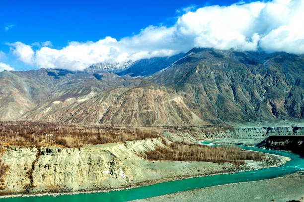
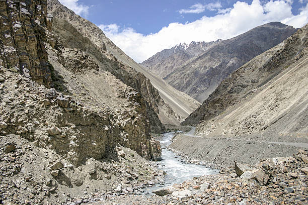
Indus river in the karakoram mountains range
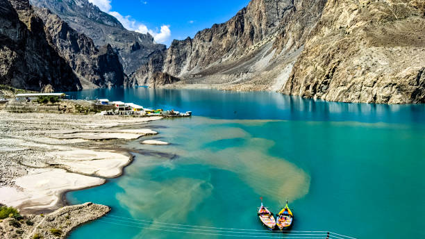
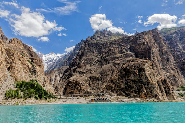
Situated in Gojal Valley, Hunza, Gilgit Baltistan, Attabad Lake has a length of 14 kilometers and was created as a result of a natural disaster in the village of Attabad. This lake is known for its icy blue water, which originates from the Hunza River and the glaciers in the surrounding area
Pamir Highway with mountain in background
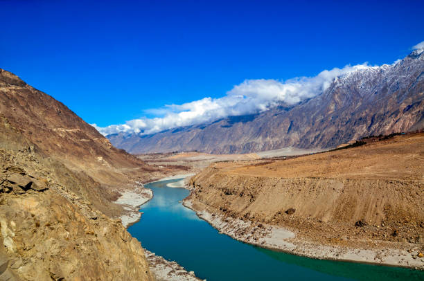
Fascinating view of the Indus River and Snow-capped karakoram mountains
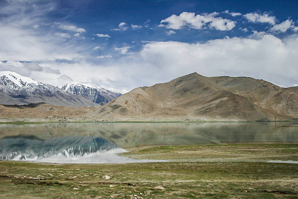
Karakul lake, in Xinjiang province of China lies on the Karakoram Highway linking Kashgar in China with Islamabad in Pakistan. It's in the Pamir mountain range.
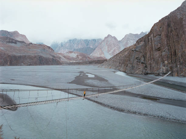
Young Caucasian woman walking on suspension bridge in Pakistan
Rakaposhi 7788m in Nagar Valley

Bow of boat, looking out onto Attabad Lake.
Fascinating view of the karakoram highway and the Indus River
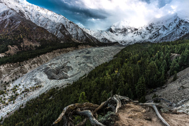
Winter scene of the Indus River and Snow-capped karakoram mountains near the Gilgit
Rakaposhi 7788m, hunza Valley view
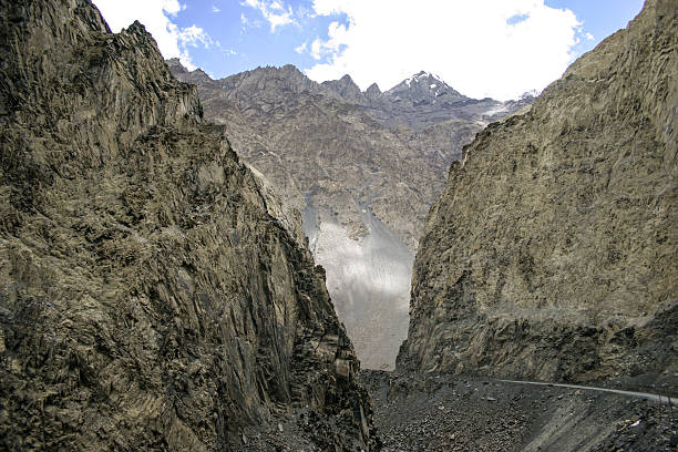
Khunjrab Pass is a high mountain pass in the Karakoram Mountains in a strategic position on the northern border of Pakistan and on the southwest border of China
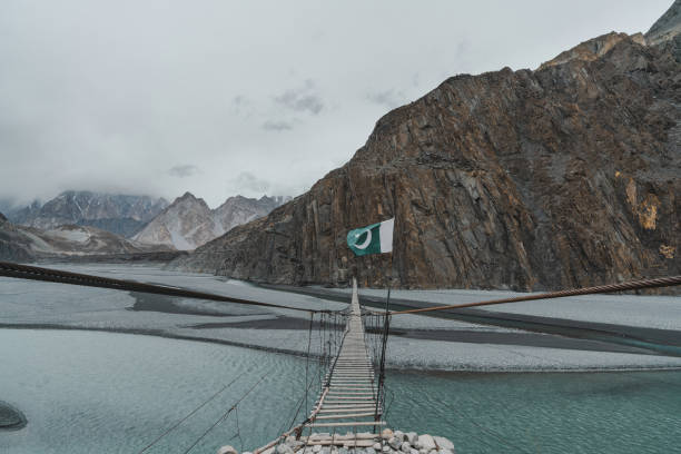
Scenic view of suspension bridge in Gilgit-Baltistan, Pakistan

Silk road or karakorum highway connect the Pakistan and China during winter season

Traditional yurt at the shore of the Karakul Lake, in the Xinjiang Province, China

K2, at 8,611 metres above sea level, is the second-highest mountain on Earth, after Mount Everest. It lies in the Karakoram range
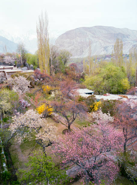
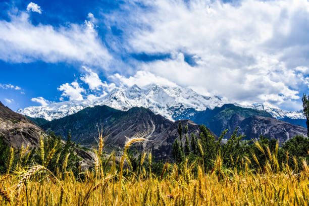
Scenic view of apricot blossom on the background of snowcapped mountains in northern Pakistan
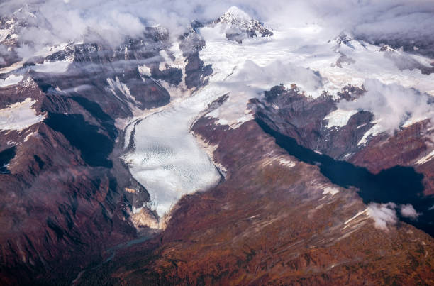
Aerial view of a glacial lake and mountains in the karakoram range
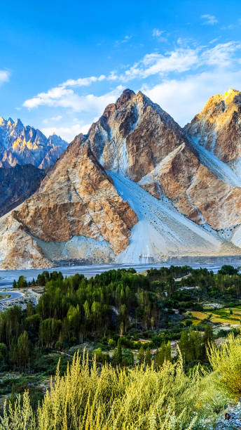
Passu Cones are few pointed peaks in the Karakoram Range that are located East of KKH in Passu / Husseini village areas. The peculiar pointed shape of the numerous peaks located on a single massif and their visibility from most areas in Gulkin, Gulmit
View of stunning mountains along the Karakoram Highway in western China and northern Pakistan
View of the Karakoram mountain range in northern Pakistan and western China
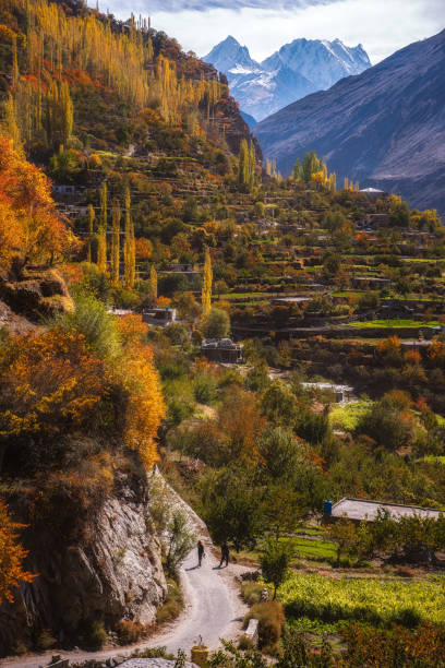
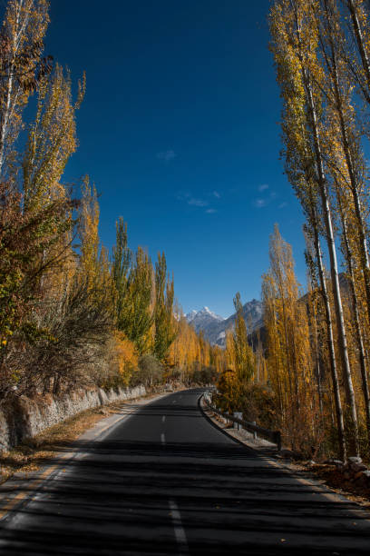
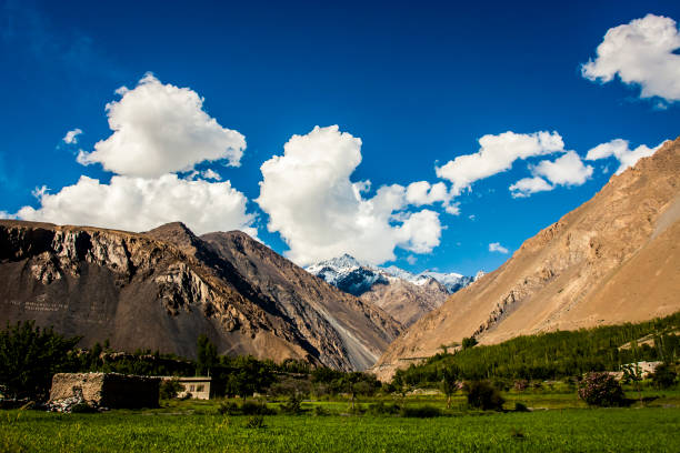
Below the unflinching mountain, one winsome mountain valley is located amid those rocky mountains that donning their falls with fiery orange and yellow leaves.
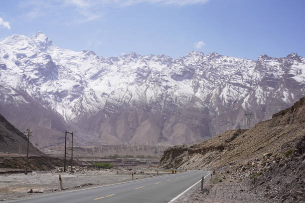
Rough landscape along the Karakoram Highway in Pakistan. This road links Pakistan with China via the Khunjerab pass
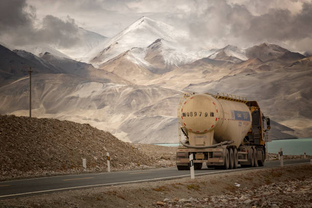
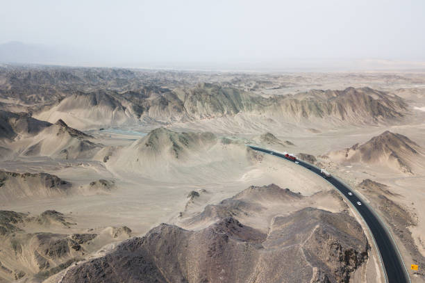
Karakoram Highway Xinjiang, China - September 6, 2018: Truck driving on the Karakoram highway from China to Pakistan
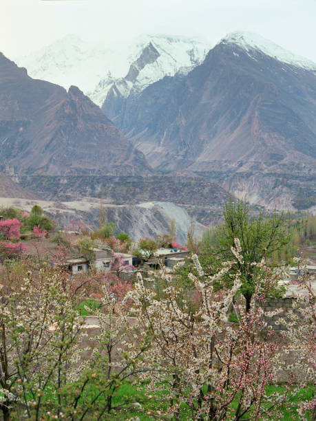
Scenic view of apricot blossom on the background of snowcapped mountains in northern Pakistan
The Karakoram Highway is a 1,300 km national highway which extends from Hasan Abdal in the Punjab province of Pakistan to the Khunjerab Pass in Gilgit-Baltistan, where it crosses into China and becomes China National Highway 314.