
Images
Peru Landscape Pictures, Images and Stock Photos
View peru landscape videos
Browse 77,700+ peru landscape stock photos and images available, or search for lima peru or mountains landscape to find more great stock photos and pictures.
Most popular
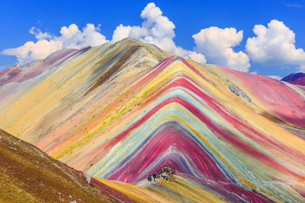
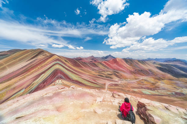
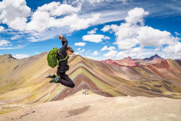
Vinicunca, Cusco Region, Peru. Montana de Siete Colores, or Rainbow Mountain.
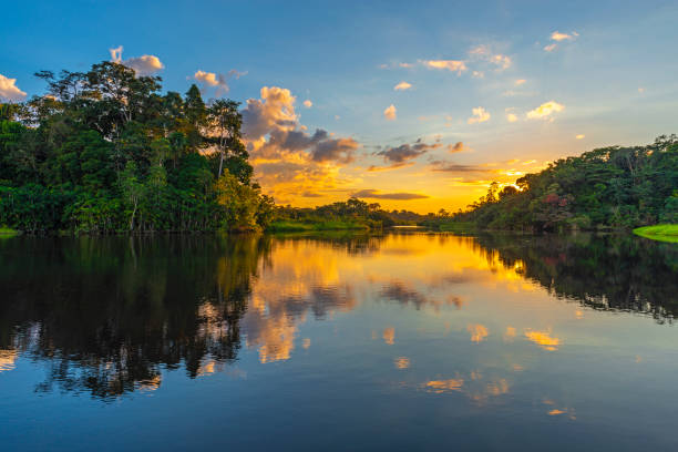
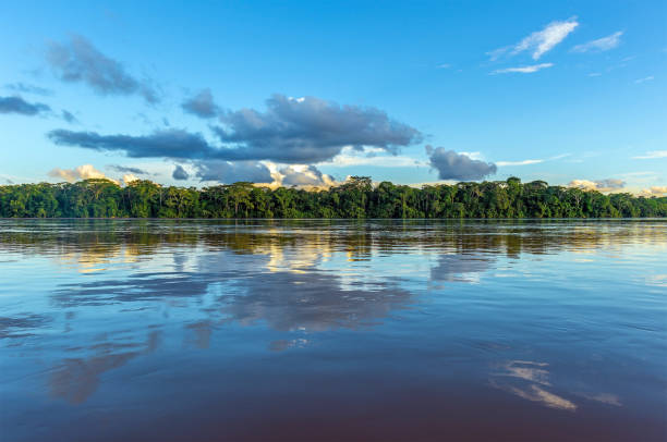
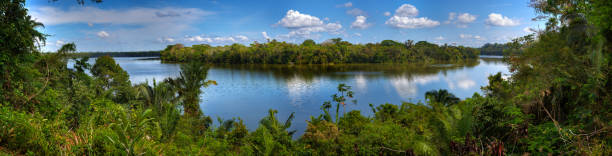
Reflection of a sunset by a lagoon inside the Amazon Rainforest Basin. The Amazon river basin comprises the countries of Brazil, Bolivia, Colombia, Ecuador, Guyana, Suriname, Peru and Venezuela.

Llama in front of ancient inca town of Machu Picchu
Our creative library is free of AI-generated contentChoose your visuals with confidence knowing our creative library is free from AI-generated content, so your searches only return safe, high-quality visuals you can trust.

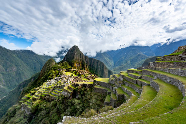
Machu Picchu, the city of the Inca Empire hidden high up in the Andean mountains.

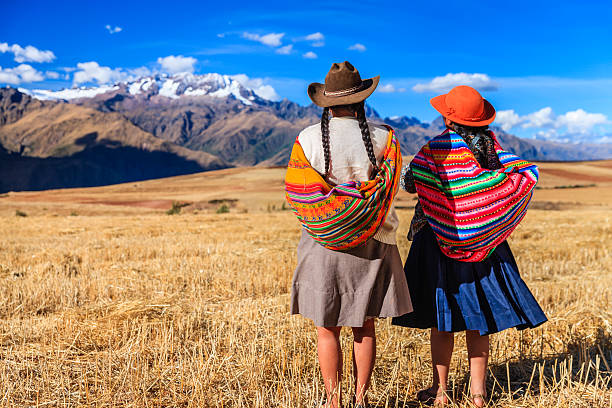
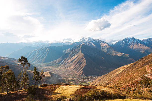
Peruvian woman in national clothing admiring view of Andes in The Sacred Valley. The Sacred Valley of the Incas or Urubamba Valley is a valley in the Andes of Peru, close to the Inca capital of Cusco and below the ancient sacred city of Machu Picchu. The valley is generally understood to include everything between Pisac and Ollantaytambo, parallel to the Urubamba River, or Vilcanota River or Wilcamayu, as this Sacred river is called when passing through the valley. It is fed by numerous rivers which descend through adjoining valleys and gorges, and contains numerous archaeological remains and villages. The valley was appreciated by the Incas due to its special geographical and climatic qualities. It was one of the empire's main points for the extraction of natural wealth, and the best place for maize production in Peru.
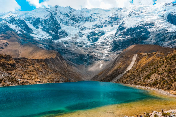
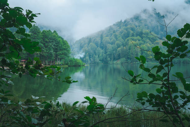
Beautiful Humantay Lagoon, located in the department of Cusco, Peru.
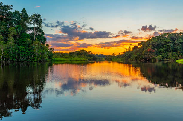
Reflection of a sunset by a lagoon inside the Amazon Rainforest Basin. The Amazon river basin comprises the countries of Brazil, Bolivia, Colombia, Ecuador, Guyana, Suriname, Peru and Venezuela.
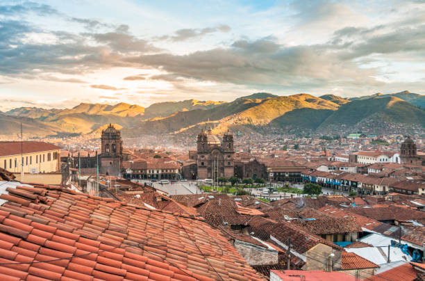
A view of cuzco, high in the Peruvian Andes
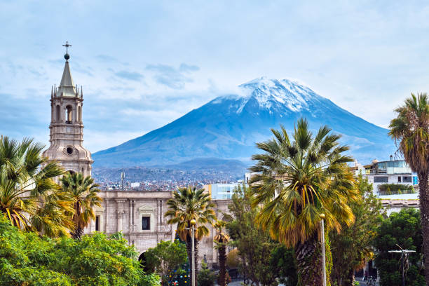
View from the central square on the volcano in Arequipa, Peru.
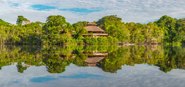
Traditional architecture of an Amazon rainforest lodge in panoramic composition, Yasuni national park, Ecuador. The tributaries of the Amazon river comprise the countries of Suriname, Guyana, French Guyana, Venezuela, Colombia, Ecuador, Peru, Bolivia and Brazil.
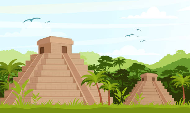
Vector Illustration of ancient Mayan pyramids in the jungle in daytime in flat cartoon style

Laguna Paron And Piramide Peak In Cordillera Blanca In The Andes Of Peru
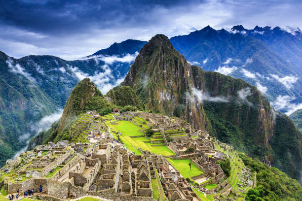
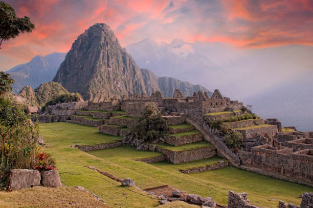
Machu Picchu, Peru. UNESCO World Heritage Site. One of the New Seven Wonders of the World


Smoke covering mountains seen from an airplane.
A view of the Andes and alpaca gazing in Lares region

Uros floating island near Puno city, Peru
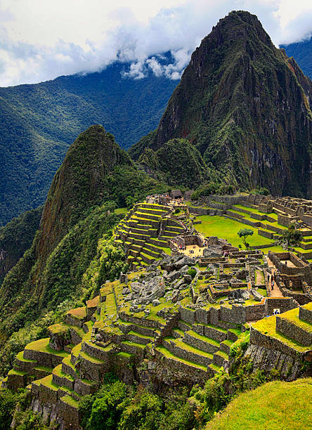
The Incan ruins of Machu Picchu.

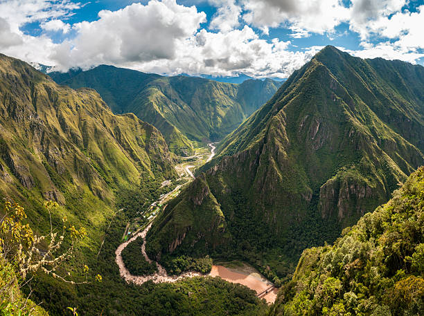
The Sacred Valley of the Incas or Urubamba Valley is a valley in the Andes of Peru, close to the Inca capital of Cusco and below the ancient sacred city of Machu Picchu. The valley is generally understood to include everything between Pisac and Ollantaytambo, parallel to the Urubamba River, or Vilcanota River or Wilcamayu, as this Sacred river is called when passing through the valley. It is fed by numerous rivers which descend through adjoining valleys and gorges, and contains numerous archaeological remains and villages. The valley was appreciated by the Incas due to its special geographical and climatic qualities. It was one of the empire's main points for the extraction of natural wealth, and the best place for maize production in Peru.http://bem.2be.pl/IS/peru_380.jpg
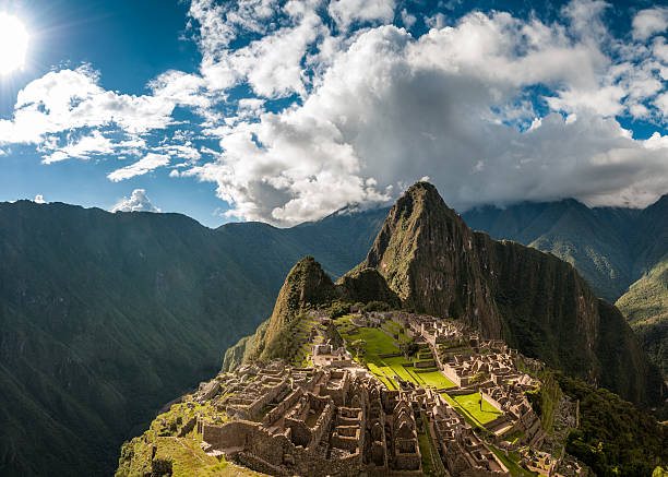
The Ancient City Of Machu Picchu In Peru
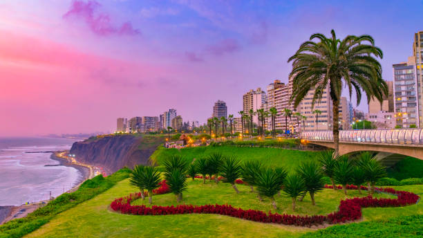
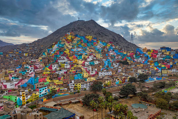
The atmosphere at Lima Miraflores is amazing, cool breezy and the people were amaizng. The sky turns from a beautiful magenta to blue .. it was wonderful.
Amazon river landscape with cloud reflection. The tributaries of the river flow through the countries of French Guyana, Venezuela, Colombia, Ecuador, Peru, Bolivia, Suriname, Brazil.

Machu Picchu, the citadel of the Inca Empire.

Young female tourist riding a horse in Peruvian Andes, Cordillera Huayhuash, South America. Andes Mountain Range is located in South America, running north to south along the western coast of the continent.It is a continual range of highlands along the western coast of South America.The Andes extend from north to south through seven South American countries: Argentina, Bolivia, Chile, Colombia, Ecuador, Peru, and Venezuela, and is the longest continental mountain range in the world.
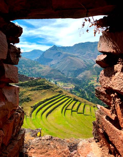
Incas agricultural terraces in Andes mountains, Pisac, Cuzco region, Peru, South America
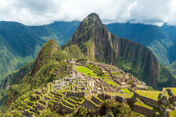
Machu Picchu inca ruins with dramatic clouds, Cusco, Peru.
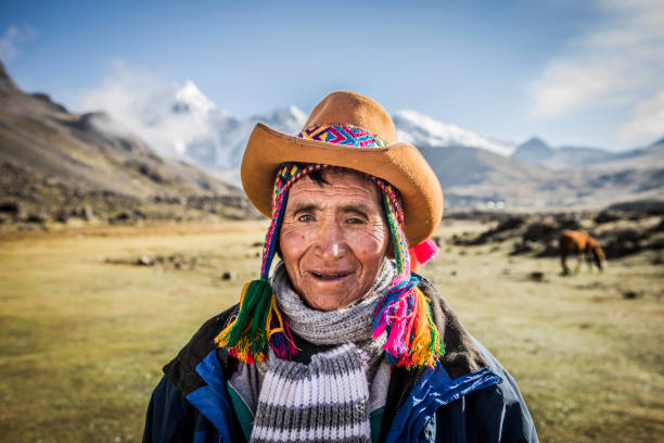
Indigenous man portrait living traditional life in the mountains.

Reflection of the Amazon rainforest in the Amazon river. The tributaries of the Amazon traverse the countries of Guyana, Ecuador, Peru, Brazil, Colombia, Venezuela and Bolivia.

Contemporary aesthetic mountains landscape art. Terracotta colors peruvian hills. Color mountains, abstract shapes sunny valley. Boho wall decor, valley with clouds. Mid century modern minimalist art print.

The Ancient City Of Machu Picchu In Peru
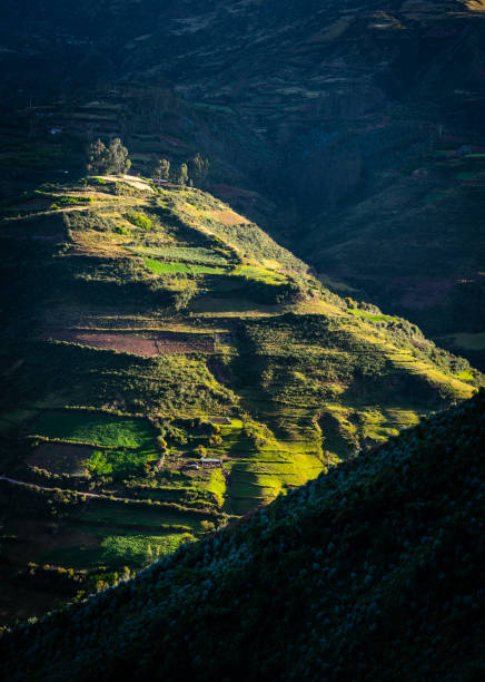
Farm land on a hillside in Peru near to city of Cusco
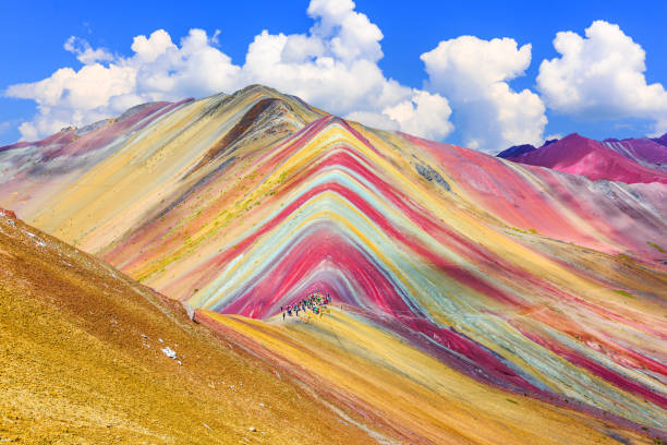
Vinicunca, Cusco Region, Peru. Montana de Siete Colores, or Rainbow Mountain.
Panoramic view of Sandoval Lake, in Tambopata natural reserve, Peru.

Green jungle with hidden animals


Man with a backpack and hat in a sunny landscape at the Maras salt mines in Cusco, Peru.
Costa Rica, Amazon River, Suriname, Colombia, Peru

Rear view of a tourist man looking at view on a mountain, in Moray

41MPix XXXXL size - this panoramic landscape is an very high resolution multi-frame composite and is suitable for large scale printing. The Altiplano (Spanish for high plain), in west-central South America, where the Andes are at their widest, is the most extensive area of high plateau on earth outside of Tibet. Lake Titicaca is its best known geographical feature. The Altiplano is an area of inland drainage (endorheism) lying in the central Andes, occupying parts of Northern Chile and Argentina, Western Bolivia and Southern Peru. Its height averages about 3,750 meters (12,300 feet), slightly less than that of Tibet. Unlike the Tibetan Plateau, however, the Altiplano is dominated by massive active volcanoes of the Central Volcanic Zone to the west like Ampato (6288 m), Tutupaca (5816 m), Nevado Sajama (6542 m), Parinacota (6348 m), Guallatiri (6071 m), Cerro Paroma (5728 m), Cerro Uturuncu (6008 m) and Licancabur (5916 m), and the Cordillera Real in the north east with Illampu (6368 m), Huayna Potosi (6088 m), Ancohuma (6427 m) and Illimani (6438 m). The Atacama Desert, one of the driest areas on the whole planet, lies to the southwest of the Altiplano. In contrast, to the east lies the humid Amazon Rainforest.

Paron lagoon, at Huascaran National Park, Peru. A blue lake in the Cordillera Blanca on the Peruvian Andes. High quality photo

Cruz Del Condor, Colca Canyon, Peru: Cruz del Condor is a popular tourist stop to view the Andean condor. At this point the canyon floor is 1,200 metres (3,900 ft) below the rim of the canyon. This place was originally called Chacllacruz yet it is now known by the title of “Cruz del Condor” (Condor’s Cross) for two reasons: one, for the flyovers performed in this area by this famous Andean bird, especially in the morning, and two, because of the stone cross built overtop a striking stone promontory.

The Sacred Valley of the Incas or Urubamba Valley is a valley in the Andes of Peru, close to the Inca capital of Cusco and below the ancient sacred city of Machu Picchu. The valley is generally understood to include everything between Pisac and Ollantaytambo, parallel to the Urubamba River, or Vilcanota River or Wilcamayu, as this Sacred river is called when passing through the valley. It is fed by numerous rivers which descend through adjoining valleys and gorges, and contains numerous archaeological remains and villages. The valley was appreciated by the Incas due to its special geographical and climatic qualities. It was one of the empire's main points for the extraction of natural wealth, and the best place for maize production in Peru.http://bem.2be.pl/IS/peru_380.jpg

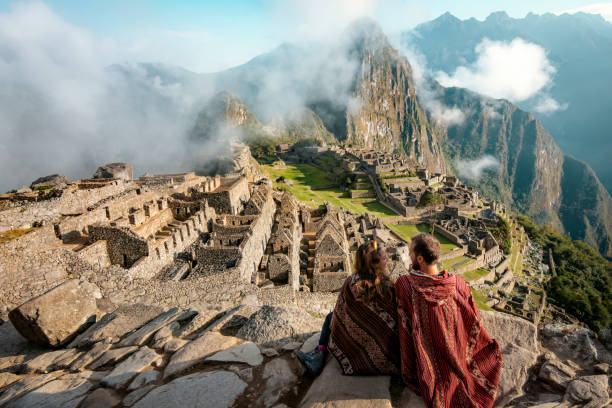
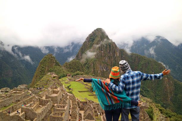
Couple dressed in ponchos watching the ruins of Machu Picchu
Sacred Valley harvested wheat field in Urubamba Valley in Peru, Andes, on the road from Cuzco to Abancay

Canoe in the Amazon rain forest river.


of100Next