Qatar Map Pictures, Images and Stock Photos
Browse 3,300+ qatar map stock photos and images available, or search for qatar map vector to find more great stock photos and pictures.
Most popular
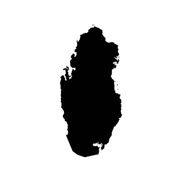
Simplified map of Qatar. Vector isolated illustration icon. Black silhouette, white background
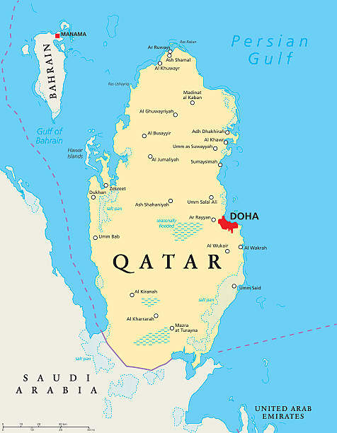
Qatar political map with capital Doha, national borders, important cities, salt pans and reefs. English labeling and scaling. Illustration.
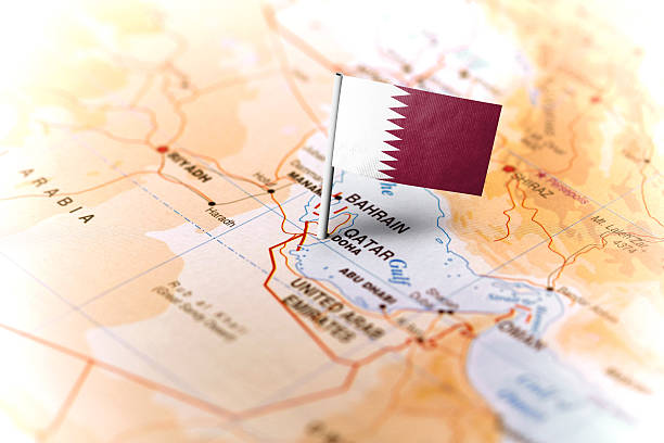
The flag of Qatar pinned on the map. Horizontal orientation. Macro photography.
vector illustration of Qatar map


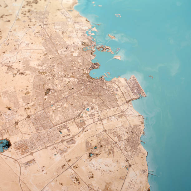
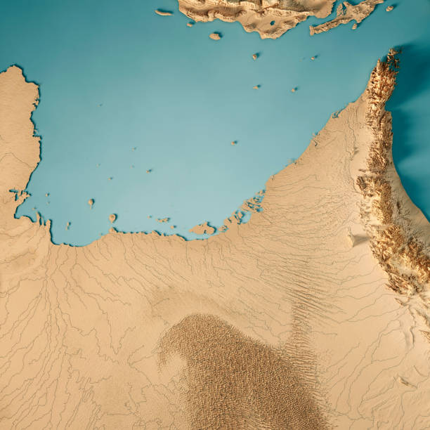
3D Render of a Topographic Map of Doha City, Qatar. All source data is in the public domain. Contains modified Copernicus Sentinel data (Feb 2019) courtesy of ESA. URL of source image: https://scihub.copernicus.eu/dhus/#/home. Relief texture SRTM data courtesy of NASA. URL of source image: https://search.earthdata.nasa.gov/search/granules/collection-details?p=C1000000240-LPDAAC_ECS&q=srtm%201%20arc&ok=srtm%201%20arc
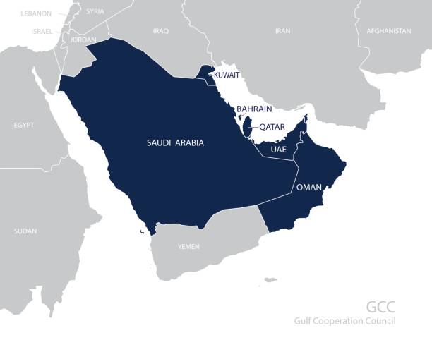
Map of the Gulf Cooperation Council (GCC)'s members. Vector
A close-up/macro photograph of Middle East from a desktop globe. Adobe RGB color profile.
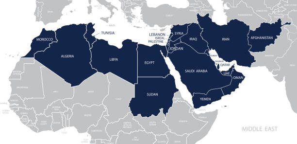
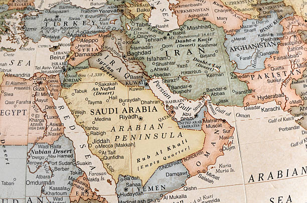
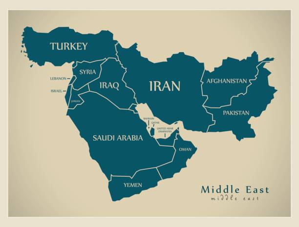
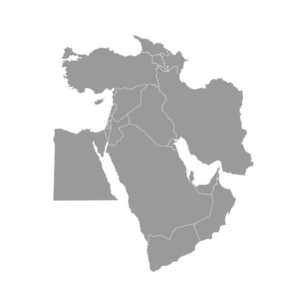
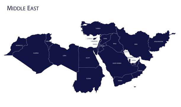
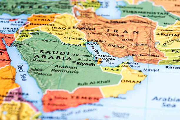
Map of Middle East. Member states are as follows;
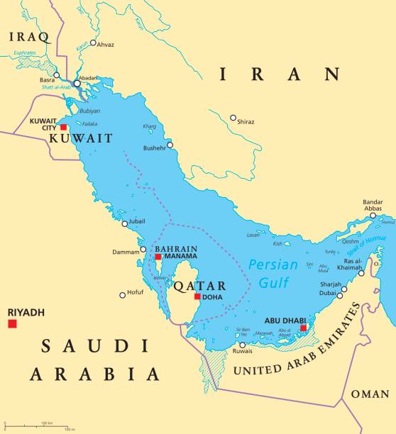
Persian Gulf region countries political map. Capitals, borders, cities and rivers. Iran, Iraq, Kuwait, Qatar, Bahrain, United Arab Emirates, Saudi Arabia, Oman. Illustration. English labeling. Vector.

Map of Qatar - Vintage Vector illustration

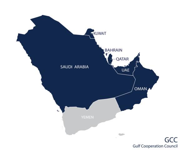
Map of the Gulf Cooperation Council (GCC)'s members. Vector

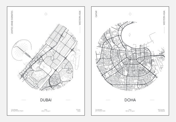
Detailed vector poster city map Doha detailed plan of the city, rivers and streets

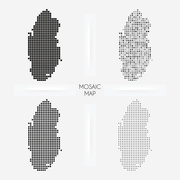
Map of Qatar for your own design. With space for your text and your background. Four maps included in the bundle: - One black map. - One blank map with only a thin black outline (in a line art style). - One mosaic map. - One white map with a thin black outline. The 4 maps are isolated on a blank background (for easy change background or texture).The layers are named to facilitate your customization. Vector Illustration (EPS10, well layered and grouped). Easy to edit, manipulate, resize or colorize.
High detail map of the Middle East Zone, with a 3D Globe centered on Middle East.
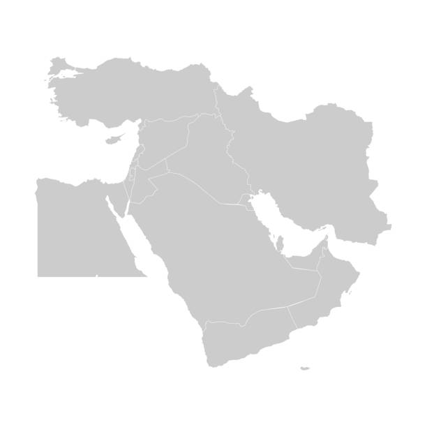
Vector illustration with simplified map of Asian countries. Middle East. States borders of Turkey, Georgia, Armenia, United Arab Emirates, Saudi Arabia, Qatar, Oman, Iran, Israel. Grey silhouette

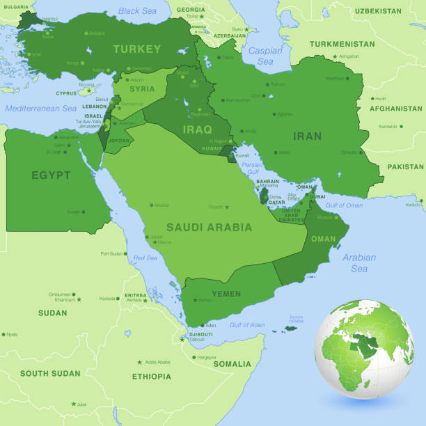
Persian Gulf region, political map. Also Arabian Gulf, a mediterranean Sea in West Asia, located between Iran and Arabian Peninsula, connected to the Gulf of Oman in the east by the Strait of Hormuz.
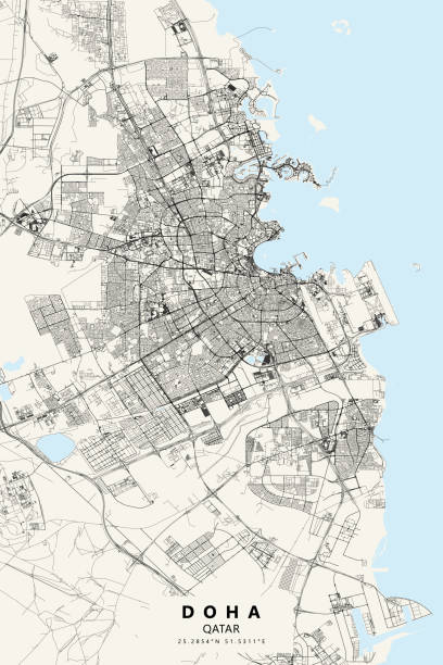
Topographic / Road map of Doha, Qatar. Map data is open data via openstreetmap contributors. All maps are layered and easy to edit. Roads are editable stroke.
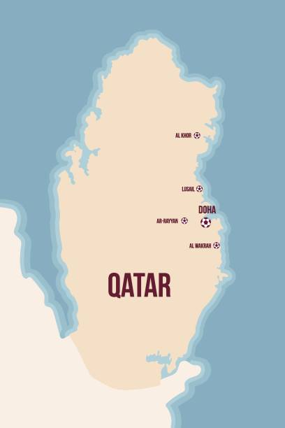
Illustrated map of Qatar with footballs and city names. Colored map concerning world competition. Vector illustation

A close-up/macro photograph of the Persian Gulf and surrounding area from a desktop globe. Adobe RGB color profile.

country silhouette of Asia, Asian map illustration, vector isolated on white background, glyph style

Qatar on a map with a red pin

3D Render of a Topographic Map of Doha City, Qatar. All source data is in the public domain. Contains modified Copernicus Sentinel data (Feb 2019) courtesy of ESA. URL of source image: https://scihub.copernicus.eu/dhus/#/home. Relief texture SRTM data courtesy of NASA. URL of source image: https://search.earthdata.nasa.gov/search/granules/collection-details?p=C1000000240-LPDAAC_ECS&q=srtm%201%20arc&ok=srtm%201%20arc

Illustrated map of Qatar with footballs and city names and landmarks. museums and famous places. Colored map concerning world competition. Vector illustation

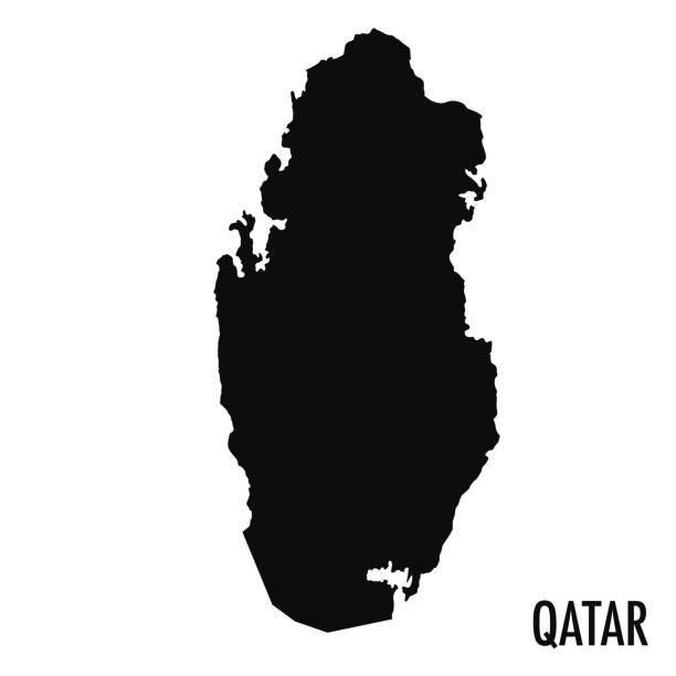
Qatar - highly detailed black and white map. Vector illustration

Abstract blue world map with magnified Qatar. Qatar flag and map. Vector Illustration.


White map of Qatar isolated on a gray background with a long shadow effect and in a flat design style. Vector Illustration (EPS10, well layered and grouped). Easy to edit, manipulate, resize or colorize.
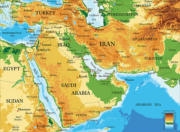
Highly detailed physical map of Middle East in vector format,with all countries, major cities and all the relief forms .
Map of Middle East. Vector
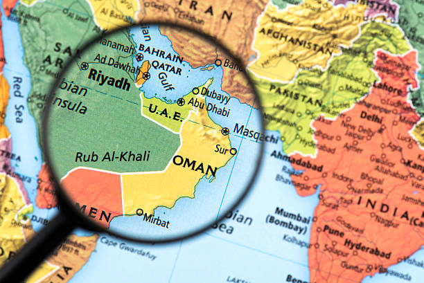
Map of Oman. Detail from the World Atlas. Selective Focus.
Map of Middle East with countries and borders. Vector illustration.
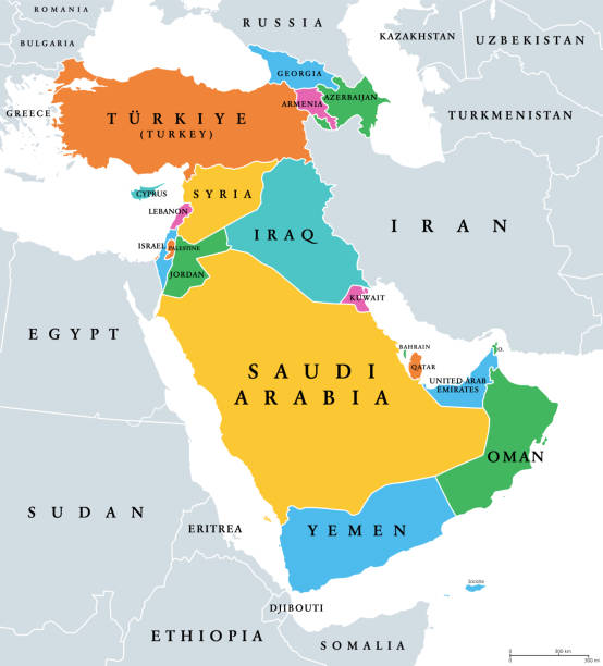
Western Asia, geoscheme and political map. Subregion of Asia, used for statistical purposes, covering geographical regions spanning from Anatolia, Caucasus, Levant, Mesopotamia till Arabian Peninsula.

3D map of Qatar isolated on a blank and gray background, with a dropshadow. Vector Illustration (EPS10, well layered and grouped). Easy to edit, manipulate, resize or colorize.

All round World Flags with country names (part3)
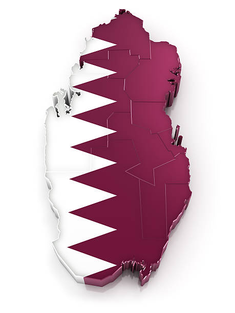
Map of State of Qatar with flag. Municipalities also visible.Digitally generated 3d image. Isolated on white background.
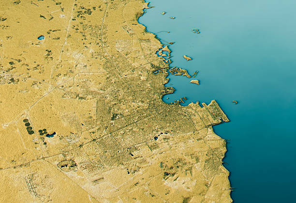
3D Render of a Topographic Map of Doha, Qatar, Middle East.

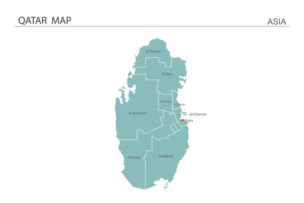
Isometric 3D Qatar map. Stylized vector map illustration with cities, borders, capital, administrative divisions and pointer marks; gradient background with grid.
3D Render of a Topographic Map of the United Arab Emirates. All source data is in the public domain. Color texture: Made with Natural Earth. http://www.naturalearthdata.com/downloads/10m-raster-data/10m-cross-blend-hypso/ Relief texture: GMTED2010 data courtesy of USGS. URL of source image: https://topotools.cr.usgs.gov/gmted_viewer/viewer.htm Water texture: World Water Body Limits: Humanitarian Information Unit HIU, U.S. Department of State http://geonode.state.gov/layers/geonode%3AWorld_water_body_limits_polygons Boundaries: Humanitarian Information Unit HIU, U.S. Department of State (database: LSIB) http://geonode.state.gov/layers/geonode%3ALSIB_10
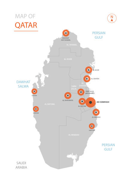
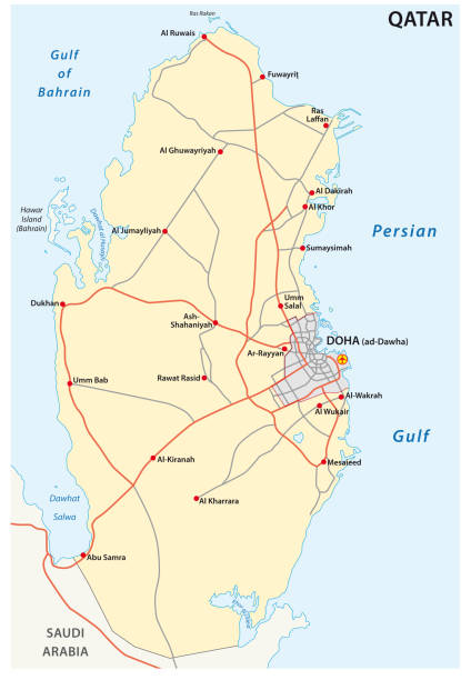
Stylized vector Qatar map showing big cities, capital Doha, administrative divisions.
Maps of Qatar isolated on white background. Easily customizable for your design.
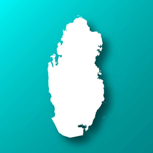
White map of Qatar isolated on a trendy color, a blue green background and with a dropshadow. Vector Illustration (EPS10, well layered and grouped). Easy to edit, manipulate, resize or colorize.
High quality map with borders of the regions
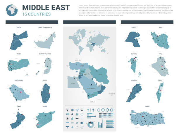
Map of Middle-Eastern Countries.

Map of Qatar with world cup 2022 host cities
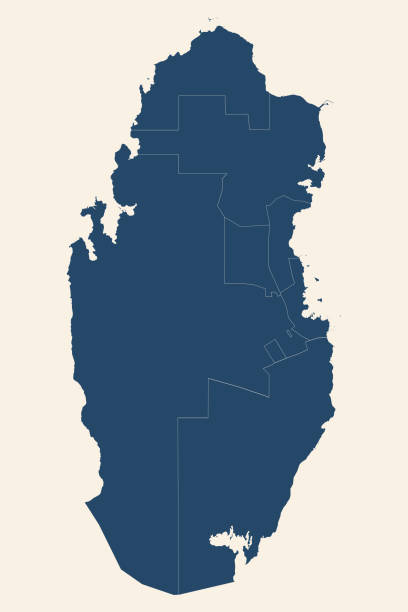
Qatar provinces map. Cyan blue, cream white background. Modern geographical chart backgrounds.

A macro photograph of Saudi Arabia from a Desktop Globe. Adobe RGB color profile.
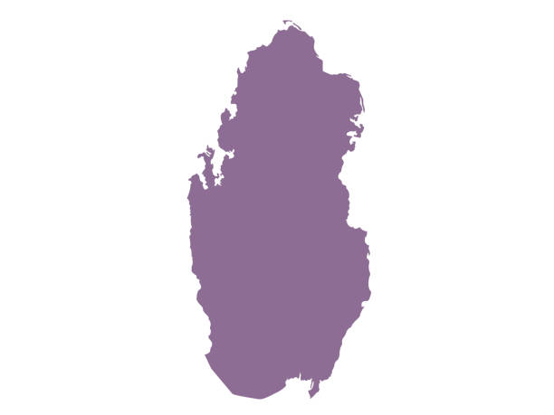
Qatar black silhouette map. Editable high quality vector cut out illustration isolated on white.

Basic square pattern vector map of Qatar, Asia. Carefully built with white squares on a turquoise background. The colors in the .eps-file are ready for print (CMYK). Included files are EPS (v10) and Hi-Res JPG (3472 x 3472 px).
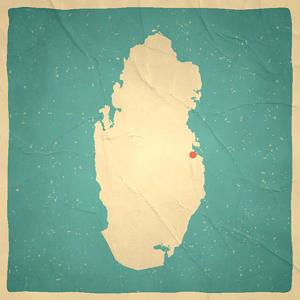
Map of Qatar with a retro style, a vintage effect on an old textured paper.

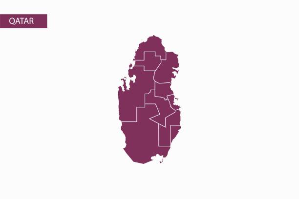
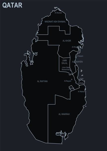
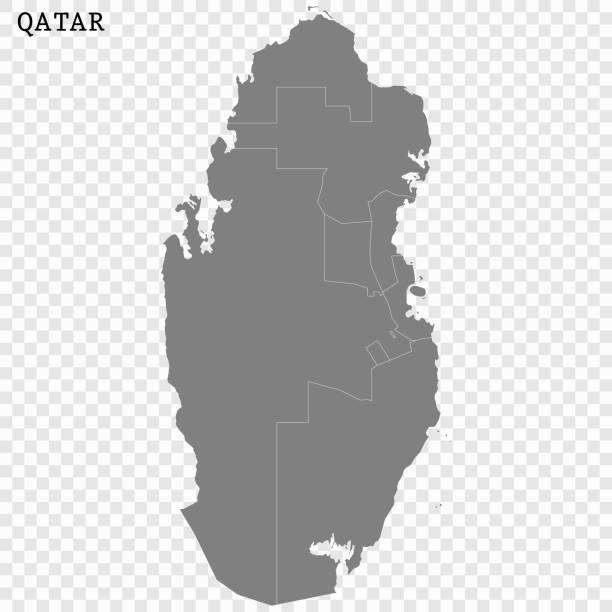
Qatar administrative map isolated on gray background