00:17
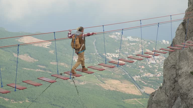
Woman backpacker walking on suspension bridge in mountains over precipice.
Young male photographer in casual outfit, with backpack and tripod in it. He is standing on high hill, enjoying picturesque landscape, sunrise and view on a river. Close up, back view
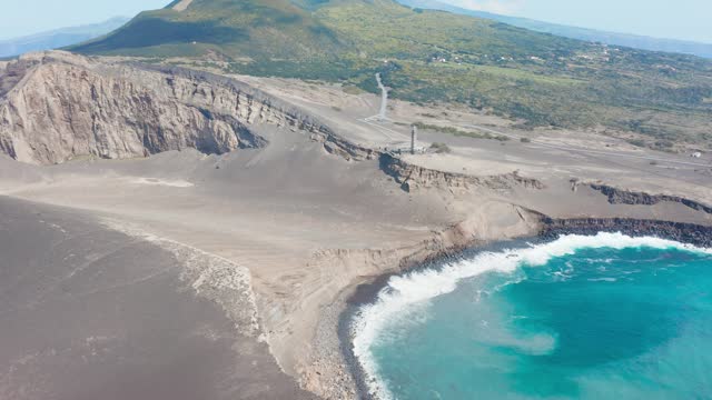
Beautiful aerial view of tropical forest and cliff near the Cimarinjung waterfall at Ciletuh Geopark, Sukabumi, West Java, Indonesia. Shot in 4k resolution
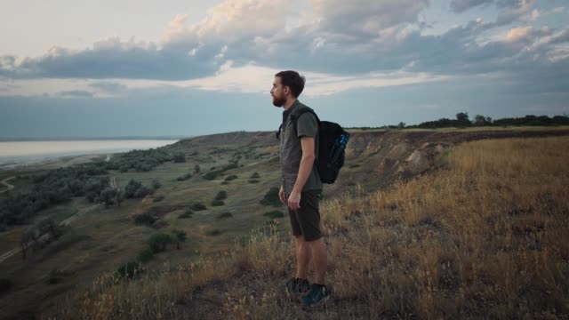
Young bearded man photographer in casual clothes, with backpack and tripod in it. He is standing on mountain, enjoying picturesque landscape, sunset and view on a river. Close up, back view
A young woman and her son tourists are visiting the Grlo Sokolovo canyon. A breathtaking sightseeing location in Montenegro.
Woman traveler walks along suspension bridge between mountains over sea.
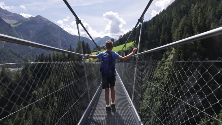
Mother and son are hiking in the Alps - Tyrol, Austria. They are walking on high up suspended bridge over a valley. Sunny day of summer vacations. Canon R5
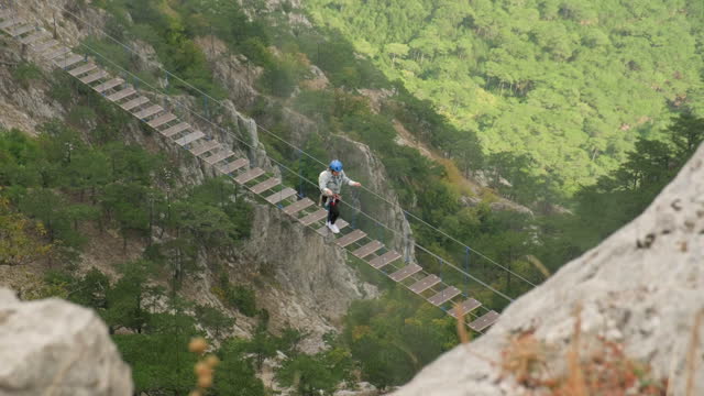
Woman tourist walking on suspension bridge in mountains over abyss.
Selfie of cheerful man sitting on the edge of stone with hanging legs near water fall. Male caucasian smiling tourist rests on the precipice of cascade and films himself. Autumn holidays in forest
flyby of tourist girl standing on edge of cliff in mountains. Aerial shot of traveler woman on edge of mountain looking into distance.
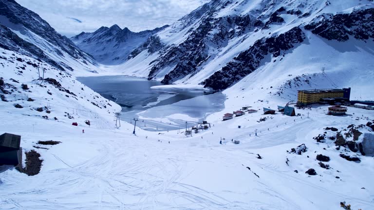
Panoramic view of Ski station centre resort at snowy Andes Mountains near Santiago Chile. Snow mountain landscape. Nevada mountains. Winter travel destination. Winter tourism travel.
Panoramic view of Ski station centre resort at snowy Andes Mountains near Santiago Chile. Snow mountain landscape. Nevada mountains. Winter travel destination. Winter tourism travel.
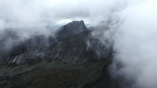
Huge stones, boulders and rocks shrouded in low clouds, Ergaki Natural Park, Russia. Summer foggy landscape high in the mountains with thick fog among the rocks. Wilderness hiking concept
Rocky coast and Almaciga beach in Tenerife, The Canaries. Spain. Scenic view. Sunny and colourful day.
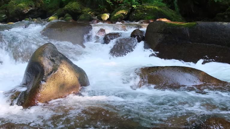
Strong flowing stream and stones in it
Tattooed man stands on top of mountain, turns around, looks at camera, beautiful sea view. Sportsman enjoys moment. Slow motion footage of traveler finished the ascent
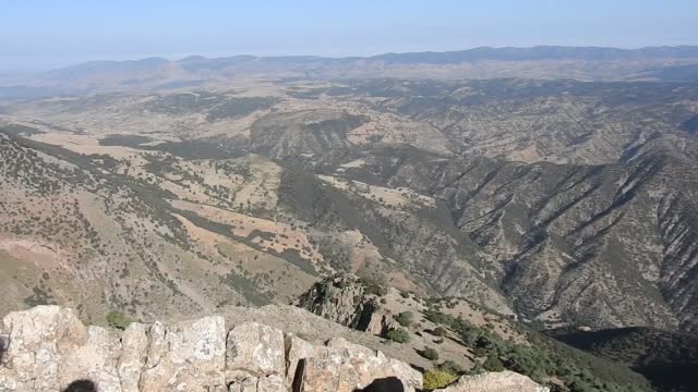
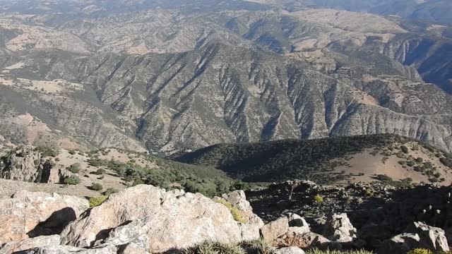
Beautiful summer panorama of Tazekka National Park, beautiful nature among the mountains, middle Atlas mountains. The beauty of nature concept background- Morocco.
Beautiful summer panorama of Tazekka National Park, beautiful nature among the mountains, middle Atlas mountains. The beauty of nature concept background- Morocco.
Huge stones, boulders and rocks shrouded in low clouds, Ergaki Natural Park, Russia. Summer foggy landscape high in the mountains with thick fog among the rocks. Wilderness hiking concept
One of the largest canyons of the earth. It is located on West Black Sea Region of Turkey.
Pinarbasi, Kastamonu, Turkey
One of the largest canyons of the earth. It is located on West Black Sea Region of Turkey.
Video footage from the drone. Amazing long mountain waterfall. Top view
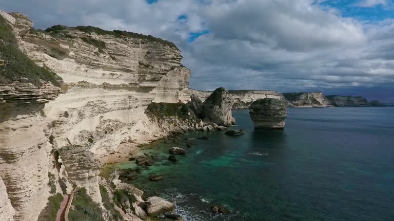
Aerial view of the steep limestone layered rocks of the island of Corsica.
Aerial drone footage of limestone layered rocks of the island of Corsica.
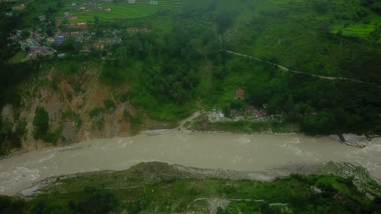
Mountain river in a deep gorge. Aerial drone footage.
Aerial view of the rapids of the mountain river in the gorge
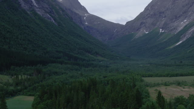
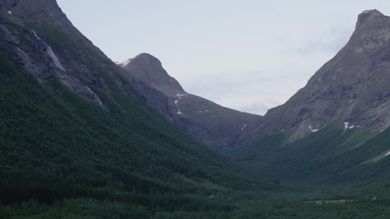
Shot of beautiful valley on the west coast of Norway
Shot of beautiful valley on the west coast of Norway
Aerial drone footage of limestone layered rocks of the island of Corsica.
Close-up of huge cliff rocks in fog. Shot. Autumn landscape.
Descent to the ground of the gorge with a river and a frozen waterfall.
Slow motion shot of a female mountain biker raising her arms in joy at the edge of the precipice. Nanos. Slovenia.
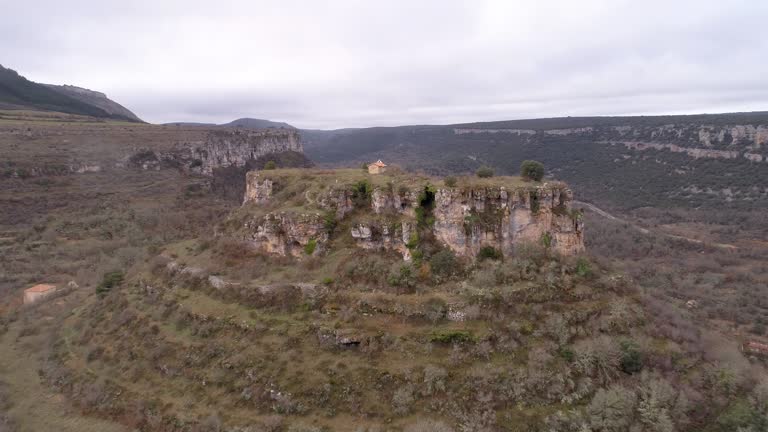
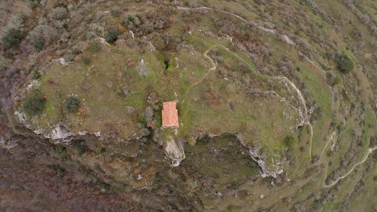
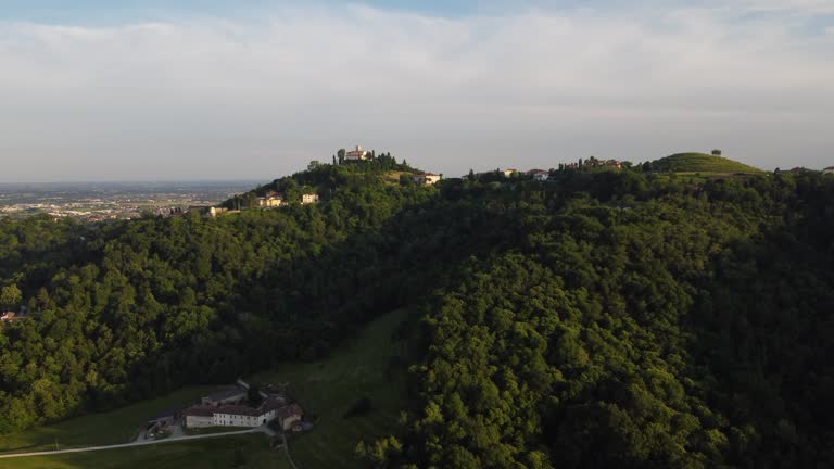
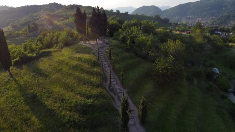
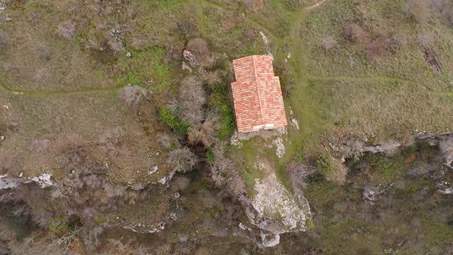
A hermitage on top of a hill
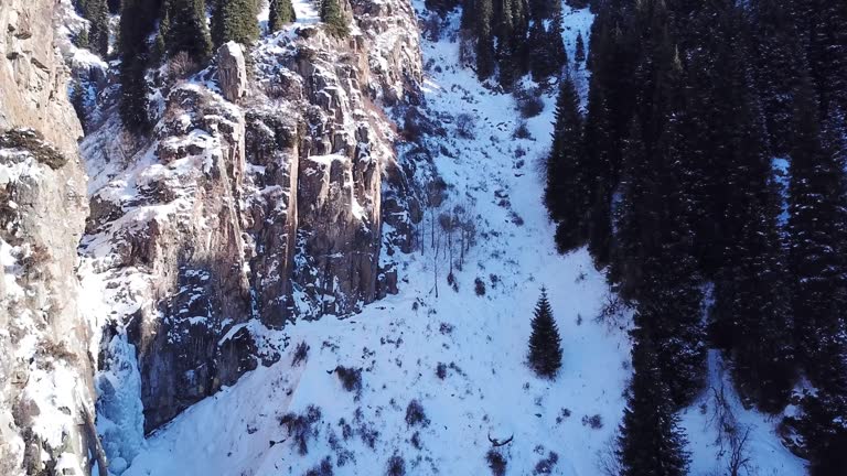
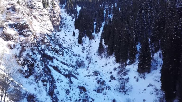
Tall fir trees and rocks stand in a snowy gorge. The view from the drone is of bushes, tall green firs, steep cliffs and rocks. The sun's rays fall on the rock. Mountainous terrain. Butakovka, Almaty
Tall fir trees and rocks stand in a snowy gorge. The view from the drone is of bushes, tall green firs, steep cliffs and rocks. The sun's rays fall on the rock. Mountainous terrain. Butakovka, Almaty
Young bearded fellow photographer in casual clothes, with backpack and tripod in it. He is standing on precipice of high hill, enjoying picturesque landscape and view on a river. Side view
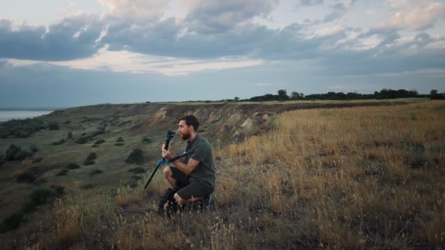
Young male photographer with backpack and tripod in it is walking along meadow on plato of a mountain and enjoying picturesque landscape and view on a river. Summer sunrise. Close up, slow motion
Landscape with dark fir trees and alpine valley with low clouds on the horizon. Raising the drone
A hermitage on top of a hill
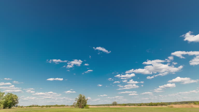
White clouds mooving on a blue sky over green field with grass and trees timelapse
White clouds mooving on a blue sky over green field with grass and trees timelapse
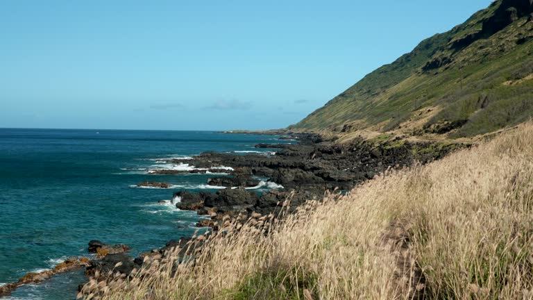
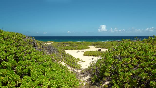
The trail to Ka‘ena Point follows an old railroad bed and former dirt road that ran along the westernmost point of O‘ahu. The trail leads to Ka‘ena Point Natural Area Reserve, a remote and scenic protected area harboring some of the last vestiges of coastal sand dune habitat on the island, and home to native plants and seabirds. Whales frequent this shoreline during the winter months. A hike to Ka‘ena Point can take two routes. From the Wai‘anae side, take the trailhead at the end of the paved road in the Keawaula Section of Ka‘ena Point State Park and follow the dirt roadway for 2.4 miles to Ka‘ena Point Natural Area Reserve. This route follows the shoreline on your left (southwest), characterized by boulder beaches and occasional tidepools, while cliffs rise above you on your right (northeast). Midway along the trail are a pair of small blowholes. In places the old road has eroded completely.
The trail to Ka‘ena Point follows an old railroad bed and former dirt road that ran along the westernmost point of O‘ahu. The trail leads to Ka‘ena Point Natural Area Reserve, a remote and scenic protected area harboring some of the last vestiges of coastal sand dune habitat on the island, and home to native plants and seabirds. Whales frequent this shoreline during the winter months. A hike to Ka‘ena Point can take two routes. From the Wai‘anae side, take the trailhead at the end of the paved road in the Keawaula Section of Ka‘ena Point State Park and follow the dirt roadway for 2.4 miles to Ka‘ena Point Natural Area Reserve. This route follows the shoreline on your left (southwest), characterized by boulder beaches and occasional tidepools, while cliffs rise above you on your right (northeast). Midway along the trail are a pair of small blowholes. In places the old road has eroded completely.
The trail to Ka‘ena Point follows an old railroad bed and former dirt road that ran along the westernmost point of O‘ahu. The trail leads to Ka‘ena Point Natural Area Reserve, a remote and scenic protected area harboring some of the last vestiges of coastal sand dune habitat on the island, and home to native plants and seabirds. Whales frequent this shoreline during the winter months. A hike to Ka‘ena Point can take two routes. From the Wai‘anae side, take the trailhead at the end of the paved road in the Keawaula Section of Ka‘ena Point State Park and follow the dirt roadway for 2.4 miles to Ka‘ena Point Natural Area Reserve. This route follows the shoreline on your left (southwest), characterized by boulder beaches and occasional tidepools, while cliffs rise above you on your right (northeast). Midway along the trail are a pair of small blowholes. In places the old road has eroded completely.
The trail to Ka‘ena Point follows an old railroad bed and former dirt road that ran along the westernmost point of O‘ahu. The trail leads to Ka‘ena Point Natural Area Reserve, a remote and scenic protected area harboring some of the last vestiges of coastal sand dune habitat on the island, and home to native plants and seabirds. Whales frequent this shoreline during the winter months. A hike to Ka‘ena Point can take two routes. From the Wai‘anae side, take the trailhead at the end of the paved road in the Keawaula Section of Ka‘ena Point State Park and follow the dirt roadway for 2.4 miles to Ka‘ena Point Natural Area Reserve. This route follows the shoreline on your left (southwest), characterized by boulder beaches and occasional tidepools, while cliffs rise above you on your right (northeast). Midway along the trail are a pair of small blowholes. In places the old road has eroded completely.
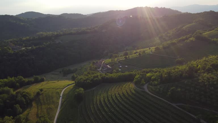
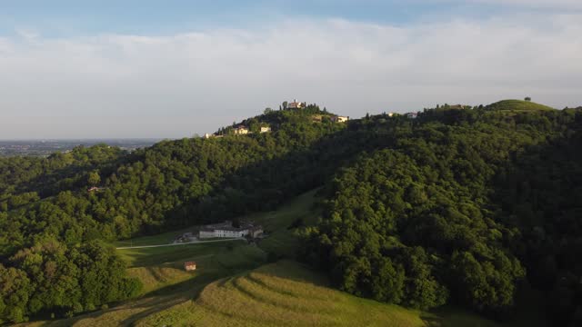
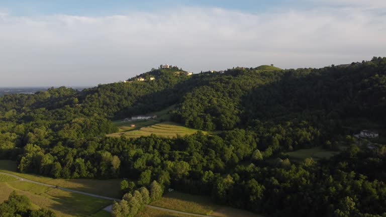
Landscape of the village of Montevecchia and Curone Valley regional park, Brianza, Lombardy, Italy
Landscape of the village of Montevecchia and Curone Valley regional park, Brianza, Lombardy, Italy
Landscape of the village of Montevecchia and Curone Valley regional park, Brianza, Lombardy, Italy
Landscape of the village of Montevecchia and Curone Valley regional park, Brianza, Lombardy, Italy
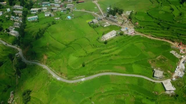
Valley videos drone shot in Turkey.
Landscape of the village of Montevecchia and Curone Valley regional park, Brianza, Lombardy, Italy
The trail to Ka‘ena Point follows an old railroad bed and former dirt road that ran along the westernmost point of O‘ahu. The trail leads to Ka‘ena Point Natural Area Reserve, a remote and scenic protected area harboring some of the last vestiges of coastal sand dune habitat on the island, and home to native plants and seabirds. Whales frequent this shoreline during the winter months. A hike to Ka‘ena Point can take two routes. From the Wai‘anae side, take the trailhead at the end of the paved road in the Keawaula Section of Ka‘ena Point State Park and follow the dirt roadway for 2.4 miles to Ka‘ena Point Natural Area Reserve. This route follows the shoreline on your left (southwest), characterized by boulder beaches and occasional tidepools, while cliffs rise above you on your right (northeast). Midway along the trail are a pair of small blowholes. In places the old road has eroded completely.
The trail to Ka‘ena Point follows an old railroad bed and former dirt road that ran along the westernmost point of O‘ahu. The trail leads to Ka‘ena Point Natural Area Reserve, a remote and scenic protected area harboring some of the last vestiges of coastal sand dune habitat on the island, and home to native plants and seabirds. Whales frequent this shoreline during the winter months. A hike to Ka‘ena Point can take two routes. From the Wai‘anae side, take the trailhead at the end of the paved road in the Keawaula Section of Ka‘ena Point State Park and follow the dirt roadway for 2.4 miles to Ka‘ena Point Natural Area Reserve. This route follows the shoreline on your left (southwest), characterized by boulder beaches and occasional tidepools, while cliffs rise above you on your right (northeast). Midway along the trail are a pair of small blowholes. In places the old road has eroded completely.
The trail to Ka‘ena Point follows an old railroad bed and former dirt road that ran along the westernmost point of O‘ahu. The trail leads to Ka‘ena Point Natural Area Reserve, a remote and scenic protected area harboring some of the last vestiges of coastal sand dune habitat on the island, and home to native plants and seabirds. Whales frequent this shoreline during the winter months. A hike to Ka‘ena Point can take two routes. From the Wai‘anae side, take the trailhead at the end of the paved road in the Keawaula Section of Ka‘ena Point State Park and follow the dirt roadway for 2.4 miles to Ka‘ena Point Natural Area Reserve. This route follows the shoreline on your left (southwest), characterized by boulder beaches and occasional tidepools, while cliffs rise above you on your right (northeast). Midway along the trail are a pair of small blowholes. In places the old road has eroded completely.
The trail to Ka‘ena Point follows an old railroad bed and former dirt road that ran along the westernmost point of O‘ahu. The trail leads to Ka‘ena Point Natural Area Reserve, a remote and scenic protected area harboring some of the last vestiges of coastal sand dune habitat on the island, and home to native plants and seabirds. Whales frequent this shoreline during the winter months. A hike to Ka‘ena Point can take two routes. From the Wai‘anae side, take the trailhead at the end of the paved road in the Keawaula Section of Ka‘ena Point State Park and follow the dirt roadway for 2.4 miles to Ka‘ena Point Natural Area Reserve. This route follows the shoreline on your left (southwest), characterized by boulder beaches and occasional tidepools, while cliffs rise above you on your right (northeast). Midway along the trail are a pair of small blowholes. In places the old road has eroded completely.
The trail to Ka‘ena Point follows an old railroad bed and former dirt road that ran along the westernmost point of O‘ahu. The trail leads to Ka‘ena Point Natural Area Reserve, a remote and scenic protected area harboring some of the last vestiges of coastal sand dune habitat on the island, and home to native plants and seabirds. Whales frequent this shoreline during the winter months. A hike to Ka‘ena Point can take two routes. From the Wai‘anae side, take the trailhead at the end of the paved road in the Keawaula Section of Ka‘ena Point State Park and follow the dirt roadway for 2.4 miles to Ka‘ena Point Natural Area Reserve. This route follows the shoreline on your left (southwest), characterized by boulder beaches and occasional tidepools, while cliffs rise above you on your right (northeast). Midway along the trail are a pair of small blowholes. In places the old road has eroded completely.
The trail to Ka‘ena Point follows an old railroad bed and former dirt road that ran along the westernmost point of O‘ahu. The trail leads to Ka‘ena Point Natural Area Reserve, a remote and scenic protected area harboring some of the last vestiges of coastal sand dune habitat on the island, and home to native plants and seabirds. Whales frequent this shoreline during the winter months. A hike to Ka‘ena Point can take two routes. From the Wai‘anae side, take the trailhead at the end of the paved road in the Keawaula Section of Ka‘ena Point State Park and follow the dirt roadway for 2.4 miles to Ka‘ena Point Natural Area Reserve. This route follows the shoreline on your left (southwest), characterized by boulder beaches and occasional tidepools, while cliffs rise above you on your right (northeast). Midway along the trail are a pair of small blowholes. In places the old road has eroded completely.
Drone aerial view of countryside in Chianti region, Tuscany, Italy
Aerial drone footage of the vast landscapes and valleys in Wyoming.
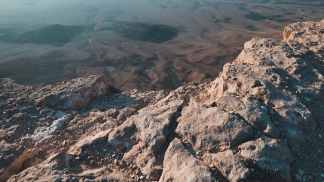
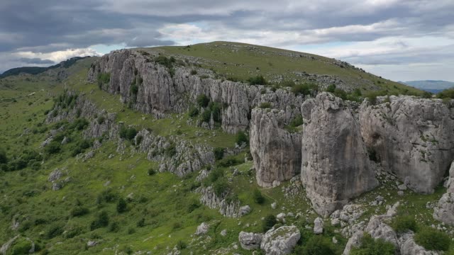
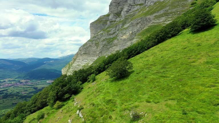
Aerial view of the limestone cliff of Colle dell' Orso, nearby Frosolone, Isernia, Italy
Super slow motion shot of an ecstatic female hiker jumping in joy at the edge of the precipice with a beautiful view of majestic landscape. Nanos. Slovenia.
Young bearded man photographer in casual outfit is standing on precipice of high hill, squatting and taking tripod out of a backpack. Picturesque morning landscape, view on a river. Side view
Trees and pasture in a hillside. Beriain mountain. Navarre, Spain, Europe. 4K.
A hermitage on top of a hill
A hermitage on top of a hill
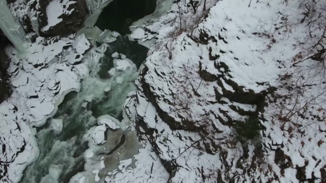
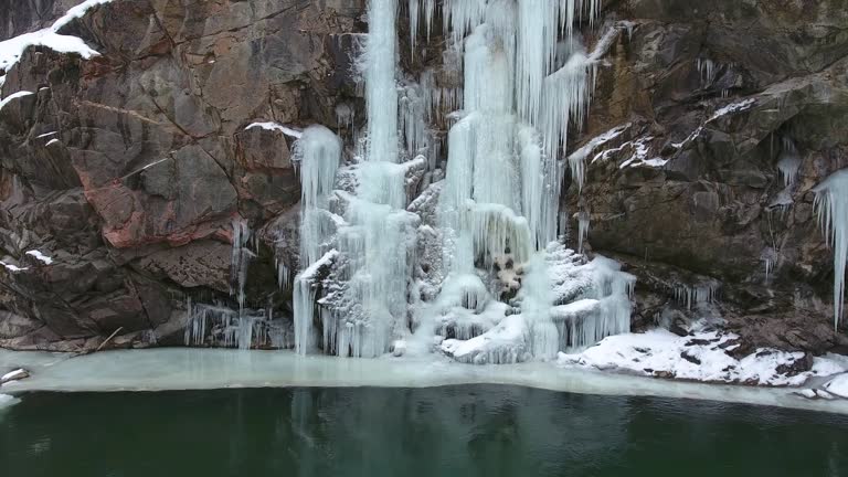
Flight over the winter river at the bottom of the gorge. Icicles hang from the stone walls of the gorge.
Aerial view of the stream at the bottom of a mountain gorge
Frozen waterfall on the rocks. Winter landscape at the bottom of the gorge.
Freezing river at the bottom of the gorge with icicles on the rocks.
© 2024 iStockphoto LP. The iStock design is a trademark of iStockphoto LP. Browse millions of high-quality stock photos, illustrations, and videos.