Zambia Pictures, Images and Stock Photos
Browse 23,500+ zambia stock photos and images available, or search for zambia flag or zambia people to find more great stock photos and pictures.
zambia flag
zambia people
zambia city
zambia business
zambia map
lusaka zambia
zambia landscape
zambia woman
zambia aerial
livingstone zambia
zambia women
zambia safari
zambia football
zambia mono
zambia border
zambia skyline
zambia music
zambia bus
zambia street
zambia mining
zambia hospital
zambia eagle
zambia mate
condoms zambia
zambia president
zambia education
zambia sun
zambia leopard
zambia statue
zambia road
Most popular
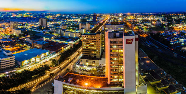
Skyline photo of Lusaka, Zambia
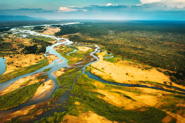
The banks of the Lower Zambezi, Africa
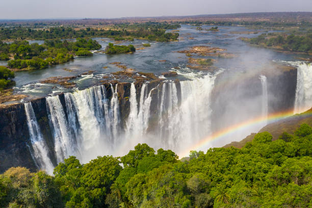
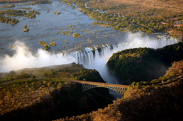
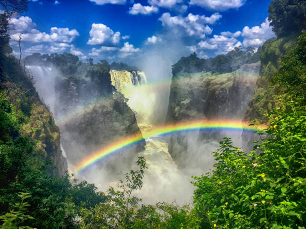
Aerial few of the world famous Victoria Falls with a large rainbow over the falls. This is right at the border between Zambia and Zimbabwe in Southern Africa. The mighty Victoria Falls at Zambezi river are one of the most visited touristic places in Africa.
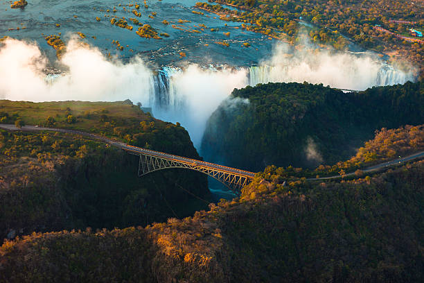
Victoria Falls from the air in the afternoon
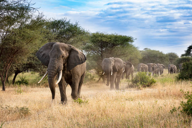
Elephants
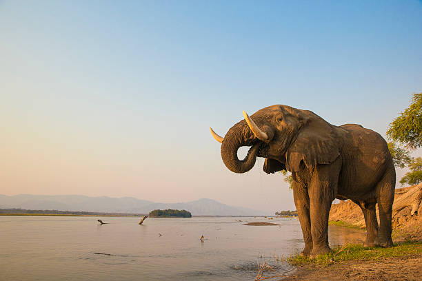
African Elephant bull drinking on the Zambezi river at sunset

Skyline of Lusaka, Zambia - Findeco House, Cairo Road
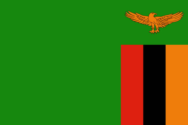
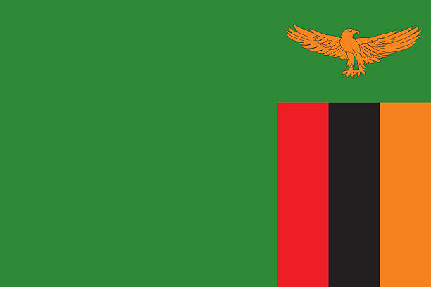
Official vector flag of Zambia .
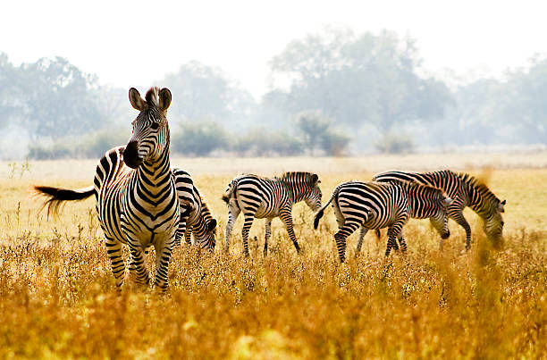
Male crawshay zebra protecting his herd in an open African plain

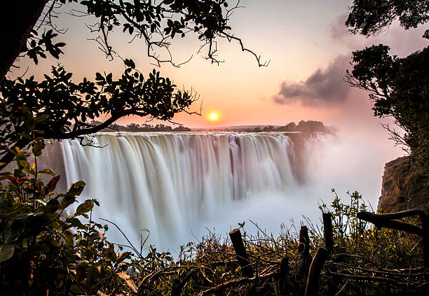
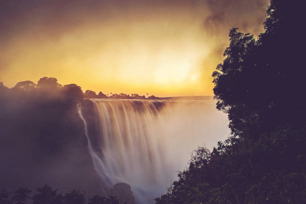
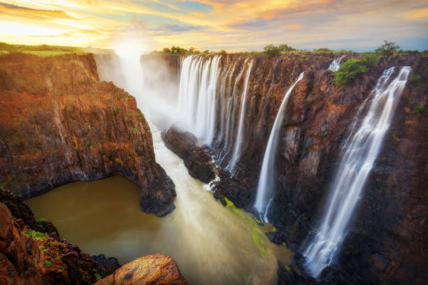
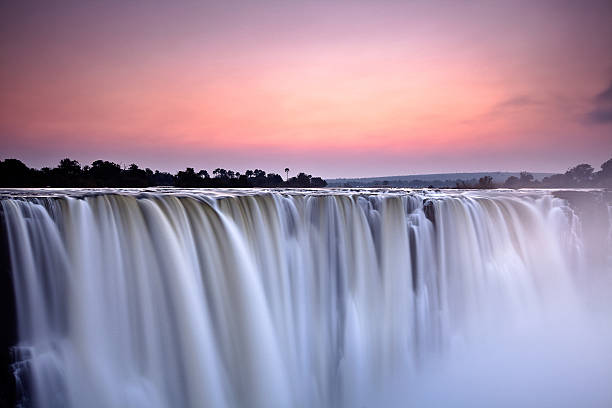
Sunset at the Victoria Falls on Zambezi River located between Zambia and Zimbabwe, the largest waterfall in the world.


Panoramic image taken from hot air balloon of sunrise over Busanga Plains with grazing lechwes
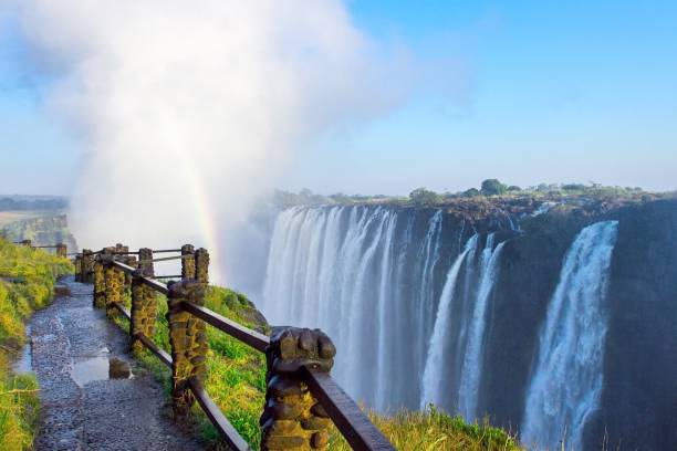
view of Victoria Falls at Zambia side, one of most iconic African natural landmarks
Victoria Falls - Zambia and Zimbabwe

Zambia road and national park vector map

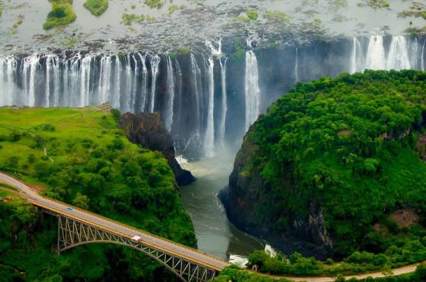
Aerial view of the Zambezi river and Victoria falls with riverboats
Victoria Falls (or Mosi-oa-Tunya (Tokaleya Tonga: the Smoke that Thunders) is a waterfall in southern Africa on the Zambezi River at the border of Zambia and Zimbabwe.

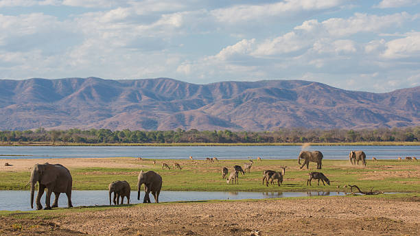
Wildlife on the Zambezi river floodplain
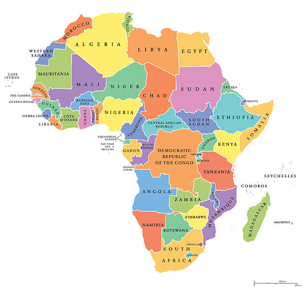
Africa single states political map. Each country with its own color area. With national borders on white background. Continent including Madagascar and island nations. English labeling.

Large elephant herd crossing Luangwa river, Zambia

The flag of Zambia pinned on the map. Horizontal orientation. Macro photography.
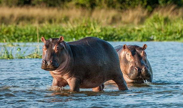
Two common hippopotamus in the water. The common hippopotamus (Hippopotamus amphibius), or hippo. Africa

Zambia flag, National symbol waving against clear blue sky, sunny day
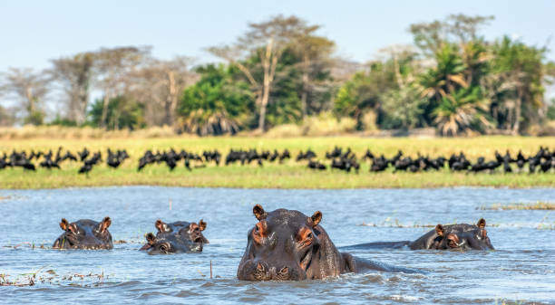
The common hippopotamus in the water. Sunny day. Africa
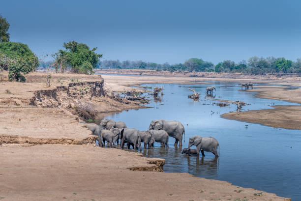
a her of elephants wading in the Luangwa river Zambia


Source: "World reference atlas"

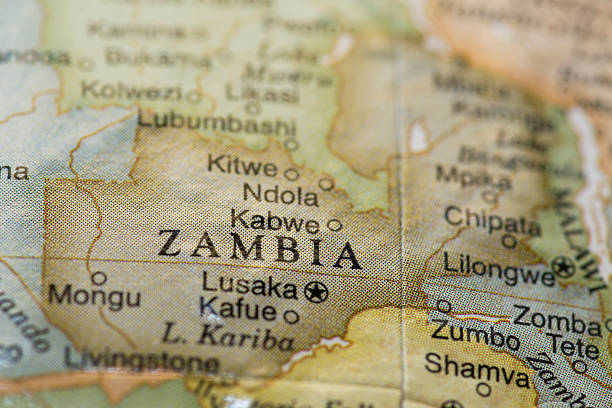
Zambia Political Map with capital Lusaka, national borders, most important cities, rivers and lakes. Illustration with English labeling and scaling.
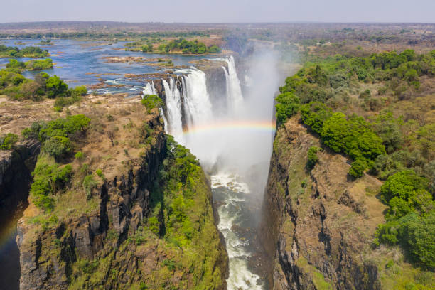
Aerial few of the world famous Victoria Falls with a large rainbow over the falls. This is right at the border between Zambia and Zimbabwe in Southern Africa. The mighty Victoria Falls at Zambezi river are one of the most visited touristic places in Africa.

Red, black, and yellow ribbon with white and green background. Zambia independence day background design. Good template for Zambia Independence day or national day.

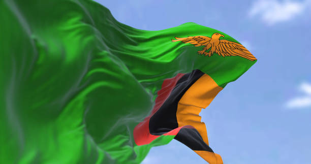
Detail of the national flag of Zambia waving in the wind on a clear day. Zambia is a landlocked country at the crossroads of Central, Southern and East Africa. Selective focus.

Victoria falls in ZambiaVictoria falls in ZambiaVictoria falls in ZambiaVictoria falls in Zambia

Women Empowerment, Africa, Corporate Business - Group of female business executives standing next to each other and joining hands to showcase Women Empowerment and Unity
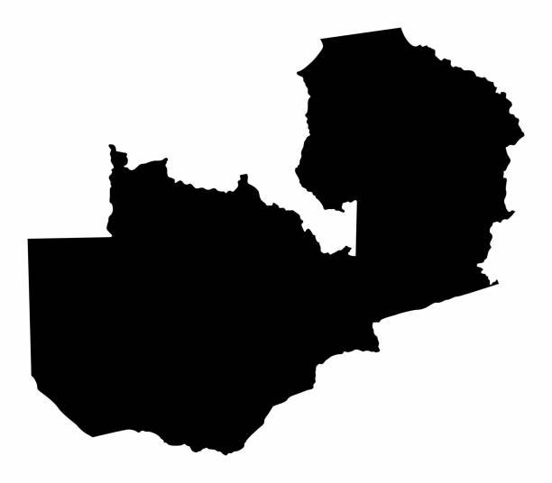
Zambia silhouette map isolated on white background
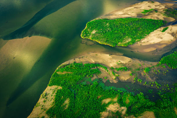
Lower Zambezi, Zambia
The Victoria Falls in flood at sunrise in April 2018 Victoria Falls Zimbabwe Africa
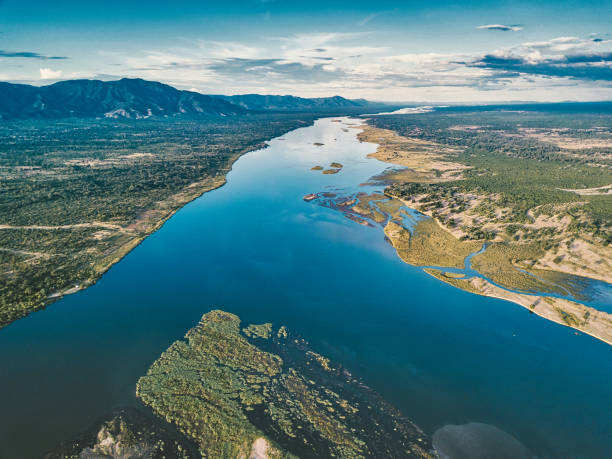
aerial view on the river of lower zambezi area in Zambia

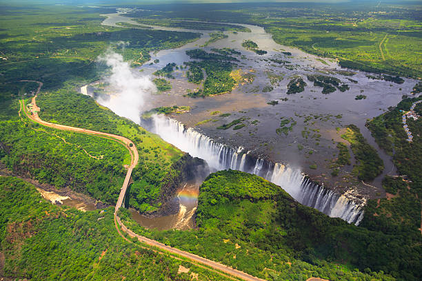
Aerial view of Victoria falls, Zambia, Zimbabwe, Africa.
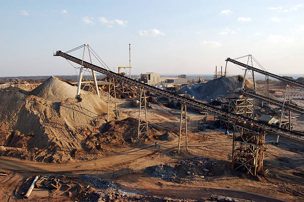
"Conveyor belts feed broken rock into two different stockpiles (oxides and sulphides) at an open-pit copper mine in Zambia, Africa."
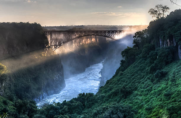
Victoria Falls, located on the Zambezi River on the border between Zambia and Zimbabwe.
Bright sunlight of the dry season creates spectacular rainbows at the famous natural area of Victoria Falls in Zambia, Africa

Simple Black Map of Zambia Isolated on White Background, can be used for business designs, presentation designs or any suitable designs.
Victoria Falls in Zambia and Zimbabwe taken in 2015
Victoria waterfall at dawn

Highly detailed physical map of Zambia in vector format,with all the relief forms,regions and big cities.
Macro of Zambia on a globe, narrow depth of field


Map of Zambia for your own design. With space for your text and your background. Four maps included in the bundle: - One black map. - One blank map with only a thin black outline (in a line art style). - One mosaic map. - One white map with a thin black outline. The 4 maps are isolated on a blank background (for easy change background or texture).The layers are named to facilitate your customization. Vector Illustration (EPS10, well layered and grouped). Easy to edit, manipulate, resize or colorize.

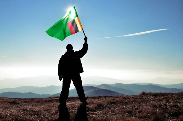
3d render Zambia Flag (Close-up)

Zambia map. Blank vector map of the Country. Borders of Zambia for your infographic. Vector illustration.
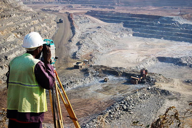
"A locally employed surveyor at an open-pit copper mine in Zambia. He peers through his survey instrument to record the daily changes in the open-pit, and help guide mining activities to the engineer's plans."