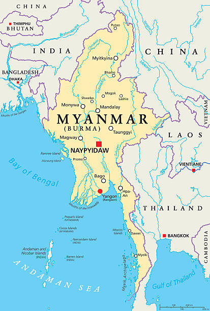
Myanmar political map with capital Naypyidaw, national borders, important cities, rivers and lakes. Also called Burma and old capital Rangoon, Yangon. English labeling. Illustration.
Browse 7,000+ myanmar stock illustrations and vector graphics available royalty-free, or search for myanmar bagan or yangon to find more great stock images and vector art.
Myanmar political map with capital Naypyidaw, national borders, important cities, rivers and lakes. Also called Burma and old capital Rangoon, Yangon. English labeling. Illustration.

A graphic illustrated vector image showing the outline of the country Burma. The outline of the country is filled with a dark navy blue colour and is on a plain white background. The border of the country is a detailed path.

Vector Image of Myanmar Flag. Based on the official and exact Myanmar flag dimensions (3:2) & colors (116C, 361C, 1788C and White)

http://dikobraz.org/map_2.jpg

Myanmar and Thailand Earthquake concept, march 2025. Vector information illustration with map for blog, articles, social media
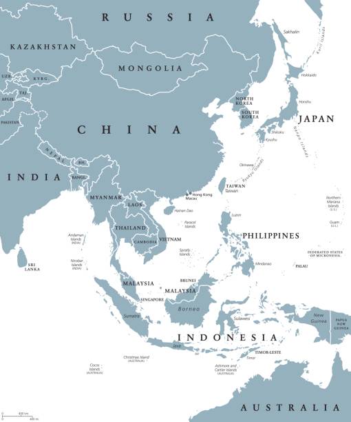
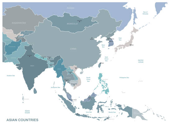
East Asia political map with countries and borders. Eastern subregion of the Asian continent with China, Japan, Mongolia and Indonesia. English labeling. Gray illustration on white background. Vector.

Bay of Bengal, political map. Northeastern part of the Indian Ocean and largest bay of the world, positioned between the Indian subcontinent and Indochinese peninsula, located below the Bengal region.

High detailed isolated map - Myanmar

Blue-gray detailed map of Myanmar administrative divisions and location on the globe. Vector illustration

African seamless borders set. Hand stamp printing. Ethnic folk ornament texture.
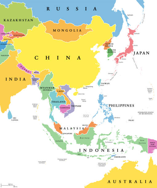
East Asia, single states, political map. All countries in different colors, with national borders, labeled with English country names. Eastern subregion of the Asian continent. Illustration. Vector.

National Symbol and Architecture, Travel and Tourist Attraction
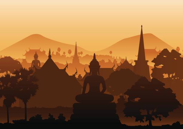
tree temple image of Buddha sculpture pagoda sea,Myanmar,Thailand,vector illustration
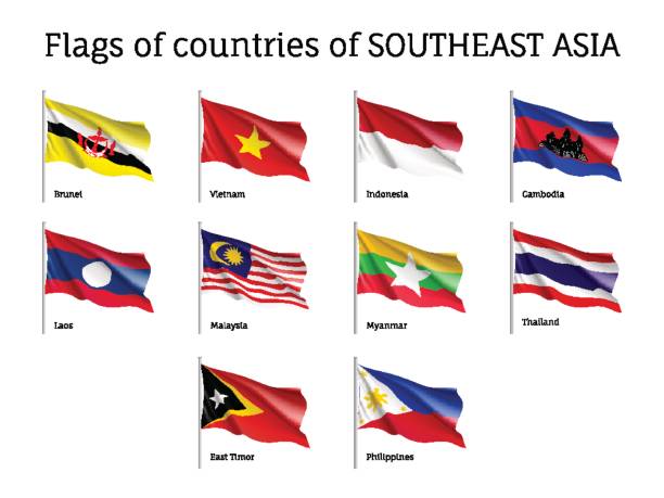
Set of waving flags of members of Asean Economic Community AEC Laos, Thailand and Vietnam, Malaysia and Philippines. Signs of Southeast Asia states. Vector isolated icons

Northern part of Mainland Southeast Asia, multi colored political map, with borders and capitals. Formerly known as Indochina, with the countries Thailand, Vietnam, Myanmar, Laos, and Cambodia.
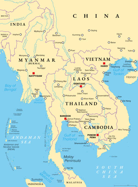
Mainland Southeast Asia, northern part of formerly known Indochina, political map. The countries Thailand, Vietnam, Myanmar, Laos, and Cambodia, with borders, their capitals and largest and cities.

Asia flags. All official national flags of the Asia.

Myanmar - Detailed Map with Regions and Cities. Set of Flags, Globe, Country Outline, Country Location on World Map.
Famous Place, Travel and Tourist Attraction

Map of Myanmar showing regional countries and capitals.

Full Collection of World Flags in Alphabetical Order

Detailed vector map of Myanmar, including main cities, roads, rivers and lakes. The colors in the .eps-file are ready for print (CMYK). Included files are EPS (v10) and Hi-Res JPG (4922 x 4922 px).

Myanmar Burma vector map. Editable template with regions, cities, red pins and blue surface on white background.

Map of Myanmar. Vector illustration. World map

Vintage engraving of British Colonial Troops, Mounted Infantry company of the 2nd Regiment. The New Regiments for service in Burmah. The London Illustrated News, 1891

Republic of the Union of Myanmar vector map

Famous Place and Historical Buildings, Travel and Tourist Attraction

Vector flower mandala. Abstract illustration with oriental ornaments for anti-stress coloring pages, posters, flyers, invitations, cards

vector map of the states of southeast asia.

Cityscape, Travel and Tourist Attraction

Vector map of the states in south east asia

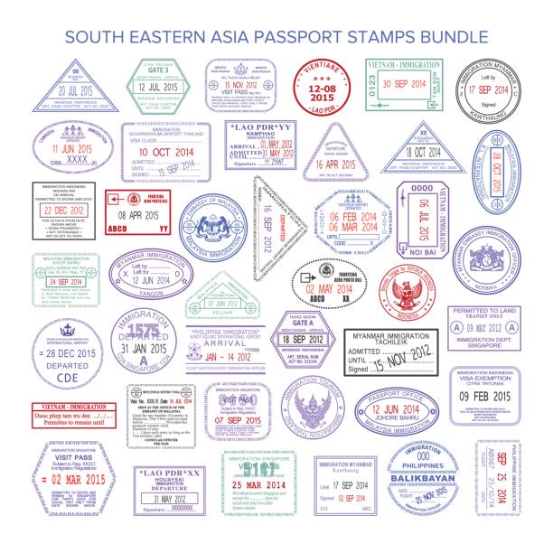
Set of travel visa stamps for passports. Abstract international and immigration office stamps. Arrival and departure customs visa stamps to country. Vector

Geography, Position, Icons and Infographic

Southeast Asia. All buildings are complete and moveable.

From left to right; Shwedagon Paya (Myanmar), Brandenburg Gate (Germany), Temple of Heaven (China), Asakusa Temple (Japan), Saint Basil's Cathedral (Russia), Statue of Liberty (America), Leaning Tower of Pisa (Italy), Eiffel Tower (France), Bank of China Tower (Hong Kong), Oriental Pearl TV Tower (China), Colosseum (Italy), Saint Peter's Basilica (Vatican), Houses of Parliament and Big Ben (Britain). Parthenon (Greece), Sungnyemun- Namdaemun Gate (Korea), Pha That Luang (Laos), Taj Mahal (India), Mexico City Metropolitan Cathedral (Mexico), Angkor Wat (Cambodia), Sphinx (Egypt), Persepolis (Iran), Borobudur (Indonesia), People's Committee Building (Vietnam), Grand Palace (Thailand), and Parliament Building (Hungary). Zoom in to see the detail!

Crossed flags of Myanmar and Japan. Official colors. Correct proportion. Vector illustration

Outline Yangon Myanmar City Skyline with White Buildings. Vector Illustration. Business Travel and Tourism Concept with Modern Architecture. Yangon Cityscape with Landmarks.
Highly detailed vector map of East Asia with countries, capitals and big cities.

india administrative and political zones vector map

Highly detailed physical map of the Myanmar,in vector format,with all the relief forms,regions and big cities.