
Vermont stock illustrations
Browse 3,600+ vermont stock illustrations and vector graphics available royalty-free, or search for burlington vermont or vermont mountains to find more great stock images and vector art.
burlington vermont
vermont mountains
vermont winter
vermont map
vermont landscape
stowe vermont
montpelier vermont
vermont summer
vermont people
vermont fall
vermont spring
killington vermont
bennington vermont
manchester vermont
vermont flag
vermont snow
vermont autumn
vermont hiking
vermont skiing
vermont house
vermont family
vermont ski
vermont mountain
vermont vector
vermont home
brattleboro vermont
vermont farm
vermont state
vermont car
vermont cheese
Most popular
Vermont map shape, united states of america. Flat concept icon symbol vector illustration .

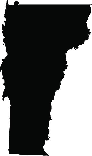
Vermont, state of USA - solid black outline map of country area. Simple flat vector illustration.

Illustrated map of the state of Vermont in United States with cities and landmarks. Editable vector illustration

Flag of the USA State of Vermont, vector
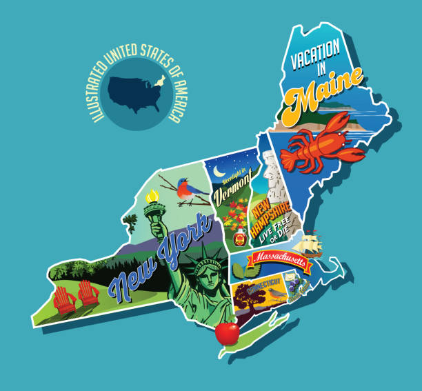
Illustrated pictorial map of Northeast United States. Includes Maine, New Hampshire, Vermont, Massachusetts, Connecticut, Rhode Island and New York. Vector Illustration.

A detailed map of the state of Vermont, including surrounding states. Includes major highways, cities, and lakes. Elements are grouped and separate for easy changes and removal. Includes an extra-large JPG so you can crop in to the area you need.


Vermont, VT, political map with capital Montpelier, borders, cities, rivers and lakes. Northeastern state in the New England region of the United States. The Green Mountain State. Illustration. Vector

vermont vector road map.

New England region of the United States of America, gray political map. Maine, Vermont, New Hampshire, Massachusetts, Rhode Island and Connecticut with capitals and borders. Illustration. Vector.

USA state map in thin line outline style. The line path is editable and the map is on a transparent background (there is no white shape behind it)
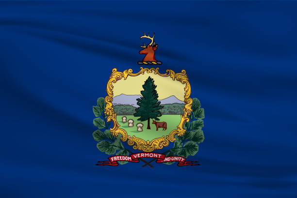
Vermont State Flag


New England region, colored map. A region in the United States of America, consisting of the six states Maine, Vermont, New Hampshire, Massachusetts, Rhode Island and Connecticut. Illustration. Vector

A set of vintage-style icons and typography representing the state of Vermont, including Burlington, Montpelier and Lake Champlain. Each items is on a separate layer. Includes a layered Photoshop document. Ideal for both print and web elements.

Greetings from Vermont USA. Retro postcard with patriotic stars and stripes lettering and United States map in the background. Vector illustration.

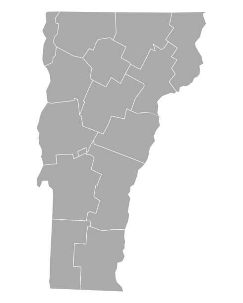
"Highly-detailed Vermont county map. Each county is in a separate labeled layer. All layers have been alphabetized for easy manipulation, recoloring or other use. (see image below -- note: labels only available in AICS2 and AI10 files)"

Vintage vector round label. Vermont. Church in the forest.


highly detailed map from Vermont state & counties for your design and products.

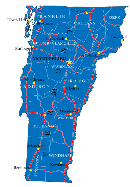
Detailed map of Vermont state,in vector format,with county borders,roads and major cities.

Abstract stamp or emblem with the name of Killington, Vermont, vector illustration

Highway map of the state of Vermont with Interstates, US Routes and state routes. It also has lines for other major roads (but not labeled). It has many cities and the State Capitol on it.

vector illustration of Circle state flag of US federal state of Vermont

vector illustration of Vermont map


Map of Vermont.

Vermont postage stamp design. Vector illustration of scenic covered bridge over stream. Grunge postmark on separate layer


vector of Vermont map

Detailed waving flag map of Vermont. Vector map with masked flag.
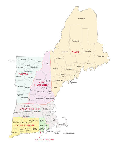
New england states vector map

An illustrated map of Vermont.

Map of Vermont for your own design. Three maps with editable stroke included in the bundle: - One black map on a white background. - One line map with only a thin black outline in a line art style (you can adjust the stroke weight as you want). - One map on a blank transparent background (for change background or texture). The layers are named to facilitate your customization. Vector Illustration (EPS file, well layered and grouped). Easy to edit, manipulate, resize or colorize. Vector and Jpeg file of different sizes.

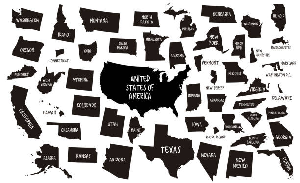
outline of USA maps

A retro-style illustration inspired by vintage ski posters.


Vintage tin sign collection with USA. Michigan. Vermont. Minnesota. Retro souvenirs or postcard templates on rust background. Vintage old paper. Road sign cities.

A highly detailed vector map of Burlington, Vermont with a multicoloured green hand painted watercolour texture. Map is isolated on a white background. "Burlington" stylized text is added overtop with a star to indicate the location of the capital city.

Vermont flat map with long shadow available in four colors

Vintage engraving of a View of Mount Mansfield, Vermont, 19th Century

Montpelier City skyline black and white silhouette. Vector illustration. Simple flat concept for tourism presentation, banner, placard or web site. Business travel concept. Cityscape with landmarks
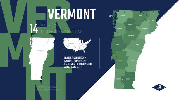
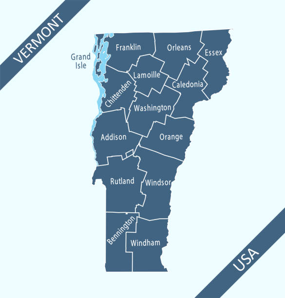
Highly detailed downloadable and printable county map of Vermont state of United States of America for web banner, mobile, smartphone, iPhone, iPad applications and educational use. The map is accurately prepared by a map expert.


Photo of a covered bridge in Vermont


Maple Products Invitation on Grunge Background Poster
Next