
Illustrations
Browse 20+ baltimore city map stock illustrations and vector graphics available royalty-free, or start a new search to explore more great stock images and vector art.


A detailed map of downtown Baltimore, Maryland. Includes neighborhoods, highways, freeways, streets, docks, parks, and points of interest, all on separate layers. Includes an extra-large JPG so you can crop in to the area you need and a CS5 file.

Vector Illustration of a City Street Map of Baltimore, Maryland, USA. Scale 1:60,000. All source data is in the public domain. U.S. Geological Survey, US Topo Used Layers: USGS The National Map: National Hydrography Dataset (NHD) USGS The National Map: National Transportation Dataset (NTD)


Topographic / Road map of Baltimore, MD, USA. Original map data is open data via © OpenStreetMap contributors. All maps are layered and easy to edit. Roads have editable stroke.

Vintage map of the city of Baltimore, Maryland, USA - See lightbox for more

City map of Baltimore, Maryland, USA. Wood engraving, published in 1897.

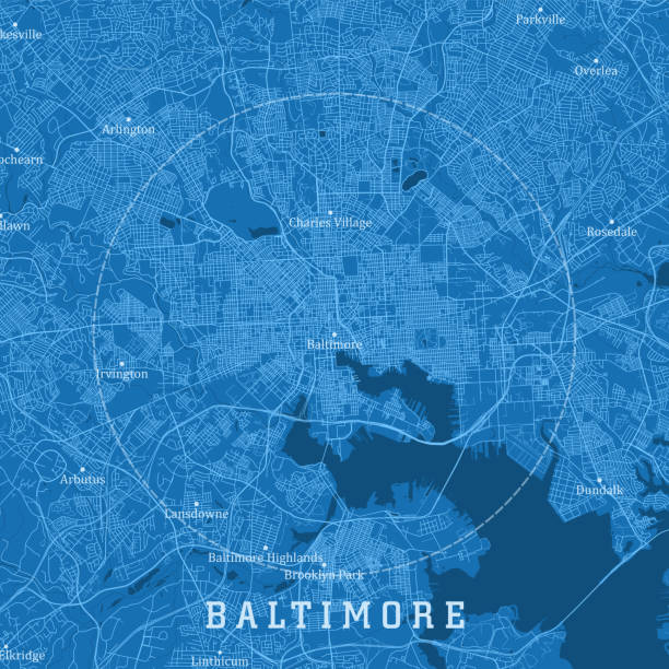
Baltimore MD City Vector Road Map Blue Horizontal. All source data is in the public domain. U.S. Census Bureau Census Tiger. Used Layers: areawater, linearwater, roads.

Topographic / Road map of Baltimore, MD, USA. Original map data is open data via © OpenStreetMap contributors. All maps are layered and easy to edit. Roads have editable stroke.

Topographic / Road map of Baltimore, MD, USA. Original map data is open data via © OpenStreetMap contributors. All maps are layered and easy to edit. Roads have editable stroke.

Poster Style Topographic / Road map of Baltimore, MD, USA. Original map data is open data via © OpenStreetMap contributors. All maps are layered and easy to edit. Roads have editable stroke.

Baltimore MD City Vector Road Map Blue Text. All source data is in the public domain. U.S. Census Bureau Census Tiger. Used Layers: areawater, linearwater, roads.


Maryland US State Vector Road Map Grey. All source data is in the public domain. Roads, Water, Regions, Urban Areas: Made with Natural Earth. https://www.naturalearthdata.com/downloads/10m-physical-vectors/ https://www.naturalearthdata.com/downloads/10m-cultural-vectors/

Poster Style Topographic / Road map of Baltimore, MD, USA. Original map data is open data via © OpenStreetMap contributors. All maps are layered and easy to edit. Roads have editable stroke.

Topographic / Road map of Baltimore, MD, USA. Original map data is open data via © OpenStreetMap contributors. All maps are layered and easy to edit. Roads have editable stroke.

Poster Style Topographic / Road map of Baltimore, MD, USA. Original map data is open data via © OpenStreetMap contributors. All maps are layered and easy to edit. Roads have editable stroke.

NY Cortland Preble Vector Road Map. All source data is in the public domain. U.S. Census Bureau Census Tiger. Used Layers: areawater, linearwater, roads, rails, cousub, pointlm, uac10. https://www.census.gov/geographies/mapping-files/time-series/geo/tiger-line-file.html

NY Cortland Homer Vector Road Map. All source data is in the public domain. U.S. Census Bureau Census Tiger. Used Layers: areawater, linearwater, roads, rails, cousub, pointlm, uac10. https://www.census.gov/geographies/mapping-files/time-series/geo/tiger-line-file.html

VT Windsor Baltimore Vector Road Map. All source data is in the public domain. U.S. Census Bureau Census Tiger. Used Layers: areawater, linearwater, roads, rails, cousub, pointlm, uac10.

VT Windsor Cavendish Vector Road Map. All source data is in the public domain. U.S. Census Bureau Census Tiger. Used Layers: areawater, linearwater, roads, rails, cousub, pointlm, uac10.

NY Cortland Truxton Vector Road Map. All source data is in the public domain. U.S. Census Bureau Census Tiger. Used Layers: areawater, linearwater, roads, rails, cousub, pointlm, uac10. https://www.census.gov/geographies/mapping-files/time-series/geo/tiger-line-file.html