00:20
Browse 12,400+ world flight map stock videos and clips available to use in your projects, or search for world map to find more stock footage and b-roll video clips.

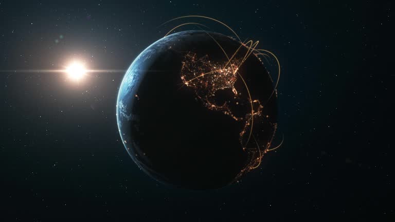
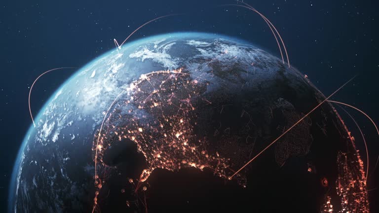
Flying over an emerging international network in a high quality 3D rendered video created from ultra high res 20k textures by NASA: https://visibleearth.nasa.gov/images/55167/earths-city-lights, https://visibleearth.nasa.gov/images/73934/topography, https://visibleearth.nasa.gov/images/57747/blue-marble-clouds/77558l

Flying over an emerging international network in a high quality 3D rendered video created from ultra high res 20k textures by NASA: https://visibleearth.nasa.gov/images/55167/earths-city-lights, https://visibleearth.nasa.gov/images/73934/topography, https://visibleearth.nasa.gov/images/57747/blue-marble-clouds/77558l

Highly detailed animation, perfectly usable for all kinds of topics related to international business, global networks or commercial flight routes.

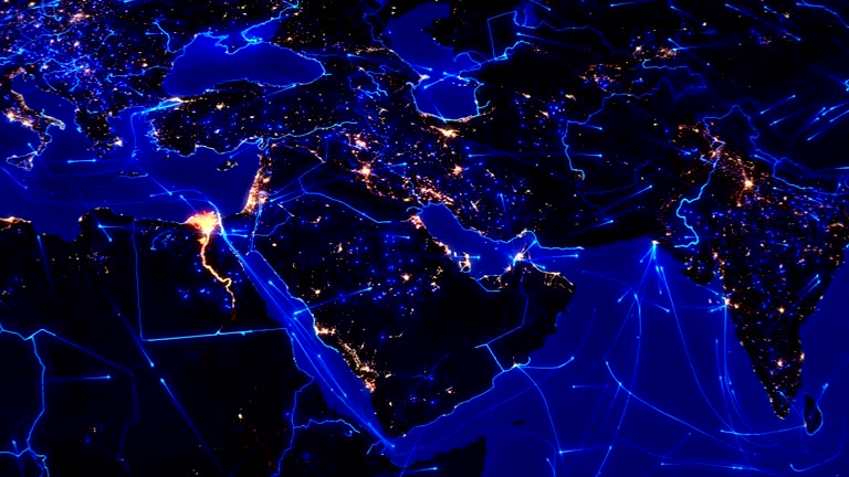
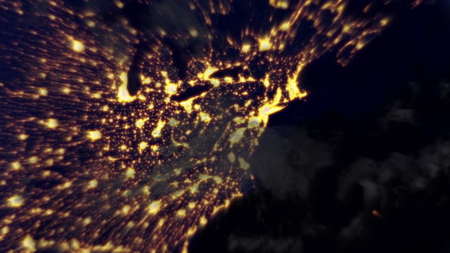
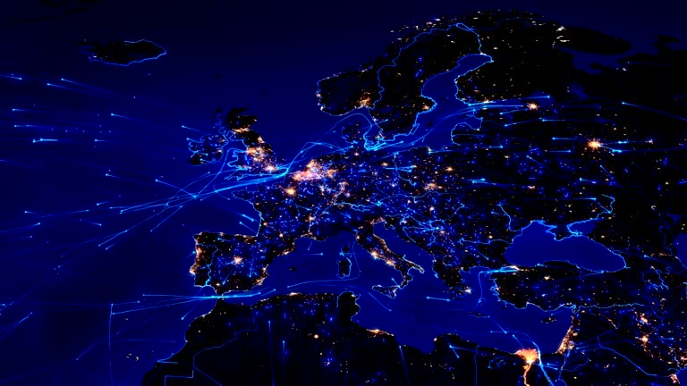
Global communications through the network of connections over Far East, Asia, Europe and America. Concept of internet, social media, traveling. High resolution texture of city lights at night. 4k.

Flying over connection lines between international airports. High quality 3D rendered video created from textures by NASA: https://visibleearth.nasa.gov/images/55167/earths-city-lights, https://visibleearth.nasa.gov/images/73934/topography

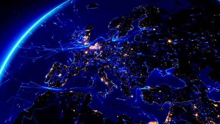
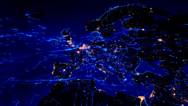
Europe from Space. Planet Earth Population Night Cities Lights. Beautiful View of the Globe Electricity Light from Orbit Satellite. Global World Technology and Business Concept. 4k Ultra HD.
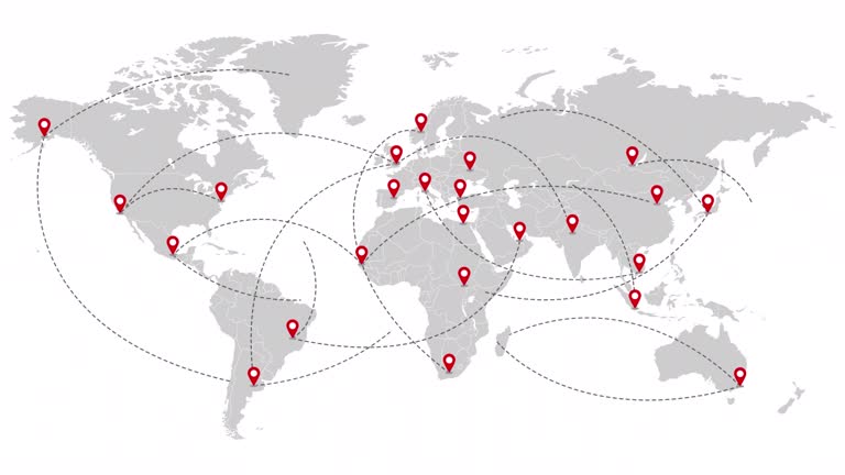
Animation of the world map with delivery points and routes. World map with travel routes and delivery of goods on all continents of the world. Motion design. Alpha channel will be included when downloading the 4K Apple ProRes 4444 file only.

Camera floats very fast from space to London city, England and back while passing into the clouds. High quality 4K resolution. Loop ready file.

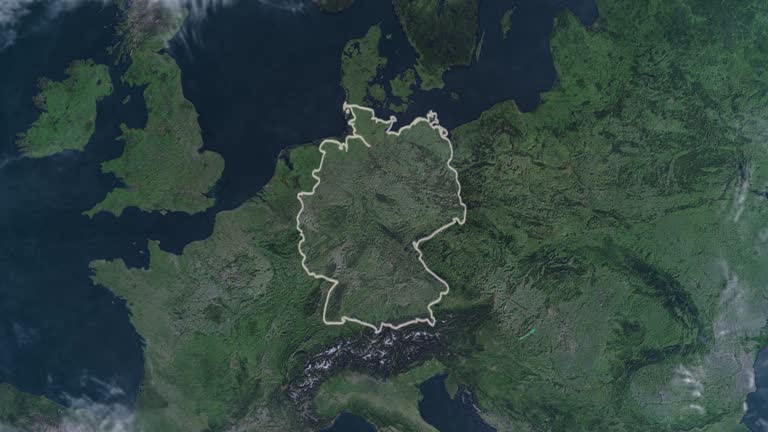
Camera floats very fast from space to Berlin city, Germany and back while passing into the clouds. High quality 4K resolution. Loop ready file.
Alpha channel will be included when downloading the 4K Apple ProRes 4444 file only

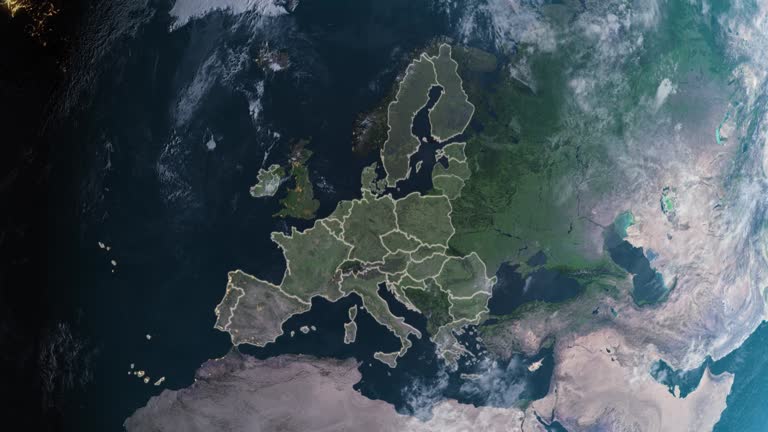
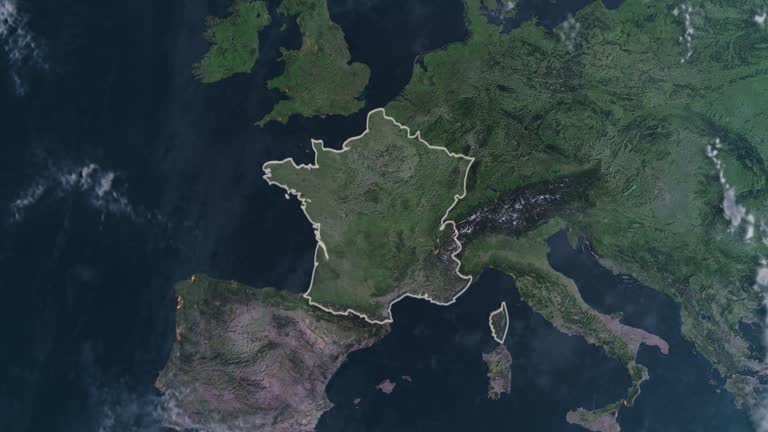
Europe and surrounding areas seen from space. Perfectly usable for topics like global business or European economy and culture. High quality 3D rendered video made from ultra high res 20k textures by NASA: https://visibleearth.nasa.gov/images/55167/earths-city-lights, https://visibleearth.nasa.gov/images/73934/topography, https://visibleearth.nasa.gov/images/57747/blue-marble-clouds/77558l
Animation of the Earth with bright connections and city lights.
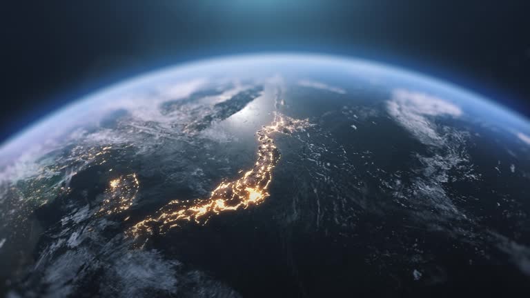
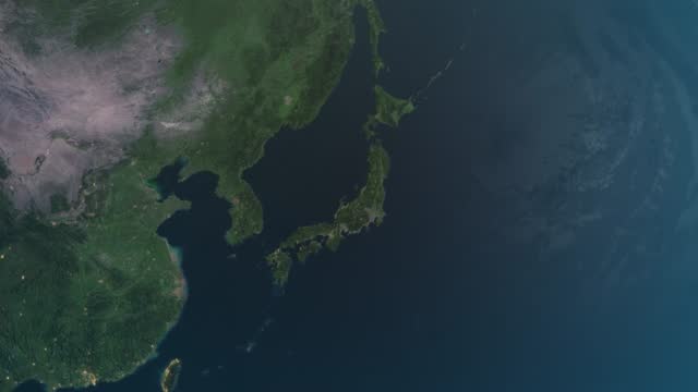
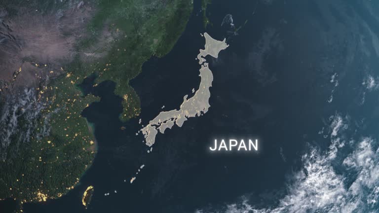
3d Animation Cinematic Realistic Rotating Night World in Space, Japan, north korea, south korea and its surroundings viewed from space. It can be used for commerce or Continental economy and culture. (depth of field) Night Maps of the Earth from NASA

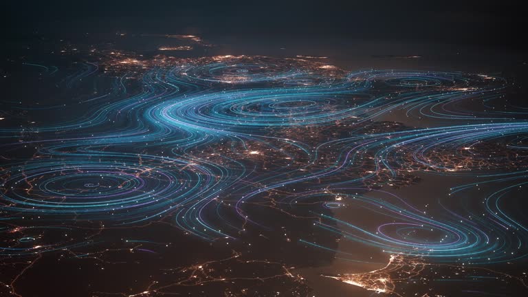
Animation of the Earth with bright connections and city lights. Aerial, maritime, terrestrial routes and country borders.

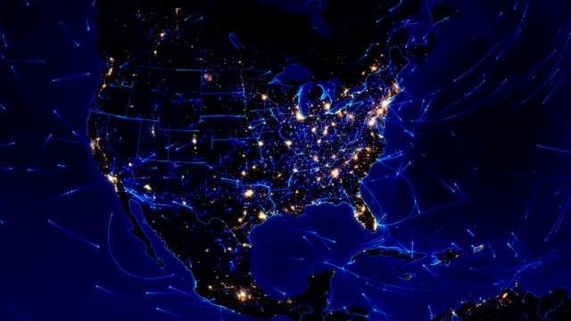
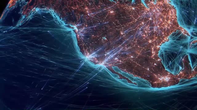
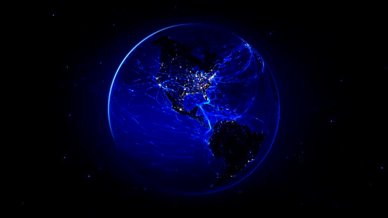
Global communications through the network of connections over North America. Concept of internet, social media, traveling or logistics. High resolution texture of city lights at night. 4k - Ultra HD.
Animation of the Earth with bright connections and city lights. Locked.
World map set of all countries, Map resolution: 22000 x 11000 pixel, Epic photo real animation, World Map Credits To NASA : https://visibleearth.nasa.gov/images/57752/blue-marble-land-surface-shallow-water-and-shaded-topography

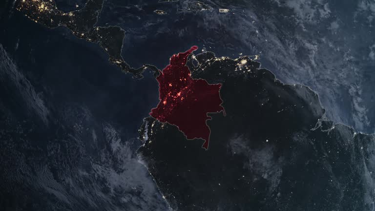
Animation of the Earth with bright connections. From North America to Europe. Aerial, maritime, ground routes and country borders. Red.
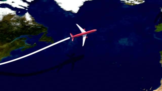
Airplane flight path from USA (New York) to Great Britain and return on satellite map. Satellite image from NASA visible Earth.
Alpha channel will be included when downloading the 4K Apple ProRes 4444 file only
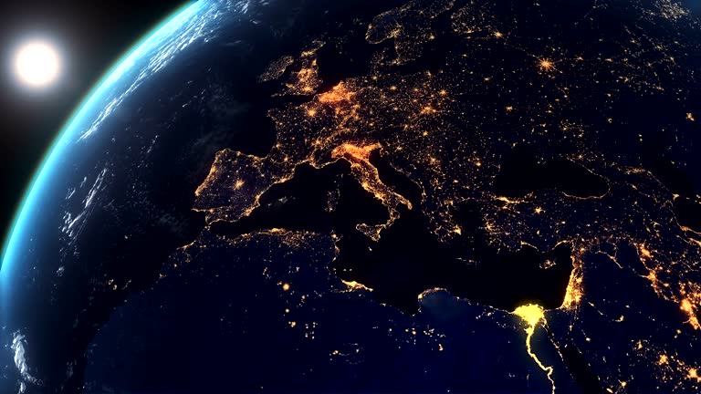
European Earth at Night City lights and sunrise
video background design, opening video, background animation, video intro, video element
3d generated world map with glowing data lines. Perfectly usable for all kinds of topics related to international business and finance, global data or technological innovation. Created from textures by NASA: https://visibleearth.nasa.gov/images/55167/earths-city-lights, https://visibleearth.nasa.gov/images/73934/topography
World map set of all countries, Epic photo real animation, World Map Credits To NASA : https://visibleearth.nasa.gov
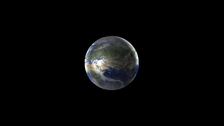
Epic 4K photo real globe animation

High quality 3D rendered video, perfectly usable for topics related to global business networks, international flight routes or the spread of a pandemic / computer virus. Textures courtesy of NASA: https://visibleearth.nasa.gov/images/55167/earths-city-lights, https://visibleearth.nasa.gov/images/73934/topography
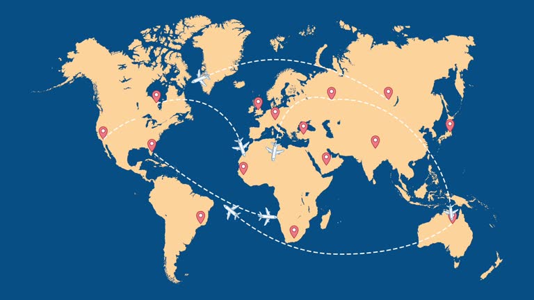
Navigation map of the world. Lots of control point icons with route lines between them. 4k - 60 fps. video
Animation of the Earth with bright connections and city lights. 2 shots in 1 file. Locked and dolly.

Airplane flying on green screen from lower left to upper right corner, leaving dotted line path behind, 4k template animation
Highly detailed animation, perfectly usable for all kinds of topics related to international business, global networks or commercial flight routes.
Alpha channel will be included when downloading the 4K Apple ProRes 4444 file only
European and North American map with bright connections and city lights. Aerial, maritime, ground routes and country borders. 2 shots in 1 file.

Flight travel concept animated map with distance information

Global Digital Grid Growing Over Earth Looped Net 3d Animation. Ai Neural Networks Covering Planet Illustration. International Airlines. Internet Connections. Business Transaction Lines Worldwide 4k.

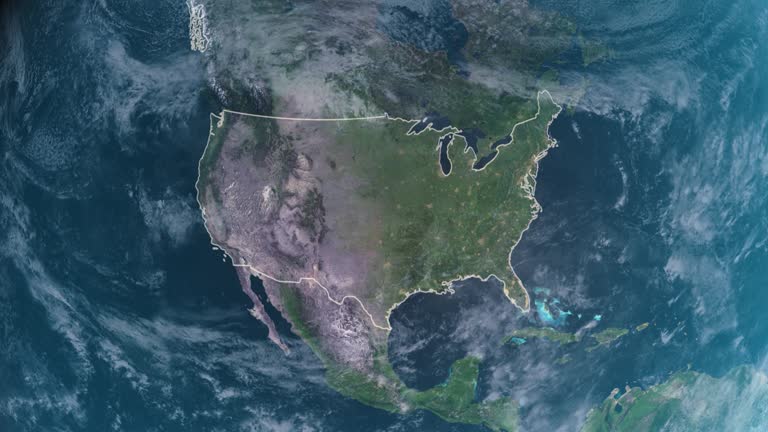
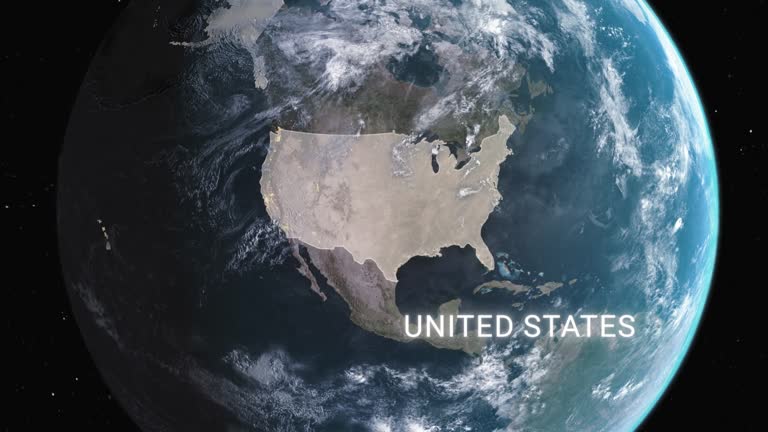
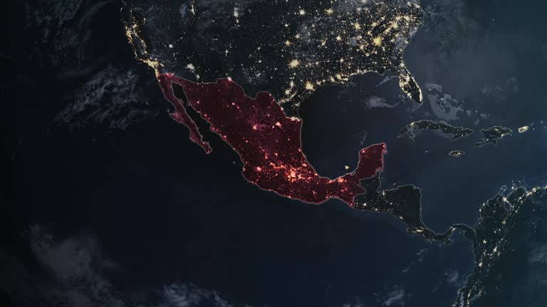
The United States Of America and surrounding areas seen from space. Perfectly usable for topics like global business or American economy and culture. High quality 3D rendered video made from ultra high res 20k textures by NASA: https://visibleearth.nasa.gov/images/55167/earths-city-lights, https://visibleearth.nasa.gov/images/73934/topography, https://visibleearth.nasa.gov/images/57747/blue-marble-clouds/77558l

travel summer vacations airplane flying at world with monuments famous landmark animation
World map set of all countries, Map resolution: 22000 x 11000 pixel, Epic photo real animation, World Map Credits To NASA : https://visibleearth.nasa.gov/images/57752/blue-marble-land-surface-shallow-water-and-shaded-topography
Animation of the Earth with bright connections and city lights. Aerial, maritime, terrestrial routes and country borders. Loop able.

High quality 3D rendered video, perfectly usable for topics related to global business networks, international flight routes or the spread of a pandemic / computer virus. Textures courtesy of NASA: https://visibleearth.nasa.gov/images/55167/earths-city-lights, https://visibleearth.nasa.gov/images/73934/topography

Epic photo real animation, World Map Credits To NASA : https://visibleearth.nasa.gov/images/57752/blue-marble-land-surface-shallow-water-and-shaded-topography

Transportation global worldwide by ship, plane, train and truck. The concept of logistics. Ocean, sea beautiful sunset. Cool Cinematic view.

Animation of the Earth with bright connections and city lights. Aerial, maritime, terrestrial routes and country borders.

USA, Los Angeles County, New York City, Washington DC, Geographical Locations
Amazing Hi Definition animation zooming out into space from a central city park. Real actors make up this difficult to achieve shot producing a dramatic self contained advert. A world surrounded by networks and computer wireless data.

Transportation global worldwide by ship, plane, train and truck. The concept of logistics. Ocean, sea beautiful sunset. Side view.

The United States Of America and surrounding areas seen from space. Perfectly usable for topics like global business or American economy and culture. High quality 3D rendered video made from ultra high res 20k textures by NASA

3d Animation Cinematic Realistic Rotating Earth in Space,Australia, Malaysia, China, Philippines, Thailand, Vietnam, Indian Ocean, North Pacific Ocean (close-up) Earth Maps,Cloud Maps, From By NASA
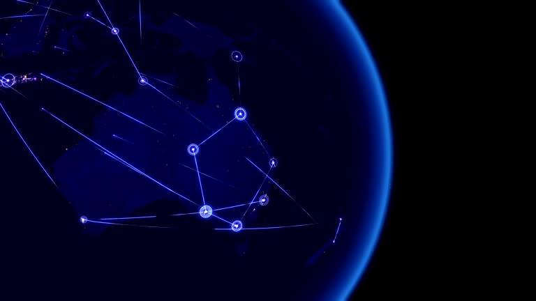
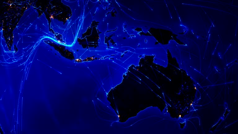
Global communications through the network of connections over Australia and Far East (China, Japan, Korea). Concept of internet, social media, traveling or logistics. High resolution texture of city lights at night. 4k - Ultra HD.

Camera floats very fast from space to Barcelona city, Spain and back while passing into the clouds. High quality 4K resolution. Loop ready file. Vertical. Map image is courtesy of NASA: https://visibleearth.nasa.gov/images/57723/the-blue-marble
Animation of the Earth with bright connections and city lights. Locked.
World map set of all countries, Map resolution: 22000 x 11000 pixel, Epic photo real animation, World Map Credits To NASA : https://visibleearth.nasa.gov/images/57752/blue-marble-land-surface-shallow-water-and-shaded-topography
World map set of all countries, Map resolution: 22000 x 11000 pixel, Epic photo real animation, World Map Credits To NASA : https://visibleearth.nasa.gov/images/57752/blue-marble-land-surface-shallow-water-and-shaded-topography
World map set of all countries, Map resolution: 22000 x 11000 pixel, Epic photo real animation, World Map Credits To NASA : https://visibleearth.nasa.gov/images/57752/blue-marble-land-surface-shallow-water-and-shaded-topography
Navigation world map and many red checkpoints icon with routes lines between them. Video animation on blue background. Traveling, vacation, journey concept. Map from dots. Tracking movement.
Highlighted dark map of countries, zooming in from the space through a 4K photo real animated globe, with a panoramic view consisting of Africa, North and South America. Epic spinning world animation, Realistic planet earth, highlight, satellite, aerial
Highly detailed animation, perfectly usable for all kinds of topics related to international business, global networks or commercial flight routes.

3d Animation Cinematic Realistic Rotating Night Earth in Space, Canada, Alaska, Greenland, Northern Pacific Ocean, Arctic Ocean (close-up) Earth Maps,Cloud Maps, From By NASA
A flight from New York City at night up to the Earth orbit, rounding the Earth and flying back to New York. Loops seamlessly. Earth map based on images courtesy of: NASA http://www.nasa.gov, and Image Science and Analysis Laboratory, NASA-Johnson Space Center. "The Gateway to Astronaut Photography of Earth.": http://eol.jsc.nasa.gov.
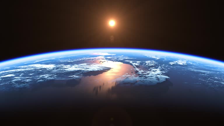
Sun Above Planet Earth. View From Space. Ultra High Definition. 4K. 3840x2160. Seamless Looped. Realistic 3d Animation.
European and Asian map with bright connections and city lights. Aerial, maritime, terrestrial routes and country borders. 2 shots in 1 file.
Highlighted dark map of countries, zooming in from the space through a 4K photo real animated globe, with a panoramic view consisting of Africa, North and South America. Epic spinning world animation, Realistic planet earth, highlight, satellite, aerial
© 2025 iStockphoto LP. The iStock design is a trademark of iStockphoto LP. Browse millions of high-quality stock photos, illustrations, and videos.
Do Not Sell or Share