
Clinton Iowa Pictures, Images and Stock Photos
Browse 50+ clinton iowa stock photos and images available, or start a new search to explore more stock photos and images.
Most popular
Iowa City, United States- February 1, 2016: Heavy turnout for the 2016 Democratic Iowa Caucus in Precinct 14 at Mark Twain Elementary School in Iowa City, Iowa with relatively mild for a January Iowa night.


Iowa City, United States- February 1, 2016: Heavy turnout for the 2016 Democratic Iowa Caucus in Precinct 14 at Mark Twain Elementary School in Iowa City, Iowa with relatively mild for a January Iowa night.

The map is accurately prepared by a map expert.

Illustrated map of the state of Iowa in United States with cities and landmarks. Editable vector illustration

Downloadable outline vector map of Iowa state of United States of America.
The map is accurately prepared by a map expert.

Iowa City, United States- February 1, 2016: Heavy turnout for the 2016 Democratic Iowa Caucus in Precinct 14 at Mark Twain Elementary School in Iowa City, Iowa with relatively mild for a January Iowa night.

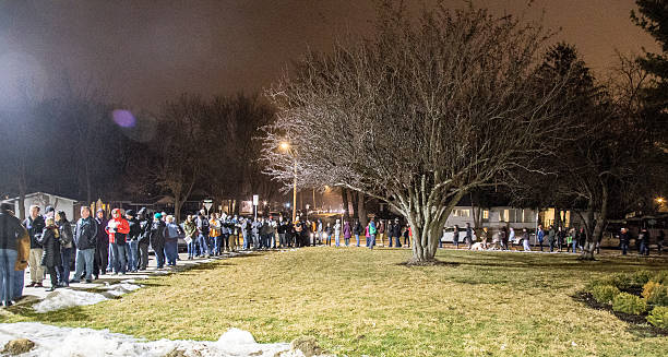
Iowa City, United States- February 1, 2016: Heavy turnout for the 2016 Democratic Iowa Caucus in Precinct 14 at Mark Twain Elementary School in Iowa City, Iowa with relatively mild for a January Iowa night.

Iowa City, United States- February 1, 2016: Heavy turnout for the 2016 Democratic Iowa Caucus in Precinct 14 at Mark Twain Elementary School in Iowa City, Iowa with relatively mild for a January Iowa night.

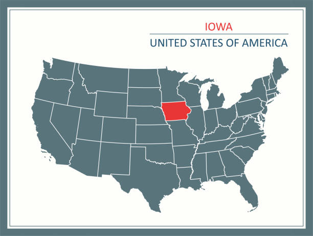
Highly detailed map of United States of America with highlighted state of Iowa for web banner, mobile, smartphone, iPhone, iPad applications and educational use. The map is accurately prepared by a map expert.
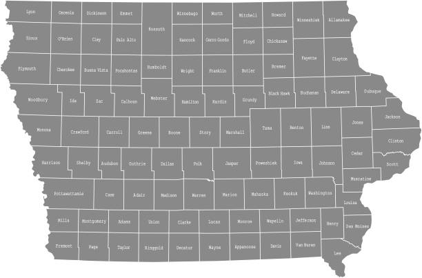
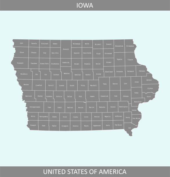
Highly detailed map of Iowa counties state of United States of America for web banner, mobile, smartphone, iPhone, iPad applications and educational use. The map is accurately prepared by a map expert.
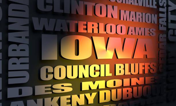
Image relative to usa travel. Iowa state cities list. 3D rendering

Highly detailed map of iowa counties state of United States of America for book cover, brochure and web banner designs, iPhone, iPad, tablet, smart phone, mobile app and educational use.

Image relative to USA travel. Michigan cities and places names cloud. 3D rendering

Iowa City, Iowa, USA - August 31, 2019: View down Clinton Street, early in the morning

Vector of Detailed Map of Iowa State with County Divisions Source file : https://legacy.lib.utexas.edu/maps/states/iowa.gif

Printable outline vector map of Iowa state of United States of America.

Downloadable county map of Iowa state of United States of America. The map is accurately prepared by a map expert.

Iowa City, United States- February 1, 2016: Heavy turnout for the 2016 Democratic Iowa Caucus in Precinct 14 at Mark Twain Elementary School in Iowa City, Iowa with relatively mild for a January Iowa night.

Word cloud map of Iowa state. Cities list collage


Wetland Ponds Along the Mississippi River Near Clinton, Iowa

Map of Clinton County - Iowa, on a blue and red colored background. The blue color represents the Democratic Party and the red color represents the Republican Party. White stars are placed above and below the map. Vector Illustration (EPS file, well layered and grouped). Easy to edit, manipulate, resize or colorize. Vector and Jpeg file of different sizes.

Highly detailed map of Iowa state of United States of America for web banner, mobile, smartphone, iPhone, iPad applications and educational use. The map is accurately prepared by a map expert.

Highly detailed map of United States of America with highlighted state of Iowa for web banner, mobile, smartphone, iPhone, iPad applications and educational use. The map is accurately prepared by a map expert.


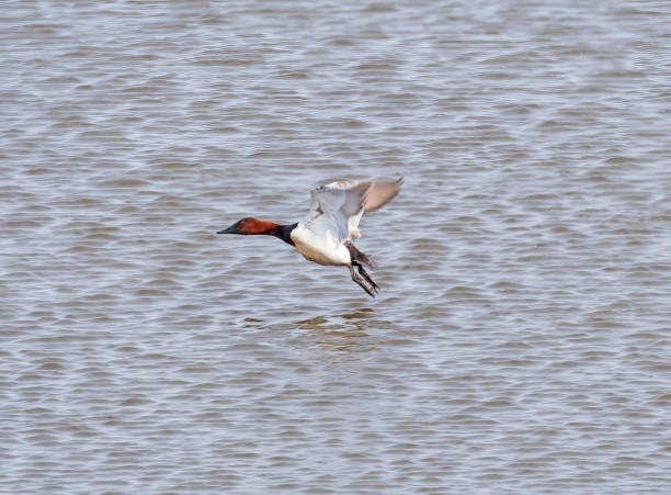
A Canvasback Taking Off From the Mississippi River

White Pelicans on the Mississippi Flyway Near Clinton, Iowa


Map of Clinton County - Iowa, with a realistic paper cut effect isolated on white background. Trendy paper cutout effect. Vector Illustration (EPS file, well layered and grouped). Easy to edit, manipulate, resize or colorize. Vector and Jpeg file of different sizes.

Printable counties map of Iowa state of United States of America. The map is accurately prepared by a map expert.

Highly detailed county map of Iowa state of United States of America for web banner, mobile, smartphone, iPhone, iPad applications and educational use. The map is accurately prepared by a map expert.

Image relative to USA travel. Mississippi cities and places names cloud. 3D rendering

Old abandoned buildings and store fronts in Midwest city.

Old abandoned buildings and store fronts in Midwest city.

Old abandoned buildings and store fronts in Midwest city.

Old abandoned buildings and store fronts in Midwest city.

Old abandoned buildings and store fronts in Midwest city.

Map of Clinton County - Iowa, for your own design. Four maps with editable stroke included in the bundle: - One black map on a white background. - One blank map on a black background. - One white map with shadow on a blank background (for easy change background or texture). - One line map with only a thin black outline (in a line art style). The layers are named to facilitate your customization. Vector Illustration (EPS file, well layered and grouped). Easy to edit, manipulate, resize or colorize. Vector and Jpeg file of different sizes.

Map of Clinton County - Iowa, isolated on a blank background and with his name on a red ribbon. Vector Illustration (EPS file, well layered and grouped). Easy to edit, manipulate, resize or colorize. Vector and Jpeg file of different sizes.

Lesser Scaup and a Pie Billed Grebe in a Lagoon on the Mississippi River Near Clinton Iowa

Map of Clinton County - Iowa, with a large group of people. The faces are blue and red and represent patriots. The color blue for the Democratic Party and the color red for the Republican Party. Conceptual creative map, can symbolize the unity, cooperation, teamwork, patriotism... Vector Illustration (EPS file, well layered and grouped). Easy to edit, manipulate, resize or colorize. Vector and Jpeg file of different sizes.

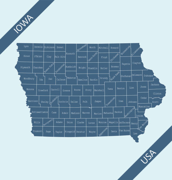
Highly detailed labeled map of Iowa counties state of United States of America for book cover, brochure and web banner designs, iPhone, iPad, tablet, smart phone, mobile app and educational use.

Highly detailed map of iowa state of United States of America for book cover, brochure and web banner designs, iPhone, iPad, tablet, smart phone, mobile app and educational use.

Printable map of Iowa state of United States of America. The map is accurately prepared by a map expert.