El Paso County Texas Pictures, Images and Stock Photos
Browse 2,400+ el paso county texas stock photos and images available, or start a new search to explore more stock photos and images.
Most popular
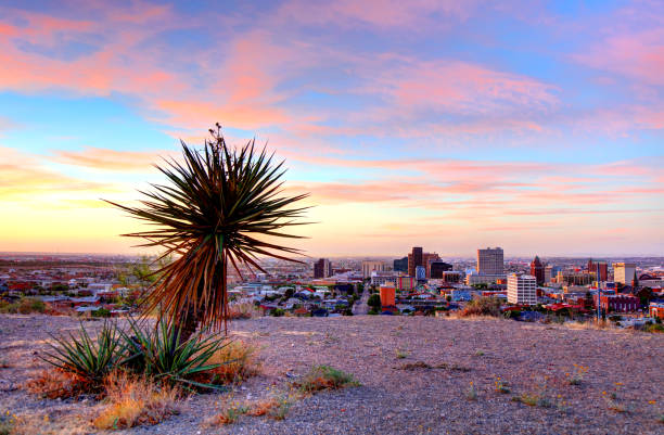
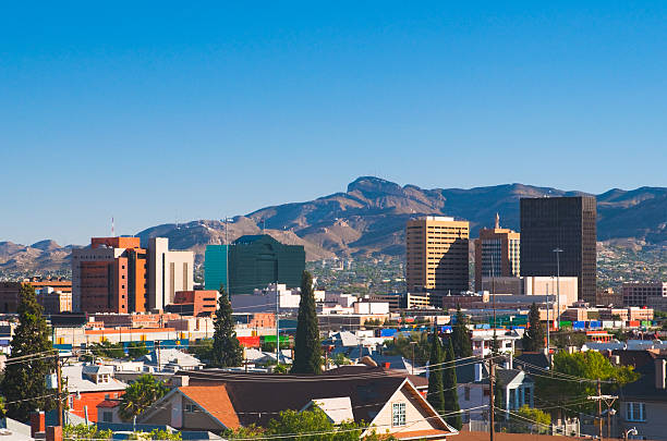
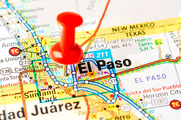
El Paso is a city in and the seat of El Paso County, Texas, United States. It is situated in the far western corner of the U.S. state of Texas.
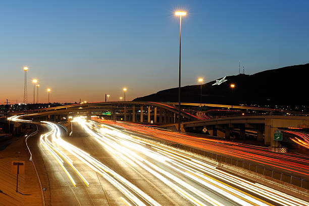
El Paso, Texas showing the star on the mountain behind traffic on Interstate 10 and the Spaghetti Bowl interchange with US-54.

El Paso, Texas, USA - April 15, 2014: The UTEP Sun Bowl football stadium in El Paso, Texas. Opened in 1963 and seating 51,500, this outdoor stadium was originally donated by the University of Texas El Paso to the city of El Paso. The stadium was built on a natural bowl shape and was commissioned after the previous sports "arena", Kidd Field, could no longer expand beyond 15,000 seats. The original Sun Bowl stadium seated 30,000 before the renovations to increase capacity occurred in 1982 and 2001

Iconic photo of El Paso, Texas showing the star on the mountain behind traffic on Interstate 10 and the Spaghetti Bowl interchange with US-54. Symmetrical composition.

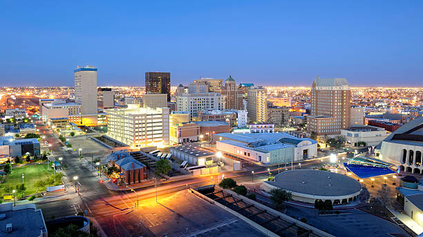
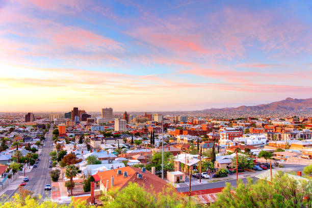
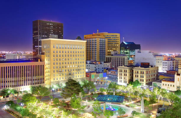
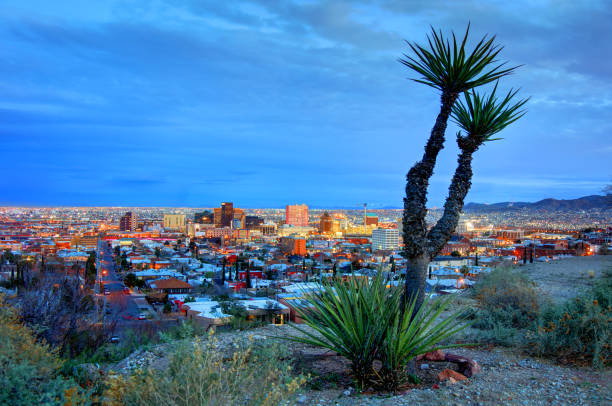
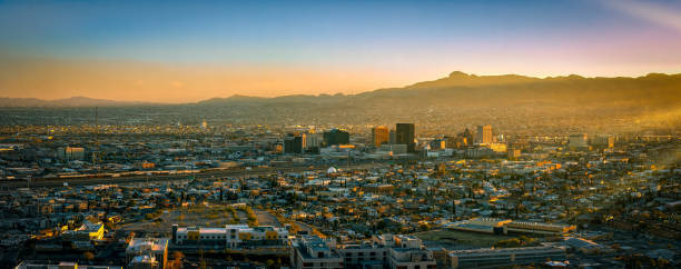
El Paso, Texas, USA downtown city skyline at dusk with Juarez, Mexico in the distance.

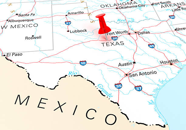
Texas, political map, with capital Austin, borders, important cities, rivers and lakes. State in the South Central region of the United States of America. English labeling. Illustration. Vector.
El Paso is a city and the county seat of El Paso County, Texas, United States
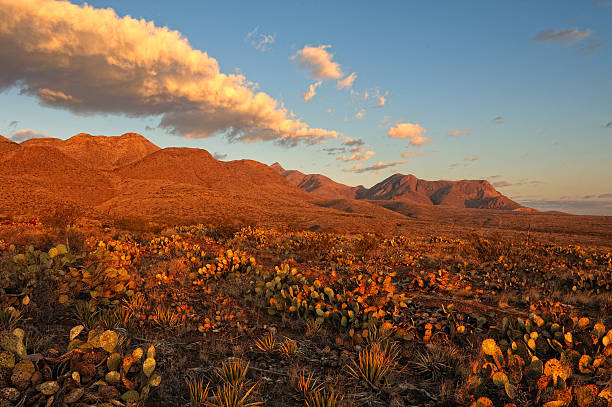
Southern Rocky Mountains in El Paso, Texas at Sunrise. Area is known as Castner Range. It is an old firing range that is off limits to the public.


"Detailed vector map of Texas with administrative divisions. File was created on October 29, 2012. The colors in the .eps-file are ready for print (CMYK). Included files: EPS (v8) and Hi-Res JPG (5600aa aaa 5140 px)."

El Paso is a city and the county seat of El Paso County, Texas, United States

Vector Texas Symbols

Series of stylized retro/vintage passport style stamps of different Texas Locations. As well as two decals.
Downtown El Paso Texas skyline seen just after sunset. 16 x 9 aspect ratio. Space for copy.
El Paso, Texas, USA downtown city skyline at dusk with Juarez, Mexico in the distance.

19th century map of Texas. Published in New Dollar Atlas of the United States and Dominion of Canada. (Rand McNally & Co's, Chicago, 1884).
Red Thumbtack Over Texas State USA Map. 3D rendering

3D render and image composing: Topographic Map of Texas, USA. Including state borders, cities, rivers and accurate longitude/latitude lines. Very high resolution available! High quality relief structure!
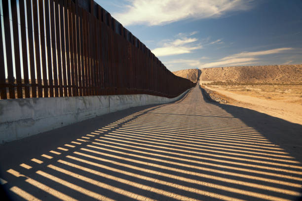
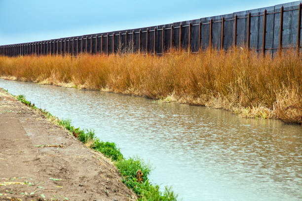
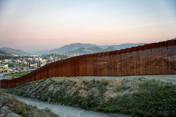
Fence separating United States and Mexico
El Paso is a city in and the seat of El Paso County, Texas, United States. It is situated in the far western corner of the U.S. state of Texas. El Paso stands on the Rio Grande river across the Mexico–United States border from Ciudad Juárez
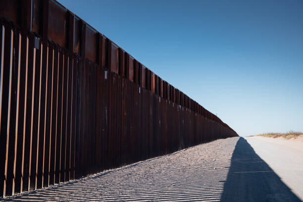
US, Mexican border wall that separates El Paso, Texas and Juarez

Thirty Three of United States biggest cities skylines.
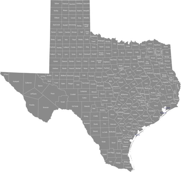
All counties have separate and accurate borders that can be selected and easily edited.

Tilt shift photo of houses on a hill

El Paso, Texas

Austin Texas Skyline 2016 from the top of Butler Park with the entire downtown cityscape and new construction with highrises and condos and office buildings. The Hill top of Butler Park shows the Texas Map with all the major cities of Texas. Austin , Amarillo , San Antonio , Fort Worth , Dallas , Corpus Christi , Laredo , El Paso ,
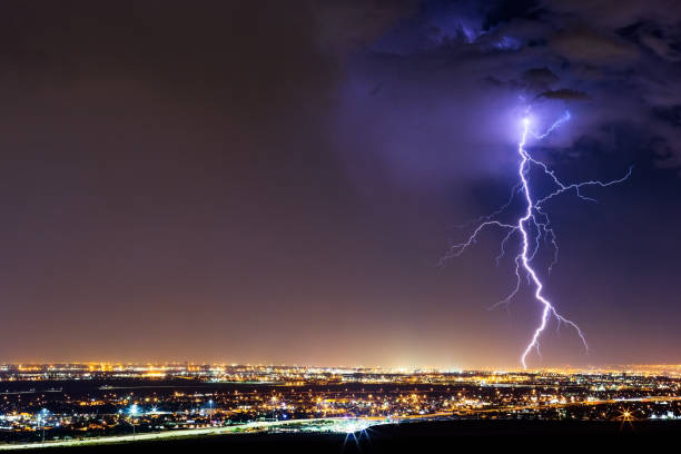
Lightning bolt strike from a thunderstorm over El Paso, Texas.
The iconic and controversial iron border wall between the USA and Mexico

Highly-detailed Texas county map. Each county is in it's own separate labeled layer. County names are in a separate layer and can be easily adjusted or removed as well. All layers have been alphabetized for easy manipulation, recoloring or other use.
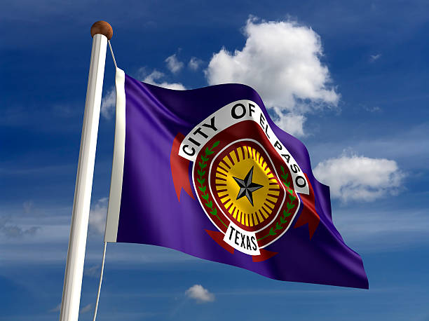
El Paso Texas flag USA (isolated with clipping path)

Socorro, Texas, USA - March 29, 2016: The sun shines on the bell tower at the Socorro Mission, built in 1840, in Socorro, Texas near El Paso.
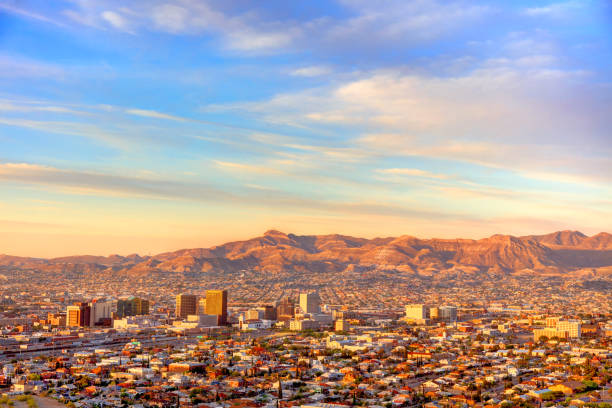
El Paso is a city and the county seat of El Paso County, Texas, United States, in the far western part of the state.

flag of Texas painted on old grungy wooden background
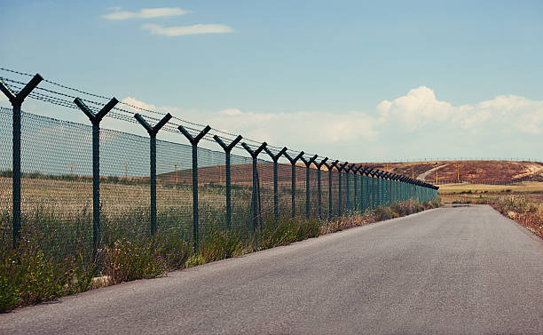
Road next to a fence in a clear day.

The fence or wall dividing the countries of the USA and Mexico
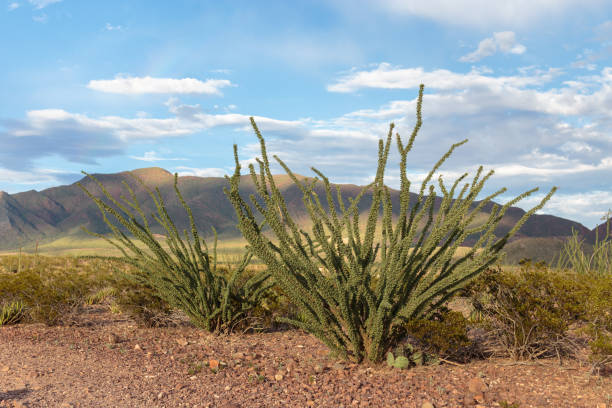
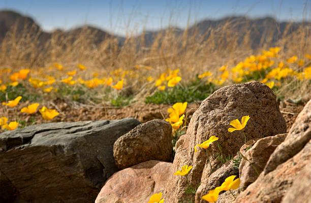
Ocotillo growing in the Franklin mountains near El Paso, Texas
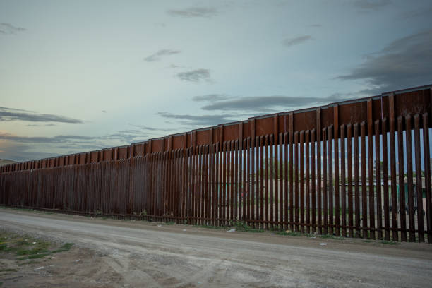
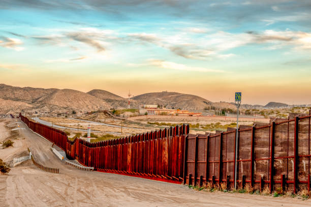
The iconic and controversial iron border wall between the USA and Mexico
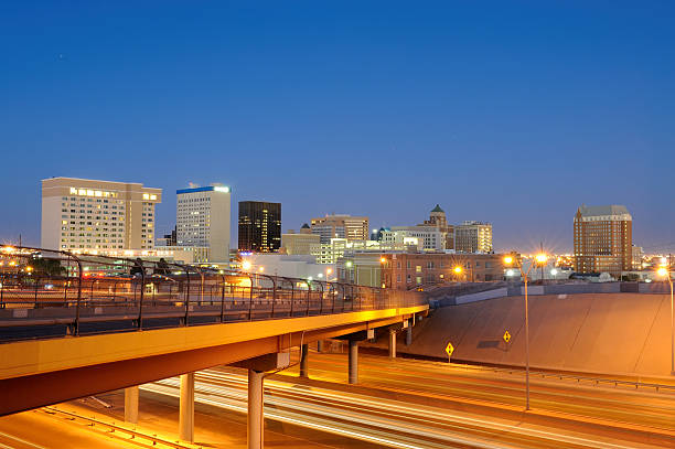
Downtown El Paso Texas as seen at dusk from the north side of Interstate 10.


El Paso is a city in and the county seat of El Paso County, Texas, United States , and lies in West Texas

El Paso is a city and the county seat of El Paso County, Texas, United States
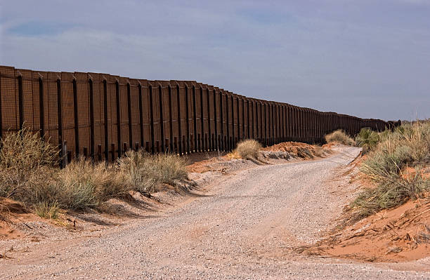
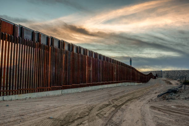
Gravel road along the Border fence between New Mexico, USA and the northern state of Chihuahua, Mexico.
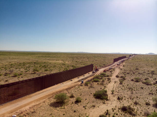
The Internation Border Wall with sections that are still under construction
The iconic and controversial iron border wall between the USA and Mexico

El Paso is a city and the county seat of El Paso County, Texas, United States, in the far western part of the state.
El Paso is a city in and the seat of El Paso County, Texas, United States. It is situated in the far western corner of the U.S. state of Texas.
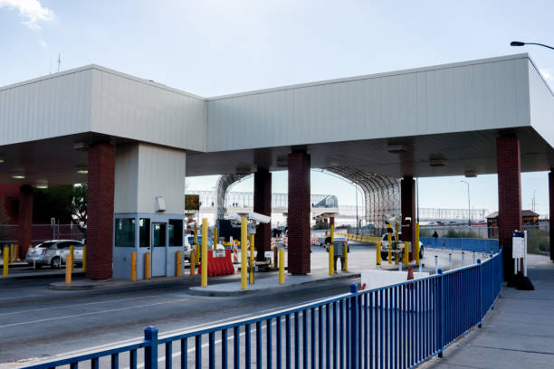
The El Paso and Juarez customs and immigration entry and exits at the border
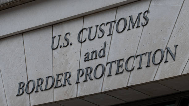
Homeland Security - ICE U.S. Boarder Protection

A view of Murchison Park on Scenic Drive overlooking the city of El Paso, Texas.
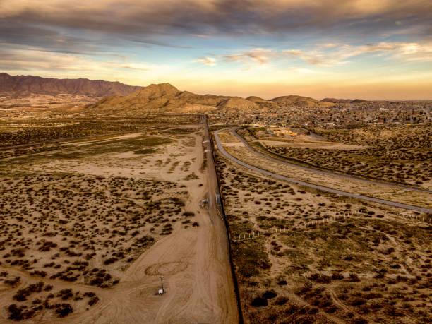
A panoramic photo of sunset on the US-Mexico border in El Paso, Texas.
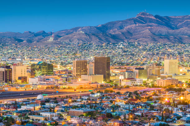
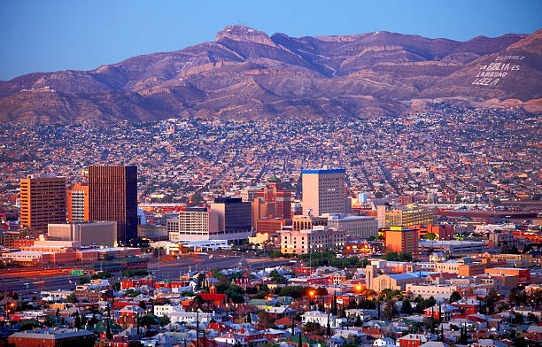
Downtown El Paso skyline with the Juarez mountains in the background.

El Paso is a city and the county seat of El Paso County, Texas, United States
El Paso is a city in and the county seat of El Paso County, Texas, United States , and lies in West Texas
The maps are accurately prepared by a GIS and remote sensing expert.
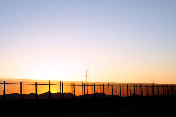
The border fence at sunset on the United States side of the lower valley in El Paso, Texas facing towards the Juarez,Mexico Mountains.
International Border Wall Between Tecate California and Tecate Mexico Near Tijuana Baja California Norte at Dusk Under Stunning Sunset with View of the City From the USA, Aerial View of the International Border Between Mexico and The USA, Drone View of the International Border Between Mexico and The United States
http://farm8.staticflickr.com/7189/6818724910_54c206caf8.jpg
Next