
Erie County Pennsylvania Pictures, Images and Stock Photos
Browse 740+ erie county pennsylvania stock photos and images available, or start a new search to explore more stock photos and images.
Most popular
A commuter train crosses the Moodna Viaduct in Cornwall, New York.
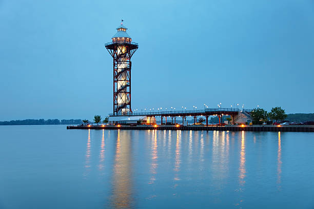
The Bicentennial Tower is an observation tower located in Erie, Pennsylvania and features panoramic views of Lake Erie, Presque Isle State Park,

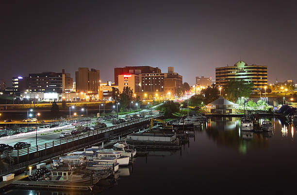
Erie, Pennsylvania, USA on Lake Erie at twilight.

An Aerial view of Buffalo, New York

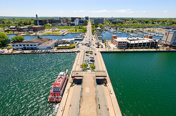
Erie is a city in and the county seat of Erie County, Pennsylvania, United States.
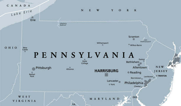
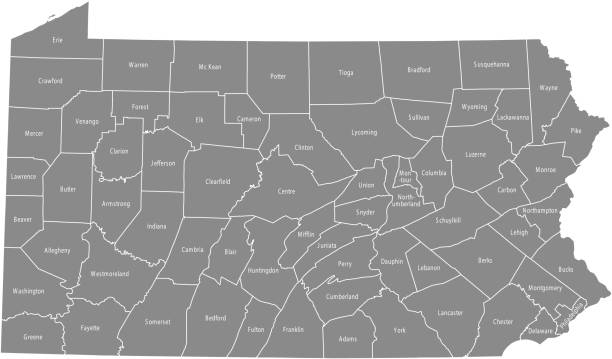
Pennsylvania, PA, gray political map. The Commonwealth of Pennsylvania, a state in the Northeastern United States of America with capital Harrisburg. Keystone State. Quaker State. Illustration. Vector

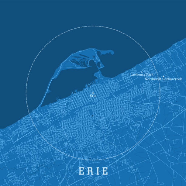
Erie PA City Vector Road Map Blue Text. All source data is in the public domain. U.S. Census Bureau Census Tiger. Used Layers: areawater, linearwater, roads.
Erie is a city located in northwestern Pennsylvania in the United States. Named for the lake and the Native American tribe that resided along its southern shoreMore Erie images
View of Erie Pennsylvania from Dobbins Landing Tower.I invite you to view some other Images from across Pennsylvania:

Vineyard on the shores of Lake Erie, Pennsylvania, USA on a sunny day.

Map of Lake Erie in North USA. Detail from the World Map.

Autumn Sunset colored reflections at the boathouses at Horseshoe Pond at Presque Isle State Park

Presque Isle Lighthouse in Erie, Pennsylvania, USA at dusk.

Detailed map of Pennsylvania state,in vector format,with county borders,roads and major cities.

The Harrington Covered Bridge crosses the West Branch of Conneaut Creek during the Autumn leaf color change in Erie County, Pennsylvania.


Welcome to Pennsylvania road sign

Erie, USA - September 19, 2014: The Scallywags tour boat at the Erie, Pennsylvania waterfront waits for passangers who want to experience a pirate adventure.

Lake Erie beach sunset with waves crashing

A beautiful Observation tower that overlooks the bay in Erie, Pennsylvania, USA.


The shore of the beautiful Lake Erie in Erie Pennsylvania.

Fire works explode above bicentennial Tower on the 4th of July in erie pa

Pedestrians stand on the sidewalk in downtown Erie Pennsylvania USA on a sunny day.

Erie - view from the park accross the lake.
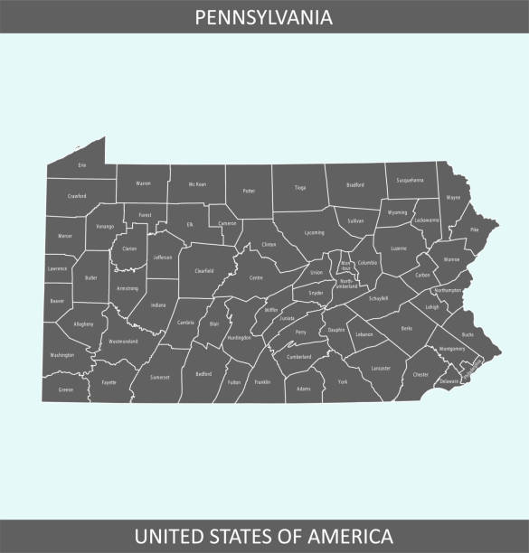
The map is accurately prepared by a map expert.

Highly-detailed Pennsylvania county map. Each county is in it's own separate labeled layer. County names are in a separate layer and can be easily adjusted or removed as well. All layers have been alphabetized for easy manipulation, recoloring or other use.

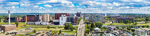
Erie, Pennsylvania, USA downtown cityscape on the lake in the morning.
The Bicentennial Tower is an observation tower located in Erie, Pennsylvania and features panoramic views of Lake Erie,

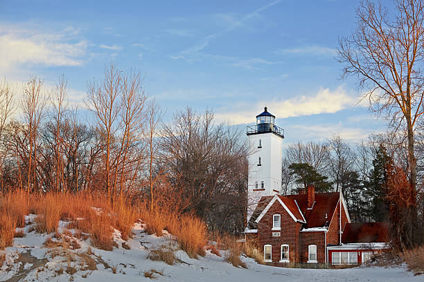
Presque Isle lighthouse, built in 1872, Lake Erie, Pennsylvania, USA

Zoar ValleyZoar Valley

"The Bicentennial Tower is an observation tower located in Erie, Pennsylvania and features panoramic views of Lake Erie, Presque Isle State Park,More Erie images"

A beautiful ship sails at full sail at sunset on a clouded evening

Sunbathing and swimming at Presque Isle State Park on Lake Erie

Presque Isle State ParkPresque Isle State Park


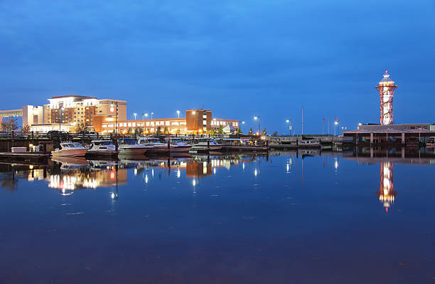
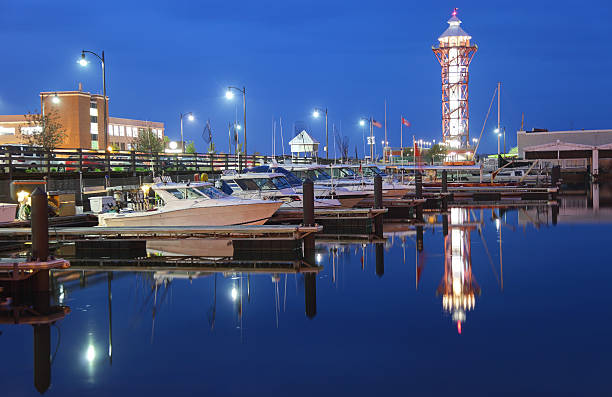
Photo of the Bicentennial Tower at Dobbins Landing, a popular tourist area of Erie, Pennsylvania, USA. It is an observation tower that features panoramic views of Lake Erie, Presque Isle State Park, and downtown Erie.
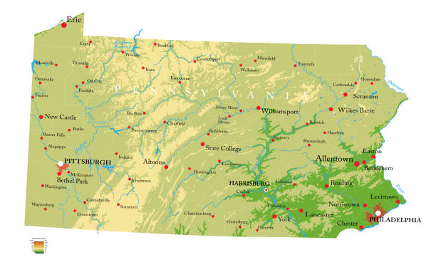
Highly detailed physical map of the Pennsylvania, in vector format,with all the relief forms,regions and big cities.
Winter sunset on lake Erie, Presque Isle Lighthouse

The bicentennial tower on the shores of Lake Erie, in Erie, Pennsylvania on a fall morning.

sunset presque isle lake erie pennsylvania

View of Erie Pennsylvania from Dobbins Landing Tower.I invite you to view some other Images from across Pennsylvania:

Printable counties map of Pennsylvania state of United States of America. The map is accurately prepared by a map expert.

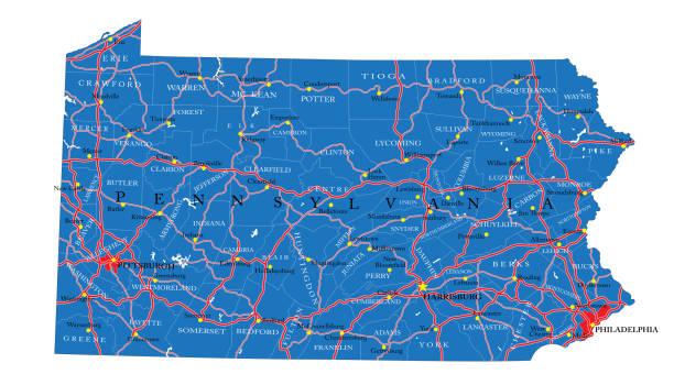
Pennsylvania state detailed editable map with cities and towns, geographic sites, roads, railways, interstates and U.S. highways. Vector EPS-10 file, trending color scheme

Presque Isle lighthouse, built in 1872, Lake Erie, Pennsylvania, USA

3D Render of a Topographic Map of Erie, Pennsylvania, USA. All source data is in the public domain. Contains modified Copernicus Sentinel data (Oct 2019) courtesy of ESA. URL of source image: https://scihub.copernicus.eu/dhus/#/home. Relief texture SRTM data courtesy of NASA. URL of source image: https://search.earthdata.nasa.gov/search/granules/collection-details?p=C1000000240-LPDAAC_ECS&q=srtm%201%20arc&ok=srtm%201%20arc

The map is accurately prepared by a map expert.

A new day dawns ... morning view at the Presque Isle Marina on Lake Erie


Erie City flag (isolated with clipping path)

Erie, Pennsylvania, USA - June 17, 2017: Daytime view of the historic Warner Theatre along State Street in the downtown district

Presque Isle State ParkPresque Isle State Park


Street name sign in downtown, Erie, Pennylvania, USA
Next