Gomera Canary Islands Pictures, Images and Stock Photos
Browse 9,200+ gomera canary islands stock photos and images available, or start a new search to explore more stock photos and images.
Most popular
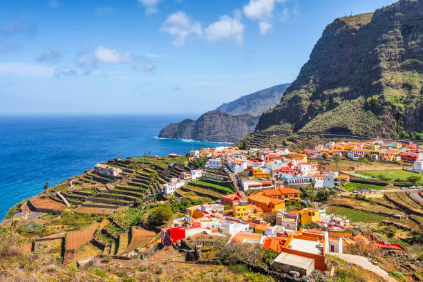
Agulo is located on the north coast of the island of La Gomera in the province of Santa Cruz de Tenerife of the Canary Islands. It is located 13 km northwest of the capital San Sebastián de la Gomera.
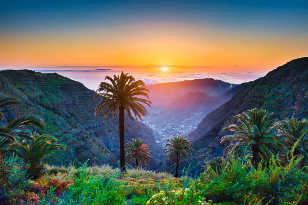
Beautiful view of amazing tropical scenery with exotic palm trees and mountain valleys above wide open sea in golden evening light at sunset with blue sky and clouds in summer, Canary Islands, Spain

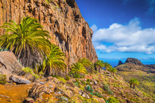
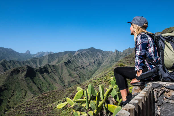
Beautiful view of remote hiking trail running through scenic tropical volcanic mountain scenery with palm trees and rocks on a sunny day with blue sky and clouds in summer, Canary Islands, Spain
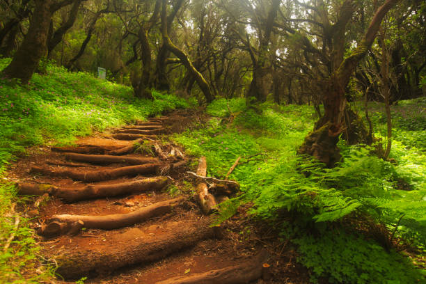
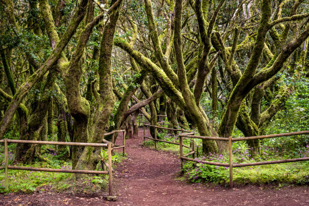
Footpath in the rainforest in Garajonay national park, La Gomera, Canary Islands, Spain
Agulo is located on the north coast of the island of La Gomera in the province of Santa Cruz de Tenerife of the Canary Islands. It is located 13 km northwest of the capital San Sebastián de la Gomera.
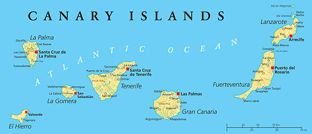
Canary Islands Political Map with Lanzarote, Fuerteventura, Gran Canaria, Tenerife, La Gomera, La Palma and El Hierro. English labeling and scaling. Illustration.

High rock at sunrise - Roque Argando
Beautiful view of La Gomera island valley, Canary Island. Spain.

La Gomera, Alto de Garajonay
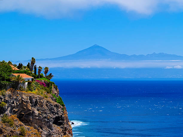
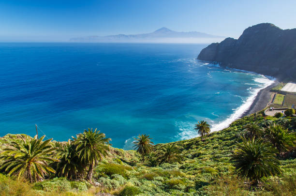
Coast of La Gomera with Teide mountain in the background, Canary Islands, Spain
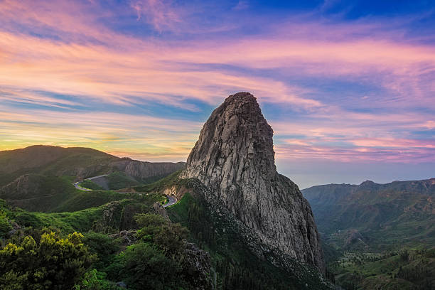
High rock at sunrise - Roque Argando
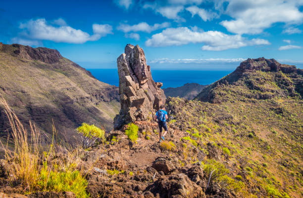
Beautiful view of male tourist hiking in idyllic exotic scenery with the Atlantic Ocean in the background on a scenic sunny day with blue sky and clouds in summer, Canary Islands, Spain

Agando cliff near Garajonay park on La Gomera island

Rear view of person standing on rock formation and looking at sea view at sunrise

Canary Islands political map with capitals Las Palmas and Santa Cruz. The Canaries are an archipelago and autonomous community of Spain in Atlantic Ocean. Gray illustration, English labeling. Vector.


Vallehermoso is a village and municipality in the western part of the island La Gomera in the province of Santa Cruz de Tenerife of the Canary Islands, Spain.
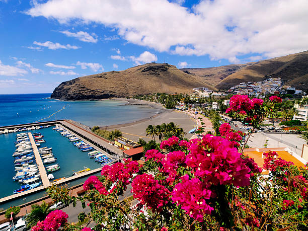
Harbour in San Sebastian de la Gomera, Canary Islands, Spain

panoramic view from the Canary island Gomera to Teneriffa with its highest mountain Teide, from Mirador La Punta, Hermigua"n
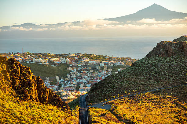
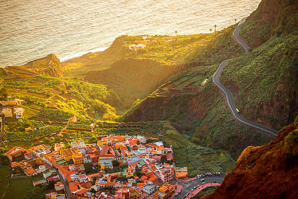
Landscape view on mountain road and San Sebastian city with Tenerife island on the background in the morning

Vistas de la capital de la isla de La Gomera. San Sebastián.
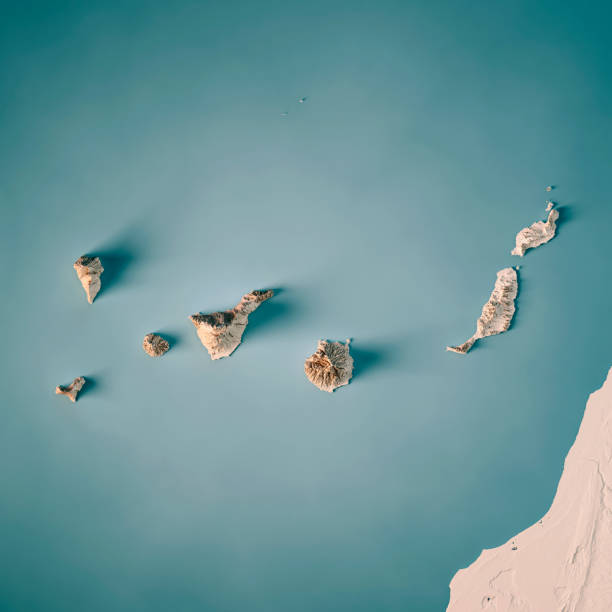
3D Render of a Topographic Map of the Canary Islands, Spain. All source data is in the public domain. Relief texture and Rivers: SRTM data courtesy of USGS. URL of source image: https://e4ftl01.cr.usgs.gov//MODV6_Dal_D/SRTM/SRTMGL1.003/2000.02.11/ Water texture: SRTM Water Body SWDB: https://dds.cr.usgs.gov/srtm/version2_1/SWBD/
Rural landscape. Gran Rey Valley. La Gomera. Canary Islands. Spain.

Rear view of man holding camera and looking at sunrise in seaside mountains

Gomera - Canary Islands, Canary Islands, Sunlight, Heat - Temperature, Sunrise - Dawn

Canary Islands map vector illustration, scribble sketch Canary Islands

Cliffs of Los Gigantes

Majestic seaside mountain landscape at foggy sunrise

Hermigua is a town and a municipality in the northeastern part of La Gomera in the province of Santa Cruz de Tenerife of the Canary Islands, Spain. It is located 12 km northwest of the island's capital, San Sebastián de la Gomera. The Garajonay National Park covers the southern part of the municipality.

View of Roque de Agando at sunset

Low angle view of male tourist hiking through mystic forest of ancient trees on the island of El Hierro near the coast of Morocco, Canary Islands, Spain, Europe

Photograph of the islands of La Gomera and El Hierro belonging to the Canary Islands, Spain
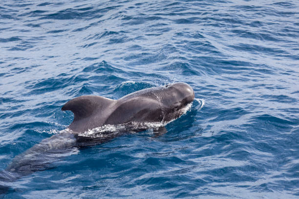
The waters between la Gomera and Tenerice is host to the only known resident group of pilot whales in the world

San Sebastian, Spain, January 15, 2021: Sunrise view of a street at San Sebastian de la Gomera, Canary Islands, Spain
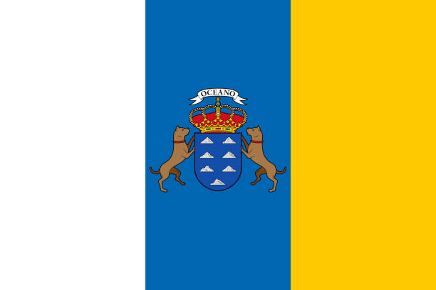
The flag of the Canary Islands. Drawn in the correct aspect ratio. File is built in the CMYK color space for optimal printing, and can easily be converted to RGB without any color shifts.

San Sebastián de la Gomera is the capital of and municipality on La Gomera in the Canary Islands, Spain. It also hosts the main harbour. The port serves ferry routes to the islands of Tenerife, La Palma and El Hierro. Streets include Calle Real and F. Olsen. A bus station named Estación de Guaguas is used for bus lines throughout the island; it is located on Avenida Quinta Centenario.


Woman traveling with backpack, photographing with photo camera beautiful evergreen forest in Garajonay park on La Gomera island on Canary island, in Spain. Wide angle shot with copy space

La Gomera, Mirador de Tajaquè e Morro de Agando,CR,GR,16x9

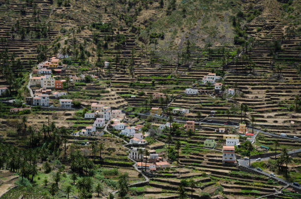
Valle Gran Rey, the most popular vacation destination on the island of La Gomera. The valley is known for its lush vegetation, fantastic panorama and beautiful beaches.

Evergreen forest in Garajonay national park with female tourist in blue jacket standing on the viewpoint terrace on La Gomera island in Spain
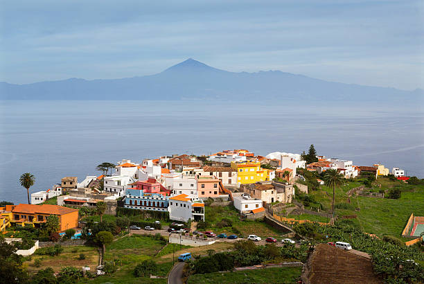
Agulo town on La Gomera with volcano Teide on a horizon, Canary Islands

Man photographing the view - View on Mt. Garajonay against clear sky, back lit and lens flare.

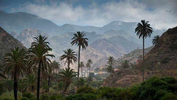
The Laurisilva (also Latin, Laurissilva), German Lorbeerwald, is common in the Spanish Canary Islands La Gomera, La Palma, Gran Canaria, El Hierro and Tenerife and in the Portuguese islands of Madeira and Azores. Laurisilva in Garajonay National Park in La Gomera. The Garajonay National Park on La Gomera (the largest contiguous laurel forest in Europe) and the Laurisilva of Madeira Lorraine are UNESCO World Heritage sites. The Garajonay National Park provides the best example of Canarian laurisilva, a humid subtropical forest that in the Tertiary covered almost all of Southern Europe. It is also found on the Azores and the Madeira Islands. Laurus azorica, known as Azores laurel, or by the Portuguese names louro, loureiro, louro-da-terra, and louro-de-cheiro, can be found in the park, as well as Laurus novocanariensis, known as Canary laurel. Garajonay National Park is located in the center and north of the island of La Gomera, one of the Canary Islands (Spain). It was declared a national park in 1981 and a World Heritage Site by UNESCO.

Beach ocean stones mountain Tenerife Teide volcano background, Santa Catalina on La Gomera, Canary Islands
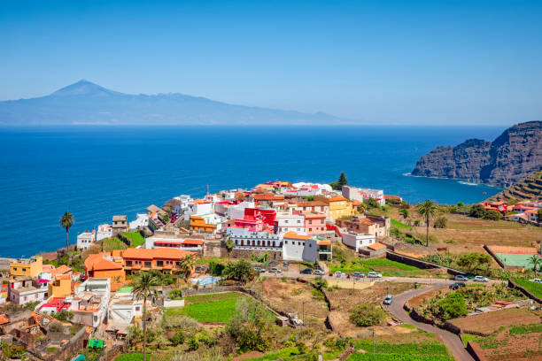
Top view from Mirador de Abrante on Agulo coastal village on La Gomera island on the sunrise in Spain

Photo Picture of a Valley in the Canary Islands Roque los Muchachos

Detailed vector map of the Canary Islands, Spain, including main cities, roads, rivers and lakes. The colors in the .eps-file are ready for print (CMYK). Included files are EPS (v10) and Hi-Res JPG (4922 x 4922 px).


Road Trip on La Gomera island, Canary Island. Spain.
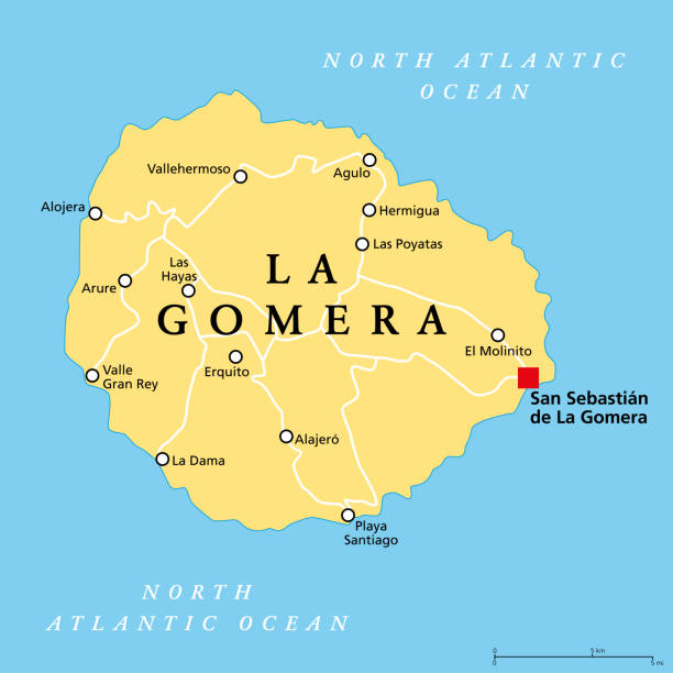
La Gomera island, political map, with capital San Sebastian de La Gomera. One of the Canary Islands, an archipelago and autonomous community of Spain, in North Atlantic Ocean, off the coast of Africa.
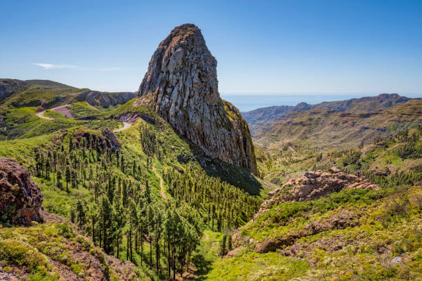
Roque de Agando (commonly called Roque Agando) is a prominent rock formation on the island of La Gomera in the Canary Islands. It is one of La Gomera's most striking features and is frequently used as a symbol for the island.
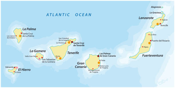
Canary Islands vector map

Outdoor view of the Flag of the Canary Islands

Next