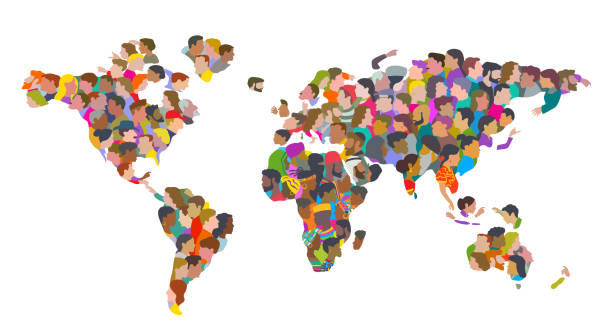
Group of People in shape of World Map. Earth Community, Multiracial Group. Fun characters drawn in a fun, whimsical, caricature or cartoon style.
Browse 1,900+ muslim world map stock photos and images available, or start a new search to explore more stock photos and images.
Group of People in shape of World Map. Earth Community, Multiracial Group. Fun characters drawn in a fun, whimsical, caricature or cartoon style.

World religions infographic with world map, charts and other elements. Vector illustration.World religions infographic with world map, charts and other elements. Vector illustration
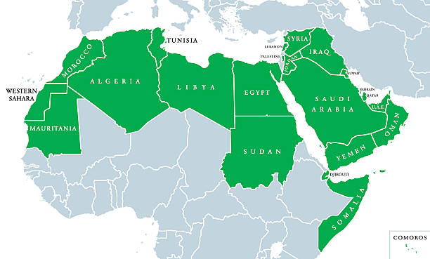
Arab World political map, also called Arab nation, consists of twenty-two arabic-speaking countries of the Arab League. All nations in green color, plus Western Sahara and Palestine. English labeling.

Political map of Middle East with each country represented by its national flag. 3D Illustration.

blackboard concept, signs of world religions - major religions group chalked on a blackboard
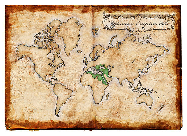
"An old grunge map showing the Ottoman Empire, was a multi-ethnic and multi-religious, although dominated by Islam Turkish-ruled state which, at the height of its power, spanned three continents, controlling much of Southeastern Europe, the Middle East and North Africa.Empire maps:"

Arab world political map highlighted in green color vector illustration. Gray background.

"Afghanistan Map. Source: ""Reference Atlas of the World"""

Vector illustration in HD very easy to make edits.
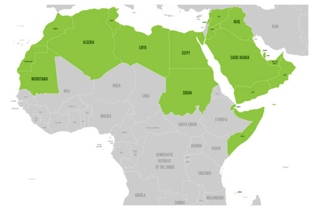
Arab World states political map with higlighted 22 arabic-speaking countries of the Arab League. Northern Africa and Middle East region. Vector illustration.

blackboard concept, signs of world religions - major religions group chalked on a blackboard

Business people stand on a map of the world. EPS 10 file format includes transparencies; high-quality JPEG also included.
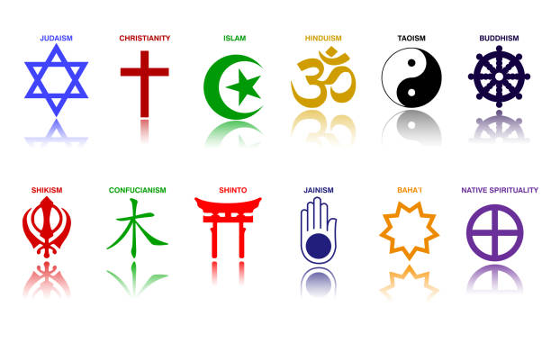
world religion symbols colored signs of major religious groups and religions. easy to modify

big set of black silhouettes of indian men, women and children standing and walking
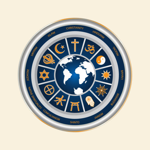
A circle of religious symbols. International religions of the world in the signs. Isolated symbol of world cultures on a white background.
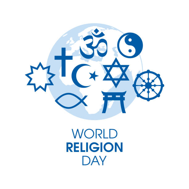
Religious symbols blue silhouette icon set vector isolated on a white background. World map and religions symbols vector. Important day

blackboard concept, signs of world religions - major religions group chalked on a blackboard, World religions are at war
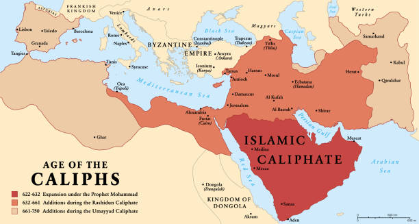
The age of the Caliphs, history map of the Islamic Caliphate from 622 to 750. The expansion under the Prophet Mohammad, with additions during the Rashidun Caliphate and the Umayyad Caliphate. Vector.

World religions - map of the world with dominant religion vector art

Global view of Libya and other countries of Northern Africa.

arabic businesspeople in web browser windows discussing during corporate online international conference meeting world map background horizontal portrait vector illustration

Arab dad and son playing with video games at home. Simple two colours world map with pins in the background.

Jerusalem on an old 1810's map. Selective focus and Canon EOS 5D Mark II with MP-E 65mm macro lens.
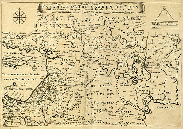
This may appear to be a straightforward map of the Middle East. However, closer inspection will reveal some extraordinary details, a number of descriptions on the map refer to stories from the Bible.
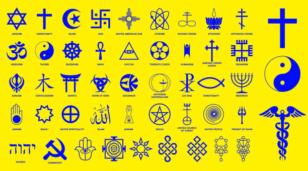
world religion symbols signs of major religious groups and other religions isolated. easy to modify

Multicultural group of people. Men and women stand on the globe. Earth Day Concept. Vector illustration

A map of prevailing religions of the world c1877. Undiscovered or unexplored areas have dotted coastlines and the language used on the map is no longer considered to be acceptable, though it was commonly used at the time of this publication. From “The Bible Atlas to Illustrate the Old and New Testaments”, published in 1877 by W. & A.K. Johnston Ltd, Edinburgh and London.
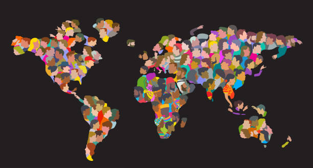
Group of People in shape of World Map. Earth Community, Multiracial Group. Fun characters drawn in a fun, whimsical, caricature or cartoon style.

International friendship day banner with diverse friend group of cartoon people standing in front of world map and talking. Flat vector illustration.
Set of diverse round avatars with facial features different nationalities, clothes and hairstyles. Cute different nationalities flat cartoon style faces avatars different nationalities man and woman.

World religions infographic with world map, charts and other elements. Vector illustration
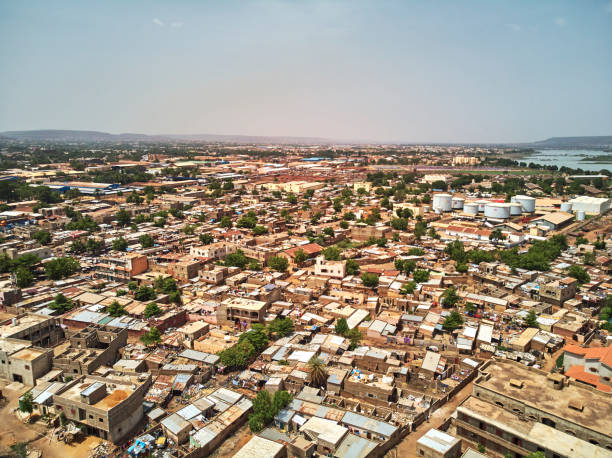
Bamako is the capital and largest city of Mali, with a population of 1.8 million. In 2006, it was estimated to be the fastest-growing city in Africa and sixth-fastest in the world. It is located on the Niger River, near the rapids that divide the upper and middle Niger valleys in the southwestern part of the country.

Contour map of Africa with a technological electronics circuit.
Three religions vector icon isolated on white background. Christianity, Judaism and Islam. Worship christian religion. Religions in flat style. EPS 10
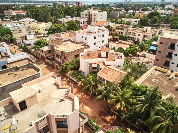
Bamako is the capital and largest city of Mali, with a population of 1.8 million. In 2006, it was estimated to be the fastest-growing city in Africa and sixth-fastest in the world. It is located on the Niger River, near the rapids that divide the upper and middle Niger valleys in the southwestern part of the country.

Red Fort is the former imperial residence of the Mughal Dynasty located in Agra, India. It is also a UNESCO World Heritage site and is about 2.5 km northwest of its more famous monument the Taj Mahal.

Little Afghan Girl at the School pointing at a desktop globe map on black background (this picture has been taken with a Hasselblad H3D II 31 megapixels camera)

Vector image of a handshake around the globe

large group of people. Men and women are holding hands, stand around the world map. Multicultural group of people. Vector illustration
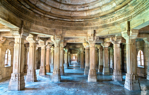
Sahar Ki Masjid at Champaner-Pavagadh Archaeological Park. A UNESCO world heritage site in Gujarat, India

Champaner-Pavagadh Fort, hill, vadodara, tourism hub

Arab League Countries maps set. Vector eps10
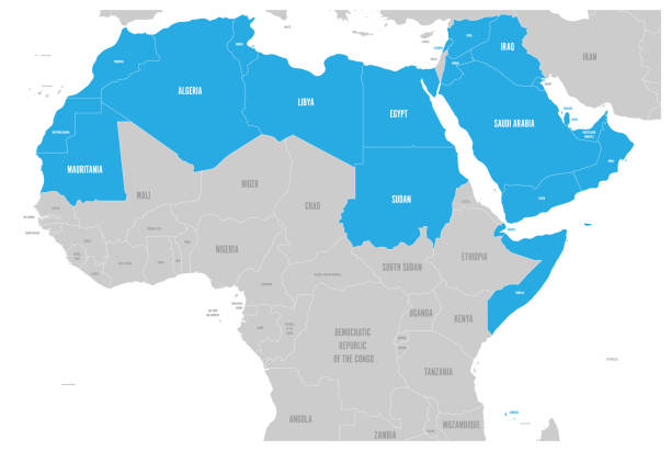
Arab World states political map with higlighted 22 arabic-speaking countries of the Arab League. Northern Africa and Middle East region. Vector illustration.

Black silhouettes. large group of people. Men and women are holding hands, stand around the world map. Multicultural group of people. vector illustration