Palmdale Los Angeles County Pictures, Images and Stock Photos
Browse 410+ palmdale los angeles county stock photos and images available, or start a new search to explore more stock photos and images.
Most popular
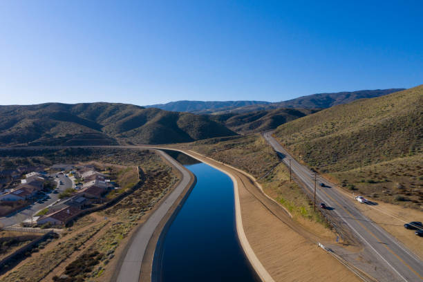
The California Aqueduct flows in Palmdale, California, near Godde Hill Road.
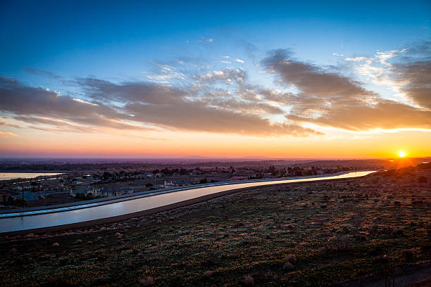
The California Aqueduct that carries water south through the state glistens at dawn at it snakes through the Antelope Valley, near the Lake Palmdale reservoir in the Mojave desert.
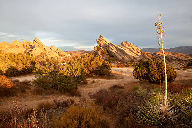
"Golden setting sun illuminates Vasquez Rocks and a yucca plant in foreground. The dramatic tilted rocks in the Vasquez Rocks County Park in Agua Dulce, California have been used in movies and television for the past 100 years. Countless westerns and many Star Trek episodes were filmed here. Vasquez Rocks Park is in Los Angeles County and very close to the studios in Hollywood and Burbank. The tilted rocks are part of the San Andreas Fault which cuts through this area between Santa Clarita and Palmdale."
Aerial of the California aqueduct winding past Palmdale California.

Setting sun casts pink light on clouds above Vasquez Rocks. The dramatic tilted rocks in the Vasquez Rocks County Park in Agua Dulce, California have been used in movies and television for the past 100 years. Countless westerns and many Star Trek episodes were filmed here. The California deserts are full of awesome rock formations, but Vasquez Rocks is in Los Angeles County and very convenient to the studios in Hollywood and Burbank.

A landscape of the famous Vasquez Rocks taken with a tilt-shift lens

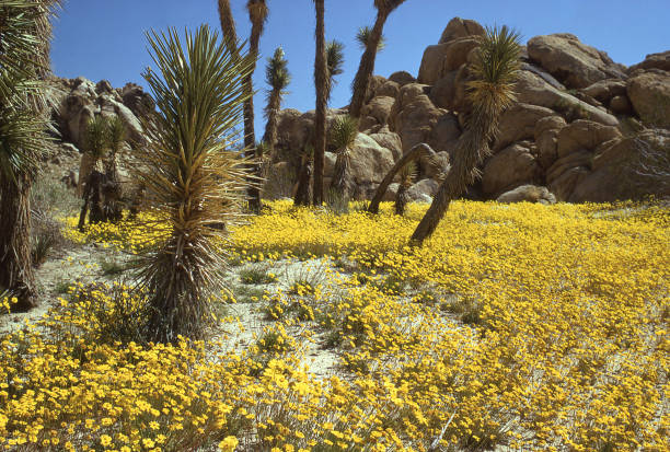
Yellow Wildflowers on Desert Rocky Outcrops and Snow San Bernardino Mountains Antelope Valley California
California aqueduct at Palmdale.


Hiking Trail in California Desert on Sunny Day

Palmdale California - Palmdale Landscape with Palmdale Lake. American Cities Photo Collection.

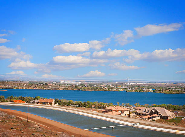
Lake Palmdale at Palmdale, California, which is fed by the California Aquaduct.


Joshua tree in the desert under the sunset sky


Joshua Tree cloudscape in Southern California high desert near Littlerock with the San Gabriel Mountains in the background

I watched some kites hovering and hunting small tents in the grassland. Appreciation for nature

The silhouette of a Joshua tree at sunset in California's Mojave desert.

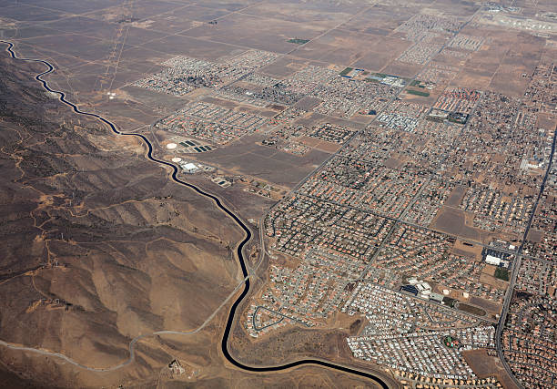
Aerial of Palmdale in California's Mojave desert.

Lake Palmdale at Palmdale, California, which is fed by the California Aquaduct.


The California Aqueduct Located in the Desert City Palmdale

Beautiful Desert Sunset Located in Palmdale California.

Series of Los Angeles California Landmark Stamps

Palmdale, California, USA - October 27, 2019: tail of Shuttle Carrier Boeing 747 with registration N911NA shown at the 'Joe Davies Heritage Airpark'.

Palmdale, Lancaster and Los Angeles sign on Pearblossom Highway - California Route 138.

Beautiful Desert Landscape With Cloudy Sky Located In Palmdale, California.

View of California aqueduct in Palmdale. The aqueducts carry water from the Sierra Nevada mountains to Southern california

An antique engine and wing from a World War II-era aircraft against a blue sky.


A view of Palmdale in Los Angeles county showing the California aqueduct.

Joshua tree at sunset in California's Joshua Tree National Park

Palmdale, California USA / Antelope Valley - Palmdale in Summer. Panoramic Photography. Cities Photo Collection.


Snow covered in California.

The California Aqueduct flows in Palmdale, California, near Godde Hill Road.
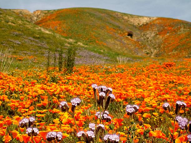
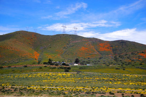
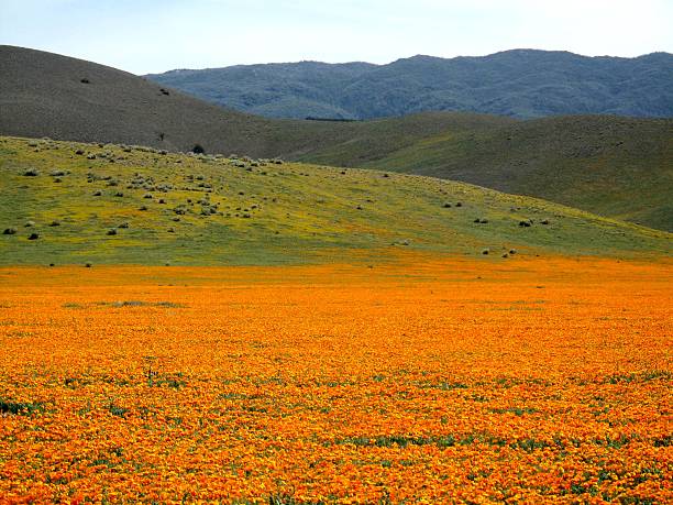
Wildflowers cover the hillside of Antelope Valley, the western tip of the Mojave Desert, California

Palmdale CA City Vector Road Map Blue Text. All source data is in the public domain. U.S. Census Bureau Census Tiger. Used Layers: areawater, linearwater, roads.
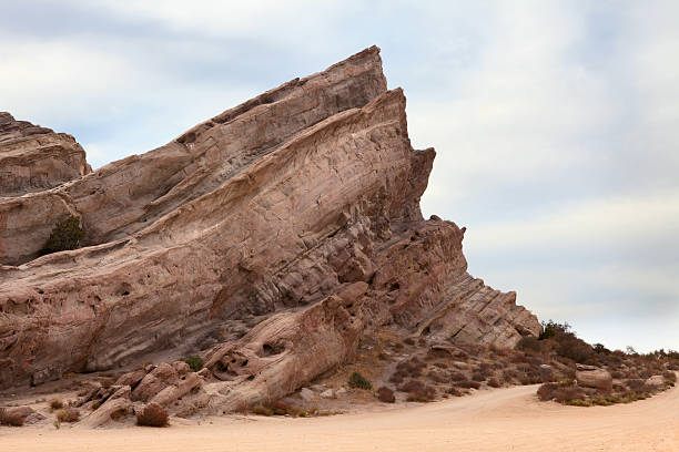
The dramatic tilted rocks in the Vasquez Rocks County Park in Agua Dulce, California have been used in movies and television for the past 100 years. Countless westerns and many Star Trek episodes were filmed here. Vasquez Rocks Park is in Los Angeles County and very close to the studios in Hollywood and Burbank.

wind farm in palmdale, california generating green, renewable enegy

Wildflowers of Antelope Valley, the western tip of the Mojave Desert, California. The Mojave Desert is a land of contrasts – undulating sand dunes, jagged volcanic cinder cones, astounding rock formations, and many other scenic wonders. About a quarter of the plant species in the Mojave Desert are endemic plants found nowhere else in the world.

A geological formation at Vasquez Rocks in Santa Clarita.

View of the Pacific Crest Trail approaching Indian Canyon in the Angeles National Forest

View of city of palmdale and lake. California aqueduct in the forground.

Beautiful Desert Landscape With Cloudy Sky Located In Palmdale, California.

Vector Illustration of a City Street Map of Palmdale, California, USA. Scale 1:60,000. All source data is in the public domain. U.S. Geological Survey, US Topo Used Layers: USGS The National Map: National Hydrography Dataset (NHD) USGS The National Map: National Transportation Dataset (NTD)

A stock photo of a Palmdale road sign in California.

famous landmark on the Devil's punchbowl hike in California, near Palmdale

Palmdale City, California (United States cities, United States of America, usa city) map vector illustration, scribble sketch City of Palmdale map


Dead Dried Out Joshua Tree Cloudscape at Sunset in the high desert hillsides near Palmdale California CA

Dead Dried Out Joshua Tree Cloudscape at Sunset in the high desert hillsides near Palmdale California CA
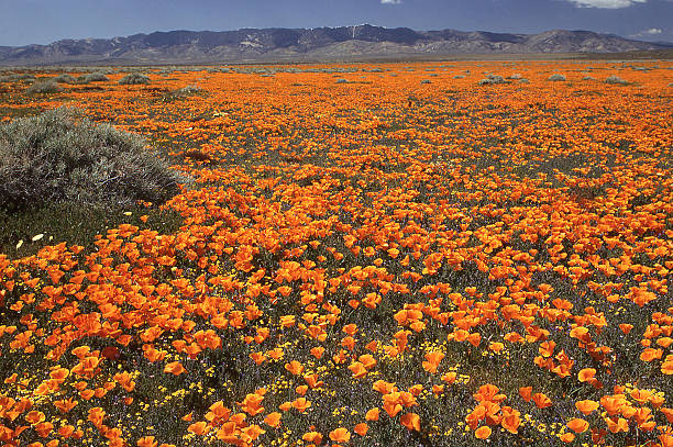
Schscholzia Californica is native to the United States and Mexico, and the official state flower of California.

Closeup of field of mixed yellow and golden wildflowers near Palmdale California


Joshua Tree cloudscape in Southern California high desert in the United States

Next