
Ussr Map Pictures, Images and Stock Photos
Browse 1,200+ ussr map stock photos and images available, or start a new search to explore more stock photos and images.
Most popular
Illustration of a Political Map of USSR with Names
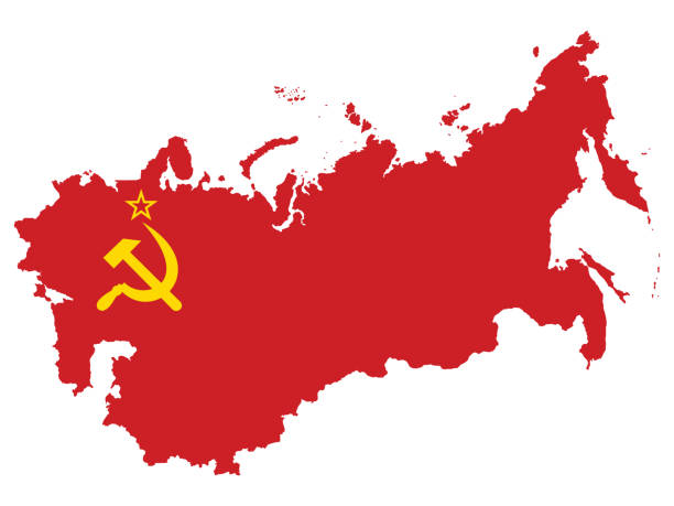
Vector Illustration of the Flag Incorporated Into the Map of USSR (former Soviet Union)
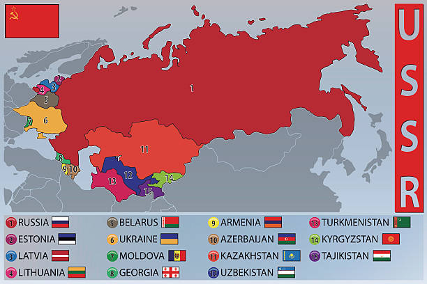
Illustration of the Map and Flags of the Republics of the Former USSR
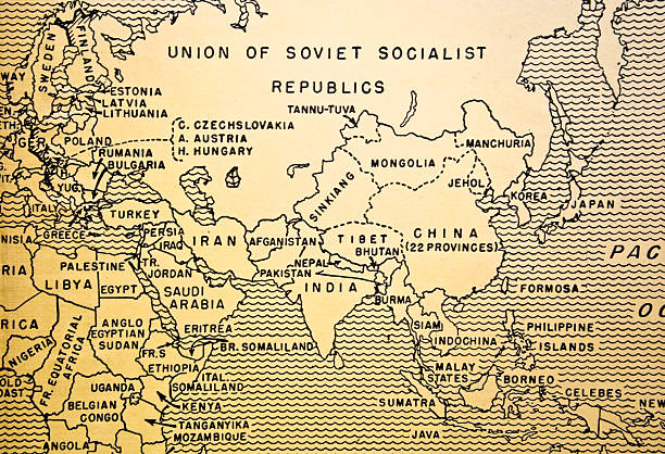
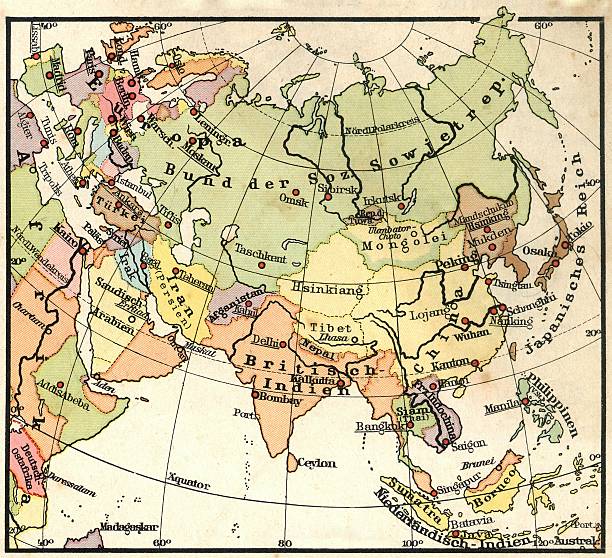
A map of the Soviet Union, the middle East, East Asia and China from a 1930s era textbook.
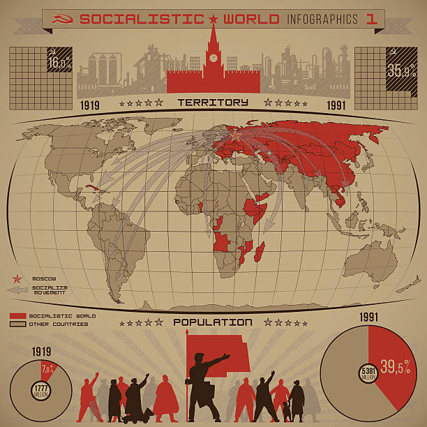
Socialistic world infographics of increasing the number of socialist people, countries, territory during the twentieth century with diagrams, world map, direction arrows, graphics vector
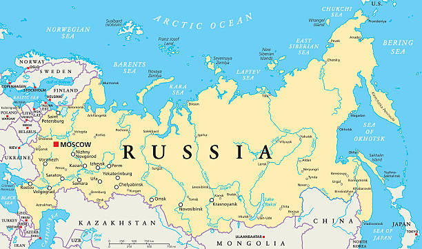
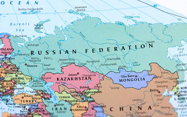
Russia political map with capital Moscow, national borders, important cities, rivers and lakes. English labeling and scaling. Illustration.

http://s017.radikal.ru/i410/1110/e5/b7d44df3f1f1.jpg
Detailed map of Russia.
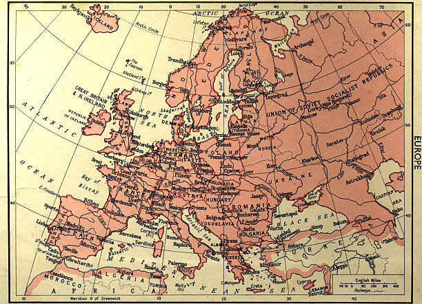
an old worn map of europe faded and aged paper
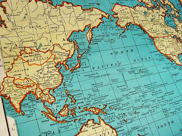
1942 Map of Asia and area from Collier's Gazette

Old vintage map of Russian Federation with separated layers.


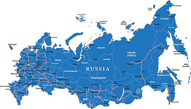
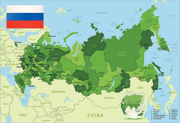
Map of Russian Federation.
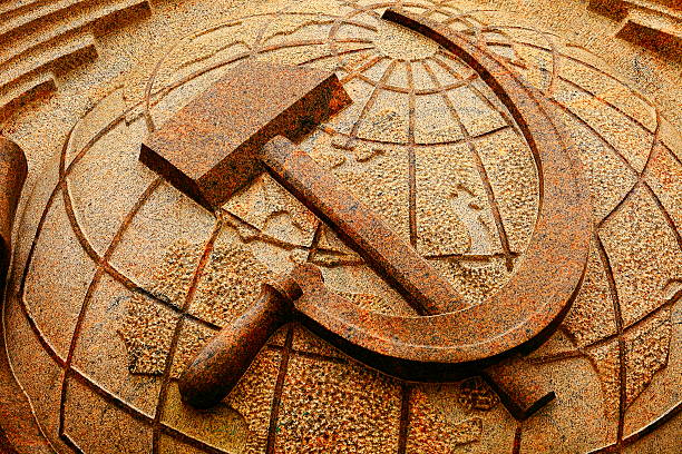
The hammer and sickle (☭) or sickle and hammer (Russian: Серп и молот) is a Communist symbol that was conceived during the Russian Revolution. At the time of creation, the hammer stood for industrial labourers and the sickle for the peasantry; combined they stood for the worker-peasant alliance for socialism and against reactionary movements and foreign intervention.
vintage map with focus on russia

Detailed vector map of Russian Federation with border states and main cities.

Russian Federation detailed map with regions and cities of the country. Vector illustration
Highly detailed vector map of Russian Federation with states, capitals and big cities.
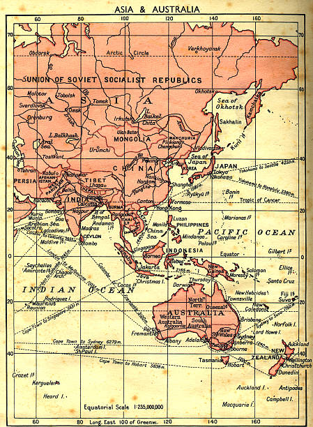
an old faded map of Russia/Asia/Australia with faded moldy worn paper.
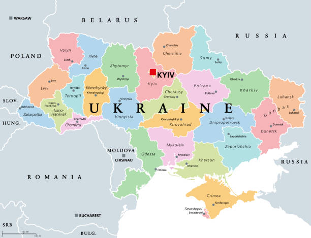
Ukraine, country subdivision, colored political map. Administrative divisions of Ukraine, with administrative centers, a unitary state in Eastern Europe with capital Kyiv (Kiev). Illustration. Vector.

Vector world map. Every country is on separate named layer. Names of countries are on top layer. Easy to customise.

Topographic / Road map of Moscow, Russia. All maps are layered and easy to edit.

an old map of Europe with other geographical information

Commonwealth of Independent States (CIS), political map. Regional intergovernmental organization in Eurasia, formed following the dissolution of the Soviet Union. Nine member states and one associate.


http://www.volny.cz/frohm/Ink_01.gif

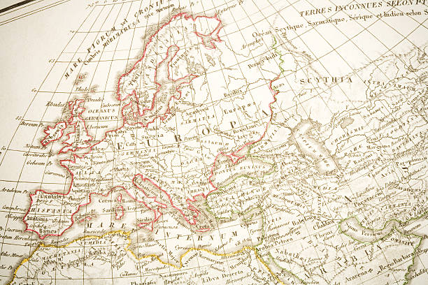
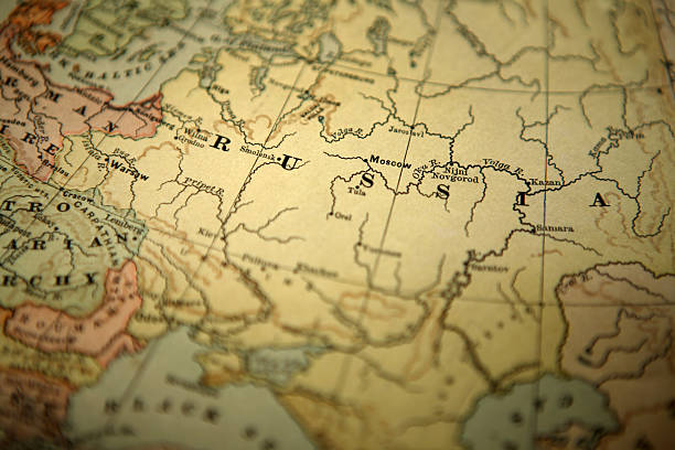
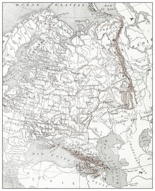
Detail of an old map (1825).

Finger pointing to Russia on a globe. Close up.
Russia map with flag and navigation icons isolated on white.


Retro USSR emblem of world-wide communism
East Europe Region. Map of countries in eastern Europe. Post Soviet and Caucasian countries. Vector illustration.

USSR postage stamp isolated on black

Russia political map divide by state colorful outline simplicity style. Vector illustration.
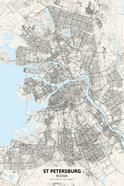
Poster Style Topographic / Road map of St. Petersburg, Russia. Original map data is open data via © OpenStreetMap contributors. All maps are layered and easy to edit. Roads are editable stroke.
Highly detailed vector map of Russian Federation with states, capitals and big cities.


Russian Federation detailed political map with separated layers.

Azerbaijan, russia countries isolated on world map. Geographical map backgrounds.
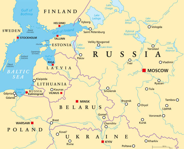
Baltic States and Kaliningrad, political map. From Finland to Estonia, Latvia and Lithuania, to Poland, and from the Russian exclave Kaliningrad Oblast, to Belarus, and to the European Part of Russia.

A retro looking map of Russia on a grid. Hires JPEG (5000 x 5000 pixels) and EPS10 file included.

Map of the Commonwealth of Independent States (CIS). Flags of countries-members of CIS without Ukraine and Turkmenistan. Vector.

Central Asia, political map with capitals. Subregion of Asia, consisting of former Soviet republics stretching from Caspian Sea to China and Mongolia, and from Afghanistan and Iran to south of Russia.

Russia political map divide by state colorful outline simplicity style. Vector illustration.

Red thumbtack in a map, pushpin pointing at Moscow city

Red and Blue Flat Map of NATO and the Warsaw Pact in Europe (year 1973) inside Gray Map of European Continent

Set of the political Russia maps, markers and symbols for infographic

First sputnik. An artificial space satellite, a spacecraft hovering in the black sky among the stars. Flat vector illustration.

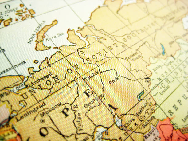
vector map of the Soviet Union

Highly detailed physical map of Russia,in vector format,with all the relief forms,regions and big cities.

The thirteen hero cities of Soviet Union for outstanding heroism during World War 2. The image was created with Apple Keynote software. Built-in maps of Apple Keynote were used.

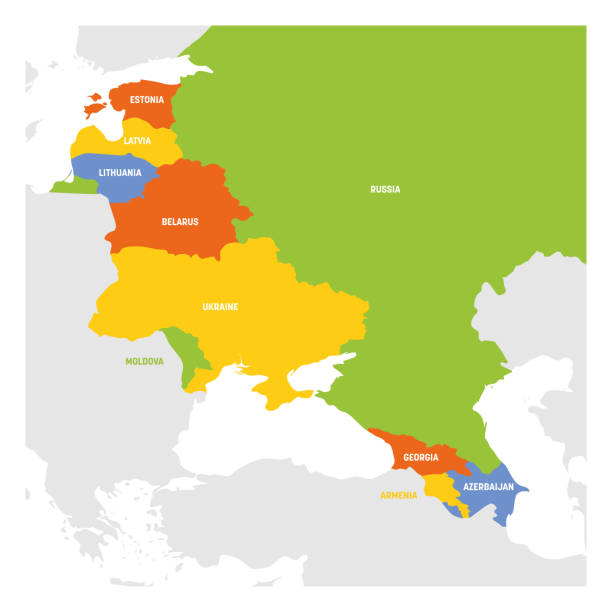
The modern countries of the former Soviet Union. The image was created with Apple Keynote software. Built-in maps of Apple Keynote were used.

Colorful Russia political map with clearly labeled, separated layers. Vector illustration.
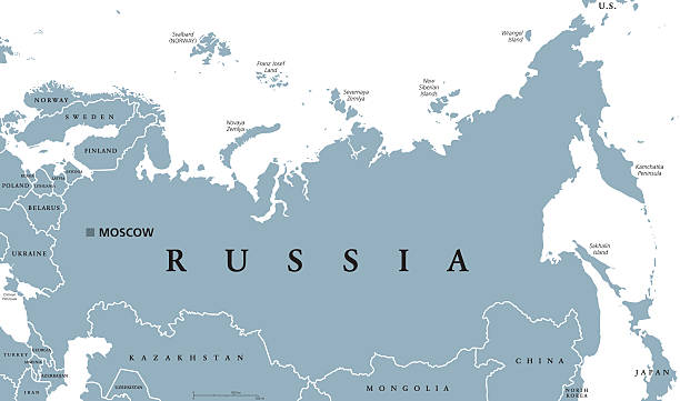
Russia political map with capital Moscow, national borders and neighbor countries. Russian Federation, a federal state in Eurasia. Gray illustration with English labeling on white background. Vector.

Next