Burgundy France Map stock illustrations
Browse 340+ burgundy france map stock illustrations and vector graphics available royalty-free, or start a new search to explore more great stock images and vector art.
Most popular
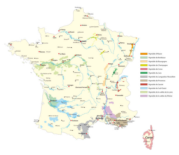
wine-growing areas vector map in France
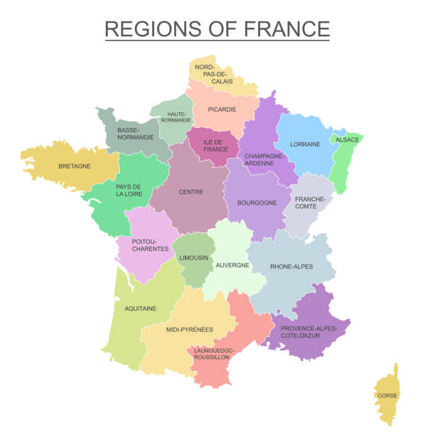
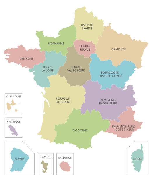
Interactive colorful map of metropolitans French regions on white background.

Interactive map of metropolitans French regions on white background.

A France map on a white background. Hires JPEG (5000 x 5000 pixels) and EPS10 file included. File contains gradient mesh (eps10).
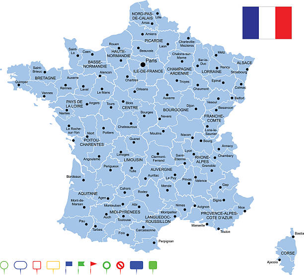
Detailed map of France with pointers.
![Antique map of France Vintage map of the France in 1861
[b]View More:[/b]
[url=http://www.istockphoto.com/file_search.php?action=file&lightboxID=9145610][img]http://www.walker1890.co.uk/istock/istock-map.jpg[/img][/url]
burgundy france map stock illustrations](https://media.istockphoto.com/id/155125177/vector/antique-map-of-france.jpg?s=612x612&w=0&k=20&c=d5Qtxz8pDcgPPLELTDu79MfYmnwYwAco8a91u5-u3Y0=)
Vintage map of the France in 1861 [b]View More:[/b] [url=http://www.istockphoto.com/file_search.php?action=file&lightboxID=9145610][img]http://www.walker1890.co.uk/istock/istock-map.jpg[/img][/url]

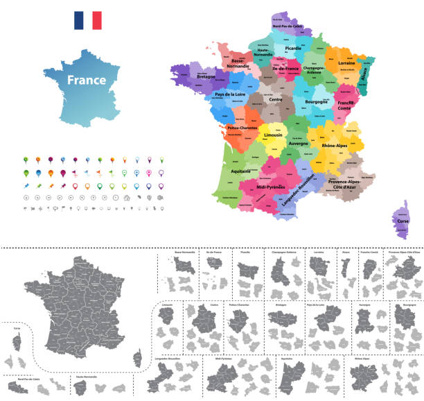
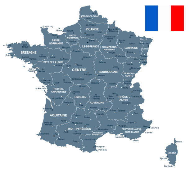
Precise map of France with administrative divisions. Vector in multiple layers so it's easy to edit.

Map of France and flag - highly detailed vector illustration


Detailed Vector Map of France.
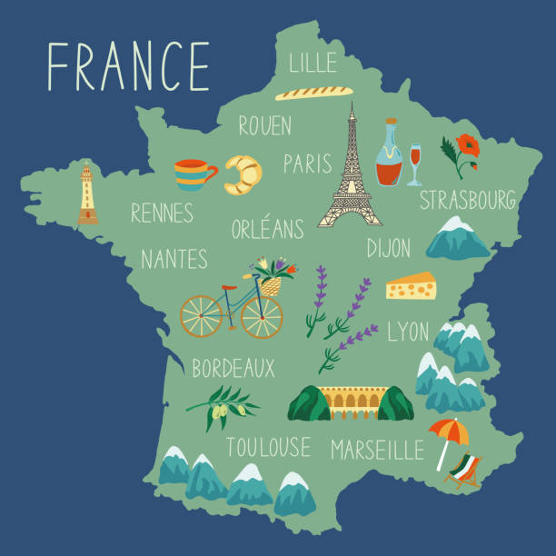
Hand drawn map of France. Concept of travel. Colored vector illustartion. Country symbols and landmarks on the map.


Detailed map of France with navigation icons.

France Map - Detailed Info Graphic Vector Illustration

Map of Bourgogne-Franche-Comte for your own design. Three maps with editable stroke included in the bundle: - One black map on a white background. - One line map with only a thin black outline in a line art style (you can adjust the stroke weight as you want). - One map on a blank transparent background (for change background or texture). The layers are named to facilitate your customization. Vector Illustration (EPS file, well layered and grouped). Easy to edit, manipulate, resize or colorize. Vector and Jpeg file of different sizes.

Large detailed road map of France
France map and flag - vector illustration


France Map - Vintage Detailed Vector Illustration

Antique map of France from 1864

Bourgogne, Picardy and Anjou regions of France, vector vintage cards and stickers. French provinces tin signs or metal plates with landmarks, region maps and national emblems of France

France - Retro Map

Vector map of France with infographic icons

France map vector outline with miles and kilometers scales in a blank design

Map of France and flag - highly detailed vector illustration

France Map - Detailed Vector Illustration

http://s017.radikal.ru/i404/1110/87/2c00b7bbd3ec.jpg

France Map - Vintage Detailed Vector Illustration

Map of France and flag - highly detailed vector illustration


Vector isolated illustration of simplified administrative map of France. Blue shape of Bourgogne-Franche-Comté. Borders of the provinces (regions). Grey silhouettes. White outline.


Vector map of France and infographic elements collection. Vector illustration.

http://s017.radikal.ru/i404/1110/87/2c00b7bbd3ec.jpg

illustration of detailed France map for your design , products and print.

France map - high details vector illustration

White map of Bourgogne-Franche-Comte isolated on a trendy color, a bright red background and with a dropshadow. Vector Illustration (EPS file, well layered and grouped). Easy to edit, manipulate, resize or colorize. Vector and Jpeg file of different sizes.

Detailed map of France.

Map from La Premiere Annee de Geographie by P. Foncin - Paris 1887

Large detailed road map of France

France map and flag - vector illustration

Vector Europe Cartoon map

This file is a map highlighting France as well as it's regions and capital cities. This map also shows surrounding countries and capital cities if present. This map has text labels for the countries, regions, capital cities and major bodies of water. ZOOM IN on this highly detailed map, it is a great addition to the collection. This file will work well for your print or web based project. This file is layered and grouped (labeled in ai v10 file), making it a very easy file to work with. This download contains an editable ai v10 and eps file, as well as a large JPG file.

"Vintage map of France in the 15th century, show the land under the control of the english during the Hundred Years War."

Map from La Premiere Annee de Geographie by P. Foncin - Paris 1887


Appleton's American Standard Geographies - New York 1881 - d. Appleton and Company

France map and flag - vector illustration

Vintage engraving of a Antique map of France in departments, 1880

Map from La Premiere Annee de Geographie by P. Foncin - Paris 1887

Illustration of a Antique map of France

Detailed map of France.

Map from La Premiere Annee de Geographie by P. Foncin - Paris 1887

Vintage map of France in Provinces fron 1837
Next