Capital Of Eritrea stock illustrations
Browse 140+ capital of eritrea stock illustrations and vector graphics available royalty-free, or start a new search to explore more great stock images and vector art.
Most popular
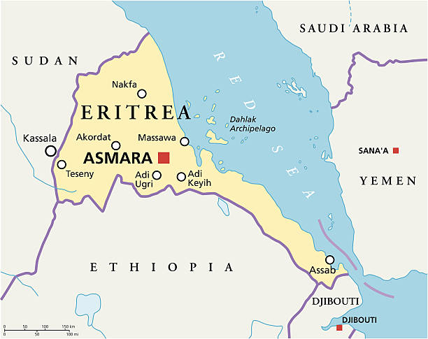
Eritrea Political Map with capital Asmara, national borders, most important cities, rivers and lakes. Illustration with English labeling and scaling.
Gulf of Aden area, political map. Deepwater gulf between Yemen, Djibouti, the Guardafui Channel, Socotra and Somalia, connecting the Arabian Sea through the Bab-el-Mandeb strait with the Red Sea.
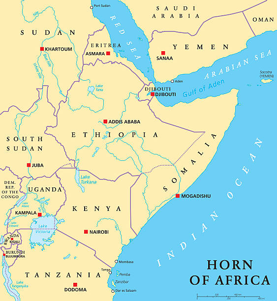
Horn of Africa peninsula political map with capitals, national borders, important cities, rivers and lakes. In ancient times called Land of the Berbers. English labeling and scaling. Illustration.
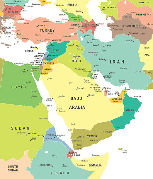
Middle East and Asia map - highly detailed vector illustration


Ethiopia administrative and political vector map


Horn of Africa peninsula countries political map with national borders and the biggest lakes. East Africa, in ancient times Land of the the Berbers. English labeling and scaling. Illustration on white.

Middle East and Asia map - highly detailed vector illustration

Historical map of Egypt, Nile Delta and Sudan. Description in German. Lithograph, published in 1893.

"An accurate line map of the Middle East and the surrounding countries, with each country individually selectable. There is a base map of the whole area, hidden below the countries, so should it be necessary to delete a country there is land below it.There is also a base layer for the sea area. Each country has its own named layer, with a total of 40 layers. A very easy map to edit or color."
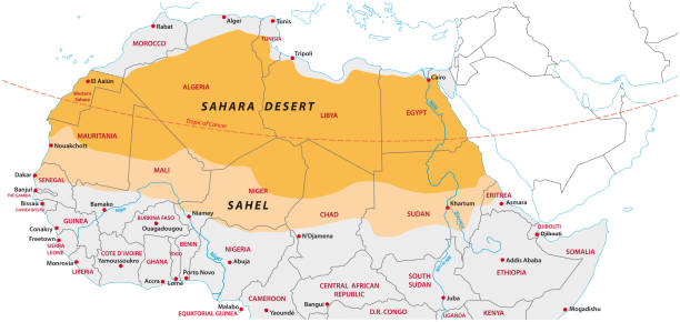
Sahara and Sahel vector map

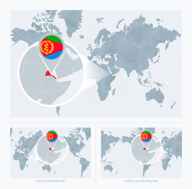
Magnified Eritrea over Map of the World, 3 versions of the World Map with flag and map of Eritrea. Vector Illustration.

Sudan political map with capital Khartoum, national borders, important cities, rivers and lakes. Illustration with English labeling and scaling.

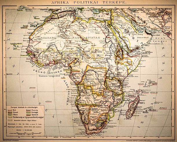
Antique illustration of a Africa Political Map from 1893


Black and white Eritrea map in trendy vintage style, isolated on a dusty white background. A grunge texture is used to have a retro and worn effect. His name is written on the bottom of the image. Vector Illustration (EPS10, well layered and grouped). Easy to edit, manipulate, resize or colorize.

horn of africa vector map


Middle East and Asia map - highly detailed vector illustration
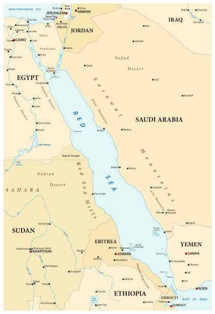
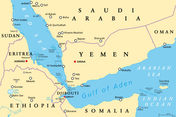
Vector map of the Red Sea with its neighboring countries.


Africa map outline vector illustration with scales of miles and kilometers, countries borders and names, their capitals and major cities in gray background

Map of Africa in realistic blank frame isolated on white background.

Middle East and Asia map - highly detailed vector illustration

Vector map of the Red Sea with its neighboring countries.
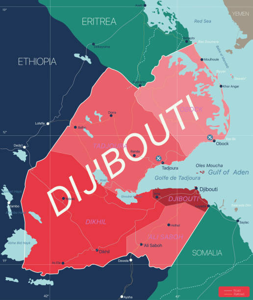
Dijibouti country detailed editable map with regions cities and towns, roads and railways, geographic sites. Vector EPS-10 file

Map of Africa on a realistic wooden wall with a natural light.

Republic of the Sudan road vector map

Red Sea region country detailed editable map with countries capitals and cities. Vector EPS-10 file


World map in perspective showing the location of the country Eritrea with detailed map with flag of Eritrea. Vector illustration.


Journey to Eritrea, illustration with a map of Eritrea. Background with airplane, cell phone, passport, compass and tickets. Vector mockup.

Map of Eritrea on a golden background with an embossing effect. Realistic circular brushed metal similar to a gold medal or coin. Vector Illustration (EPS10, well layered and grouped). Easy to edit, manipulate, resize or colorize. Vector and Jpeg file of different sizes.

Eritrea blueprint map template with capital city. Asmara marked on blueprint Eritrean map. Vector illustration.

Outline Skyline panorama of city of Asmara, Eritrea - vector illustration

Eritrea country flag on wavy silk fabric background panorama - illustration

Map of Africa isolated on a realistic blueprint with measures.

Detailed map of Eritrea with surroundings, provinces, capital and flag.

Location of Eritrea on the world map, marked with Eritrea flag pin. Cartographic vector illustration.


Colourfull Skyline panorama of city of Asmara, Eritrea - vector illustration
Eastern Africa flags icons set, regions and territories, geography or geopolitics poster, educational card. Flat style vector illustration on gray background

Crossed flags of Eritrea and LGBTQ. Official colors. Correct proportion. Vector illustration

Script text word art lettering design vector of country name for Eritrea

Script text word art lettering design vector of country name for Eritrea

Outline Skyline panorama of city of Asmara, Eritrea - vector illustration

Travel to Eritrea, top view airplane with map and flag of Eritrea. Travel and tourism banner design.

Eritrea map filled with golden glitter. Luxurious design element, vector illustration.

Waving flag of Eritrea. Sign african state in official djiboutian colors and proportion correctly. Patriotic sign East Africa country. Vector icon illustration
Next