China Yangtze River stock illustrations
Browse 100+ china yangtze river stock illustrations and vector graphics available royalty-free, or start a new search to explore more great stock images and vector art.
Most popular
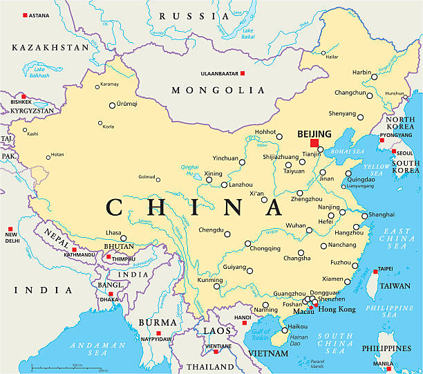
China political map with capital Beijing, national borders, important cities, rivers and lakes. English labeling and scaling. Illustration.
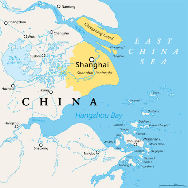
Shanghai and the Yangtze River Delta, political map with major cities. Megalopolis of China, located where the Yangtze River drains into the East China Sea, with Hangzhou Bay and Zhoushan Archipelago.
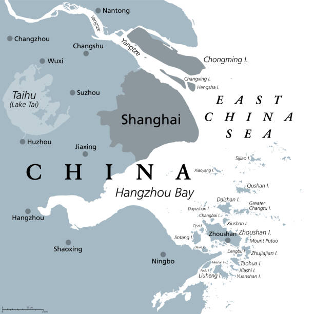
Shanghai and the Yangtze River Delta, gray political map, with major cities. Megalopolis of China, located where Yangtze River drains into East China Sea, with Hangzhou Bay and Zhoushan Archipelago.
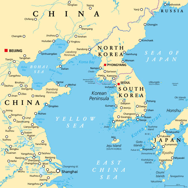
Korean Peninsula region, political map. Peninsular region Korea in East Asia, divided between the 2 countries North and South Korea, bordered by China and Russia, separated from Japan by Korea Strait.


Symbol of Yin Yan on a dark background. Vector illustration.

Shanghai skyline. All buildings are complete and moveable.

Shanghai skyline. All buildings are complete and moveable.

Shanghai skyline. All buildings are complete and moveable.


China, Chongqing architecture line skyline illustration. Linear vector cityscape with famous landmarks, city sights, design icons. Editable strokes


Shanghai buildings. Each silhouette is a real Shanghai building.


Detailed map of Shanghai.

The Bund in front with Pudong behind. Each building is separate, complete, and highly detailed. Each is a trace of an actual Shanghai building.
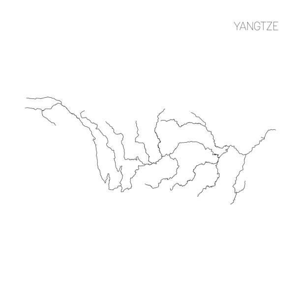
Map of Yangtze river drainage basin. Simple thin outline vector illustration.

Pudong (behind) and the Bund (in front) of Shanghai. Each building is separate and complete. Each is a trace of an actual Shanghai building. Each building is separate and complete. This image contains transparency effects for the snow and a gradient mesh for the background.


Poster Style Topographic / Road map of Wuhan, China. Original map data is open data via © OpenStreetMap contributors. All maps are layered and easy to edit. Roads are editable stroke.

Pudong and the Bund, Shanghai, China. All buildings are complete and moveable.

Shanghai skyline. All buildings are complete and moveable.


The drawbridge over the lake, vector illustration. Computer digital drawing.

19th century map of the Yangtze River in China.

Shanghai skyline. All buildings are complete and moveable.

Shanghai skyline. All buildings are complete and moveable.


Shanghai skyline. All buildings are complete and moveable.

The Bund in front with Pudong behind. Each building is separate, complete, and highly detailed. Each is a trace of an actual Shanghai building.

Shanghai skyline. All buildings are complete and moveable.

Shanghai City architecture China vintage engraved illustration hand drawn sketch

Shanghai skyline. All buildings are complete and moveable.


Shanghai skyline. All buildings are complete and moveable.


Poster Style Topographic / Road map of Nanjing, China . Original map data is open data via © OpenStreetMap contributors. All maps are layered and easy to edit. Roads are editable stroke.

Poster Style Topographic / Road map of Wuhan, China. Original map data is open data via © OpenStreetMap contributors. All maps are layered and easy to edit. Roads are editable stroke.

Topographic / Road map of Nanjing, China . Map data is open data via openstreetmap contributors. All maps are layered and easy to edit. Roads are editable stroke.

Historical view of the upper Yangtze - the longest river in Asia, the third-longest in the world and the longest in the world to flow entirely within one country. Wood engraving, published in 1893.

Poster Style Topographic / Road map of Nanjing, China . Original map data is open data via © OpenStreetMap contributors. All maps are layered and easy to edit. Roads are editable stroke.

The drawbridge over the lake, round seal, vector illustration. Computer digital drawing.


Topographic / Road map of Nanjing, China . Map data is open data via openstreetmap contributors. All maps are layered and easy to edit. Roads are editable stroke.

Poster Style Topographic / Road map of Nanjing, China . Original map data is open data via © OpenStreetMap contributors. All maps are layered and easy to edit. Roads are editable stroke.

Topographic / Road map of Nanjing, China . Map data is open data via openstreetmap contributors. All maps are layered and easy to edit. Roads are editable stroke.

Trackers on the upper Yangtze river pulling boat - Scanned 1899 Engraving

Shanghai skyline. All buildings are complete and moveable.

Shanghai skyline. All buildings are complete and moveable.


Vintage engraving of Entrance to the Lukan Gorge, Upper Yangtze, 19th Century

Next