
Dubuque Iowa stock illustrations
Browse 40+ dubuque iowa stock illustrations and vector graphics available royalty-free, or search for great river road or sandpoint idaho to find more great stock images and vector art.
Greetings from Dubuque vintage rusty metal sign on a white background, vector illustration
Detailed map of Iowa state,in vector format,with county borders,roads and major cities.
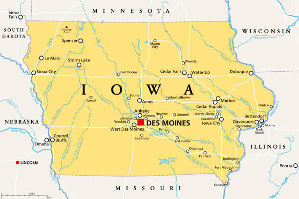
Iowa, IA, political map, with the capital Des Moines and most important cities, rivers and lakes. State in the Midwestern region of the United States of America, nicknamed The Hawkeye State. Vector.
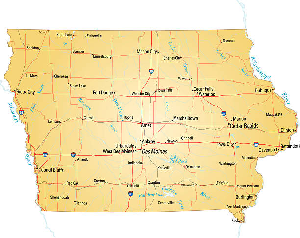
"Vector illustration of map of Iowa with major roads, rivers and lakes."
The map is accurately prepared by a map expert.

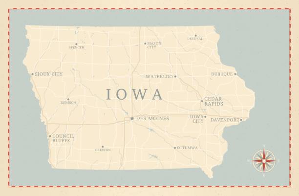
A vintage-style map of Iowa with freeways, highways and major cities. Shoreline, lakes and rivers are very detailed. Includes an EPS and JPG of the map without roads and cities.
Downloadable outline vector map of Iowa state of United States of America.
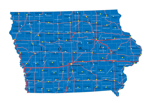
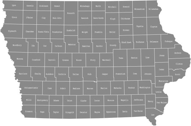
Highly-detailed Iowa county map. Each county is in it's own separate labeled layer. County names are in a separate layer and can be easily adjusted or removed as well. All layers have been alphabetized for easy manipulation, recoloring or other use.

View from Kelly's Bluff of Dubuque, Iowa, USA. Pencil and pen, engraving published 1874. This edition edited by William Cullen Bryant is in my private collection. Copyright is in public domain.

High angle view of Dubuque, Iowa, on the Mississippi River, USA. Pencil and pen, engraving published 1874. This edition edited by William Cullen Bryant is in my private collection. Copyright is in public domain.

Downloadable county map of Iowa state of United States of America. The map is accurately prepared by a map expert.

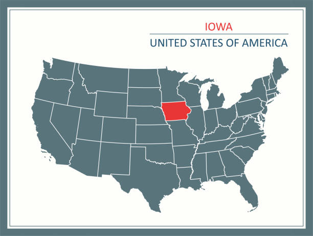
Iowa county map outline vector illustration and its location highlighted on USA map

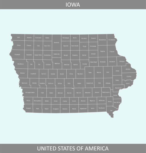
Iowa, IA, gray political map, with the capital Des Moines and most important cities. State in the Midwestern region of the United States of America, nicknamed The Hawkeye State. Illustration. Vector.

Highly detailed map of United States of America with highlighted state of Iowa for web banner, mobile, smartphone, iPhone, iPad applications and educational use. The map is accurately prepared by a map expert.

The map is accurately prepared by a map expert.
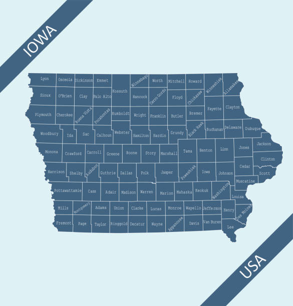
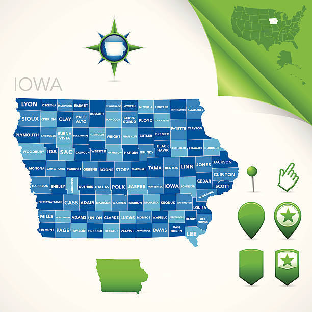
Highly detailed map of Iowa counties state of United States of America for web banner, mobile, smartphone, iPhone, iPad applications and educational use. The map is accurately prepared by a map expert.

Highly detailed map of iowa counties state of United States of America for book cover, brochure and web banner designs, iPhone, iPad, tablet, smart phone, mobile app and educational use.


Printable outline vector map of Iowa state of United States of America.

Dubuque Eagle Point, Iowa, USA. Pencil and pen, engraving published 1874. This edition edited by William Cullen Bryant is in my private collection. Copyright is in public domain.

Word cloud map of Iowa state. Cities list collage


Map of Dubuque County - Iowa, on a blue and red colored background. The blue color represents the Democratic Party and the red color represents the Republican Party. White stars are placed above and below the map. Vector Illustration (EPS file, well layered and grouped). Easy to edit, manipulate, resize or colorize. Vector and Jpeg file of different sizes.

Highly detailed map of United States of America with highlighted state of Iowa for web banner, mobile, smartphone, iPhone, iPad applications and educational use. The map is accurately prepared by a map expert.

Highly detailed map of Iowa state of United States of America for web banner, mobile, smartphone, iPhone, iPad applications and educational use. The map is accurately prepared by a map expert.

Map of Dubuque County - Iowa, for your own design. Four maps with editable stroke included in the bundle: - One black map on a white background. - One blank map on a black background. - One white map with shadow on a blank background (for easy change background or texture). - One line map with only a thin black outline (in a line art style). The layers are named to facilitate your customization. Vector Illustration (EPS file, well layered and grouped). Easy to edit, manipulate, resize or colorize. Vector and Jpeg file of different sizes.


Printable counties map of Iowa state of United States of America. The map is accurately prepared by a map expert.

Highly detailed county map of Iowa state of United States of America for web banner, mobile, smartphone, iPhone, iPad applications and educational use. The map is accurately prepared by a map expert.

Map of Dubuque County - Iowa, with a realistic paper cut effect isolated on white background. Trendy paper cutout effect. Vector Illustration (EPS file, well layered and grouped). Easy to edit, manipulate, resize or colorize. Vector and Jpeg file of different sizes.


Map of Dubuque County - Iowa, isolated on a blank background and with his name on a red ribbon. Vector Illustration (EPS file, well layered and grouped). Easy to edit, manipulate, resize or colorize. Vector and Jpeg file of different sizes.

A close-up scene of people in residential Dubuque, Iowa, USA. Pencil and pen, engraving published 1874. This edition edited by William Cullen Bryant is in my private collection. Copyright is in public domain.

Map of Dubuque County - Iowa, with a large group of people. The faces are blue and red and represent patriots. The color blue for the Democratic Party and the color red for the Republican Party. Conceptual creative map, can symbolize the unity, cooperation, teamwork, patriotism... Vector Illustration (EPS file, well layered and grouped). Easy to edit, manipulate, resize or colorize. Vector and Jpeg file of different sizes.

Highly detailed map of iowa state of United States of America for book cover, brochure and web banner designs, iPhone, iPad, tablet, smart phone, mobile app and educational use.

Printable map of Iowa state of United States of America. The map is accurately prepared by a map expert.

Highly detailed labeled map of Iowa counties state of United States of America for book cover, brochure and web banner designs, iPhone, iPad, tablet, smart phone, mobile app and educational use.