
Gotland Visby stock illustrations
Browse 60+ gotland visby stock illustrations and vector graphics available royalty-free, or start a new search to explore more great stock images and vector art.
Most popular
Map of Gotland in a trendy vintage style. Beautiful retro illustration with old textured paper and light rays in the background (colors used: blue, green, beige and black for the outline). Vector Illustration (EPS10, well layered and grouped). Easy to edit, manipulate, resize or colorize.

Map of Gotland in a trendy vintage style. Beautiful retro illustration with old textured paper (colors used: blue, green, beige and red). Vector Illustration (EPS10, well layered and grouped). Easy to edit, manipulate, resize or colorize. Vector and Jpeg file of different sizes.
Map of Gotland for your own design. Four maps with editable stroke included in the bundle: - One black map on a white background. - One blank map on a black background. - One white map with shadow on a blank background (for easy change background or texture). - One line map with only a thin black outline (in a line art style). The layers are named to facilitate your customization. Vector Illustration (EPS10, well layered and grouped). Easy to edit, manipulate, resize or colorize. Vector and Jpeg file of different sizes.

The Battle of Visby was fought in 1361 near the town of Visby on the island of Gotland, between the forces of the Danish king and the Gutnish country yeomen. The Danish force was victorious. Illustration from 19th century.
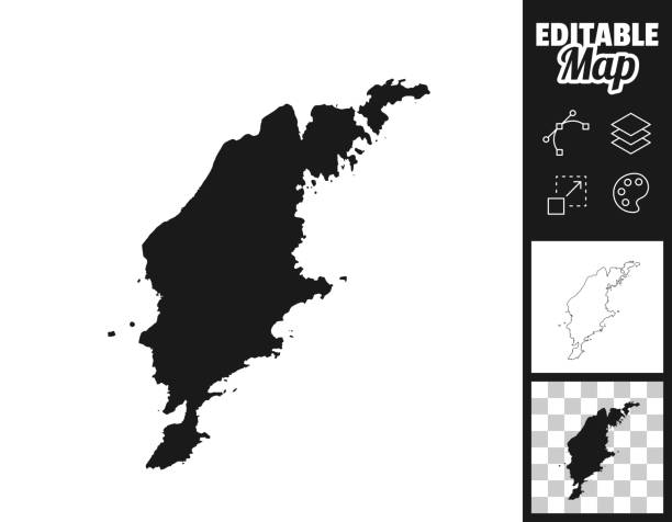
Map of Gotland for your own design. Three maps with editable stroke included in the bundle: - One black map on a white background. - One line map with only a thin black outline in a line art style (you can adjust the stroke weight as you want). - One map on a blank transparent background (for change background or texture). The layers are named to facilitate your customization. Vector Illustration (EPS file, well layered and grouped). Easy to edit, manipulate, resize or colorize. Vector and Jpeg file of different sizes.

Map of Gotland isolated on white background. Includes 9 buttons with a flat design style for your design, in different colors (red, orange, yellow, green, blue, purple, gray, black, white, line art), each icon is separated on its own layer. Vector Illustration (EPS10, well layered and grouped). Easy to edit, manipulate, resize or colorize.
This vector map is accurately prepared by a GIS and remote sensing expert with highly detailed information.

White map of Gotland isolated on a trendy color, a bright red background and with a dropshadow. Vector Illustration (EPS file, well layered and grouped). Easy to edit, manipulate, resize or colorize. Vector and Jpeg file of different sizes.

Simple vector map of Swedish isle of Gotland


Illustration of a City walls of Visby, Sweden, in the Middle Ages

Map of Gotland for your own design. With space for your text and your background. Four maps included in the bundle: - One black map. - One blank map with only a thin black outline (in a line art style). - One mosaic map. - One white map with a thin black outline. The 4 maps are isolated on a blank background (for easy change background or texture).The layers are named to facilitate your customization. Vector Illustration (EPS10, well layered and grouped). Easy to edit, manipulate, resize or colorize.

White map of Gotland isolated on a blue background with a long shadow effect and in a flat design style. Vector Illustration (EPS10, well layered and grouped). Easy to edit, manipulate, resize or colorize.


Map of Gotland isolated on a blank background and with his name on a red ribbon. Vector Illustration (EPS10, well layered and grouped). Easy to edit, manipulate, resize or colorize. Vector and Jpeg file of different sizes.

Map of Gotland for your design, with space for your text and your background. White map with a shadow creating a relief effect. Vector Illustration (EPS10, well layered and grouped). Easy to edit, manipulate, resize or colorize.

Map of Gotland sketched and isolated on a white background. The map is purple with a black outline. Pink and blue are overlapped to create a modern visual effect, looking like anaglyph image. The combination of pink and blue in this illustration creates a predominantly purple map. Vector Illustration (EPS file, well layered and grouped). Easy to edit, manipulate, resize or colorize. Vector and Jpeg file of different sizes.


Map of Gotland drawn in chalk on a green chalkboard with chalk traces. Vector Illustration (EPS10, well layered and grouped). Easy to edit, manipulate, resize or colorize.

Map of Gotland in realistic white frame isolated on blank wall (colors used: blue, green, gray and white). Vector Illustration (EPS10, well layered and grouped). Easy to edit, manipulate, resize or colorize.


3D map of Gotland isolated on a blank and gray background, with a dropshadow. Vector Illustration (EPS10, well layered and grouped). Easy to edit, manipulate, resize or colorize. Vector and Jpeg file of different sizes.


Map of Gotland sketched, isolated on a blank background. Vector Illustration (EPS10, well layered and grouped). Easy to edit, manipulate, resize or colorize.

Map of Gotland sketched and isolated on a blank background. The map is gray with a black outline. Vector Illustration (EPS file, well layered and grouped). Easy to edit, manipulate, resize or colorize. Vector and Jpeg file of different sizes.
Map of Gotland isolated on blue background. Trendy icon with a flat design style and a long shadow effect. Vector Illustration (EPS10, well layered and grouped). Easy to edit, manipulate, resize or colorize. Vector and Jpeg file of different sizes.


Map of Gotland with a mesh of straight lines and a slight shadow, on a gray blank background. Conceptual illustration of networks (communication, connection, social, internet, ...). Vector Illustration (EPS10, well layered and grouped). Easy to edit, manipulate, resize or colorize. Vector and Jpeg file of different sizes.

Map of Gotland folded and isolated on blank background. The map is squared with a blue background and the territory in white. Vector Illustration (EPS10, well layered and grouped). Easy to edit, manipulate, resize or colorize. Vector and Jpeg file of different sizes.

Map of Gotland cut out on a blank white paper with a blue background. Modern and trendy paper cutout effect. Vector Illustration (EPS file, well layered and grouped). Easy to edit, manipulate, resize or colorize. Vector and Jpeg file of different sizes.

Map of Gotland drawn with a blue highlighter, isolated on a blank background. Easily change the color of the map (yellow, orange, pink, purple, blue, green) as you like. Vector Illustration (EPS10, well layered and grouped). Easy to edit, manipulate, resize or colorize. Vector and Jpeg file of different sizes.

Map of Gotland created with thin black lines diagonally and a slight shadow, isolated on a blank background. Vector Illustration (EPS10, well layered and grouped). Easy to edit, manipulate, resize or colorize. Vector and Jpeg file of different sizes.


This vector map is accurately prepared by a GIS and remote sensing expert with highly detailed information.

Map of Gotland in a realistic neon sign style. The map is created with a pink glowing neon light on a dark brick wall. Modern and trendy illustration with beautiful bright colors. Vector Illustration (EPS10, well layered and grouped). Easy to edit, manipulate, resize or colorize.

Map of Gotland with a coronavirus warning tape (COVID-19, 2019-nCoV) isolated on a gray background. The map is white with a long shadow effect and in a flat design style. Conceptual image: coronavirus outbreak on the territory, coronavirus detected, closing of borders, area under control, stop coronavirus, quarantined area, spread of the disease, virus alert, danger zone, confined space. Vector Illustration (EPS10, well layered and grouped). Easy to edit, manipulate, resize or colorize.

Map of Gotland created with a mesh of thin bright blue lines and glowing dots, isolated on a dark blue background. Conceptual illustration of networks (communication, social, internet, ...). Vector Illustration (EPS10, well layered and grouped). Easy to edit, manipulate, resize or colorize.

Coronavirus pandemic reported on the map of Gotland. Spread of COVID-19 represented with red circles on a black background, like a radar screen. Included: Big set of infographic elements. This large selection of modern elements includes charts, pie charts, diagrams, demographic graph, people graph, datas, time lines, flowcharts, icons... (Colors used: red, white, black). Vector Illustration (EPS10, well layered and grouped). Easy to edit, manipulate, resize or colorize.

Map of Gotland created with round blue dots on a blank background. Modern and trendy mosaic illustration. Vector Illustration (EPS10, well layered and grouped). Easy to edit, manipulate, resize or colorize.

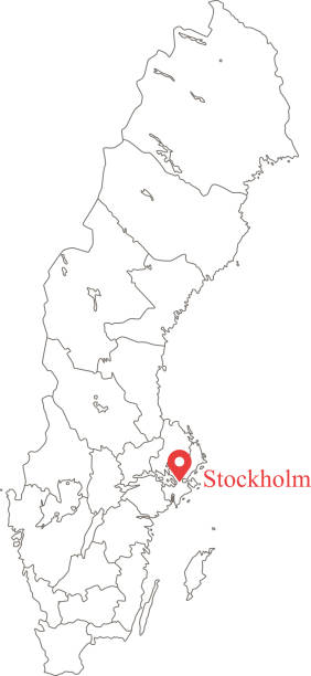
Karta över Gotland med Visby utsatt på kartan
Map of Gotland with a red arrow moving down on a white checkered background. Conceptual image. Vector Illustration (EPS10, well layered and grouped). Easy to edit, manipulate, resize or colorize.

Map of Gotland in a trendy vintage style. Beautiful retro illustration with old textured yellow paper and a black long shadow (colors used: yellow, white and black). Vector Illustration (EPS10, well layered and grouped). Easy to edit, manipulate, resize or colorize. Vector and Jpeg file of different sizes.

Map of Gotland created with a thin black outline and light rays. Trendy and modern illustraion isolated on a blank background. Vector Illustration (EPS10, well layered and grouped). Easy to edit, manipulate, resize or colorize.

Map of Gotland draw with the stippling technique. Beautiful and trendy illustration created only with dots and isolated on a blank background. White map with dotted black outline and dark shadow. White background with a stippled circular gradient. (colors used: black and white). Vector Illustration (EPS10, well layered and grouped). Easy to edit, manipulate, resize or colorize. Vector and Jpeg file of different sizes.

Map of Gotland created with pink and purple square dots on a blank background. Modern and trendy mosaic illustration in pixel art style. Vector Illustration (EPS file, well layered and grouped). Easy to edit, manipulate, resize or colorize. Vector and Jpeg file of different sizes.

Map of Gotland isolated on a blank background with a black outline and shadow. Vector Illustration (EPS file, well layered and grouped). Easy to edit, manipulate, resize or colorize. Vector and Jpeg file of different sizes.

Map of Gotland on a golden background with an embossing effect. Realistic circular brushed metal similar to a gold medal or coin. Vector Illustration (EPS10, well layered and grouped). Easy to edit, manipulate, resize or colorize. Vector and Jpeg file of different sizes.

Map of Gotland on a sticker with a drop shadow isolated on a gray blank background. Trendy illustration in a flat design style. Vector Illustration (EPS10, well layered and grouped). Easy to edit, manipulate, resize or colorize. Vector and Jpeg file of different sizes.

Map of Gotland sketched and isolated on a blank background. The map is blue green with a black outline. Vector Illustration (EPS10, well layered and grouped). Easy to edit, manipulate, resize or colorize.


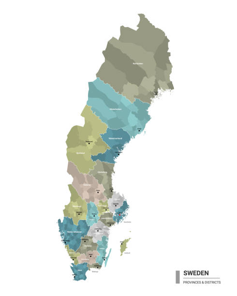
Gotland, political map. Largest island of Sweden, fully encompassed by Baltic Sea. Province Gotland with capital Visby includes the island Faroe, Gotska Sandoen and Karlsoe Islands Lilla and Stora.

Coronavirus pandemic reported on the map of Gotland. Spread of COVID-19 represented with red circles on a black background, like a radar screen. Conceptual image: coronavirus detected, quarantined area, spread of the disease, coronavirus outbreak on the territory, virus alert, danger zone, confined space, closing of borders, area under control, stop coronavirus, defeat the virus. Vector Illustration (EPS10, well layered and grouped). Easy to edit, manipulate, resize or colorize.

Map of Gotland folded with design elements. Blue map with grid lines, isolated on a blank background. Vector Illustration (EPS10, well layered and grouped). Easy to edit, manipulate, resize or colorize.

Map of Gotland with long shadow style on colored circle buttons. Two map versions included in the bundle: - One white map on a pink / red circle button. - One white map on a blue circle button. Vector Illustration (EPS file, well layered and grouped). Easy to edit, manipulate, resize or colorize. Vector and Jpeg file of different sizes.

Map of Gotland with a realistic paper cut effect isolated on white background. Vector Illustration (EPS10, well layered and grouped). Easy to edit, manipulate, resize or colorize.
Next