
Grand Rapids Mi stock illustrations
Browse 90+ grand rapids mi stock illustrations and vector graphics available royalty-free, or search for downtown grand rapids mi or blue footbridge grand rapids mi to find more great stock images and vector art.


Grand Rapids Blue City skyline silhouette vector background


A vintage-style map of Michigan with freeways, highways and major cities. Shoreline, lakes and rivers are very detailed. Includes an EPS and JPG of the map without roads and cities. Texture, compass, cities, etc. are on separate layers for easy removal or changes.

Michigan, MI, political map, with capital Lansing and metropolitan area Detroit. State in Great Lakes region of upper Midwestern United States, nicknamed The Great Lake State, and The Wolverine State.

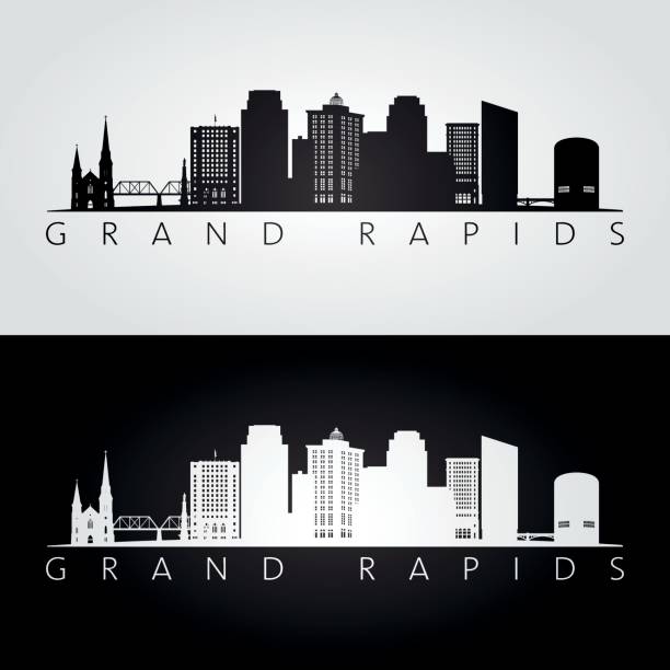
Grand Rapids Michigan city skyline vector silhouette illustration

Abstract Watercolor Skyline of Grand Rapids, a Michigan city on the Grand River, east of Lake Michigan

"Detailed vector map of Michigan with administrative divisions. File was created on January 8, 2013. The colors in the .eps-file are ready for print (CMYK). Included files: EPS (v8) and Hi-Res JPG (5423aa aaa 5600 px)."

Grand Rapids MI City Vector Road Map Blue Text. All source data is in the public domain. U.S. Census Bureau Census Tiger. Used Layers: areawater, linearwater, roads.

Detailed map of Michigan state,in vector format,with county borders and major cities.


Vector Illustration of the Silhouette Skyline of Grand Rapids


"Highly detailed vector map of Michigan, United States. File was created on November 14, 2012. The colors in the .eps-file are ready for print (CMYK). Included files: EPS (v8) and Hi-Res JPG (5600aa aaa 5600 px)."


Michigan, MI, gray political map with capital Lansing and metropolitan area Detroit. State in the Great Lakes region of upper Midwestern United States, nicknamed Great Lake State, and Wolverine State.
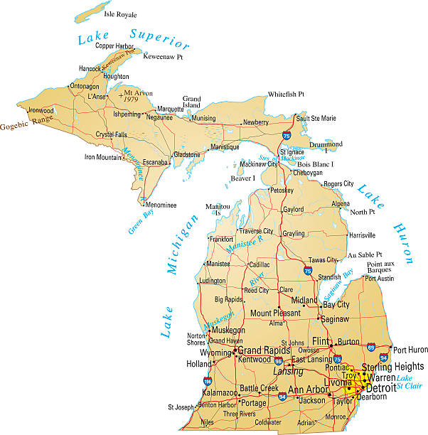
Vector illustration of map of Michigan with major roads, rivers and lakes.
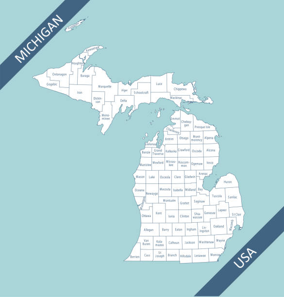
Highly detailed map of Michigan counties state of United States of America for web banner, mobile app, and educational use. The map is accurately prepared by a map expert.

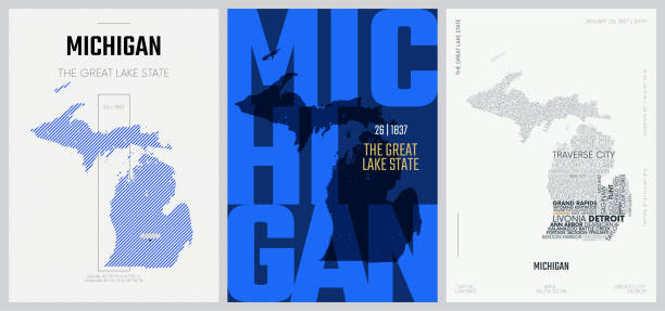
USA - Michigan state infographic template with map, area and population informations included

Grand Rapids Michigan city skyline vector silhouette illustration

vector road map of the US American State of michigan

Highly detailed map of Michigan state of United States of America for web banner, mobile app, and educational use. The map is accurately prepared by a map expert.
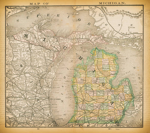
19th century map of Michigan. Published in New Dollar Atlas of the United States and Dominion of Canada. (Rand McNally & Co's, Chicago, 1884).

Grand Rapids Michigan city skyline vector silhouette illustration

Vector Illustration of a City Street Map of Grand Rapids, Michigan, USA. Scale 1:60,000. All source data is in the public domain. U.S. Geological Survey, US Topo Used Layers: USGS The National Map: National Hydrography Dataset (NHD) USGS The National Map: National Transportation Dataset (NTD)

City skyline set. USA. Vector silhouette background illustration.


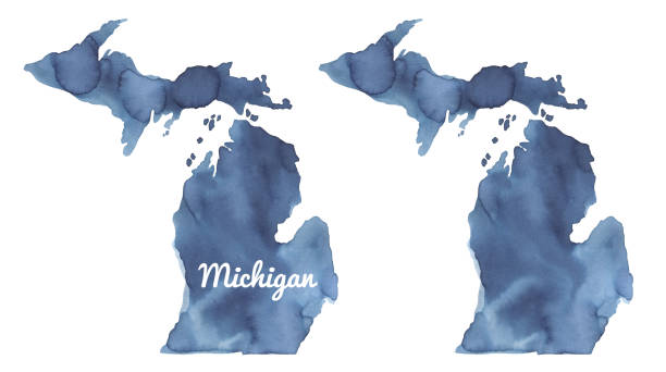
Hand painted watercolour drawing with art stains on white, cut out clipart elements for design.

Wyoming MI City Vector Road Map Blue Text. All source data is in the public domain. U.S. Census Bureau Census Tiger. Used Layers: areawater, linearwater, roads.

Antique illustration
Set of icons. Cities of the USA flags. Vector.

Grand Rapids Michigan city skyline vector silhouette illustration

Stamp or label with text Grand Rapids, Michigan written inside, vector illustration

Vector Illustration of a Road Map of Michigan State, USA. All source data is in the public domain. U.S. Geological Survey, US Topo Used Layers: USGS The National Map: National Hydrography Dataset (NHD) USGS The National Map: National Transportation Dataset (NTD)

The map is accurately prepared by a map expert.

Grand Rapids Michigan city skyline vector silhouette illustration


USA - Michigan state infographic template, map, population, area informations included

All elements were drawn in a vector graphics editor and design program. Elements and layers are well organized, separable, detachable and easy to use and edit. Map data is in the public domain, available from the United States Census Bureau via census.gov

"Vector illustration of map of Michigan with major roads, rivers and lakes."

Vector Illustration of the Silhouette Skyline of Lansing


Grand Rapids Michigan city skyline vector silhouette illustration


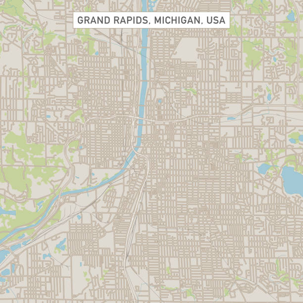
Topographic / Road map of Grand Rapids, MI. Map data is open data via openstreetmap contributors. All maps are layered and easy to edit. Roads are editable stroke.

Topographic / Road map of Grand Rapids, MI. Map data is open data via openstreetmap contributors. All maps are layered and easy to edit. Roads are editable stroke.

Greetings from Grand Rapids vintage rusty metal sign on a white background, vector illustration


Printable map of Michigan state of United States of America. The map is accurately prepared by a map expert.
Next