Lesotho administrative map isolated on white background
Browse 1,400+ lesotho map stock illustrations and vector graphics available royalty-free, or start a new search to explore more great stock images and vector art.
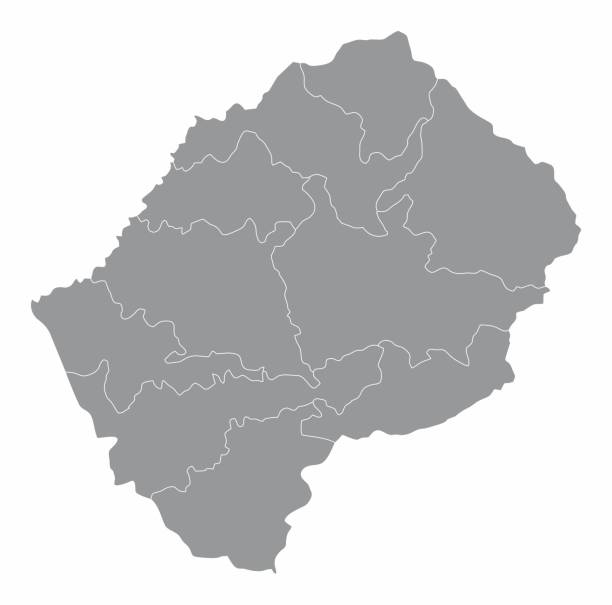
Lesotho administrative map isolated on white background

Abstract image Lesotho map from point blue and glowing stars on a dark background. vector illustration.

Teardrop map marker with flag of Lesotho. Kingdom of Lesotho flag inserted in the location map pin. 3D vector illustration isolated on light grey background.

Computer monitor with map of Lesotho in browser, search for the country of Lesotho on the web mapping program. Vector template.

Lesotho - colorful low poly country shape. Multicolor geometric triangles. Modern trendy design. Vector illustration.

Lesotho Metal and Glass Flag Badges, Buttons, Map marker pin and Shields. Vector illustrations

Infographic for Lesotho, detailed map of Lesotho with flag. Vector Info graphic green map.

Lesotho map with national flag decoration

Lesotho map with national flag decoration

Lesotho map with national flag decoration

Lesotho map with national flag decoration

Lesotho map with national flag decoration

Isometric 3D Lesotho map. Stylized vector map illustration with cities, borders, capital, administrative divisions and pointer marks; gradient background with grid.

Lesotho political map with capital Maseru. Kingdom and landlocked country in South Africa. Previously known as Basutoland. Gray illustration with English labeling. Vector.
Lesotho icons collection. Bright colourful trendy map icons. Modern Lesotho badge with country map. Vector illustration.

Lesotho map silhouette illustration on the white background. Vector illustration

Map link URL: https://legacy.lib.utexas.edu/maps/world_maps/united_states_foreign_service_posts-september_2011.pdf. Some urban locations were taken from: https://legacy.lib.utexas.edu/maps/world_maps/txu-oclc-264266980-world_pol_2008-2.jpg. The image was created in Adobe Illustrator in eps10 format

Abstract blue background with Lesotho map, internet line, connected points. Lesotho map with dot nodes. Global network connection concept. Wire frame 3D mesh polygonal network line. vector.

Map of Lesotho. Vector illustration. World map

Map of Lesotho. Vector illustration. World map

Map of Lesotho. Vector illustration. World map

Map of Lesotho. Vector illustration. World map

Map of Lesotho. Vector illustration. World map

Map of Lesotho. Vector illustration. World map

vector illustration of Lesotho map

Lesotho map silhouette illustration on the white background. Vector illustration

vector illustration of Lesotho maps

Map of Lesotho isolated on a realistic blueprint with measures.

Dotted Map of Lesotho. Simple Silhouette of Lesotho. The National Flag of Lesotho. Set of Multicolored Map Markers. Vector Illustration Isolated on White Background.

Map of Lesotho. Mosaic style map with flag of Lesotho. Popular vector illustration.

Brush style color flag of Lesotho Flag, blue white and green with a black mokorotlo (a Basotho hat). with name text Lesotho.
Vector illustration of Lesotho map dotted basic shape icons and flag

LGBT flag map of Lesotho. Vector rainbow map of Lesotho in colors of LGBT (lesbian, gay, bisexual, and transgender) pride flag.

Lesotho detailed map with flag of country. Painted in watercolor paint colors in the national flag.

Vector dotted map of Lesotho isolated on white background . Travel vector illustration
Africa with selected Lesotho map and Lesotho flag icon. Vector map and flag.

Lesotho map with national flag decoration

Africa contoured map with highlighted Ivory Coast. Ivory Coast map and flag on Africa map. Vector Illustration.
Pixel map of Lesotho. Vector dotted map of Lesotho isolated on white background. Abstract computer graphic of Lesotho map. vector illustration.

Map of Lesotho folded and isolated on white background.

Modern of lesotho Map connections network design, Best Internet Concept of lesotho map business from concepts series, map point and line composition. Infographic map. Vector Illustration.


