Maseru Lesotho stock illustrations
Browse 1,000+ maseru lesotho stock illustrations and vector graphics available royalty-free, or start a new search to explore more great stock images and vector art.
Most popular
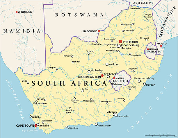
Political map of South Africa with the capitals Pretoria, Bloemfontein and Cape Town, with national borders, most important cities, rivers and lakes. Vector illustration with English labeling and scaling.
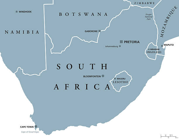
South Africa political map with the capitals Pretoria, Bloemfontein and Cape Town. With national borders and neighbor countries. Gray illustration with English labeling on white background. Vector.

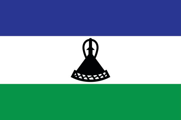
Lesotho national flag icon in the correct aspect ratio. File is built in the CMYK color space for optimal printing, and can easily be converted to RGB without any color shifts.


Lesotho Political Map with capital Maseru, national borders, important cities and rivers. English labeling and scaling. Illustration.


Crossed and waving flags of South Africa and Kingdom of Lesotho. Vector illustration
Lesotho map, stylish location icon with Lesotho map and flag. Green pin icon.

Lesotho flag in the form of wave ribbon. Vector illustration.

Vector of nice Lesotho flag.

Lesotho map flag. Vector design isolated on white background. Vector illustration eps10

Crossed and waving flags of Lesotho and Zambia. Vector illustration

Vintage illustration British Residency in Maseru, Basutoland, present-day Lesotho, 1880s, 19th Century

Vintage illustration Litasa's cave near Maseru, Basutoland, present-day Lesotho, 1880s, 19th Century


Lesotho - detailed map of the country in brown colors, divided into regions. Vector illustration

Shield with Lesotho flag on white background. Vector illustration.

http://dikobraz.org/map_2.jpg

identifying its capital city, Maseru. African set. Spiral fingerprint series

Low poly map of Lesotho. Gold polygonal wireframe. Glittering vector with gold particles on white background. Vector illustration eps 10

Lesotho country detailed editable map with regions cities and towns, roads and railways, geographic sites. Vector EPS-10 file

Lesotho flag, vector illustration on a white background

Lesotho flag, vector illustration on a white background

Lesotho flag, vector illustration on a white background

Computer monitor with map of Lesotho in browser, search for the country of Lesotho on the web mapping program. Vector template.

Lesotho flag, vector illustration on a white background

vector illustration of Lesotho map

Lesotho flag, vector illustration on a white background

Lesotho flag, vector illustration on a white background

Lesotho flag, vector illustration on a white background

Map pointer with flag of Lesotho. Colorful pointer icon for map. Vector Illustration.

Lesotho flag, vector illustration on a white background

Lesotho flag, vector illustration on a white background

Lesotho flag, vector illustration on a white background

Lesotho flag, vector illustration on a white background

Lesotho flag, vector illustration on a white background

Lesotho flag, vector illustration on a white background

Lesotho flag, vector illustration on a white background

Crossed flags of Qatar and the Kingdom of Lesotho. Official colors. Correct proportion. Vector illustration

national flag ofKingdom of Lesotho and Usa crossed on the sticks in the original colours

Lesotho flag, vector illustration on a white background

Lesotho flag, vector illustration on a white background

Lesotho flag, vector illustration on a white background

Lesotho flag, vector illustration on a white background

Lesotho flag, vector illustration on a white background

Lesotho flag, vector illustration on a white background

Lesotho flag, vector illustration on a white background

Detailed map of Lesotho.
Africa with selected Lesotho map and Lesotho flag icon. Vector map and flag.

Infographic about Coronavirus in Lesotho – Stay at Home, Save Lives. Lesotho Flag and Map, World Map with COVID-19 cases.

Abstract vector color map of Lesotho with transparent paint effect. For colorful presentation isolated on white.

Lesotho flags collection. Flags and outline of the country vector illustration set
Lesotho national day badge. Independence from the United Kingdom in 1966. Celebrated on October 4.

Map link URL: https://legacy.lib.utexas.edu/maps/world_maps/united_states_foreign_service_posts-september_2011.pdf. Some urban locations were taken from: https://legacy.lib.utexas.edu/maps/world_maps/txu-oclc-264266980-world_pol_2008-2.jpg. The image was created in Adobe Illustrator in eps10 format

Lesotho political map with capital Maseru. Kingdom and landlocked country in South Africa. Previously known as Basutoland. Gray illustration with English labeling. Vector.

Lesotho flag, vector illustration on a white background

vector illustration of Lesotho map and flag
Next