Republic Of Congo Map stock illustrations
Browse 1,200+ republic of congo map stock illustrations and vector graphics available royalty-free, or search for democratic republic of congo map to find more great stock images and vector art.
Most popular
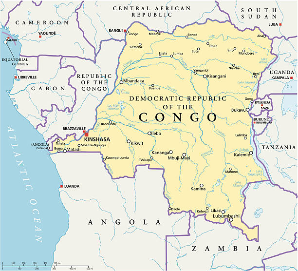
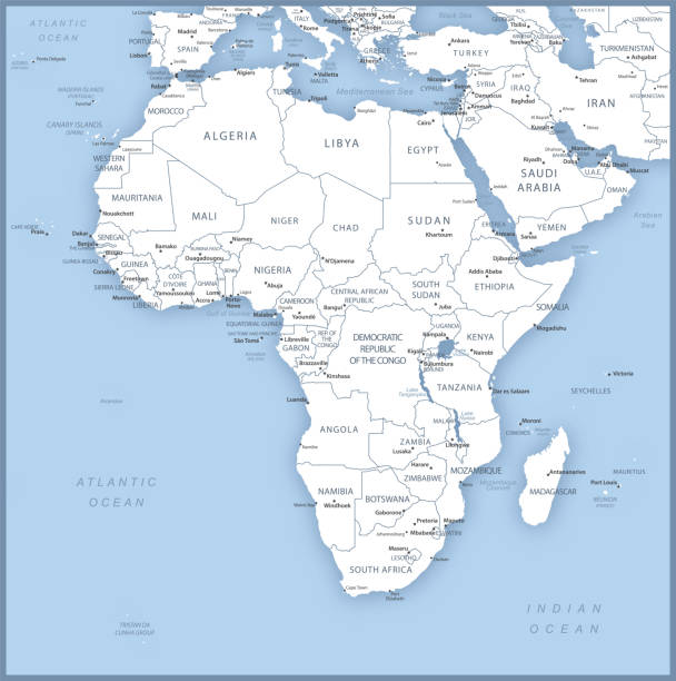
Congo Democratic Republic Political Map with capital Kinshasa, national borders, most important cities, rivers and lakes. Illustration with English labeling and scaling.
http://dikobraz.org/map_2.jpg

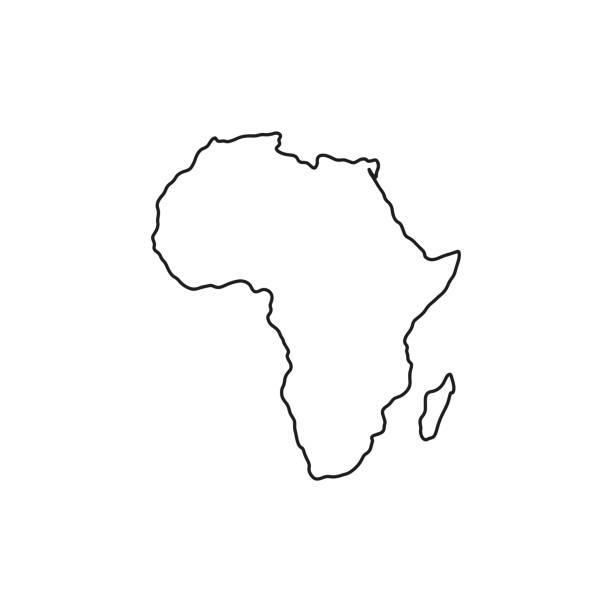
Africa map vector outline illustration with countries borders in blue background. Highly detailed accurate map of African continent prepared by a map expert.

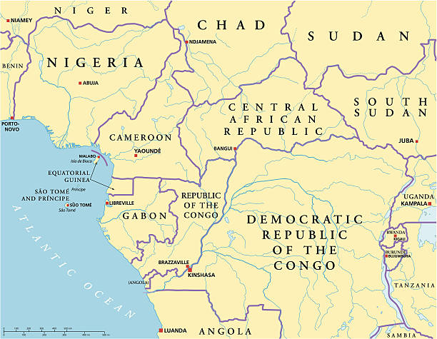
Central Africa region, political map. Area with capitals, borders, lakes and important rivers. Core region of the African continent, also called Middle Africa. English labeling. Illustration. Vector.


Vector illustration of the map of Congo


Congo, The Democratic Republic Of The high resolution map with national flag. Flag of the country overlaid on detailed outline map isolated on white background.
Vector map with contour.

Republic of the Congo - country map and flag located on globe, world map. 3D Vector illustration


Illustration from 19th century
West Central Africa Political Map with capitals, national borders, rivers and lakes. Illustration with English labeling and scaling
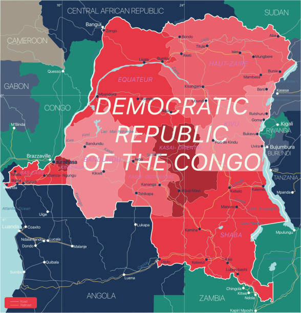
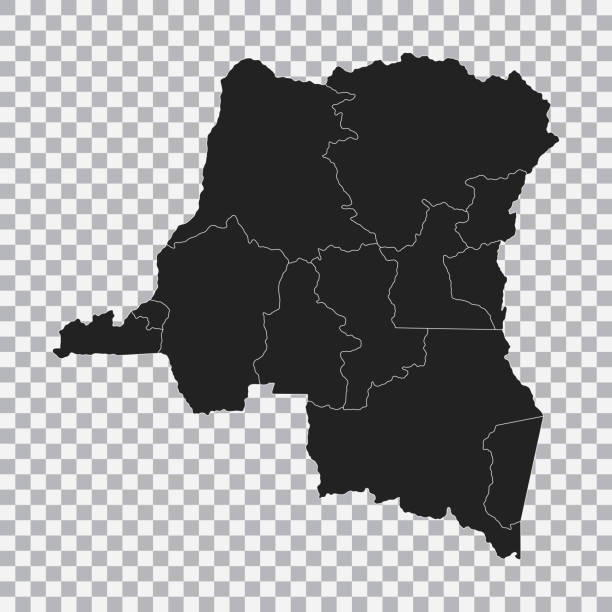
Democratic Republic of Congo country detailed editable map with regions cities and towns, roads and railways, geographic sites. Vector EPS-10 file
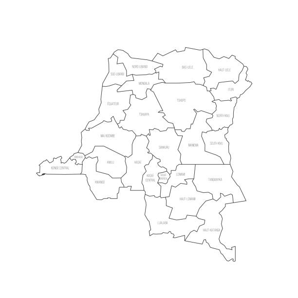
Democratic Republic of the Congo political map of administrative divisions - provinces. Thin black outline map with division name labels.

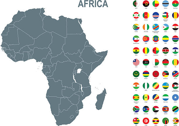
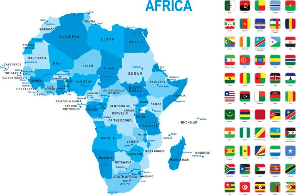
Map of African Continent with names of countries, capitals and cities. Vector illustration


Map of Republic of the Congo in vintage style. Beautiful illustration of antique map on an old textured paper of sepia color. Old realistic parchment with a compass rose, lines indicating the different directions (North, South, East, West) and a frame used as scale of measurement.Vector Illustration (EPS10, well layered and grouped). Easy to edit, manipulate, resize or colorize. Please do not hesitate to contact me if you have any questions, or need to customise the illustration. http://www.istockphoto.com/portfolio/bgblue

Map of Republic of the Congo for your own design. With space for your text and your background. Four maps included in the bundle: - One black map. - One blank map with only a thin black outline (in a line art style). - One mosaic map. - One white map with a thin black outline. The 4 maps are isolated on a blank background (for easy change background or texture).The layers are named to facilitate your customization. Vector Illustration (EPS10, well layered and grouped). Easy to edit, manipulate, resize or colorize.

Central Africa vector map with flags


vector illustration of Congo map and flag


DR Congo region map: colorful with white outline. Detailed map of DR Congo regions. Vector illustration.
Blue map of Africa with flag against white background. The url of the reference to political map is: http://www.lib.utexas.edu/maps/world_maps/united_states_foreign_service_posts-september_2011.pdf

Africa Map - Vintage Detailed Vector Illustration

Africa map - green hue colored on dark background. High detailed political map of african continent with country, capital, ocean and sea names labeling.


http://dikobraz.org/map_2.jpg


Vector illustration set with simplified maps of all fully recognised african states. Black silhouettes, white background.

Vintage illustration of Map of the Emin Pasha Relief Expedition, 1886 to 1889 was one of the last major European expeditions into the interior of Africa in the nineteenth century, ostensibly to the relief of Emin Pasha, General Charles Gordon's besieged governor of Equatoria, threatened by Mahdist forces. The expedition was led by Henry Morton Stanley

Illustration of a Congo map ,central Africa from 1895

Political Map of Africa. Vector Illustration. Map with Name of Countries Isolated on White.


Democratic Republic of the Congo and Hamerkop http://legacy.lib.utexas.edu/maps/world_maps/world_physical_2015.pdf

Republic of the Congo detailed map with regions and cities of the country. Vector illustration

Part of Central Africa, a subregion of the African continent, political map, with capitals, borders and largest cities. Gabon, the Republic of the Congo, Sao Tome and Principe, and Equatorial Guinea.


http://dikobraz.org/map_2.jpg

Congolese flag map pin pointer layout. Vector illustration.

africa map background isolated on background. Vector

Africa map. High detailed political map of african continent with country, capital, ocean and sea names labeling.

Blue-green detailed map of Rwanda administrative divisions with country flag and location on the globe. Vector illustration


Southern Africa map - green hue colored on dark background. High detailed political map of southern african region with country, capital, ocean and sea names labeling.

Vector Africa map. Generative growth structure in form of continent. Organic texture with geographic silhouettes

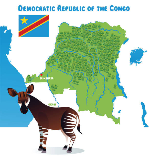
Democratic Republic of the Congo and Okapi http://legacy.lib.utexas.edu/maps/world_maps/world_physical_2015.pdf
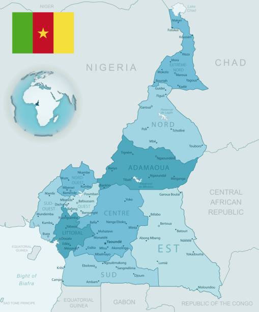
Blue-green detailed map of Cameroon administrative divisions with country flag and location on the globe. Vector illustration

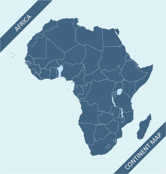
Vector isolated illustration with African continent with borders and names of all states. Political map. White background and outline, blue shapes

Map of Central part of Africa. Handdrawn doodle style. Vector illustration.

Meyers Konversations-Lexikon. Ein Nachschlagewerk des allgemeinen Wissens, 5th edition 17 volumes Bibliographisches Institut - Leipzig 1895-1897
Next