Caspian Sea Drawings Pictures, Images and Stock Photos
Browse 110+ caspian sea drawings stock photos and images available, or start a new search to explore more stock photos and images.
Most popular
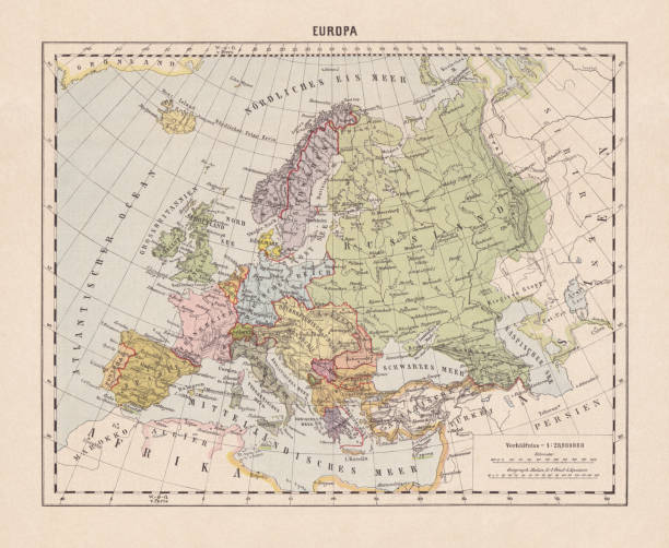
Political map of Europe. Descriptions in German. Lithograph, published in 1893.
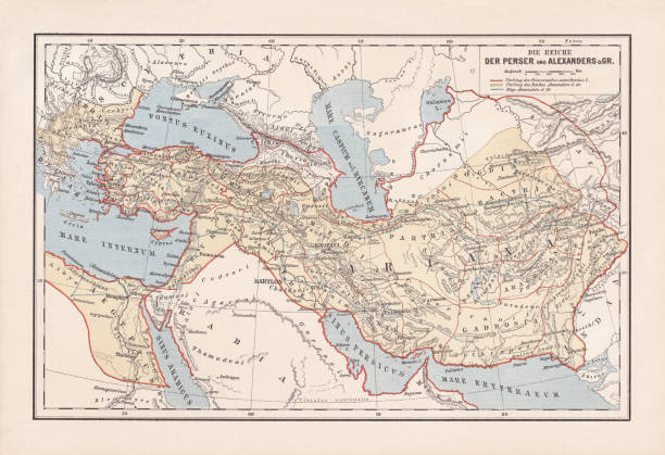
Map of the Persian Empire and Empire of Alexander the Great. Lithograph, published in 1893.


The beluga also known as the beluga sturgeon or great sturgeon ( Huso huso ) is a species of anadromous fish in the sturgeon family ( Acipenseridae ) of order Acipenseriformes. It is found primarily in the Caspian and Black Sea basins, and formerly in the Adriatic Sea. Original edition from my own archives Source : Tour du monde 1867 Drawing : Movnet - J. Ettlino

Bony fish (Osteichthyes, Actinopterygii and Tetraodontiformes): a) Lumpfish (Cyclopterus lumpu); b) Angler (Lophius piscatorius); c) European sea sturgeon (Acipenser sturio); d) Beluga sturgeon (Huso huso); e) Sterlet (Acipenser ruthenus); f) Boxfish (Ostracion cornutus); g) Spot-fin porcupinefish (Diodon hystrix); h) Stellate puffer (Arothron stellatus). Chromolithograph, published in 1882.

World map according to Eratosthenes - Scanned 1899 Engraving

Flag of Turkmenistan. Vector illustration on white background. Beautiful brush strokes. Abstract concept. Elements for design.

World Geography Map of Middle East


Modern office building in Baku Azerbaijan


Sturgeons of the Caspian Sea - Scanned 1897 Engraving

Vintage illustration Western Terminus of Trans-Caspian railway, Ouzoun Ada on the Caspian Sea, Russia, 19th Century, 1880s


Steel engraving of Sterlet ( Acipenser Ruthenus )

Golestan Province (Provinces of Iran, Islamic Republic of Iran, Persia) map vector illustration, scribble sketch Golestan map

Gilan Province (Provinces of Iran, Islamic Republic of Iran, Persia) map vector illustration, scribble sketch Guilan Province map


Zanjan Province (Provinces of Iran, Islamic Republic of Iran, Persia) map vector illustration, scribble sketch Zanjan map

Yazd Province (Provinces of Iran, Islamic Republic of Iran, Persia) map vector illustration, scribble sketch Yazd map

Tehran Province (Provinces of Iran, Islamic Republic of Iran, Persia) map vector illustration, scribble sketch Tehran map

Tehran Province (Provinces of Iran, Islamic Republic of Iran, Persia) map vector illustration, scribble sketch Tehran map

Historical view of Baku - capital and largest city of Azerbaijan. Wood engraving after a photograph, published in 1897.

Baku White City Office Building. Baku White City is one of the modern world's largest projects and is built on land of former industrial area.

Baku White City Office Building. Baku White City is one of the modern world's largest projects and is built on land of former industrial area.

Baku White City Office Building. Baku White City is one of the modern world's largest projects and is built on land of former industrial area.


Kermanshah Province (Provinces of Iran, Islamic Republic of Iran, Persia) map vector illustration, scribble sketch Kermanshah map

Kurdistan Province (Provinces of Iran, Islamic Republic of Iran, Persia) map vector illustration, scribble sketch Kurdistan map
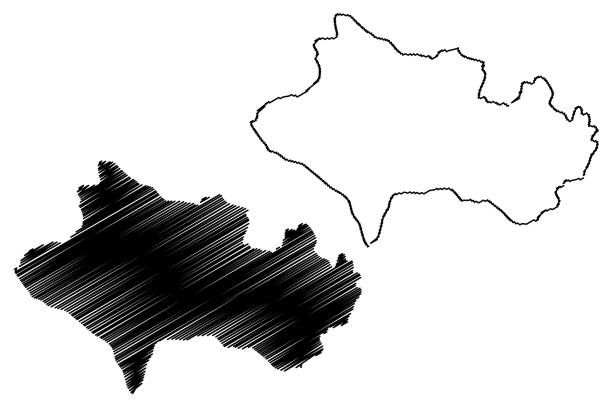
Khuzestan Province (Provinces of Iran, Islamic Republic of Iran, Persia) map vector illustration, scribble sketch Khuzestan map

Mazandaran Province (Provinces of Iran, Islamic Republic of Iran, Persia) map vector illustration, scribble sketch Mazandaran map

North Khorasan Province (Provinces of Iran, Islamic Republic of Iran, Persia) map vector illustration, scribble sketch North Khorasan map

Markazi Province (Provinces of Iran, Islamic Republic of Iran, Persia) map vector illustration, scribble sketch Markazi map
Lorestan Province (Provinces of Iran, Islamic Republic of Iran, Persia) map vector illustration, scribble sketch Luristan (Lurestan,Loristan) map

Qazvin Province (Provinces of Iran, Islamic Republic of Iran, Persia) map vector illustration, scribble sketch Qazvin map

Qom Province (Provinces of Iran, Islamic Republic of Iran, Persia) map vector illustration, scribble sketch Qom map

Hamadan Province (Provinces of Iran, Islamic Republic of Iran, Persia) map vector illustration, scribble sketch Hamadan map

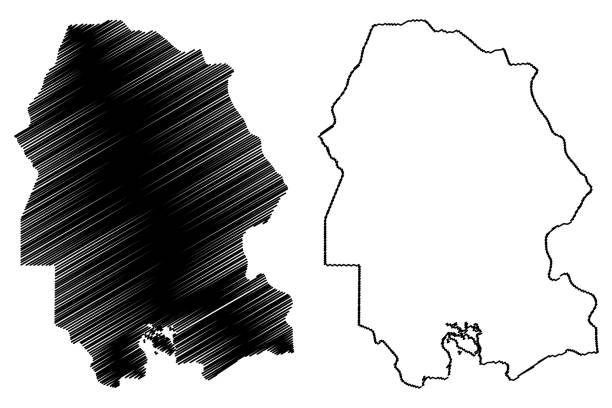
Kohgiluyeh and Boyer-Ahmad Province (Provinces of Iran, Islamic Republic of Iran, Persia) map vector illustration, scribble sketch Kohgiluyeh and Boyer-Ahmad map

Two maps, one of the distribution of nations after ‘the Deluge’ (the great flood) with the destinations of descendants of Noah and his three sons: the second map shows the distribution of the sons of Canaan and their descendants. From “The Bible Atlas to Illustrate the Old and New Testaments”, published in 1877 by W. & A.K. Johnston Ltd, Edinburgh and London.


Tajikistan map vector illustration, scribble sketch Tadjikistan

Tajikistan map vector illustration, scribble sketch Tadjikistan

Illustration from 19th century


Сonstruction of houses in the French style at Baku White City. It is one of the modern world's largest projects and is built on land of former industrial area.

Сonstruction of houses in the French style at Baku White City. It is one of the modern world's largest projects and is built on land of former industrial area.


Tajikistan map vector illustration, scribble sketch Tadjikistan


View of Baku White City Building. Baku White City is one of the modern world's largest projects and is built on land of former industrial area. Azerbaijan

Azerbaijan 3D map. Stylized neon digital isometric striped vector map of Azerbaijan is in violet and pink colors on black background


Yazd Province (Provinces of Iran, Islamic Republic of Iran, Persia) map vector illustration, scribble sketch Yazd map

Gilan Province (Provinces of Iran, Islamic Republic of Iran, Persia) map vector illustration, scribble sketch Guilan Province map

Yazd Province (Provinces of Iran, Islamic Republic of Iran, Persia) map vector illustration, scribble sketch Yazd map

Lorestan Province (Provinces of Iran, Islamic Republic of Iran, Persia) map vector illustration, scribble sketch Luristan (Lurestan,Loristan) map

Kohgiluyeh and Boyer-Ahmad Province (Provinces of Iran, Islamic Republic of Iran, Persia) map vector illustration, scribble sketch Kohgiluyeh and Boyer-Ahmad map

North Khorasan Province (Provinces of Iran, Islamic Republic of Iran, Persia) map vector illustration, scribble sketch North Khorasan map

Semnan Province (Provinces of Iran, Islamic Republic of Iran, Persia) map vector illustration, scribble sketch Semnan map
Next