
Chula Vista San Diego Pictures, Images and Stock Photos
Browse 240+ chula vista san diego stock photos and images available, or start a new search to explore more stock photos and images.
Most popular
Sunrise over Otay Lakes in Chula Vista, CA. HDR image taken with graduated filters, and with the camera mounted on a tripod.

Aerial view of little park in front of Otay Lake City Reservoir with blue sky and mountain on the background, Chula Vista, California. USA
Chula Vista is the second-largest city in the San Diego metropolitan area, the seventh largest city in Southern California, the fifteenth largest city in the state of California

Houses, roofs and the mountain, Chula Vista, California, USA. High quality photo

Chula Vista is the second largest city in the San Diego metropolitan area, the seventh largest city in Southern California, the fourteenth largest city in the state of California
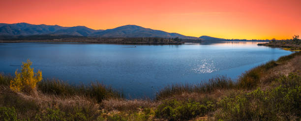
Southern California Nature Winter Landscape Series, tranquil sunset scenery of mountain wilderness and open space preserve at Lower Otay Lake in Chula Vista, USA

Chula Vista is the second largest city in the San Diego metropolitan area, the seventh largest city in Southern California, the fourteenth largest city in the state of California

Chula Vista is the second-largest city in the San Diego metropolitan area, the seventh largest city in Southern California, the fifteenth largest city in the state of California
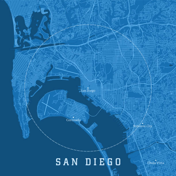
San Diego CA City Vector Road Map Blue Text. All source data is in the public domain. U.S. Census Bureau Census Tiger. Used Layers: areawater, linearwater, roads.

Chula Vista is the second largest city in the San Diego metropolitan area, the seventh largest city in Southern California

Chula Vista is the second largest city in the San Diego metropolitan area, the seventh largest city in Southern California, the fourteenth largest city in the state of California

Macro shot of stick pin on map of San Diego, California USA. Other towns, including Tijuana, Mexico are also visible. Travel and vacation destination.
Set of icons. Cities of the USA flags.

Chula Vista is the second largest city in the San Diego metropolitan area, the seventh largest city in Southern California, the fourteenth largest city in the state of California

Chula Vista CA City Vector Road Map Blue Text. All source data is in the public domain. U.S. Census Bureau Census Tiger. Used Layers: areawater, linearwater, roads.

Seasonal and permanent duck and geese populations call Eastlake home. Chula Vista, California.


Southern California Nature Winter Landscape Series, two bold eagles sitting on the tree at Lower Otay Lake in Chula Vista, USA

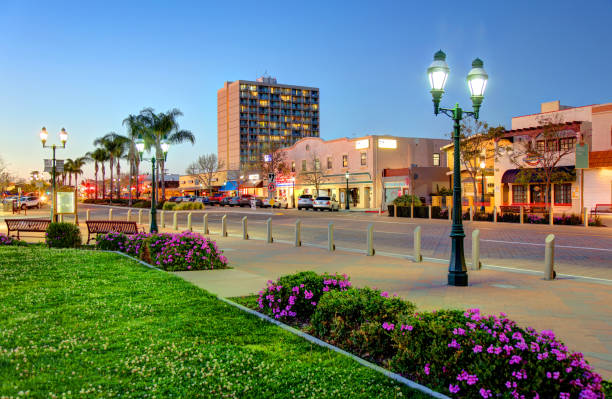
Chula Vista, California, USA - March 17, 2019: Daytime view of shops and restaurants along Third Ave in the heart of the downtown district

San Diego County, California (Counties in California, United States of America,USA, U.S., US) map vector illustration, scribble sketch San Diego map
Highly detailed map of California state of United States of America for web banner, mobile app, and educational use. The map is accurately prepared by a map expert.


Southern California Nature Autumn Landscape Series, Sweetwater River Bridge, built in 1929, at San Diego National Wildlife Refuge in Jamul, USA

Southern California Nature Autumn Landscape Series, Sweetwater River Bridge, built in 1929, at San Diego National Wildlife Refuge in Jamul, USA

3D Render of a Topographic Map of Chula Vista, California, USA. All source data is in the public domain. Contains modified Copernicus Sentinel data (Jul 2019) courtesy of ESA. URL of source image: https://scihub.copernicus.eu/dhus/#/home. Relief texture SRTM data courtesy of NASA. URL of source image: https://search.earthdata.nasa.gov/search/granules/collection-details?p=C1000000240-LPDAAC_ECS&q=srtm%201%20arc&ok=srtm%201%20arc
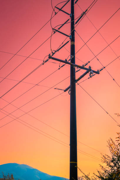
Power poles and lines, or electricity pylons and cables at sunset, abstract geometry of the shapes and lines against a moody sunset sky in San Diego National Wildlife Refuge in Jamul, Southern California, USA

View from Point Lomas. Coronado Island, and in the far distance, the Mexico Border in Chula Vista and Otay Mesa.

San Diego County, California (Counties in California, United States of America,USA, U.S., US) map vector illustration, scribble sketch San Diego map

Eastlake is a community in Chula Vista, California.

Houses, roofs and the mountain, Chula Vista, California, USA. High quality photo


3D Illustration of a waving flag of Chula Vista

White Pelicans winter on Eastlake in Chula Vista, California.

Mountain range, trees, marsh grass, and lake at Otay Lakes County Park in Chula Vista, California.

Stamp or label with text Chula Vista, California written inside, vector illustration

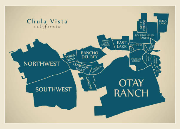
Vector Illustration of a City Street Map of Chula Vista, California, USA. Scale 1:60,000. All source data is in the public domain. U.S. Geological Survey, US Topo Used Layers: USGS The National Map: National Hydrography Dataset (NHD) USGS The National Map: National Transportation Dataset (NTD)

Aerial view of little park in front of Otay Lake City Reservoir with blue sky and mountain on the background, Chula Vista, California. USA

Chula Vista, USA- June 9, 2012: A young girl swings at a large pinata while the rest of the party watches. In the background other kids are playing on the playground at Mountain Hawk Park in Chula Vista, California, USA. Mountain Hawk Park is a public park.

Aerial view of Otay Lake Reservoir with blue sky and mountain on the background, Chula Vista, California. USA

Southern California Nature Winter Landscape Series, tranquil scenery of mountain wilderness and open space preserve at Lower Otay Lake in Chula Vista, USA


Eastlake is a community in Chula Vista, California.

Aerial view of Otay Lake Reservoir with blue sky and mountain on the background, Chula Vista, California. USA

Seasonal and permanent duck and geese populations call Eastlake home. Chula Vista, California.

Otay Lakes shot in Infrared. Otay Lakes is located in Chula Vista, CA.


Southern California Nature Winter Landscape Series, tranquil scenery of mountain wilderness and open space preserve at Lower Otay Lake in Chula Vista, USA

Sweetwater River, National City

Chula Vista city (United States of America, USA, U.S., US, United States cities, usa city)- map is designed cannabis leaf green, City of Chula Vista map made of marijuana (marihuana,THC) foliage,


Mother Miguel Mountain stands next to its taller counterpart, Mount San Miguel (aka San Miguel Mountain) in San Diego County, California.

White signboard with an arrow pointing left towards Chula Vista, California, USA, against a hazy blue sky in a concept of travel, navigation and direction. Path included for the signboard

The Bird of Paradise Flower appears in October and November in Southern California.

Seasonal and permanent duck and geese populations call Eastlake home. Chula Vista, California.


Aerial view of little park in front of Otay Lake City Reservoir with blue sky and mountain on the background, Chula Vista, California. USA

Ducks in a lake with marsh grass, and a background of trees and a mountain range at Otay Lakes County Park in Chula Vista, California.

Next