Dnieper Water Pictures, Images and Stock Photos
Browse 15,900+ dnieper water stock photos and images available, or start a new search to explore more stock photos and images.
Most popular
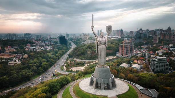
"Motherland" is a monumental sculpture in Kiev on the right bank of the Dnieper. Located on the territory of the Museum of the History of Ukraine in World War II
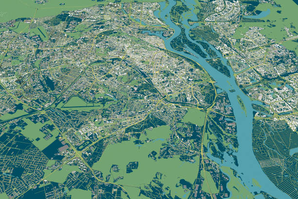
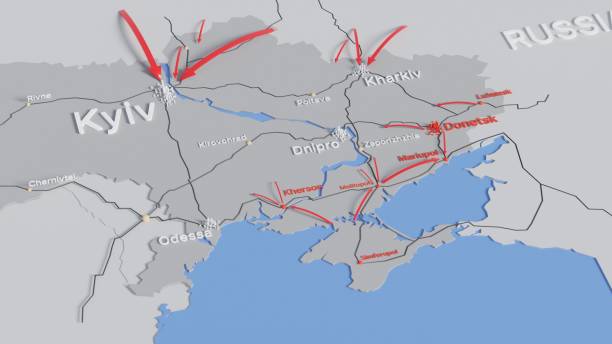
Map of the capital of Ukraine, Kiev. Buildings and city center. Aerial view. Roads and communication routes. 3d rendering. Access points to the city
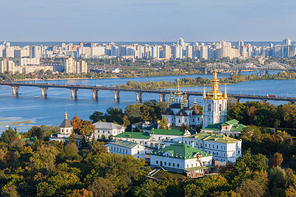
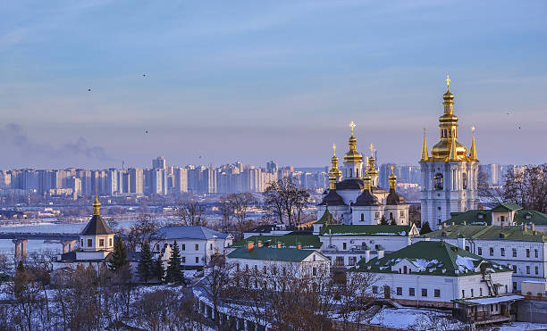
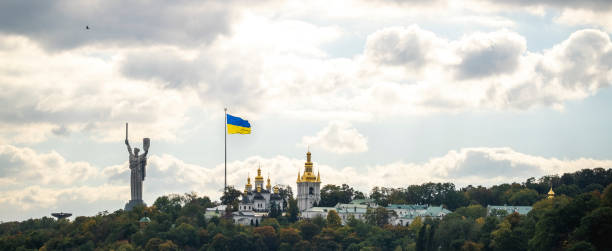
View of Kiev Pechersk Lavra, city and Dnepr river. Kiev, Ukraine.
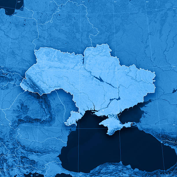
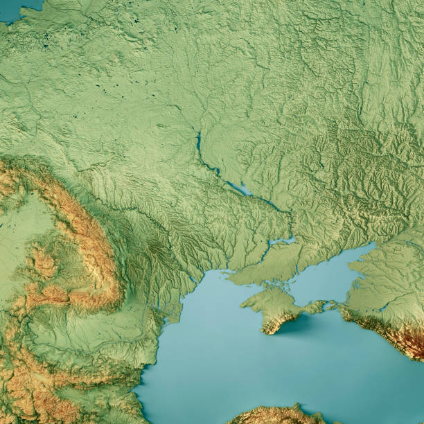
"3D render and image composing: Topographic Map of Ukraine. Including country borders, rivers and accurate longitude/latitude lines. High resolution available! High quality relief structure!Relief texture and satellite images courtesy of NASA. Further data source courtesy of CIA World Data Bank II database.Note: This image is perfectly congruent to the image"
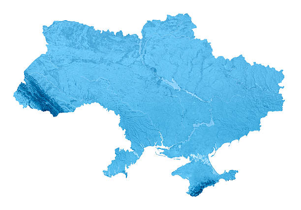
3D render and image composing: Topographic Map of Ukraine. Isolated on White. High quality relief structure!

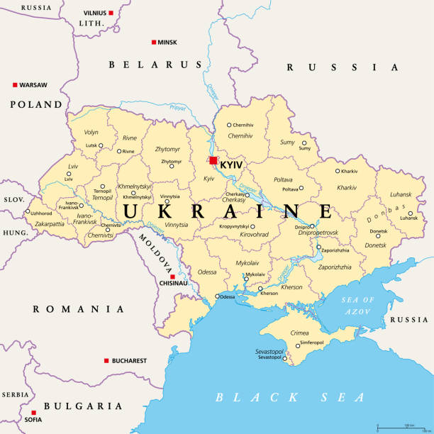
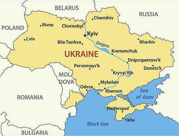
Ukraine political map with capital Kiev, national borders, important cities, rivers and lakes. English labeling and scaling. Illustration.
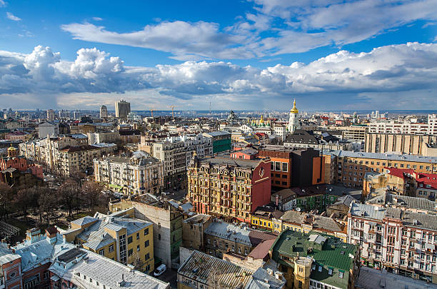
Cityscape Kiev city day view, panorama Kiev, Ukraine
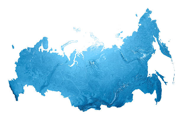
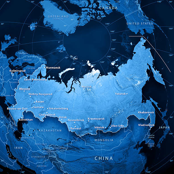
3D render and image composing: Topographic Map of the Russian Federation (Russia). Isolated on White. Very high resolution available! High quality relief structure!
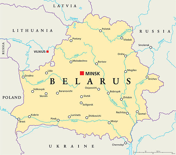
Belarus Political Map with capital Minsk, national borders, important cities, rivers and lakes. English labeling and scaling. Illustration.
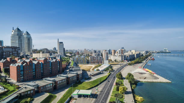
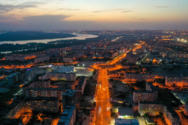
Aerial view on the modern and well-groomed Ukrainian city of Dnieper (Dnipropetrovsk) located on the bank of the big river.

parked cars in the snow in the morning after a blizzard, the driver cleans the snow from his car, Ukraine Dnipro
Panoramic view of Kiev Pechersk Lavra Monastery in winter. The Dnieper River, Church of the Nativity of the Virgin Mary, Bell tower at the Far Caves. Ukrainian baroque, 18th century
Ukraine, administrative divisions, political map. Country and unitary state in Eastern Europe with capital Kyiv, also called Kiev. Country subdivision with administrative centers. Illustration. Vector
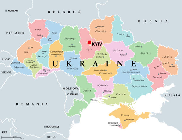
Ukraine, country subdivision, colored political map. Administrative divisions of Ukraine, with administrative centers, a unitary state in Eastern Europe with capital Kyiv (Kiev). Illustration. Vector.
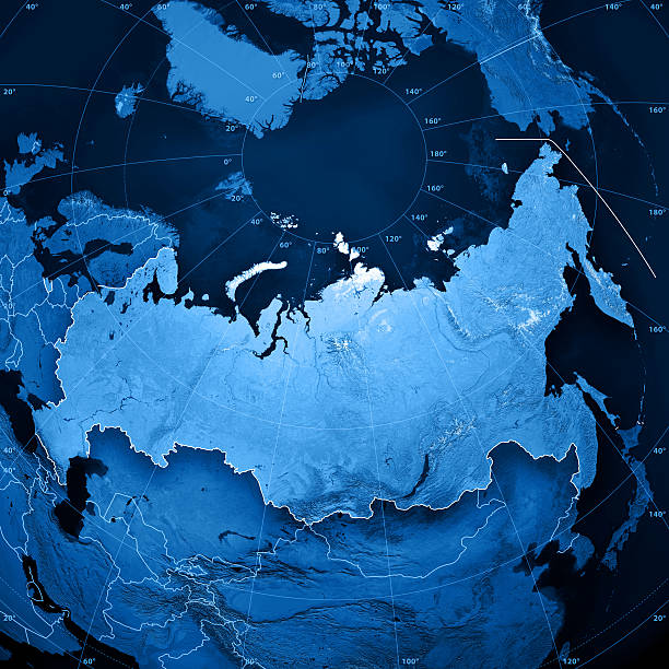
3D render and image composing: Topographic Map of the Russian Federation (Russia). Including country borders, rivers and accurate longitude/latitude lines. Very high resolution available! High quality relief structure!
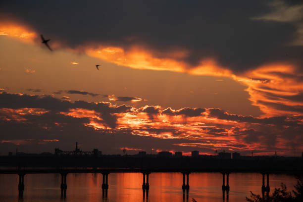
Sunset on the Dnieper River across the bridge in Ukraine in the city of Dnepr during the war, evening sunset in the city

Administrative, political and road vector map of the Ukrainian capital Kiev

Kyiv, Ukraine 07.11.2020. Independence Monument on the Maidan Nazalezhnosti in Kyiv, Ukraine, on a sunny summer morning

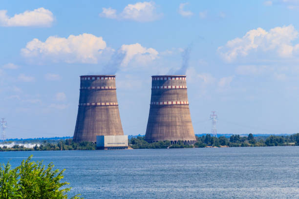
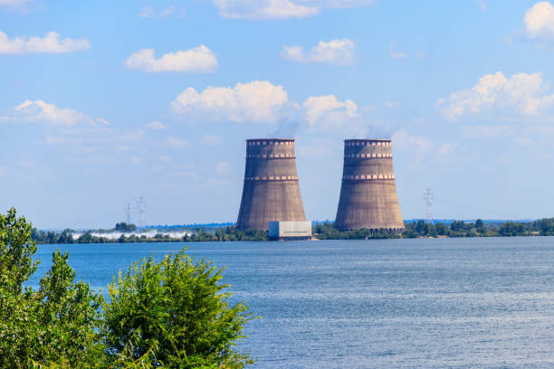
Cooling towers of Zaporizhia Nuclear Power Station in Enerhodar, Ukraine

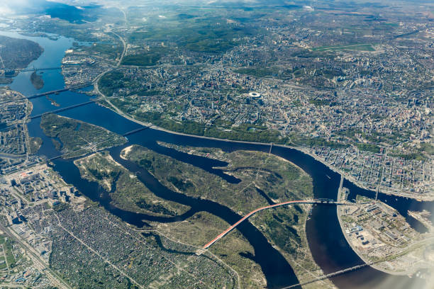
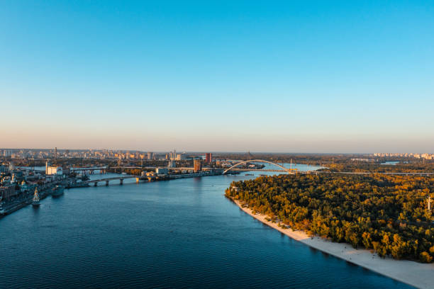
Aerial view on the terrain of Dnieper river and Kiev.
3D Render of a Topographic Map of Ukraine. All source data is in the public domain. Color texture: Made with Natural Earth. http://www.naturalearthdata.com/downloads/10m-raster-data/10m-cross-blend-hypso/ Relief texture: SRTM data courtesy of NASA JPL (2020). URL of source image: https://e4ftl01.cr.usgs.gov//DP133/SRTM/SRTMGL3.003/2000.02.11 Water texture: SRTM Water Body SWDB: https://dds.cr.usgs.gov/srtm/version2_1/SWBD/ Boundaries Level 0: Humanitarian Information Unit HIU, U.S. Department of State (database: LSIB) http://geonode.state.gov/layers/geonode%3ALSIB7a_Gen

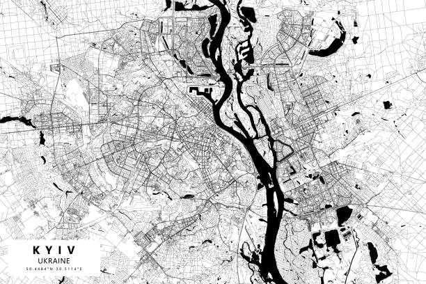
Topographic / Road map of Kyiv, Ukraine. Map data is open data via openstreetmap contributors. All maps are layered and easy to edit. Roads are editable stroke.
3D render and image composing: Topographic Map of the Russian Federation. Including important cities, country borders, rivers and accurate longitude/latitude lines. High resolution available! High quality relief structure! This is the improved version of the deactivated file #14662296.
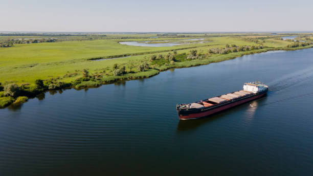
Grain carrier in the sea goes along the Dnieper. Delivery of wheat worldwide. Ship logistics during the war in Ukraine. Turkish corridor in Ukraine for the import of grain
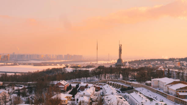
Kyiv Motherland Monument and Pechersk Lavra, 6.10.2021
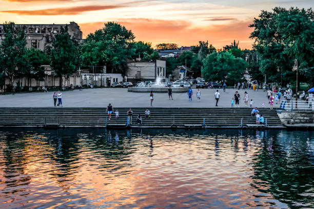
Kherson, Ukraine - July 22, 2020: View from the Dnieper River to the Kherson embankment at twilight (Ukraine). Many people-tourists walk along the promenade in the Ukrainian town in the evening
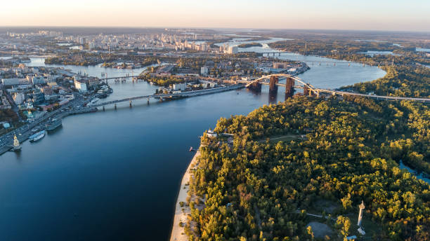
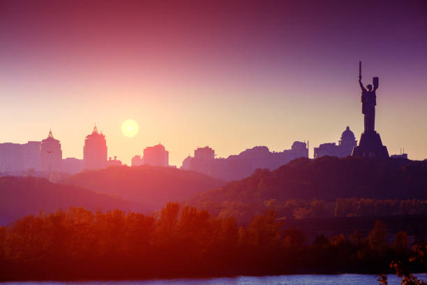
View of Motherland Monument and the Dnieper river in Kiev, Ukraine. Kiev cityscape
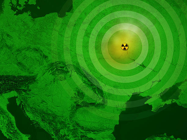
3D render and image composing: Topographic Map of Ukraine with focus on the nuclear disaster at Chernobyl. A radioactive sign marks the place of the Chernobyl Nuclear Power Plant disaster on April 26, 1986.
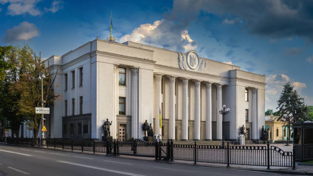
Kyiv, Ukraine 07.11.2020. Supreme Council of Ukraine or Verkhovna Rada in Kyiv, Ukraine, on a sunny summer morning

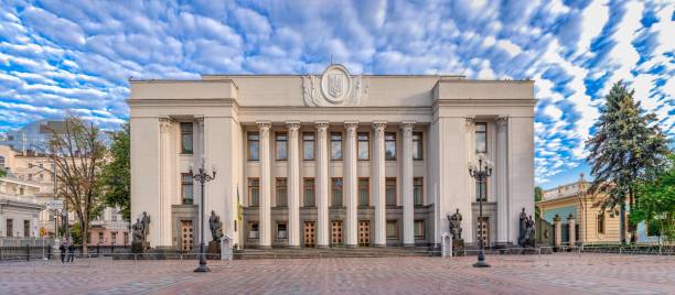
Supreme Council of Ukraine in Kyiv, Ukraine in Ukraine, Kyiv region, Kyiv

KIEV, UKRAINE - JANUARY 10, 2018: Kiev metro station Dnipro. Subway train against sky. People going to work in the subway
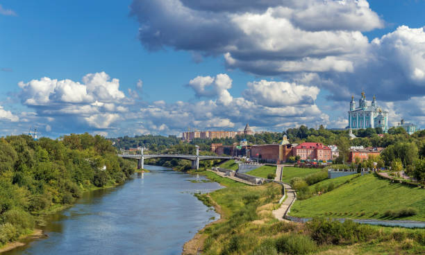
View of Smolensk with Dormition Cathedral from Dnieper river, Russia

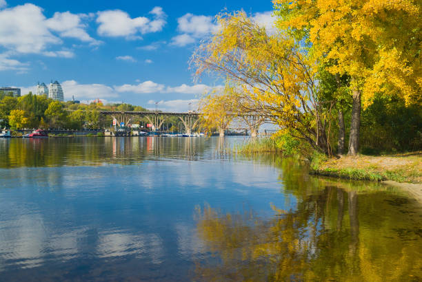
Fall comes to Dnepr river in Dnepropetrovsk city, Ukraine.

Photo of the flooded shore after the dam at the Kakhovskaya HPP was blown up
Poster Style Topographic / Road map of Kyiv, Ukraine. Map data is open data via openstreetmap contributors. All maps are layered and easy to edit. Roads are editable stroke.

View to Kyiv Podil district from above at sunrise.

Kherson, Ukraine - July 22, 2020: A man has fun on a personal watercraft in the Dnieper River off the coast of Kherson. An adult on a Jet Ski leaves a trail of white foam on blue water
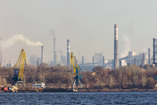
View of the industrial city of Zaporozhye, Ukraine. Smog emissions from chimneys, air pollution. Poor environmental situation. Metallurgical factories and cargo port.
map of Ukraine - vector illustration. Eps 8.

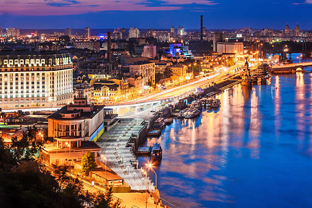
Picturesque evening landscape of the Postal Square, the river station and the Dnieper River in the capital of Ukraine, the city of Kyiv. Skyline of Podil and Obolon at night in Kiev.
Scenic summer evening aerial view of Dnieper river pier and port in Kyiv, Ukraine. See also:

Paton bridge over the river Dnieper, Mother Motherland monument in Kiev, Ukraine

Kyiv, Ukraine - August 12, 2018: Ukrainian park in downtown city Kiev in summer with closeup of colorful carousel roundabout merry-go-round

Urban city map of Kyiv Kiev. Vector illustration, Kyiv Kiev map grayscale art poster. Street map image with roads, metropolitan city area view.
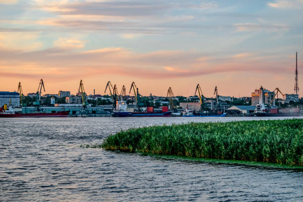
Evening view of the Kherson port from the Dnieper river (Ukraine). Islet of reeds in the water against the background of the coastline with cargo port cranes

Picturesque agricultural landscape. Shining new building of a modern granary and a barge for transporting grain on the banks of the Dnieper River, Ukraine. Agriculture in Eastern Europe

Panorama Assumption Cathedral, Refectory Church, Dnieper and left bank of the city from the Great bell tower of the Lavra. Kyiv-Pechersk Lavra, Ukraine.


Left-bank part of the railroad bridge made of steel trusses and stone supports across river. Podilskyi Railroad Bridge across Dnieper River, Kyiv, Ukraine
Next