Eysturoy Pictures, Images and Stock Photos
Browse 2,100+ eysturoy stock photos and images available, or start a new search to explore more stock photos and images.
Most popular
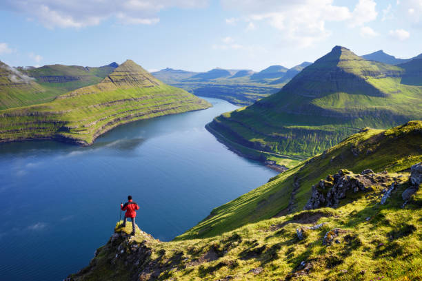
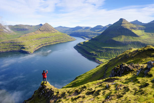
View on Funningur fjord from the Funningur top. Eysturoy Island, Faroe islands. Tourist in a red jacket explores natural attractions. Summer mountain landscape
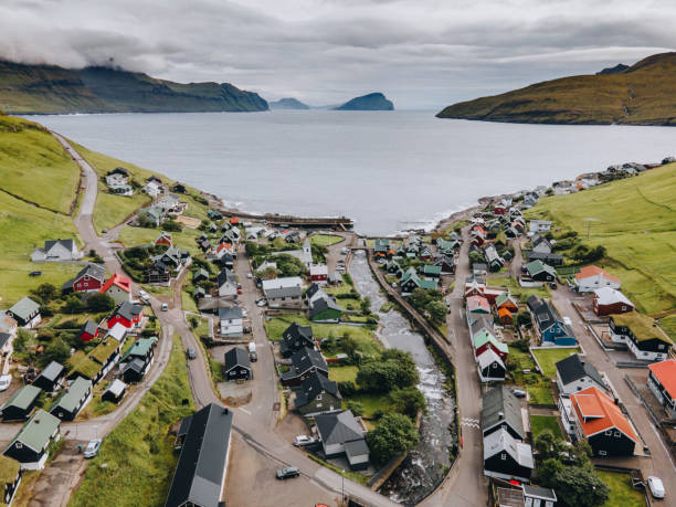
Gjógv, Eysturoy, Faroe Islands - March 20, 2022; Gjógv is the most northern village on the island of Eysturoy, named after a 200-metre long sea-filled gorge that runs from the village into the ocean. With less than 50 inhabitants, all living in old timber-walled and turf-roofed cottages, Gjógv has an abundance of charm and appeal. The village includes a charming teashop, a guesthouse (Gjáargarður) and a campsite, and is located approximately a one-hour drive from Tórshavn.

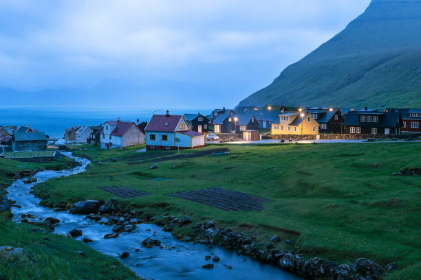
Reflections of colourful houses and boats in the water of a bay, dusk time, Leirvik, Eysturoy Island, Faroe Islands
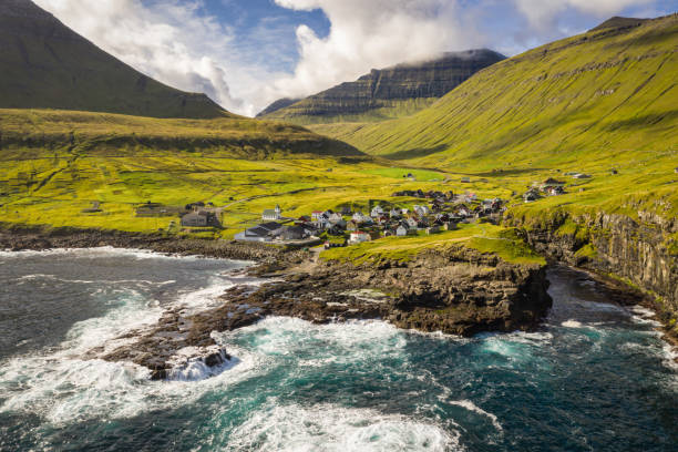
Gjógv is a village located on the northeast tip of the island of Eysturoy, in the Faroe Islands and 63 km north by road from the capital of Tórshavn.

Aerial view of an open water aquaculture salmon fishfarm outside of Haldorsvik in the bay between Streymoy and Eysturoy on Faroe Islands

Hiker in red jacket from the top of a rock takes photos at the Funningur fjord during the sunrise, Eysturoy island, Faroe islands,Denmark, Europe
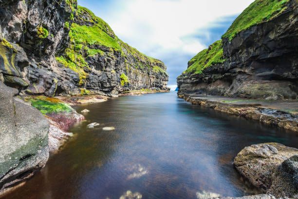
The nature of the Faroe Islands in the north Atlantic

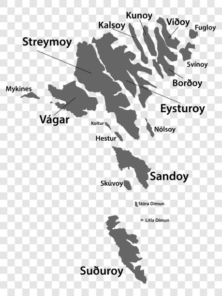
Faroe Islands political map with capital Torshavn and important cities. English labeling and scaling. Illustration.

Great view from the village of Saksun to the bay at high tide in the ocean. Faroe Islands. Northern Europe
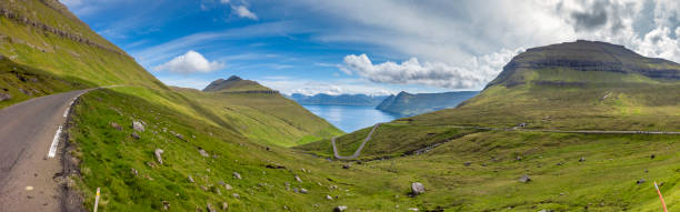
winding mountain roads at the fjords of eysturoy island, faroe islands.
Stunning view of Funningur fjord and of nearby mountains on Eysturoy Island, Faroe Islands
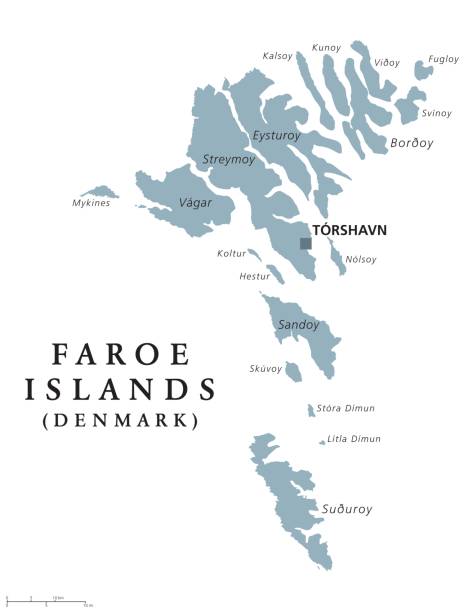
Faroe Islands political map with capital Torshavn, also the Faeroes. Autonomous country and part of the Kingdom of Denmark. Archipelago in North Atlantic. Gray illustration. English labeling. Vector.

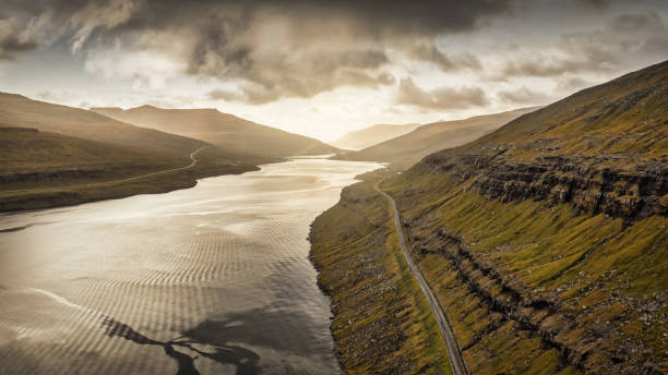
Lonely empty country road along Funningsfjordur Fjord in late summer, Aerial Drone Point of view along the rural national road on Funningsfjørður on Eysturoy Island in between green hills and North Atlantic Ocean Fjord Inlet. Funningsfjørður Fjord, Eysturoy Island, Faroe Islands, Kingdom of Denmark, Nordic Countries, Scandinavia, Europe.
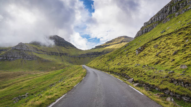
Open Country Mountain Road Panorama on Eysturoy Island of the Faroe Islands, Mountain Road from Funningur - Funnings Kommuna - up to Slættaratindur Mountain Range - highest Mountain of the Faroe Islands - under moody cloudscape on Eysturoy Island, Slættaratindur Mountain, Funningur, Eysturoy Island, Faroe Island, Denmark, Nordic Countries, Europe.

Cascada de Múlafossur e isla de Mykines

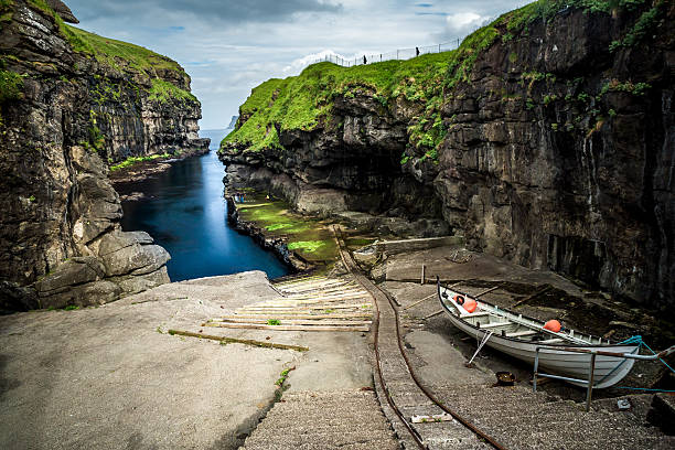
Beautiful view of dock or harbor with clear water and red seaweed in Gjogv village, Eysuroy island, Faroe Islands, Denmark. Landscape photography
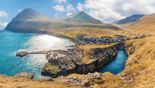
Faroe Islands drone flight view towards the rocky coastline of Gjogv Harbour under sunny summer sky on Eysturoy Island, View to the famous natural coastal Gjógv Harbor Rock Valley - Natural sharp cliff crack in the rocky coastline and Gjogv Village from the North Atlantic Ocean, Gjogv, Eysturoy Island, Faroe Island, Kingdom of Denmark, Nordic Countries, Europe.
Faroe Islands Aerial Panorama to the rocky coastline of Gjogv Harbour under moody sunny summer sky on Eysturoy Island, View to the famous natural coastal Gjógv Harbor Rock Valley - Natural sharp cliff crack in the rocky coastline and Gjogv Village from the North Atlantic Ocean, Gjogv, Eysturoy Island, Faroe Island, Denmark

Faroe Islands Gjógv Kirkja - Gjaar Church of Gjógv under sunny summer skyscape. View over the small village cemetery towards the Gjáar Kirkja - Evangelical Lutheran Church built in the year 1929. Gjogv, Minnisvarđin, Eysturoy Island, Faroe Island, Kingdom of Denmark, Nordic Countries, Europe.
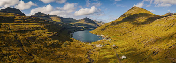
Panorama of Funningsfjordur Fjord and surrunding Funningsfjørður Mountain Range in summer under blue summer cloudscape with fluffy clouds. XXL Aerial Eysturoy Island - Faroe Islands Panorama. Funningsfjørður - Funningsfjordur Fjord, East Coast of Eysturoy Island, Faroe Islanda, Kingdom of Denmark, Nordic Countries, Europe.
Beautiful view of dock or harbor with natural black rock and green grass in Gjogv village with clear water deep into blue north Atlantic ocean, cloudy sky, Faroe Islands, hidden travel destination.
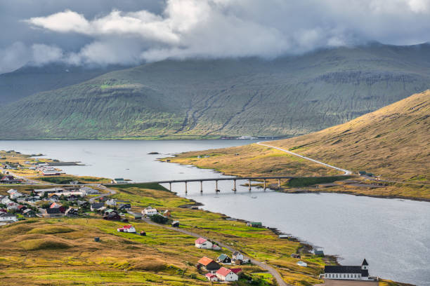
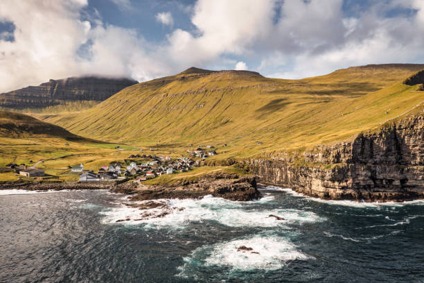
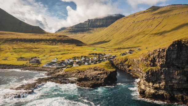
Bridge between Eysturoy Island and Streymoy Island. Oyrarbakki Village in Summer. Oyrarbakki is a village on the west coast of the Faroese island of Eysturoy in the Sunda municipality, between Norðskáli and Oyri. Oyrarbakki, Eysturoy Island - Streymoy Island, Faroe Islands, Kingdom of Denmark, Nordic Countries, Northern Europe.

Aerial Panorama of Aquaculture Fish Farm Salmon Breeding Nets and Fishing in front of natural Fjord of Eysturoy Island. Moody Dramatic Cloudscape over the North Atlantic Ocean Seascape. Panoramic Drone Point of View Shot. Eysturoy Island, Faroe Islands, Kingdom of Denmark, Nordic Countries - Scandinavia, Europe.
Streymoy and Eysturoy cliffs in sunset light, Faroe Islands
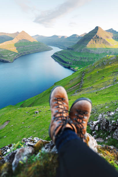
Boots of lonely tourist over majestic fjords of Funningur, Eysturoy island, Faroe Islands. Landscape photography


fishing village Tjornuvik on the Faroe Islands
Faroe Islands Kunoy Island empty coastal road along the grass covered fjord hills. Aerial Drone Point of View towards the cloud covered mountain peaks and North Atlantic Ocean horizon. Kunoy Island, Faroe Islands, Kingdom of Denmark, Nordic Countries, Europe
Panoramic high angle view of the small village Eiði located on the north-west tip of Eysturoy on a sunny cloudy day on Faroe Islands. Its name means isthmus in the Faroese language. The town has a population of 669 inhabitants. Eiði was settled by Vikings in the 9th century AD. In the center of the village there is a large stone church from 1881.

Faroe Islands Gjogv Village Natural Harbor Coastal Inlet on Eysturoy Island of Faroe Islands. Aerial drone point of view towards the rocky coastline of Gjogv Harbour under sunny summer sky with the famous natural coastal Gjógv Harbor Rock Valley - Natural sharp cliff crack - North Atlantic Ocean Inlet in the rocky coastline. Gjogv Town on top of the coast on the left., Gjogv, Eysturoy Island, Faroe Island, Denmark

Oyrarbakki village and the bridge connecting Eysturoy and Streymoy islands, Faroe Islands
Aerial drone photo flying over Tjornuvik beach on Streymoy island, Faroe Islands, Denmark. Landscape photography
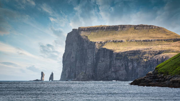
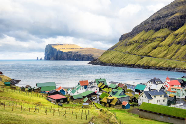
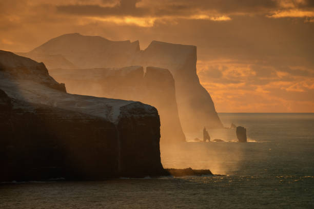
Risin og Kellingin Sea Stacks Panorama. Risin and Kellingin Seas Stack - in the North Atlantic Ocean under blue summer skyscape. Risin og Kellingin means 'The Giant and the Witch' and references to an old legend about the sea stack origins. Risin is the 71m high stack further from the coast (left), and the Kellingin is the 68m stack nearer land (middle). These numbers gives a relation how the dimensions how tall and gigantic the fjord cliff coast is (on the right). Northern Coast of the Island of Eysturoy close to the town of Eiði. Eysturoy Island, Faroe Islands, Kingdom of Denmark, Nordic Countries, Europe
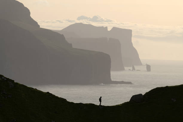
Man silhouette on background of famous Risin og Kellingin rocks and cliffs of Eysturoy and Streymoy Islands seen from Kalsoy Island. Faroe Islands, Denmark. Landscape photography

Panoramic image of the northern lights at the Faroe islands

Husavik village near the coast in Sandoy island, Faroe Islands
Moody Sunset Panorama Coastal Fjord Road between Streymoy Island and Eysturoy Island of the Faroe Islands. Aerial Drone Point of view Panorama over the North Atlantic Ocean Fjord Canal. Streymoy Island - Eysturoy Island, Haldarsvík, Faroe Islands, Kingdom of Denmark, Nordic Counties, Europe
night view of Gjogv village on Faroe Islands
Gjogv Natural Harbor Coastal Inlet on Eysturoy Island of Faroe Islands. Aerial view towards the rocky coastline of Gjogv Harbour under sunny summer sky with the famous natural coastal Gjógv Harbor Rock Valley - Natural sharp cliff crack - North Atlantic Ocean Inlet in the rocky coastline. Gjogv Town on top of the coast on the left., Gjogv, Eysturoy Island, Faroe Island, Denmark


Vista general de Eiđi en las Islas Feroe

Picturesque view on village of Gjogv with typically colourful houses on the Eysturoy island, Faroe Islands, Denmark. Landscape photography
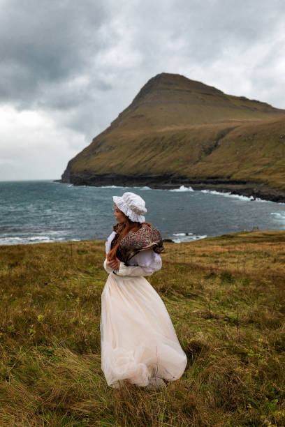
A young redhead woman stays on the grass field near Atlantic ocean coastline in old-fashioned clothes. Mountain range and dramatic clouds behind her. Village Gjov. Island Eysturoy, Faroe Islands.

A young red-haired woman dressed as an elf stays on the beach with black sand. Two sea stacks (Risin and Kellingin) behind her. Eysturoy, Faroe Islands, Denmark.
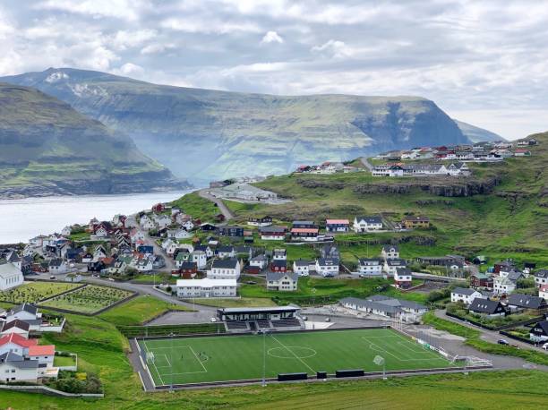
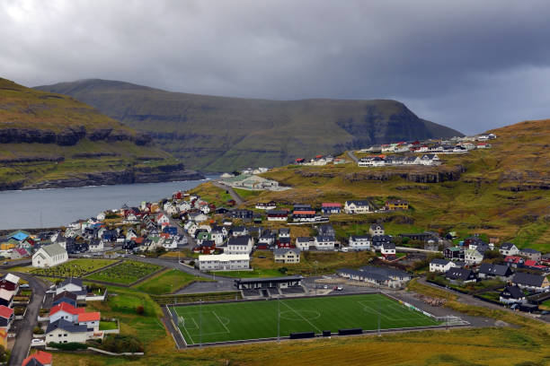
View from above of a soccer field in the Faroe Islands.

Vestmanna Sea Cliffs - view from teh boat. Streymoy. Faroe Islands. Kingdom of Denmark. Europe.

Vista general de Klaksvik. Segunda ciudad más poblada de Islas Feroe

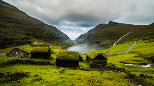
Grass roofed Church in the village of Funningur on the island of Eysturoy, Faroe Islands, Denmark.
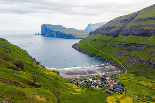
View on valley near Gjogv at Eysturoy island at summer under rain, Faroe Islands. Drops of rain on lens.
Next