French Antilles Pictures, Images and Stock Photos
Browse 22,200+ french antilles stock photos and images available, or search for french overseas territory to find more great stock photos and pictures.
Most popular
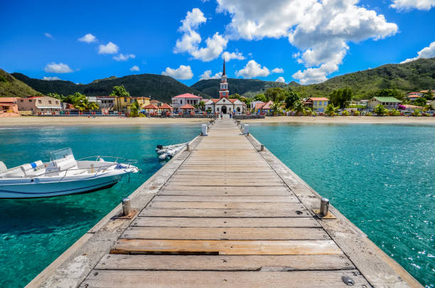
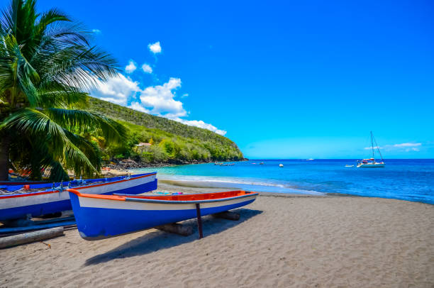
Anse d'Arlet
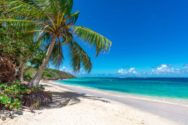
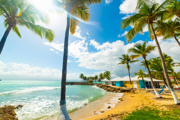
View of nice tropical beach with palm tree. Holiday and vacation concept.
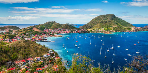
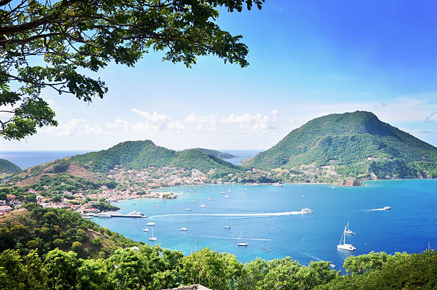
Colorful image of Guadeloupe Terre de Haut bay and town with buildings along the coastline. Small ships anchored in port. Cruise destination. Green mountains in the background. Blue sky and some white clouds.
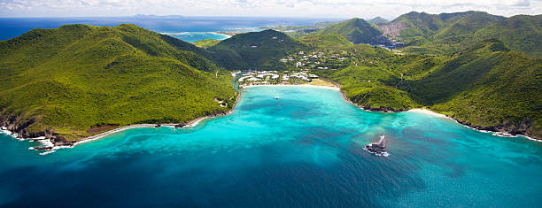
aerial view of a marina and a resort in Anse Marcel, St.Martin, French West Indies
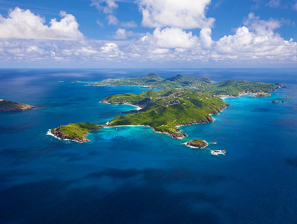
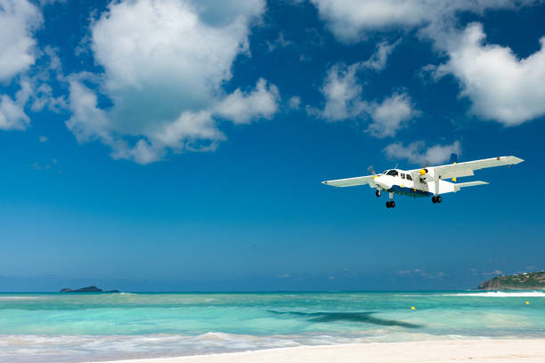
aerial view of St. Barths, French West Indies from west to east side of the island, taken from a light aircraft


Shot at 18/135, 640 iso, f 5.6, 1/160 second
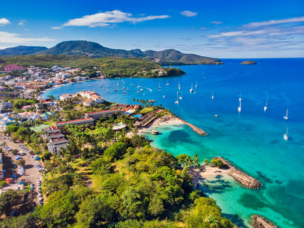
Above,Aerial View,Antilles,Caribbean,Cityscape,French Overseas Territory,Horizontal,Martinique,No People,Outdoors,Photography
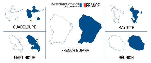
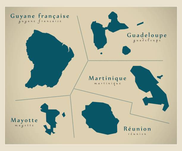
Map of overseas departments and regions of France. High detailed vector outline and blue silhouette. France flag. English labeling. All isolated on white background. For geographic themes. Vector illustration
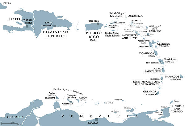
Lesser Antilles political map. Caribbees with Haiti, Dominican Republic and Puerto Rico in the Caribbean Sea. Gray illustration with English labeling on white background. Vector.Illustration. Vector.
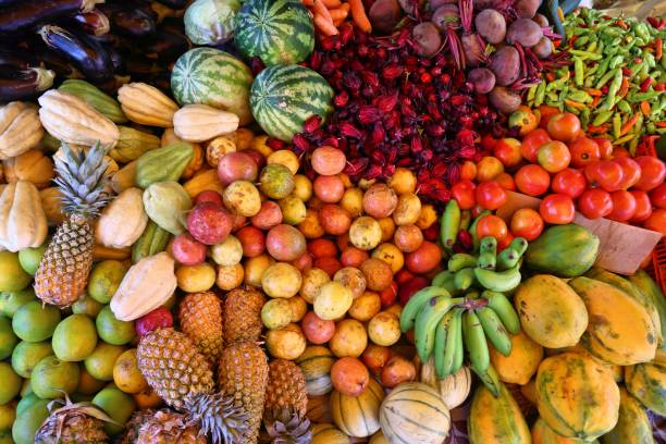
Guadeloupe fruit market in Pointe a Pitre, biggest city of Guadeloupe.
Photo taken indoors on 08/01/2017 at 200 iso, at f 1.3 seconds with the help of a flash and ambient light with macro lens
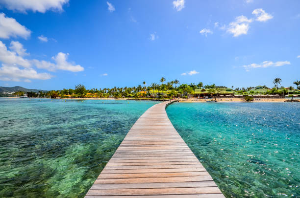
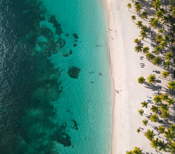
Sun shining over beautiful Bas du Fort beach in Guadeloupe, French west indies. Lesser Antilles, Caribbean sea
View of the sky from the caravel beach in Sainte-Anne

School of tropical fish, Spotfin Butterflyfish, with water surface in background, Caribbean sea
In March 2018, tourists could admire the beautiful creole houses on Les Saintes Islands in Guadeloupe.
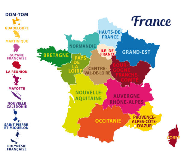
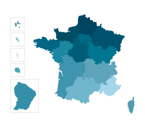
Vector isolated illustration of simplified administrative map of France. Borders of the regions. Colorful blue silhouettes
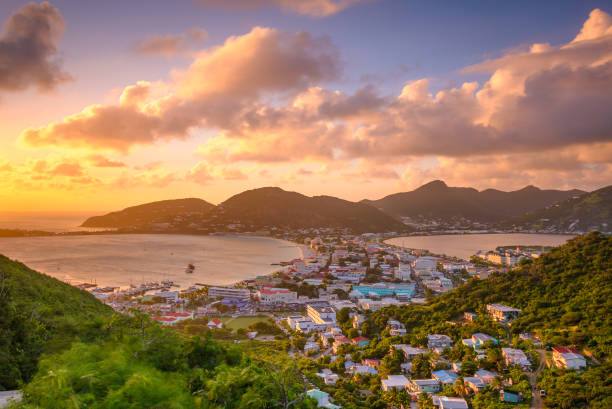
Philipsburg, Sint Maarten, cityscape at the Great Bay and Great Salt Pond.
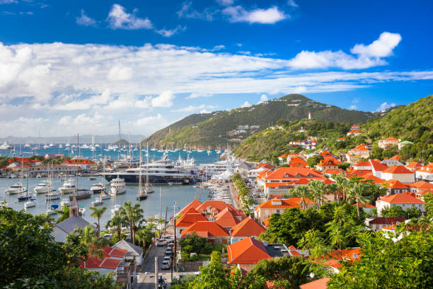
Gustavia, St. Barths town skyline at the harbor.
Picturesque street in Guadeloupe, French west indies. Lesser Antilles, Caribbean
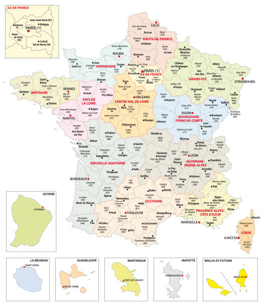
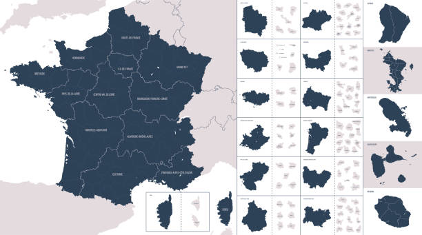
Administrative map of the 13 regions of France and overseas territories.


Marie-Galante island in Guadeloupe, man who peels some sugar cane on the market


Cascade de Saut Gendarme waterfall on a summer's day with lush jungle green

Point-a-Pitre, Guadeloupe - February 09, 2013: woman sells fresh fruits at the outdoor market in Guadeloupe atPoint-a-Pitre on February 09, 2013. The Pointe-a-Pitre Market is located by the harbour next to Place de la Victoire.

Sunset with a heart-shaped tree with boats behind

panoramic view of St.Jean Bay in St.Barths, French West Indies
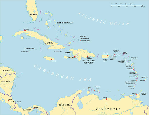
Political map of Caribbean - Large And Lesser Antilles - with capitals, national borders, most important cities, rivers and lakes. Vector illustration with English labeling and scaling.
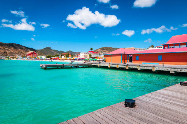
Colorful image of Philipsburg, St Maarten Sint Maarten, Saint Martin, Caribbean. Tender platform in the city centre of Philipsburg. Popular cruise destination. Blue sky and white clouds on a beautiful summer day.


Guadeloupe administrative and political vector map

Bassin Paradise lagoon in Guadeloupe, French west indies. Lesser Antilles, Caribbean
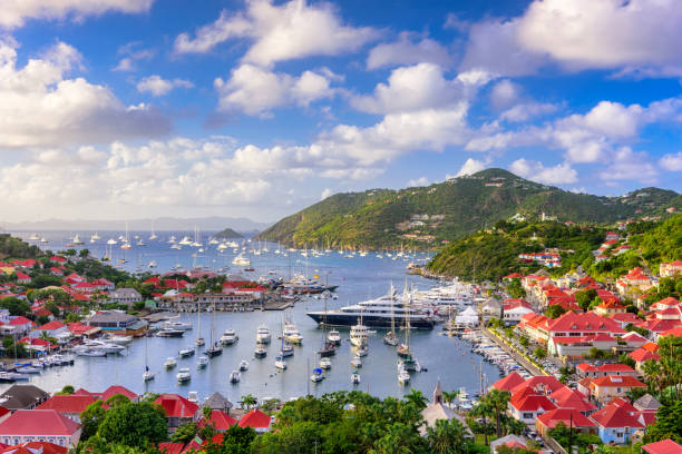
Saint Barthelemy skyline and harbor in the West Indies of the Caribbean.

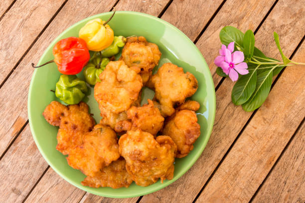
a Caribbean specialty garnished with ham, cheese, salad and tomato
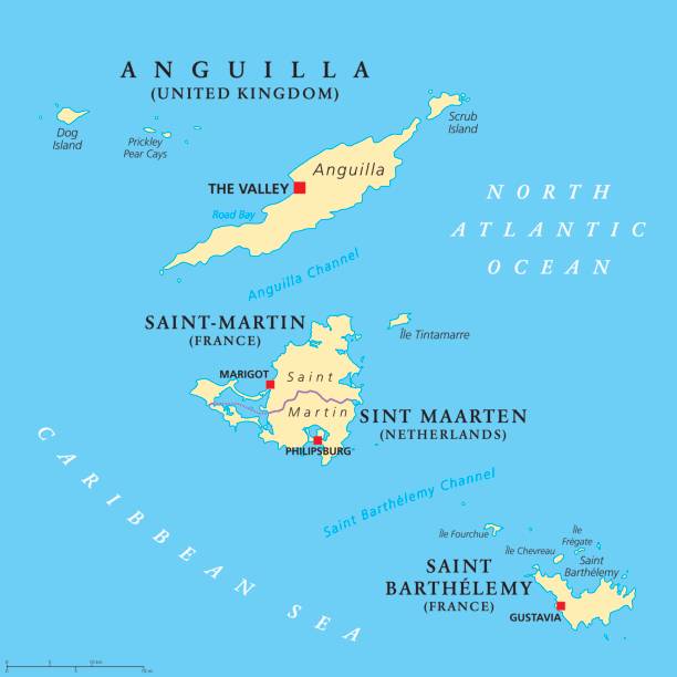
Anguilla, Saint-Martin, Sint Maarten and Saint Barthelemy political map. Islands in the Caribbean, part of Leeward Islands and Lesser Antilles. Gray illustration over white. English labeling. Vector.

Two rainbow lorikeets kiss in the Jardin de Balata, Martinique in Fort-de-France, Fort-de-France, Martinique

Guadeloupe is a French island in the Caribbean with magnificent beaches, a tropical forest and a volcano. Tourists also appreciate day excursions on the nearby islands. The "Iles des Saintes" ("Islands of the Saints") are located South of Basse-Terre and can be reached by ferry from the town of Trois-Rivières.

Antique map of Guadeloupe. Published by Thomas Jefferys (1755). Photo by N. Staykov (2007)

Lesser Antilles political map. The Caribbees with Haiti, the Dominican Republic and Puerto Rico in the Caribbean Sea. With capitals and national borders. English labeling. Illustration. Vector.

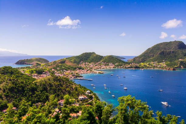
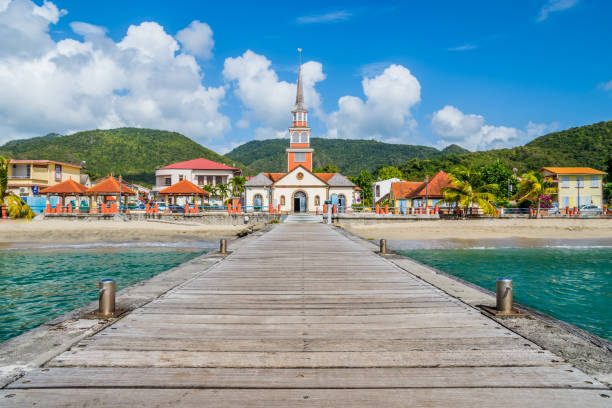
Terre-de-Haut, capital of Les Saintes islands, Guadeloupe archipelago, Caribbean Sea

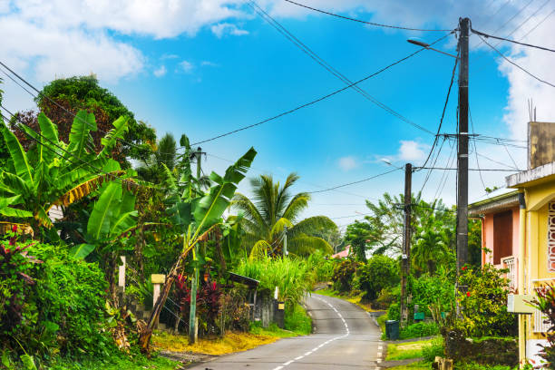
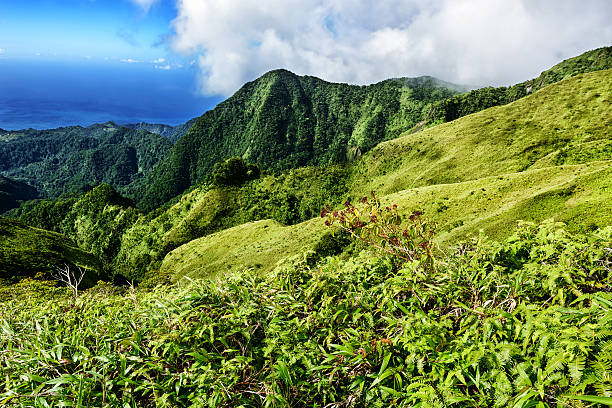
Rural landscapes
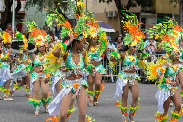
Pointe-a-Pitre, Guadeloupe, February 11, 2018: group of beatiful black girls in fancy dress dancing at carnival parade in Guadeloupe, Caribbean

Windward Islands political map. Islands of the Lesser Antilles, south of the Leeward Islands in the Caribbean Sea. From Dominica, Martinique, Saint Lucia, Saint Vincent and the Grenadines, to Grenada.
Map of Saint Barthelemy with long shadow style on colored circle buttons. Two map versions included in the bundle: - One white map on a pink / red circle button. - One white map on a blue circle button. Vector Illustration (EPS file, well layered and grouped). Easy to edit, manipulate, resize or colorize. Vector and Jpeg file of different sizes.
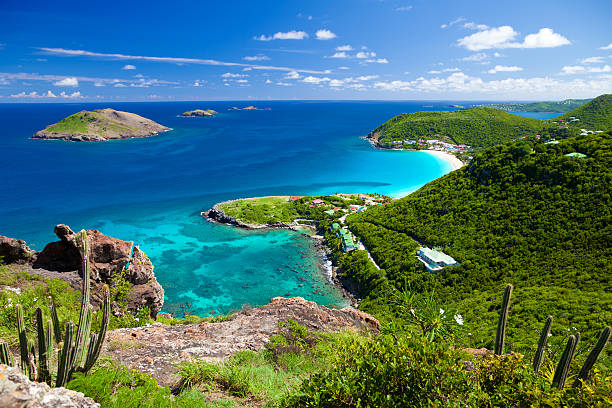
high angle view of Anse des Flamands in St. Barths, French West Indies
Next