Georgia Map Country Pictures, Images and Stock Photos
Browse 5,000+ georgia map country stock photos and images available, or start a new search to explore more stock photos and images.
Most popular
The Caucasus, or Caucasia, political map. A region between the Black Sea and the Caspian Sea, mainly occupied by Armenia, Azerbaijan, Georgia, and parts of Southern Russia, with disputed areas. Vector
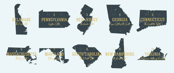
Georgia Political Map with capital Tbilisi, with national borders, important cities, rivers and lakes. English labeling and scaling. Illustration.
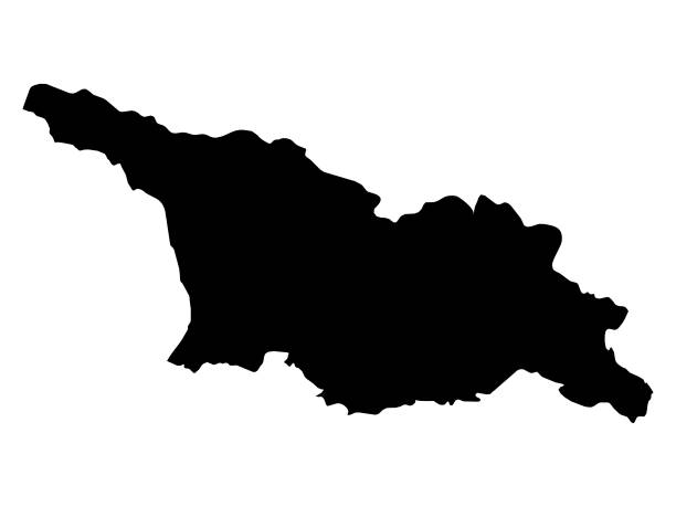
vector illustration of Black map of Georgia
Western Asia, geoscheme and political map. Subregion of Asia, used for statistical purposes, covering geographical regions spanning from Anatolia, Caucasus, Levant, Mesopotamia till Arabian Peninsula.

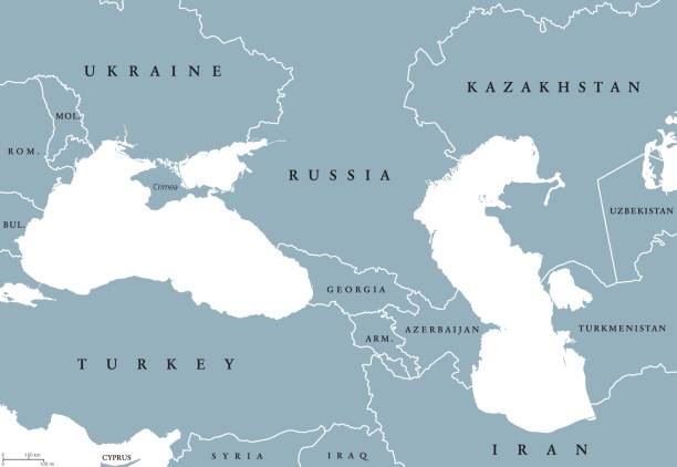
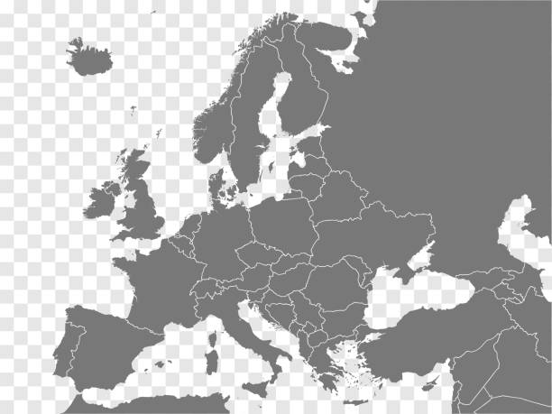
Black Sea and Caspian Sea region political map with countries, borders and English labeling. Bodies of water between Eastern Europe and Western Asia. Gray illustration. Vector.
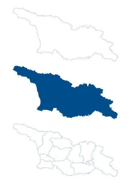
Georgia (country) map. Detailed blue outline and silhouette. Administrative divisions, autonomous republics and regions. Set of vector maps. All isolated on white background. Template for design and infographics.
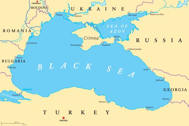
Black Sea and Sea of Azov region political map with capitals, most important cities, borders and rivers. Body of water between Eastern Europe and Western Asia. Illustration. English labeling. Vector.
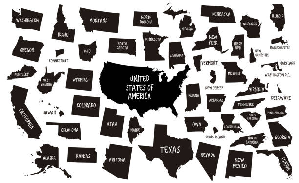
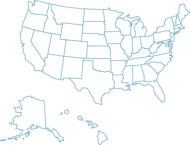
outline of USA maps
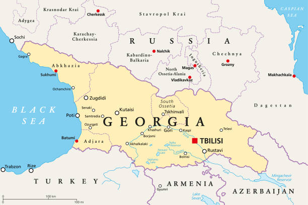
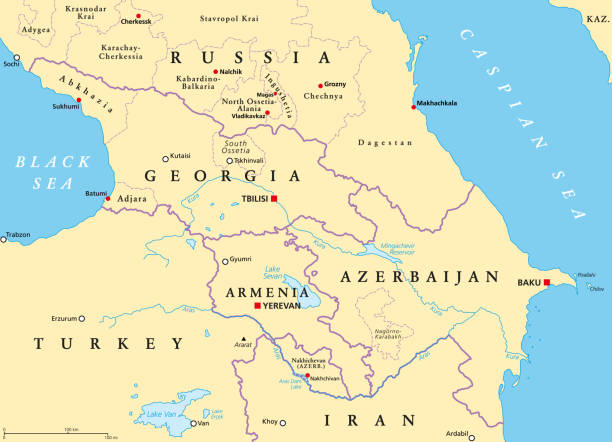
Georgia, political map, with capital Tbilisi, and international borders. Republic and transcontinental country in Eurasia, located south of the North Caucasus Federal District of Russia. Illustration.
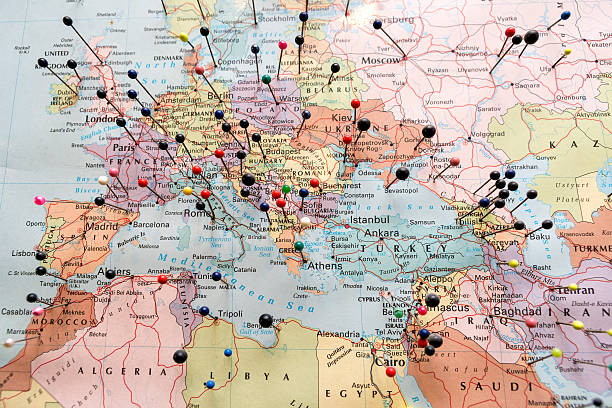
European And North African Map Pinned
Isometric illustration of the continental United States, showing general locations of key cities, farms, mountains, beaches, and forests of the 48 contiguous states. Details include more than 100 buildings clustered in key cities, hundreds of trees, and dozens of cows. Roads and land contours based on illustrator's interpretations, and not on any specific map.
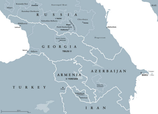
The Caucasus, or Caucasia, gray political map. Region between the Black Sea and the Caspian Sea, mainly occupied by Armenia, Azerbaijan, Georgia, and parts of Southern Russia. Map with disputed areas.
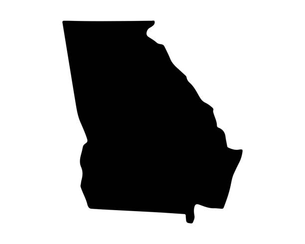
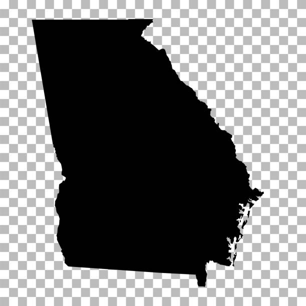
Georgia state map. US state map. Georgia silhouette symbol. Vector illustration
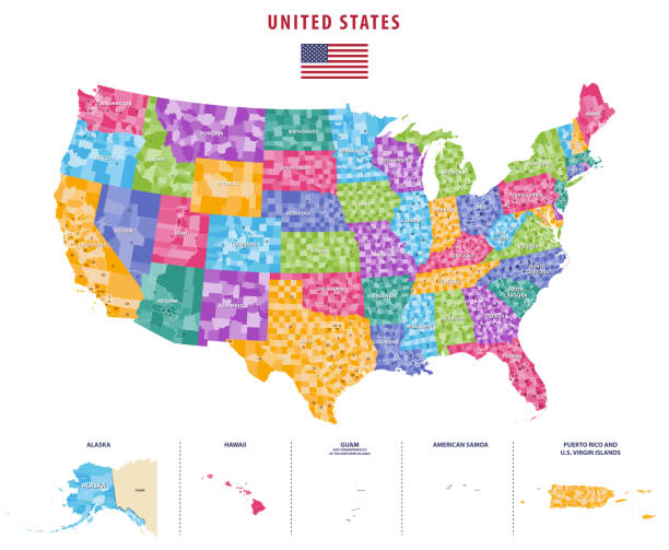
Downloadable map of United States of America. The spatial locations of Hawaii, Alaska and Puerto Rico approximately represent their actual locations on the earth.

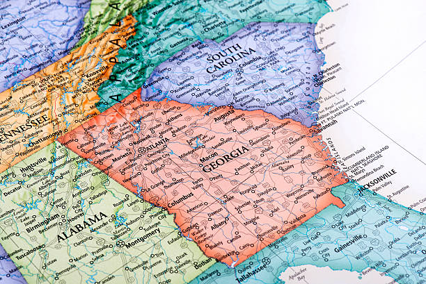
Map of Georgia State in USA. Detail from the World Map.
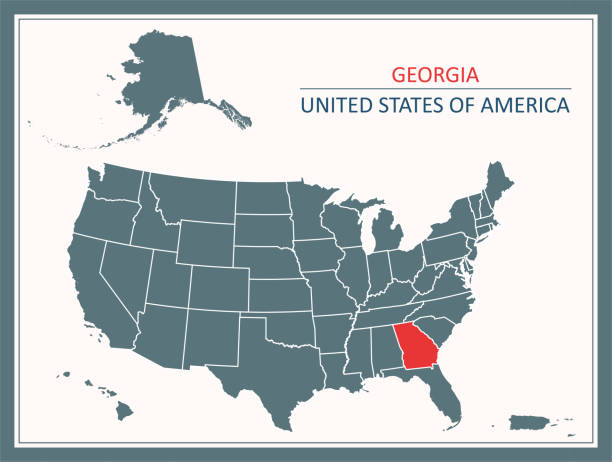
Downloadable map of Georgia state of United States of America. The spatial locations of Hawaii, Alaska and Puerto Rico approximately represent their actual locations on the earth.
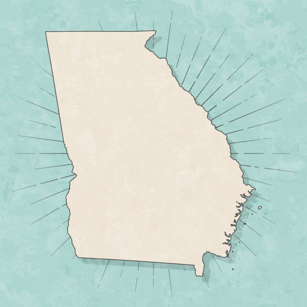
Map of Georgia (USA) in a trendy vintage style. Beautiful retro illustration with old textured paper and light rays in the background (colors used: blue, green, beige and black for the outline). Vector Illustration (EPS10, well layered and grouped). Easy to edit, manipulate, resize or colorize.

3D Render of a Topographic Map of Georgia country. Version with Country Boundaries. All source data is in the public domain. Color texture: Made with Natural Earth. http://www.naturalearthdata.com/downloads/10m-raster-data/10m-cross-blend-hypso/ Relief texture: SRTM data courtesy of NASA JPL (2020). URL of source image: https://e4ftl01.cr.usgs.gov//DP133/SRTM/SRTMGL3.003/2000.02.11 Water texture: SRTM Water Body SWDB: https://dds.cr.usgs.gov/srtm/version2_1/SWBD/ Boundaries Level 0: Humanitarian Information Unit HIU, U.S. Department of State (database: LSIB) http://geonode.state.gov/layers/geonode%3ALSIB7a_Gen
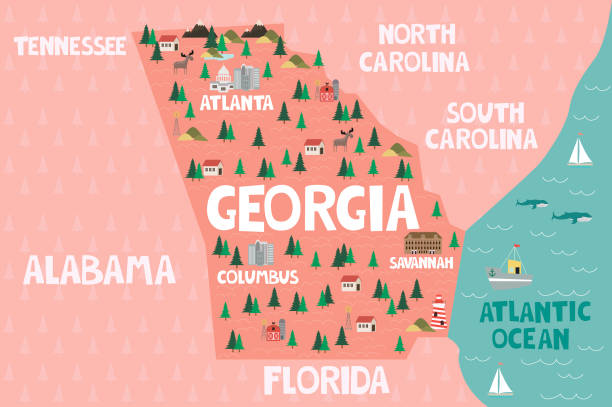
Illustrated map of the state of Georgia in United States with cities and landmarks. Editable vector illustration
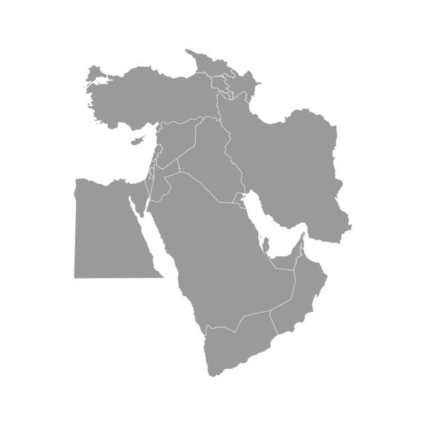
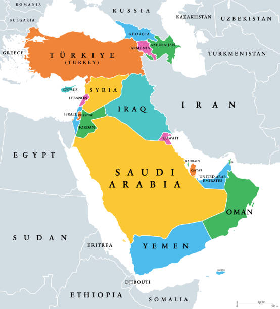
Vector illustration with simplified map of Asian countries. Middle East. States borders of Turkey, Georgia, Armenia, United Arab Emirates, Saudi Arabia, Qatar, Oman, Iran, Israel. Grey silhouette
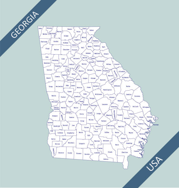
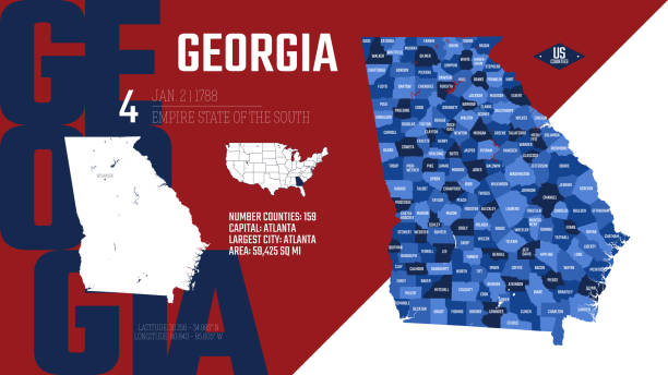
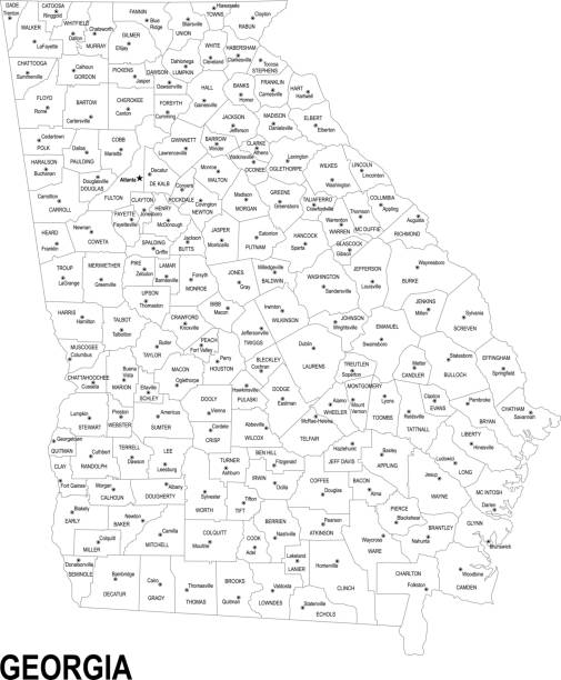
Highly detailed map of Georgia counties state of United States of America for web banner, mobile, smartphone, iPhone, iPad applications and educational use. The map is accurately prepared by a map expert.

A dictionary map of the Southeast US. The photo was taken out of a one hundred + year old dictionary.

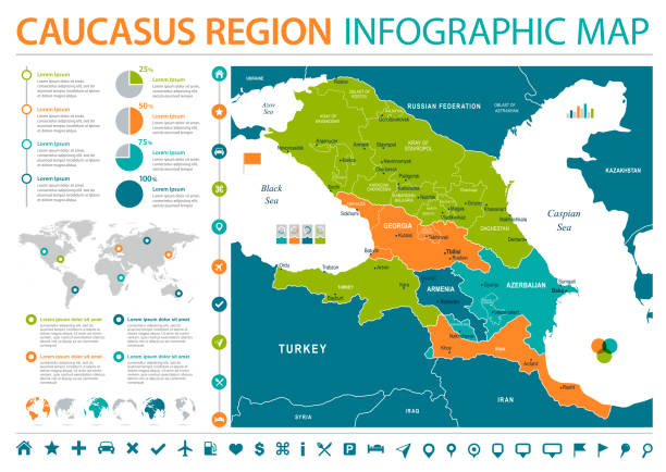
Caucasus Region Map - Detailed Info Graphic Vector Illustration

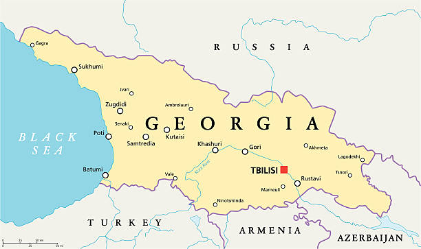
Detailed outline map of Georgia with capital

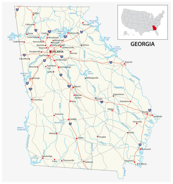
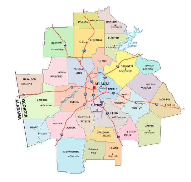
City map Atlanta, travel vector poster design detailed plan of the city, rivers and streets
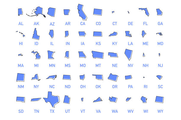
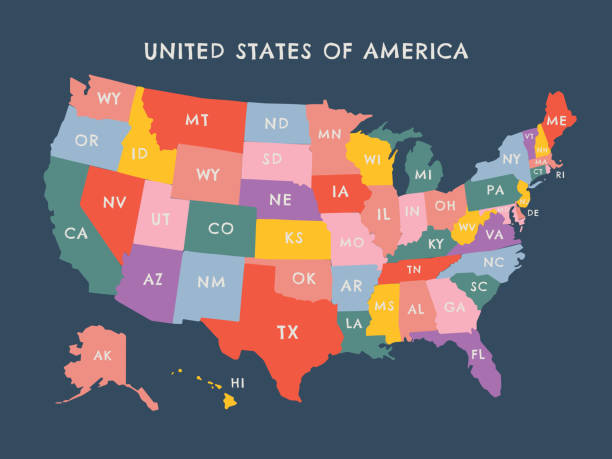
USA states vector illustration. All 50 states of America shapes coloured in lilac isolated on white background.

Ohio, state of USA - solid black silhouette map of country area. Simple flat vector illustration.
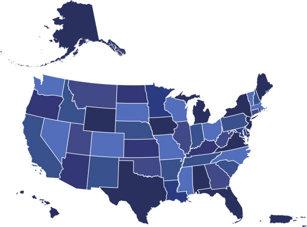
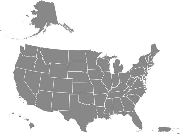
Downloadable blue color gradient map of United States of America. The spatial locations of Hawaii, Alaska and Puerto Rico approximately represent their actual locations on the earth.
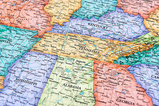
Map of Tennessee and Kentucky States in USA. Detail from the World Map.
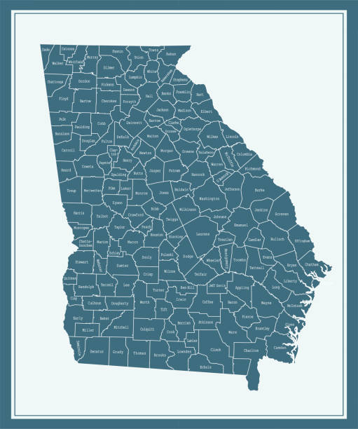
Downloadable county map of Georgia state of United States of America. The map is accurately prepared by a map expert.

Road map of Georgia, US American federal state. Editable highly detailed transportation map with highways and interstate roads, rivers and cities realistic vector illustration
Location flat illustration including icons - compass, travel, globe, map, geography, earth, distance, direction vector illustration. Simple Glyph silhouette art about navigation app ui. Black Color.
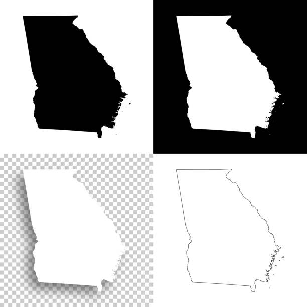
Map of Georgia for your own design. With space for your text and your background. Four maps included in the bundle: - One black map on a white background. - One blank map on a black background. - One white map with shadow on a blank background (for easy change background or texture). - One blank map with only a thin black outline (in a line art style). The layers are named to facilitate your customization. Vector Illustration (EPS10, well layered and grouped). Easy to edit, manipulate, resize or colorize. Please do not hesitate to contact me if you have any questions, or need to customise the illustration. http://www.istockphoto.com/portfolio/bgblue
Vector illustration of a USA map with all fifty states. Each star is a separate outlined piece and can be used or colored individually.

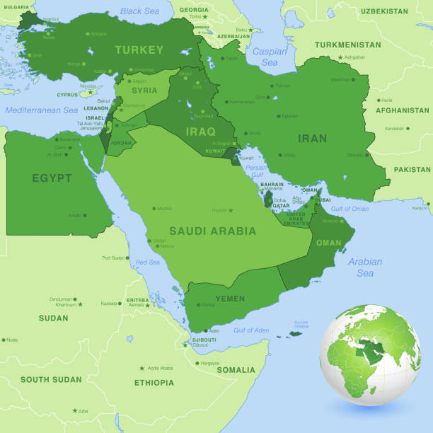
High detail map of the Middle East Zone, with a 3D Globe centered on Middle East.

Georgia political map of administrative divisions - regions and autonomous republics of Abkhasia and Adjara. 3D colorful vector map with name labels.

Georgia on the map of Middle East (Western Asia) in soft grunge and vintage style, like old paper with watercolor painting.
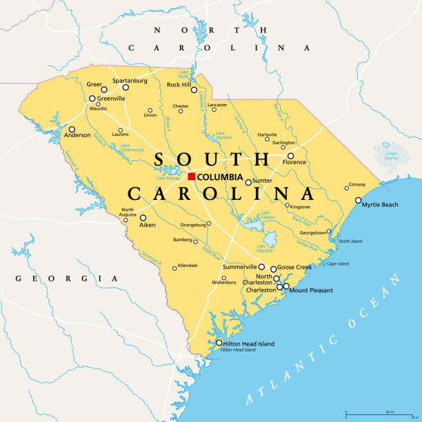
South Carolina, SC, political map, with the capital Columbia, largest cities and borders. State in the southeastern region of the United States of America. The Palmetto State. Illustration. Vector.

Georgia map, black and white detailed outline with regions of the country. Vector illustration

Detailed map of Georgia state,in vector format,with county borders and major cities.

Representation of United States divided into states and regions. Infographic.

Set of vector polygonal Georgia maps. Bright gradient map of the US state in low poly style. Multicolored Georgia map in geometric style for your infographics.
Map of country line icon set, country collection, vector graphics, logo illustrations, map countries vector icons, travel signs, outline pictograms, editable stroke
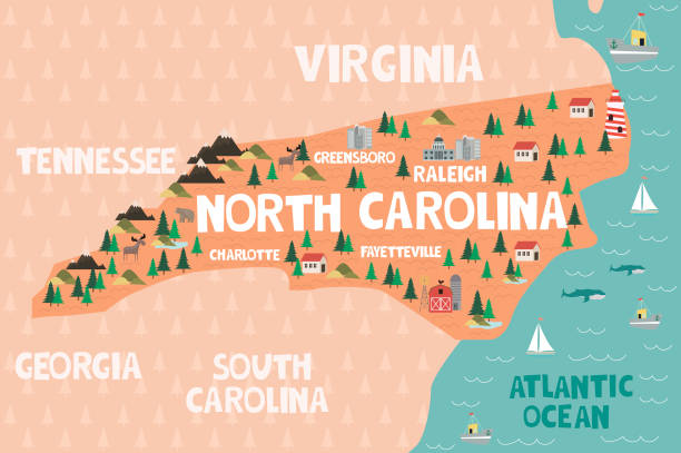
Illustrated map of the state of North Carolina in United States with cities and landmarks. Editable vector illustration
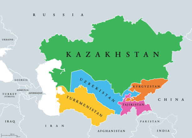
Central Asia, or Middle Asia, colored political map. Region of Asia from Caspian Sea to western China, and from Russia to Afghanistan. Kazakhstan, Kyrgyzstan, Tajikistan, Turkmenistan, and Uzbekistan.

3D Render of a Topographic Map of the State of Georgia, USA. All source data is in the public domain. Color texture: Made with Natural Earth. http://www.naturalearthdata.com/downloads/10m-raster-data/10m-cross-blend-hypso/ Boundaries Level 1: USGS, National Map, National Boundary Data. https://viewer.nationalmap.gov/basic/#productSearch Relief texture and Rivers: SRTM data courtesy of USGS. URL of source image: https://e4ftl01.cr.usgs.gov//MODV6_Dal_D/SRTM/SRTMGL1.003/2000.02.11/ Water texture: SRTM Water Body SWDB: https://dds.cr.usgs.gov/srtm/version2_1/SWBD/
Next