Gulf Of St Lawrence Pictures, Images and Stock Photos
Browse 3,000+ gulf of st lawrence stock photos and images available, or search for newfoundland or montreal to find more great stock photos and pictures.
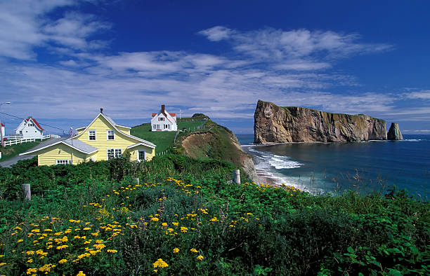
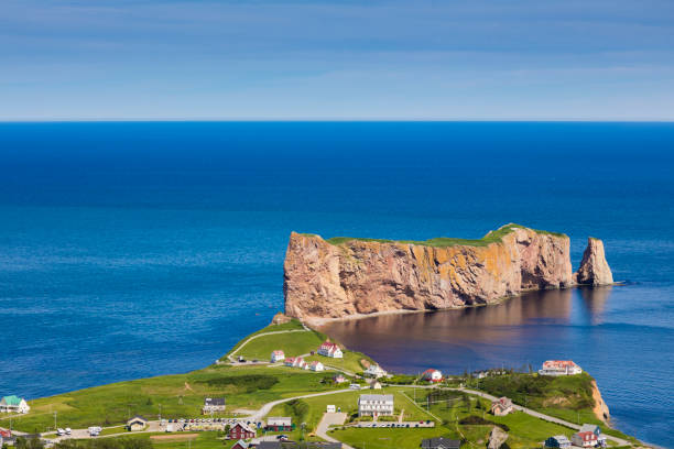
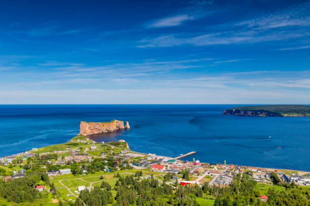
Perce rock is a huge sheer rock formation in the Gulf of Saint Lawrence on the tip of the Gaspe Peninsula in Quebec, Canada, off Perce Bay.

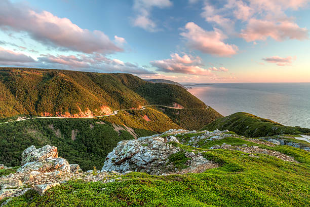
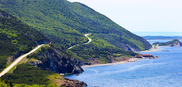
The winding Cabot Trail road seen from high above on the Skyline Trail at sunset in Cape Breton Highlands National Park, Nova Scotia
The Magdalen Islands (îles de la Madeleine) are an archipelago in the Canadian Gulf of St. Lawrence belonging to Quebec.
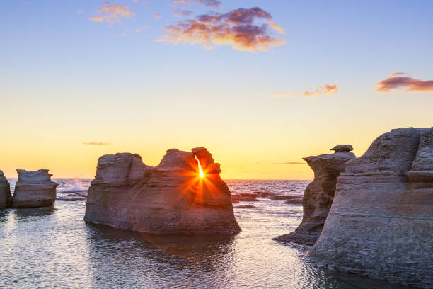
Monoliths of Île Nue de Mingan at sunset, Quebec, Canada
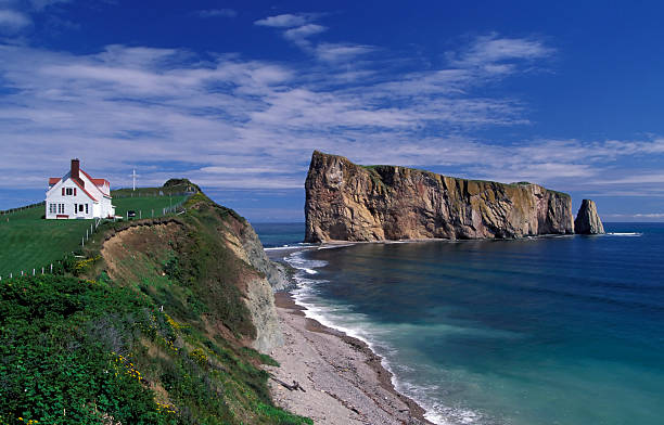
Perce rock is a huge sheer rock formation in the Gulf of Saint Lawrence on the tip of the Gaspe Peninsula in Quebec, Canada, off Perce Bay.
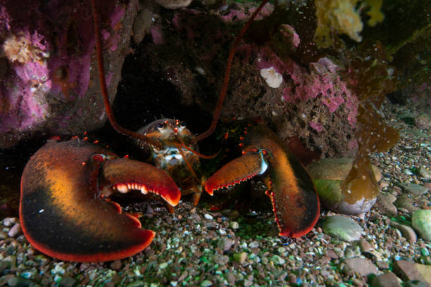
American lobster underwater in the St. Lawrence River in Canada.
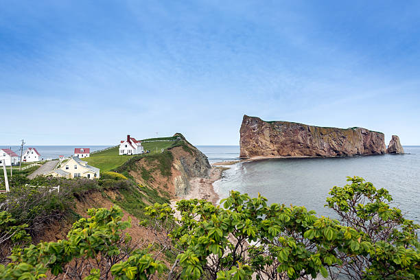
Perce rock is a huge sheer rock formation in the Gulf of Saint Lawrence on the tip of the Gaspe Peninsula in Quebec, Canada.
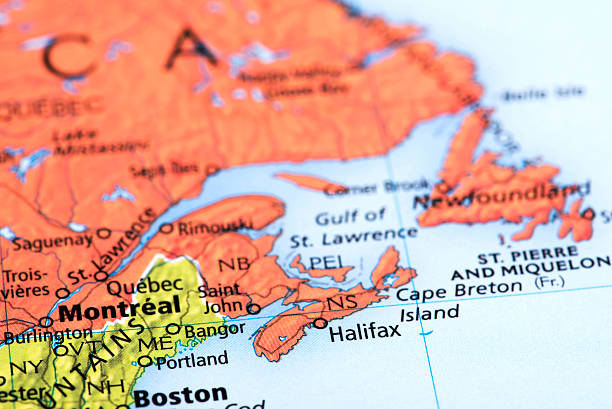
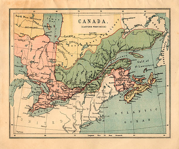
Map of Montreal and Quebec in Canada. Detail from the World Atlas.

Underwater marine life and sea anemone in the St-Lawrence River
Forillon National Park as seen from the viewpoint atop Mount-St-Alban, Gaspe Peninsula, Quebec, Canada
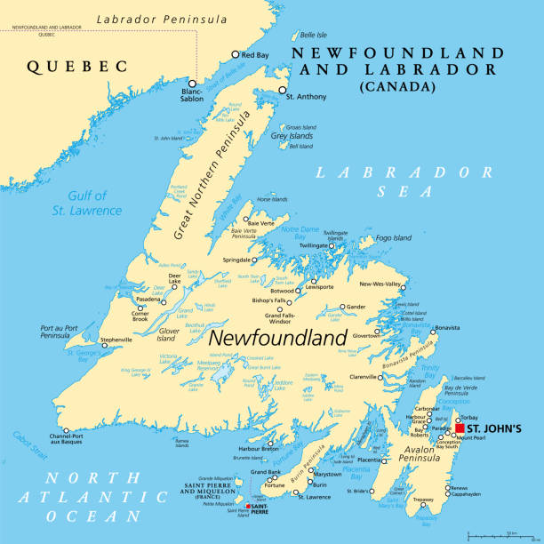
Island of Newfoundland, political map. Part of Canadian province of Newfoundland and Labrador with capital St. John's. Large island off the coast of mainland North America southwest of Labrador Sea.

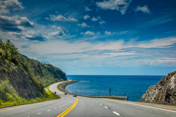
Gaspé Peninsula in July


Crosstown, Traytown, Glovertown, Culls Harbour, Eastport Beach, Salvage, Newfoundland and Labrador, Canada.
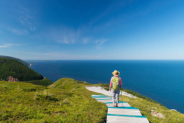
Woman walking on boardwalk at the top of Skyline Trail in Cape Breton Highlands National Park, Cabot Trail in Nova Scotia, Canada.

"3D render and image composing: Topographic Map of Nova Scotia, Canada. Including state borders, rivers and accurate longitude/latitude lines. High quality relief structure!Relief texture and satellite images courtesy of NASA. Further data source courtesy of CIA World Data Bank II database.Related images:"
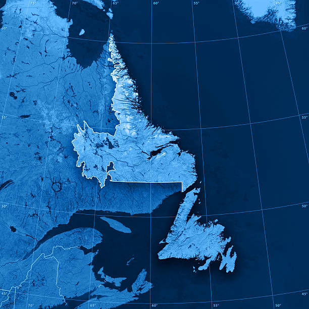
"3D render and image composing: Topographic Map of Newfoundland and Labrador, Canada. Including state borders, rivers and accurate longitude/latitude lines. High quality relief structure!Relief texture and satellite images courtesy of NASA. Further data source courtesy of CIA World Data Bank II database.Related images:"
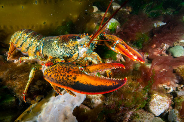
American lobster foraging for food on a rocky bottom.
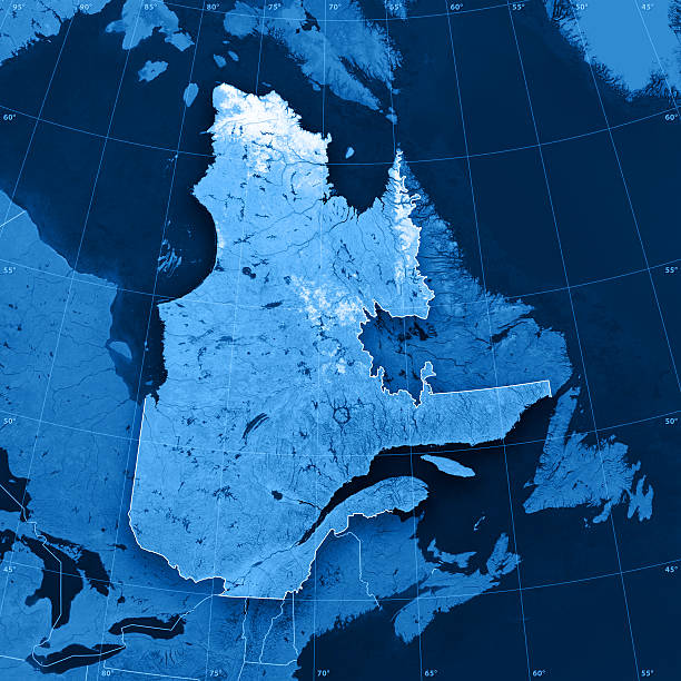
"3D render and image composing: Topographic Map of Quebec, Canada. Including state borders, rivers and accurate longitude/latitude lines. High quality relief structure!Relief texture and satellite images courtesy of NASA. Further data source courtesy of CIA World Data Bank II database.Note: This image is perfectly congruent to the image"
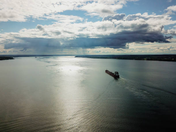
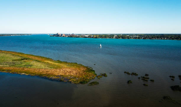
Travel photography.
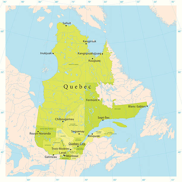
"Highly detailed vector map of Quebec, Canada. File was created on November 6, 2012. The colors in the .eps-file are ready for print (CMYK). Included files: EPS (v8) and Hi-Res JPG (5600 x 5600 px)."


Elements of this image furnished by NASA.


3D render and image composing: Topographic Map of Quebec, Canada. Including state borders, cities, rivers and accurate longitude/latitude lines. Very high resolution available! High quality relief structure!
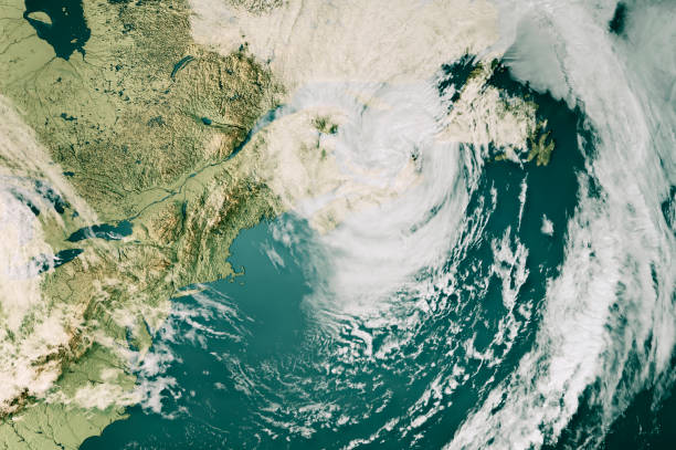
3D Render of a Topographic Map of the US East Coast and the Gulf of St. Lawrence with the clouds from September 24, 2022. Category 4 Major Hurricane Fiona over Nova Scotia, Canada. All source data is in the public domain. Cloud texture: Global Imagery Browse Services (GIBS) courtesy of NASA, GOES data courtesy of NOAA. https://www.earthdata.nasa.gov/eosdis/science-system-description/eosdis-components/gibs Color texture: Made with Natural Earth. http://www.naturalearthdata.com/downloads/10m-raster-data/10m-cross-blend-hypso/ Relief texture: GMTED 2010 data courtesy of USGS. URL of source image: https://topotools.cr.usgs.gov/gmted_viewer/viewer.htm Water texture: SRTM Water Body SWDB: https://dds.cr.usgs.gov/srtm/version2_1/SWBD/

Ultra detailed vector map of Canada with administrative divisions. Including main rivers and lakes. Each province and territory is grouped separately. You can zoom in well in the vector file. There's more detail visible than you can see in the preview window, because there's a limit of 6000 pixels. You may open the .eps-file in Photoshop at even higher resolutions. Great for super-size usage like trade fair walls. File was created on August 09, 2012. The colors in the .eps-file are ready for print (CMYK). Included files: EPS (v8) and Hi-Res JPG (6000 x 6000 px).
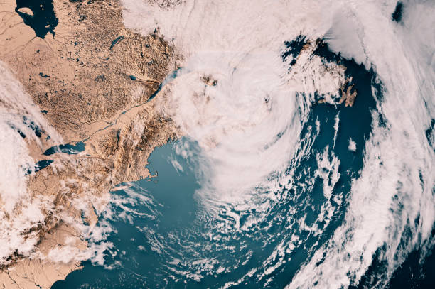
3D Render of a Topographic Map of the US East Coast and the Gulf of St. Lawrence with the clouds from September 24, 2022. Category 4 Major Hurricane Fiona over Nova Scotia, Canada. All source data is in the public domain. Cloud texture: Global Imagery Browse Services (GIBS) courtesy of NASA, GOES data courtesy of NOAA. https://www.earthdata.nasa.gov/eosdis/science-system-description/eosdis-components/gibs Color texture: Made with Natural Earth. http://www.naturalearthdata.com/downloads/10m-raster-data/10m-cross-blend-hypso/ Relief texture: GMTED 2010 data courtesy of USGS. URL of source image: https://topotools.cr.usgs.gov/gmted_viewer/viewer.htm Water texture: SRTM Water Body SWDB: https://dds.cr.usgs.gov/srtm/version2_1/SWBD/

Woman taking selfie in front of sea of La Martre (Gaspesie) during summer day

Prince Edward Island road vector map

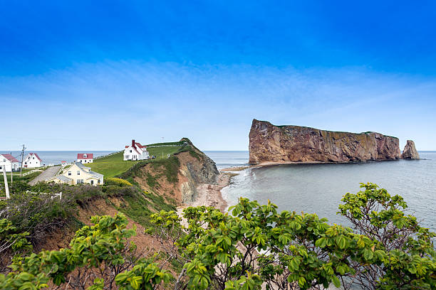
Perce rock is a huge sheer rock formation in the Gulf of Saint Lawrence on the tip of the Gaspe Peninsula in Quebec, Canada.
Cabot Trail, Cape Breton Highlands National Park. Nova Scotia, Canada

Prince Edward Island vector road map with flag.

Travel photography.
Travel photography.

Sea Lettuce underwater in the St. Lawrence River in Canada.

A glimpse at beautiful Pokeshaw Beach, Gloucester county in New Brunswick, Canada.

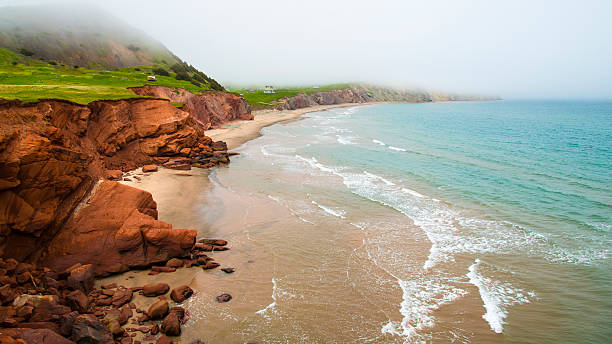
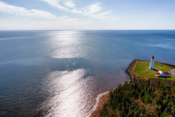
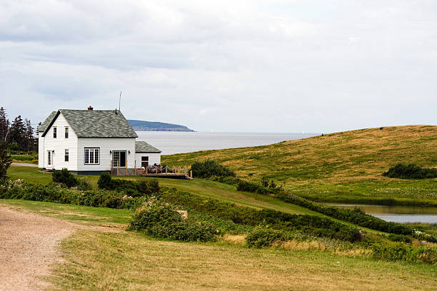
Ocean scene along the Gaspe Peninsula in Quebec, Canada, with red roofed shed.

newfoundland road vector map
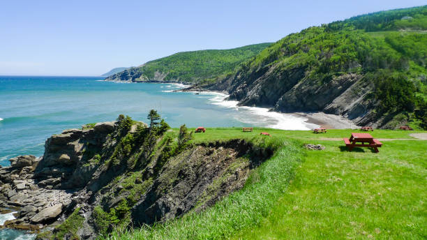
Cape Breton Highlands National Park,Canada
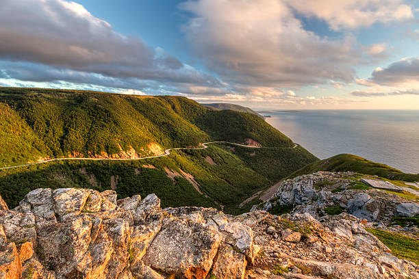
The winding Cabot Trail road seen from high above on the Skyline Trail at sunset in Cape Breton Highlands National Park, Nova Scotia
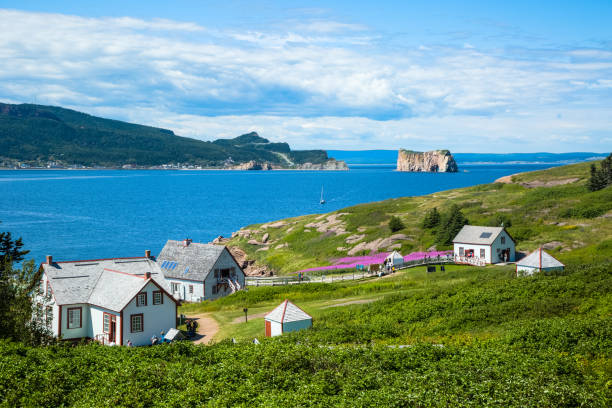
View of Perce Rock from Île-Bonaventure-et-du-Rocher-Percé National Park in Quebec, Canada. The buildings of the National Park are in the foreground.
Travel photography.


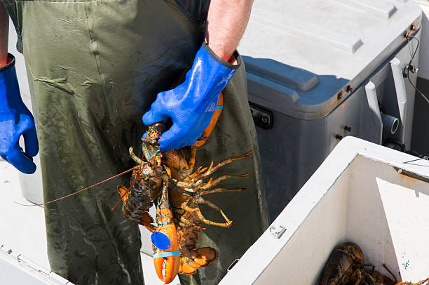
Fresh Live Lobster. Straight off the fishing boat in Canada

PEI sign in front of Confederation Bridge, Prince Edward Island, Canada.

Ocean iceberg with red fishing ship in greenland
Next