Haiti Capital City Pictures, Images and Stock Photos
Browse 590+ haiti capital city stock photos and images available, or start a new search to explore more stock photos and images.
Most popular
OLYMPUS DIGITAL CAMERA

detail of a map of cuba, jamaica haiti and santo domingo


Vintage engraving of Street life in Port-au-Prince, Haiti. Ferdinand Hirts Geographische Bildertafeln,1886.
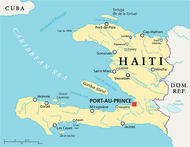
Haiti Political Map with capital Port-au-Prince, with national borders, important cities, rivers and lakes. English labeling and scaling. Illustration.
Port-Au-Prince, Haiti - February 9th, 2010 : Haitians shop for food and other products from a temporarily set up open bazaar. The earthquake, with a magnitude of 7.0Mw, destroyed most of Haiti's modest infrastructure compelling people to live on the streets or in temporary shelters.

Port-Au-Prince, Haiti
"Port-Au-Prince, Haiti - February 8th, 2010 : Haitians collect cables and other metal scraps from the rubble of a telecommunication building which was completely destroyed by the earthquake. Selling metal scraps is one of the ways that enables people to earn a little money to buy food."
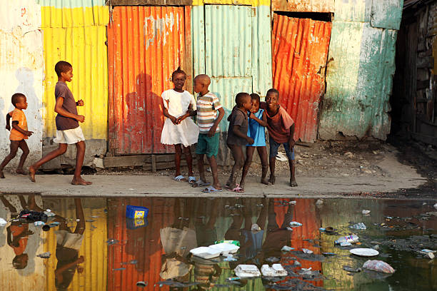
Port-Au-Prince, Haiti - February 13th, 2010 : Haitian children playing together near an open bazaar street.

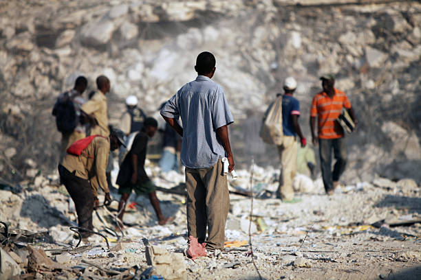
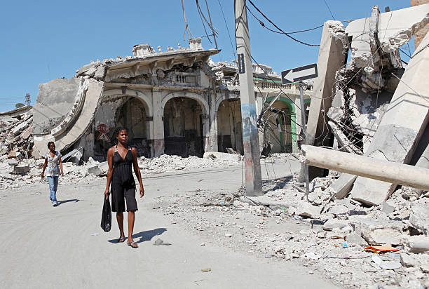
Port-Au-Prince, Haiti - February 4th, 2010 : A young Haitian girl walks past a smashed car and some destroyed buildings without a second glance. After witnessing all the destruction caused by the earthquake, the people of Haiti have grown accustomed to such scenes.

Hispaniola political map, also San Domingo. Haiti and Dominican Republic with capitals Port-au-Prince and Santo Domingo, in the Caribbean island group. Gray illustration with English labeling. Vector.

Collapsed Haiti Presidential Palace post Earthquake 2010
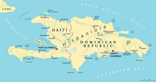
Hispaniola Political Map with Haiti and Dominican Republic, located in the Caribbean island group, the Greater Antilles. With capitals, national borders, important cities, rivers and lakes. English labeling and scaling. Illustration.
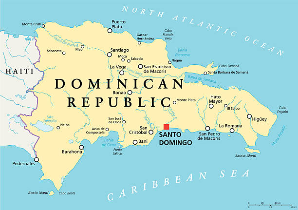
Dominican Republic Political Map with capital Santo Domingo, with national borders, important cities, rivers and lakes. English labeling and scaling. Illustration.

Recife, Pernambuco, Brazil - March 01, 2020:Also known as Palácio do Campo das Princesas, it is the seat of the government of Pernambuco state.
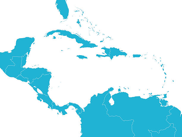
Empty Blue Map of Central America
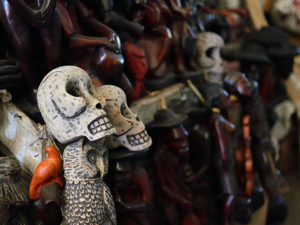
Figurines voodoo on Iron Market in the centre of capital city Haiti

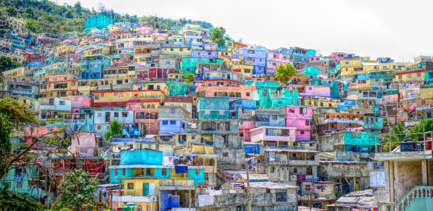
An expanse of favellas before the earthquake in Port-au-Prince, Haiti
Port-Au-Prince, Haiti - February 9th, 2010 : Haitians go about daily business in a dusty open street market after their modest infrastructure was destroyed by the earthquake.

Map of Cuba and Jamaıca.

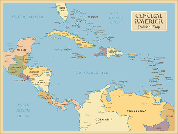
Map of Central America. Detail from THE POLITICAL MAP OF THE WORLD.

"Port-Au-Prince, Haiti - August 31, 2010: Residents gathered in a meeting to decide on the future action regarding the alleged atrocities of the NGO's in the tent cities."
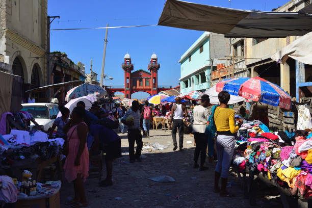
PORT AU PRINCE, REPUBLIC OF HAITI - 17 DECEMBER 2017: Bazzar in the capital city Haiti, in the vicinity of the Iron Market
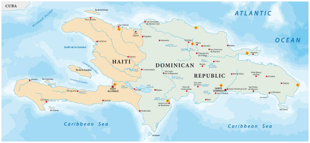
Vector map of the Caribbean island of Hispaniola

Flag of Haiti in front of a clear blue sky

Port-Au-Prince to Jacmel, Haiti - February 10th, 2010 : People travel together in a crowded, colourful truck from Port-Au-Prince to Jacmel. On the sides of the road people have set up a temporary street bazaar to sell fruits, vegetables and other necessary things. The eathquake destroyed a major amount of the Haitian infrastructure and the lives of millions of people.

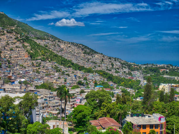
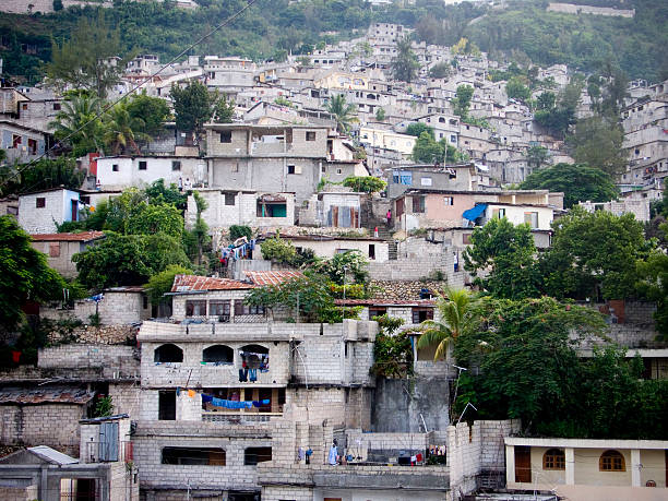
A landscape of a town on hills on a sunny day in Port-au-Prince, Haiti
Colored Empty Map of Central America with Country Names and Capital Cities

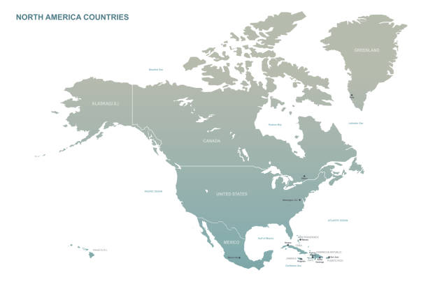
North and South America map - highly detailed vector illustration

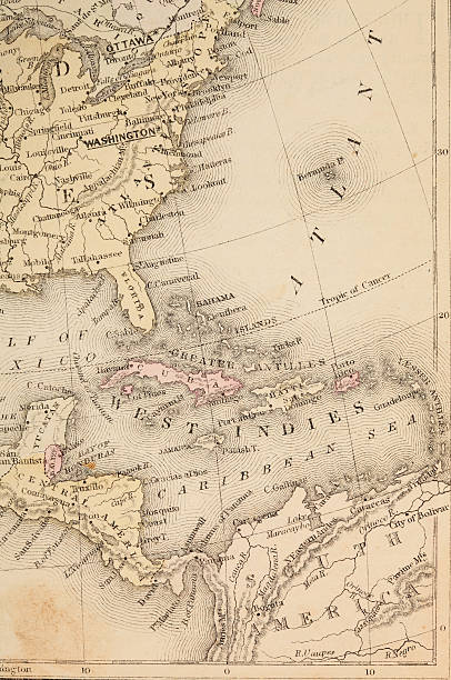
Vintage 1800's map with Carribean sea and Atlantic ocean and more.
World Geography Cewntral America

Haitian flag, flag series... Horizontal composition. Full frame.
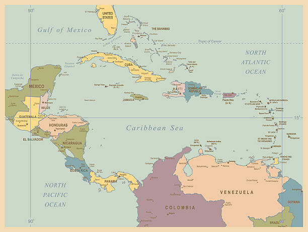
Central America map - highly detailed vector illustration

Map of Haiti with national flag. Highly detailed editable map of Haiti, North America country territory borders. Political or geographical design element vector illustration on white background

Port-Au-Prince, Haiti - February 13th, 2010 : Young Haitian children playing together near an open bazaar street.
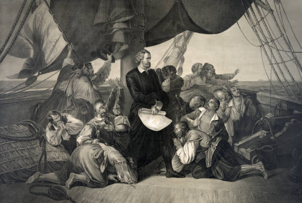
Vintage illustration features Italian explorer Christopher Columbus in 1492 standing among his crew aboard the Santa Maria with the distant view of an island on the horizon. Columbus called this North American island (in what is now the Bahamas) San Salvador; the natives called it Guanahani.
Central America map - highly detailed vector illustration
Central America - Retro Map
"Port-Au-Prince, Haiti - February 7th, 2010 : A young Haitian woman walks past destroyed buildings and rubble after an earthquake causes massive damage to people and infrastructure in cities all over Haiti. The earthquake destroyed thousands of buildings and claimed the lives of millions of people."

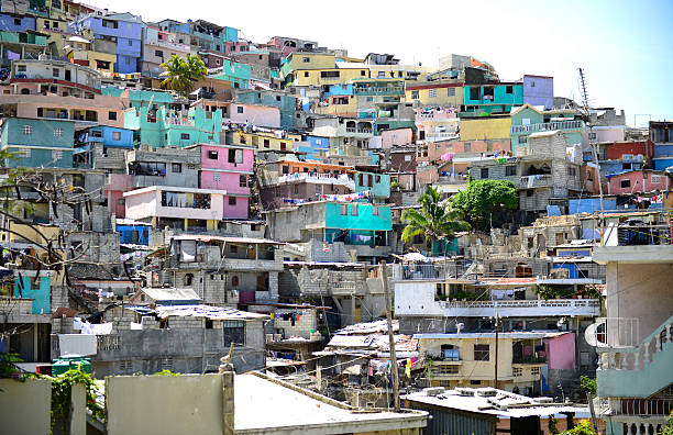
A view of Port au Prince from the top of a mountain.

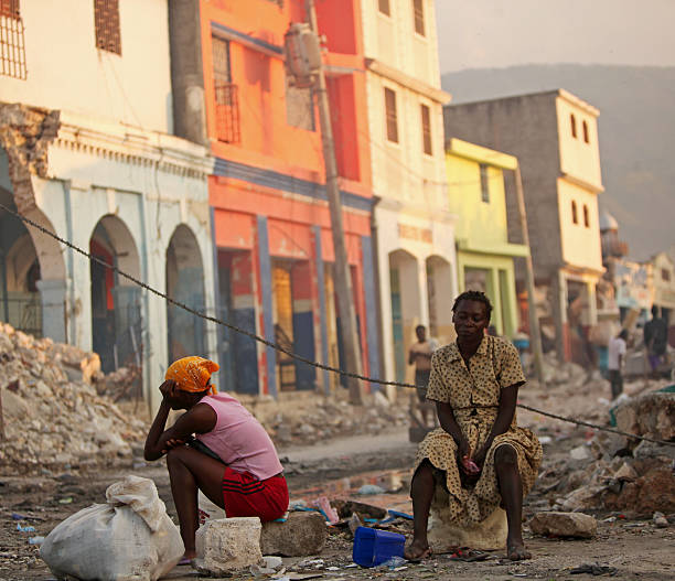
"Port-Au-Prince, Haiti - February 9th, 2010 : A young Haitian woman wearing a head band looks on calmly as she sits. The earthquake with a magnitude of 7.0 Mw destroyed most of Haiti's modest infrastructure compelling people to live on the streets or in temporary shelters."
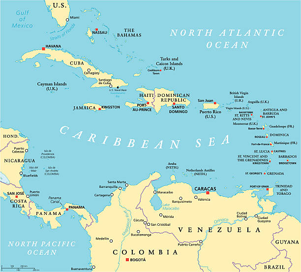
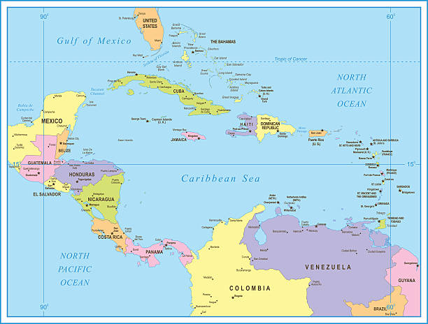
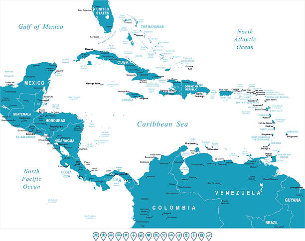
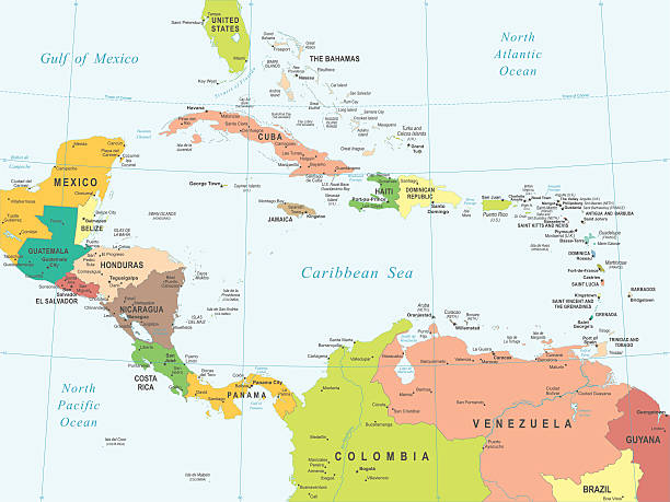
Caribbean political map with capitals, national borders, important cities, rivers and lakes. English labeling and scaling. Illustration.
Central America - Retro Map

"Port-Au-Prince, Haiti - August 30, 2010: Young Haitian adults playing soccer which is one of their favorite sport inside their tent cities ."

Port-Au-Prince, Haiti - February 9th, 2010 : Haitians shop for food and other products from a temporarily set up open bazaar. On the right corner, rice is being sold from a US relief aid ration. The earthquake, with a magnitude of 7.0Mw, destroyed most of Haiti's modest infrastructure compelling people to live on the streets or in temporary shelters.

A young and colorful girl attends United Kingdom's largest street festival Caribbeans' Notting Hill Carnival is smiling.

Map of Central America. Detail from the World Atlas (Webster's Concise.)

"Port-Au-Prince, Haiti - February 13th, 2010 : An old Haitian man smiles as he leans against his wheel barrow standing in the middle of a temporarily build open bazaar. The eathquake destroyed a major amount of the Haitian infrastructure and the lives of millions of people."

"Port-Au-Prince, Haiti - February 9th, 2010 : Haitian women sit on chairs, selling their vegetables together in a busy open bazaar, set up temporarily to enable people to buy and sell necessary products. The earthquake with a magnitude of 7.0 Mw destroyed most of Haiti's modest infrastructure, compelling people to live on the streets or in temporary shelters."

Caribbean Beach.
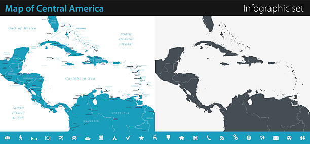
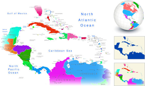
Vector maps of Central America with variable specification and icons

Flag of Haiti waving in the wind. Silk texture pattern


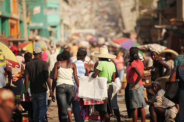
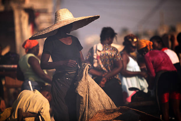
Port-Au-Prince, Haiti - February 9th, 2010 : A young Haitian woman wearing a sun hat sits in a temporarily set up open market.The earthquake, with a magnitude of 7.0Mw, destroyed most of Haiti's modest infrastructure compelling people to live on the streets or in temporary shelters.
Next