
Hawaii Islands Map Big Island Old Fashioned Pictures, Images and Stock Photos
Browse 60+ hawaii islands map big island old fashioned stock photos and images available, or start a new search to explore more stock photos and images.
Most popular
Encyclopedia Britannica 9th Edition New York Samuel L. Hall 1883 Vol XI
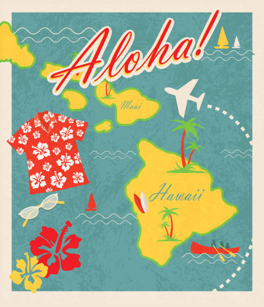
Retro Hawaiian Luau invitation design template. Includes sample text design. Includes maps of Hawaii islands including Maui. Cute travel and destination theme with Hawaiian shirt, sunglases, hibiscus, canoe, sailboat, palm trees and waves and airplane. Easy to edit with layers.

vintage postcard of the islands of hawaii


Hawaii Map, - Antique style. Includes mountains and water bodies. High detail - vector illustration

A vintage-style map of Hawaii with freeways, highways and major cities. Includes an EPS and JPG of the map without roads and cities. Texture, compass, cities, etc. are on separate layers for easy removal or changes.

A hand-drawn map of Hawaii on old paper. Created with Adobe Ideas for the iPad.

Old map of hawaii island


Illustration of a Map of the Hawaiian Archipelago

Retro Hawaiian Luau invitation design template. Includes sample text design. Includes maps of Hawaii islands including Maui. Cute travel and destination theme with Hawaiian shirt, sunglases, hibiscus, canoe, sailboat, palm trees and waves and airplane. Easy to edit with layers.


Map of Hawaii draw with the stippling technique. Beautiful and trendy illustration created only with dots and isolated on a blank background. White map with dotted black outline and dark shadow. White background with a stippled circular gradient. (colors used: black and white). Vector Illustration (EPS10, well layered and grouped). Easy to edit, manipulate, resize or colorize. Vector and Jpeg file of different sizes.


Map of Hawaii in a trendy vintage style. Beautiful retro illustration with old textured paper and light rays in the background (colors used: blue, green, beige and black for the outline). Vector Illustration (EPS10, well layered and grouped). Easy to edit, manipulate, resize or colorize.


Stamp or label with name of Hawaii, The Big Island, USA, vector illustration


3D Render of a Map of Hawaii with Straight Pins at the Position of important Cities. Vintage Color Style. Very high resolution available! All source data is in the public domain. http://www.naturalearthdata.com/about/terms-of-use/ Made with Natural Earth: Internal Administrative Boundaries, Populated Places http://www.naturalearthdata.com/downloads/10m-cultural-vectors/

Stamp or label with name of Florida, Miami Beach, USA, vector illustration

Series of passport style retro/vintage stamps in the shape of North America.

Map of Hawaii with a retro style, a vintage effect on an old textured paper.


surf composition with hawaiian map and flag

Engraving from 1873 of Haleakala, Hawaii

Map of Hawaii island in a trendy vintage style. Beautiful retro illustration with old textured paper and light rays in the background (colors used: blue, green, beige and black for the outline). Vector Illustration (EPS10, well layered and grouped). Easy to edit, manipulate, resize or colorize.

Retro Hawaiian Luau invitation design template. Includes sample text design and retro Fun in the Sun workmark. Includes maps of Hawaii islands including Maui. Cute theme with Hawaiian shirt, sunglases, hibiscus, canoe, sailboat, palm trees and waves. Easy to edit with layers.

hawaiian islands / in the pacific ocean / there's many of them

Map of Hawaii island in a trendy vintage style. Beautiful retro illustration with old textured paper (colors used: blue, green, beige and red). Vector Illustration (EPS10, well layered and grouped). Easy to edit, manipulate, resize or colorize. Vector and Jpeg file of different sizes.


Engraving from 1873 showing a map of Hawaii.

Graphic vector illustration in EPS format

hawaiian surfing emblem, made with grunge technique, two models colors. Plain colors.

Map of Hawaii island in a realistic neon sign style. The map is created with a pink glowing neon light on a dark brick wall. Modern and trendy illustration with beautiful bright colors. Vector Illustration (EPS10, well layered and grouped). Easy to edit, manipulate, resize or colorize.

Map of Hawaii island draw with the stippling technique. Beautiful and trendy illustration created only with dots and isolated on a blank background. White map with dotted black outline and dark shadow. White background with a stippled circular gradient. (colors used: black and white). Vector Illustration (EPS10, well layered and grouped). Easy to edit, manipulate, resize or colorize. Vector and Jpeg file of different sizes.

Outline map of Hawaii (USA). Border is marked with a ribbon in the national colors. The package contains a stamp with flag and frames. The file is made with no transparencies and gradients.


Hawaii - rubber stamp - vector, Hawaii map pattern - sticker - black, green, yellow, purple, blue and red

Hawaii state map on old paper background

Map of Hawaii island created with a thin black outline and light rays. Trendy and modern illustraion isolated on a blank background. Vector Illustration (EPS10, well layered and grouped). Easy to edit, manipulate, resize or colorize.

Map of Hawaii island in a trendy vintage style. Beautiful retro illustration with old textured yellow paper and a black long shadow (colors used: yellow, white and black). Vector Illustration (EPS10, well layered and grouped). Easy to edit, manipulate, resize or colorize. Vector and Jpeg file of different sizes.

Map of Hawaii in a realistic neon sign style. The map is created with a pink glowing neon light on a dark brick wall. Modern and trendy illustration with beautiful bright colors. Vector Illustration (EPS10, well layered and grouped). Easy to edit, manipulate, resize or colorize.

Map of Hawaii in a trendy vintage style. Beautiful retro illustration with old textured yellow paper and a black long shadow (colors used: yellow, white and black). Vector Illustration (EPS10, well layered and grouped). Easy to edit, manipulate, resize or colorize. Vector and Jpeg file of different sizes.

1920s map of the Big Island; focus on the Mauna Loa area. Selective focus.

Map of the Hawaiian Islands on a vintage black sea globe.

hawaiian flag with engraved map, two models colors, made with grunge technique

Black and white Hawaii map in trendy vintage style, isolated on a dusty white background. A grunge texture is used to have a retro and worn effect. His name is written on the bottom of the image. Vector Illustration (EPS10, well layered and grouped). Easy to edit, manipulate, resize or colorize.

USA and Hawaii flag map on white background. Good for your presentations, websites and for printing. Hires JPEG (5000 x 5000 pixel) and EPS file included.

Map of Hawaii in a trendy vintage style. Beautiful retro illustration of an antique map with light rays in the background and on old textured paper. Included: Realistic texture of an old parchment (colors used: sepia, beige, brown). Vector illustration (EPS10, well superimposed and grouped). Easy to edit, manipulate, resize or colorize.

Made in Hawaii - rubber stamp - vector, Hawaii map pattern - black, green, yellow, purple, blue and red

Stamp or label with name of Hawaii, Honolulu, USA, vector illustration

vintage composition of hawaii. plain colors

Graphic vector illustration in EPS format

Map of Hawaii on a blackboard texture with chalk traces.

Vector illustration of a hand drawn map of the United States of America. All elements drawn in different layers for easier editing: change color or size easily to adapt the illustration to your design.

Map of Hawaii created with a thin black outline and light rays. Trendy and modern illustraion isolated on a blank background. Vector Illustration (EPS10, well layered and grouped). Easy to edit, manipulate, resize or colorize.


Retro Hawaiian Luau invitation design template. Includes sample text design and retro Fun in the Sun workmark. Includes maps of Hawaii islands including Maui. Cute theme with Hawaiian shirt, sunglases, hibiscus, canoe, sailboat, palm trees and waves. Easy to edit with layers.

Andres Allgemeiner Handatlas - Bielefeld und Leipzig 1896

Graphic vector illustration in EPS format
Next