
Illinois Map Pictures, Images and Stock Photos
Browse 7,000+ illinois map stock photos and images available, or search for illinois map vector or state of illinois map to find more great stock photos and pictures.
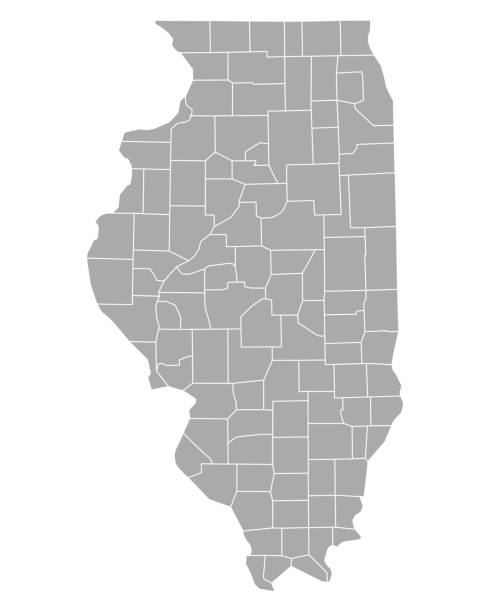
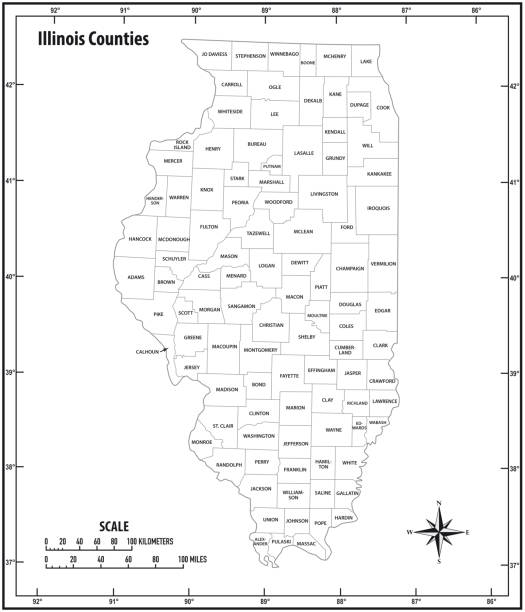
Detailed state-county map of Illinois.

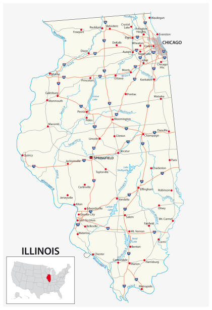
A detailed map of Illinois state with cities, roads, major rivers, and lakes plus National Forests. Includes neighboring states and surrounding water.
vector illustration of Illinois map

The maps are accurately prepared by a GIS and remote sensing expert.
Vector illustration


Vector illustration of map of Illinois with major roads, rivers and lakes.

Road map of Illinois, US American federal state. Editable highly detailed Illinois transportation map with highways and interstate roads, rivers and cities realistic vector illustration

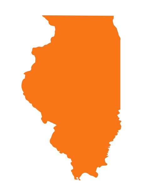
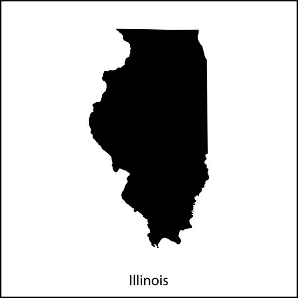
Illinois, state of USA - solid black outline map of country area. Simple flat vector illustration.
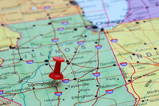
Photo of pinned Springfield on a map of USA. May be used as illustration for traveling theme.


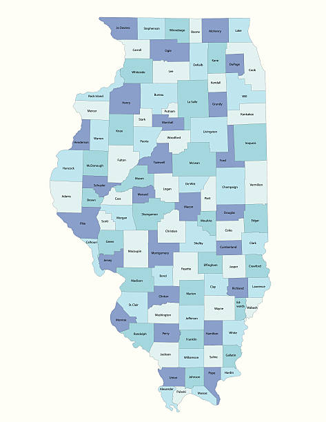
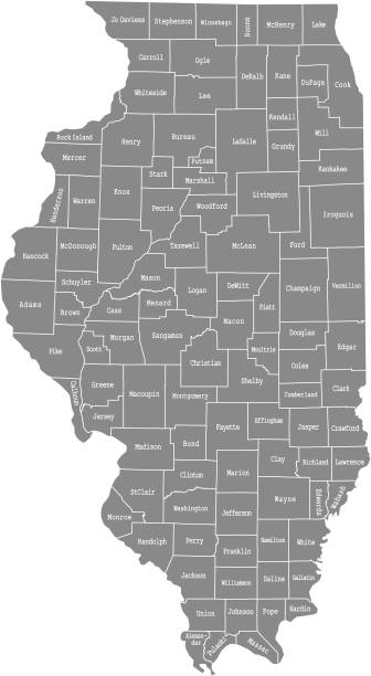
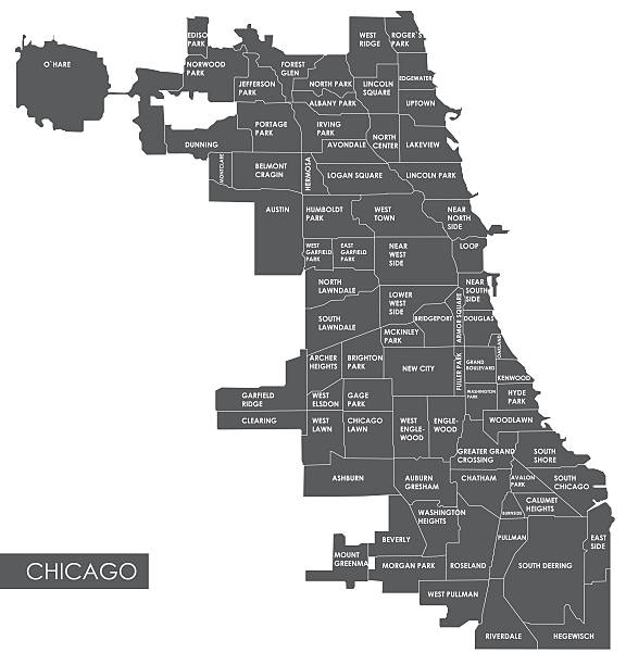
Highly-detailed Illinois county map. Each county is in a separate labeled layer. All layers have been alphabetized for easy manipulation, recoloring or other use. (see image below -- note: labels only available in AICS2 and AI10 files)
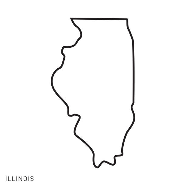
Illinois - States of USA Outline Map Vector Template Illustration Design. Editable Stroke. Vector EPS 10.

vector of the Illinois map
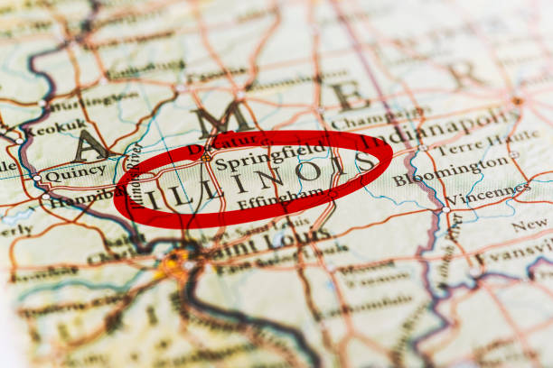
Illinois circled with red marker on map. Close up shot.
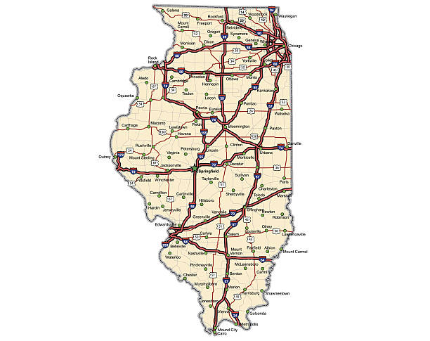
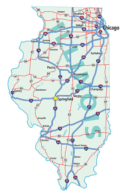
Highway map of the state of Illinois with Interstates and US Routes. State and county roads are also on here, but not labeled. All county seats (cities) and the state capitol are also on the map.


Abstract image Illinois map from point blue and glowing stars on a dark background. vector illustration.
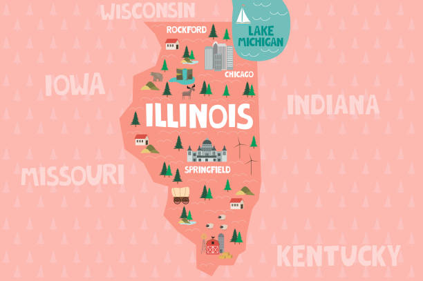
Illustrated map of the state of Illinois in United States with cities and landmarks. Editable vector illustration
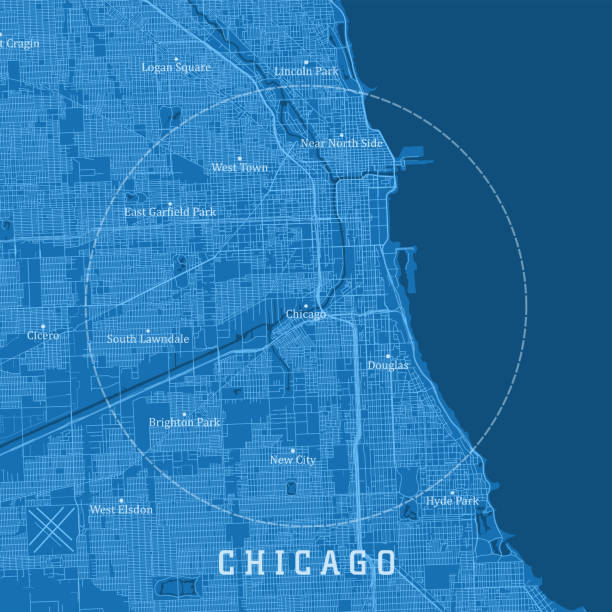
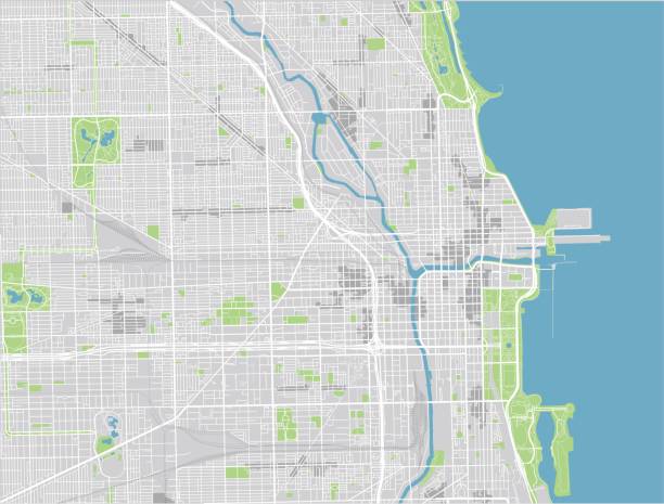
Chicago IL City Vector Road Map Blue Text. All source data is in the public domain. U.S. Census Bureau Census Tiger. Used Layers: areawater, linearwater, roads.

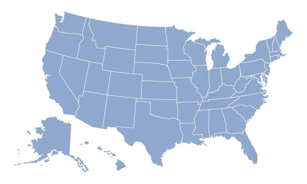
United States map - vector illustration

Map of Illinois.
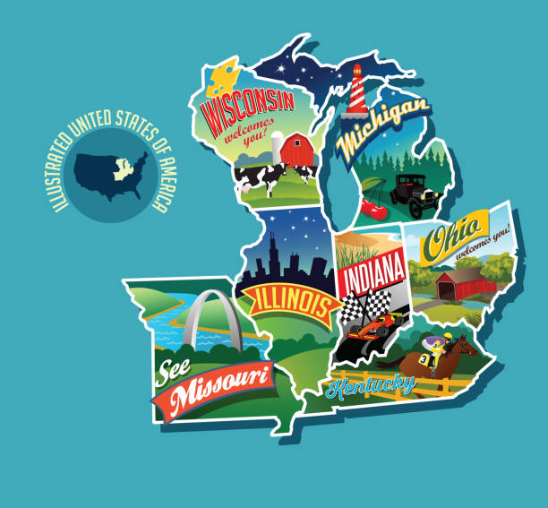
Illustrated pictorial map of Midwest United States. Includes Wisconsin, Michigan, Missouri, Illinois, Indiana, Kentucky and Ohio. Vector Illustration.
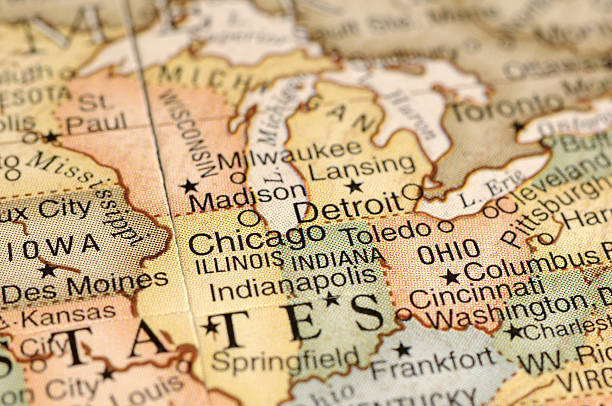
![Chicago, IL Chicago, IL .Source: "World reference atlas"
[url=/search/lightbox/5890567][IMG]http://farm4.static.flickr.com/3574/3366761342_e502f57f15.jpg?v=0[/IMG][/url] illinois map stock pictures, royalty-free photos & images](https://media.istockphoto.com/id/110925202/photo/chicago-il.jpg?s=612x612&w=0&k=20&c=N9FyXoIOEkwI-CyZDnXkG4zB4hrVg2R1az2TMPw8pAA=)
Chicago, IL .Source: "World reference atlas" [url=/search/lightbox/5890567][IMG]http://farm4.static.flickr.com/3574/3366761342_e502f57f15.jpg?v=0[/IMG][/url]
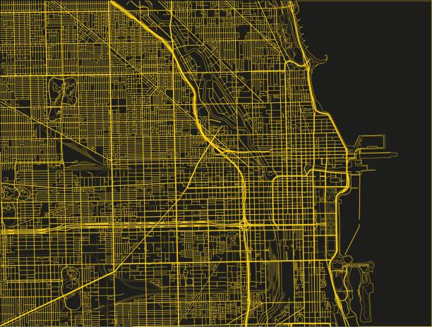
Black and yellow vector city map of Chicago with well organized separated layers.
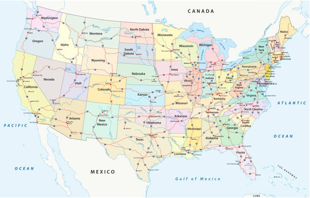
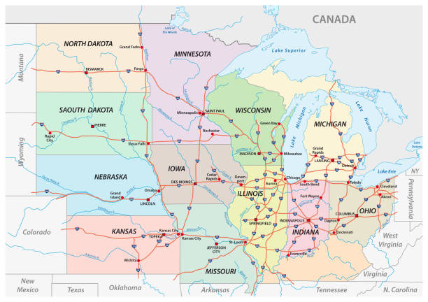
us interstate highway, administrative and political vectormap
greater chicago, Illinois vector map

Poster map of United States of America with state names. Print map of USA for t-shirt, poster or geographic themes. Hand-drawn colorful map with states. Vector Illustration

3D render and image composing: Topographic Map of Illinois, USA. Isolated on White. High quality relief structure!

Vector illustration of the Silver Map of USA State of Illinois

illustration of Illinois state map with road map for your design and products.

Vector Illustration of a City Street Map of Chicago, Illinois, USA. Scale 1:60,000. All source data is in the public domain. U.S. Geological Survey, US Topo Used Layers: USGS The National Map: National Hydrography Dataset (NHD) USGS The National Map: National Transportation Dataset (NTD)

vector of the Illinois map
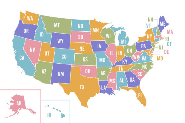
USA map with abbreviated state names. United States of America cartography with colored states. Vector illustration.

Vector city map of Chicago with well organized separated layers.

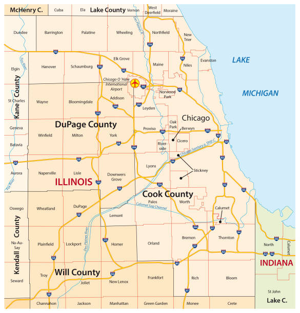
Illinois, IL, political map, with capital Springfield and metropolitan area Chicago. State in the Midwestern region of United States, nicknamed Land of Lincoln, Prairie State, and Inland Empire State.


Illinois state detailed editable map with with cities and towns, geographic sites, roads, railways, interstates and U.S. highways. Vector EPS-10 file, trending color scheme

illustration of Illinois state road map for your design and products.

"Highly detailed vector map of Illinois, United States. File was created on November 12, 2012. The colors in the .eps-file are ready for print (CMYK). Included files: EPS (v8) and Hi-Res JPG (5600aa aaa 5600 px)."

Greetings from Illinois, USA. Retro style postcard with patriotic stars and stripes lettering and United States map in the background. Vector illustration.

"Map with pin on Chicago, Illinois"

"Detailed vector map of Illinois with administrative divisions. File was created on December 10, 2012. The colors in the .eps-file are ready for print (CMYK). Included files: EPS (v8) and Hi-Res JPG (3753aa aaa 5600 px)."
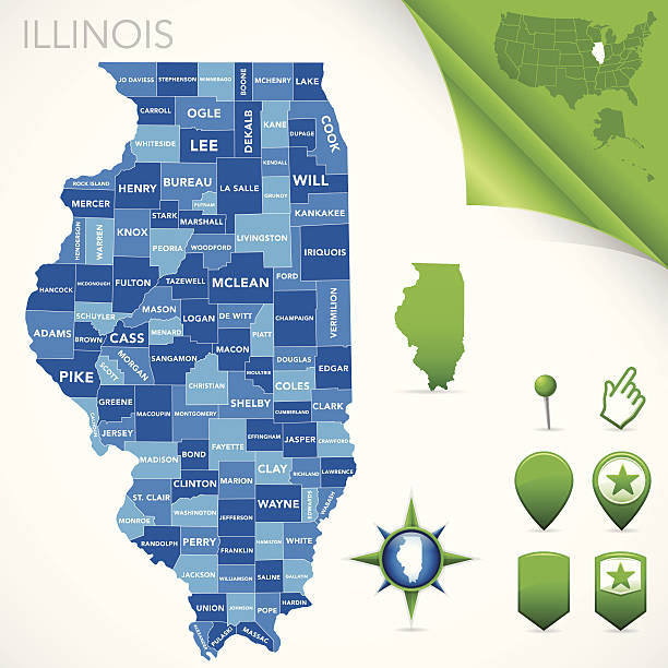
Highly-detailed Illinois county map. Each county is in it's own separate labeled layer. County names are in a separate layer and can be easily adjusted or removed as well. All layers have been alphabetized for easy manipulation, recoloring or other use.

Map of Illinois in a trendy vintage style. Beautiful retro illustration with old textured paper and light rays in the background (colors used: blue, green, beige and black for the outline). Vector Illustration (EPS10, well layered and grouped). Easy to edit, manipulate, resize or colorize.

Topographic / Road map of Chicago, IL. Original map data is public domain sourced from www.census.gov/

Next