Jerusalem Map Pictures, Images and Stock Photos
Browse 2,700+ jerusalem map stock photos and images available, or search for israel or jerusalem old city to find more great stock photos and pictures.
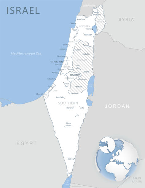
Blue-gray detailed map of Israel and administrative divisions and location on the globe. Vector illustration
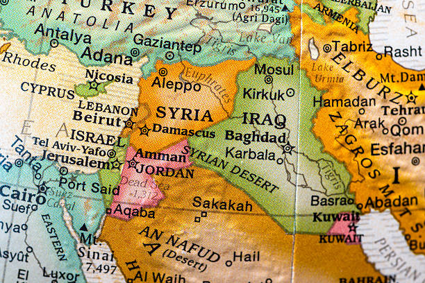
small desktop world globe showing Syria,Israel,lebanon,jordan, and vicinities

map of jerusalem area

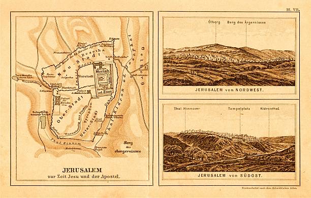
Historical map of Jerusalem with the Stations of the Cross of Jesus Christ. From Gethsemane to Calvary. Explanations in German. Wood engraving, published in 1898.
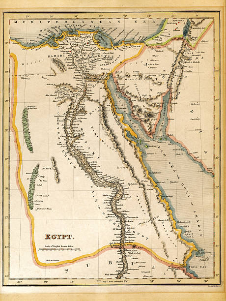
An old 19th century map, engraved and printed in England in 1845, depicting Egypt (Jerusalem in the north down to the border with Nubia in the south.

Israel map vector illustration, scribble sketch State of Israel, West Bank and Gaza Strip
Old plan of Jerusalem in a german bible:


Israel background vector frame border card omelette

A closeup shot of an 18-19th century vintage map of Jerusalem

3D Render of a Topographic Map of Jerusalem, Israel.

Poster Style Topographic / Road map of Jerusalem, Israel. Original map data is open data via © OpenStreetMap contributors. All maps are layered and easy to edit. Roads are editable stroke.

Topographic / Road map of Jerusalem, Israel. Original map data is open data via © OpenStreetMap contributors. All maps are layered and easy to edit. Roads are editable stroke.

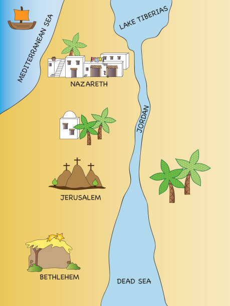
illustration of map of palestine in the jesus time
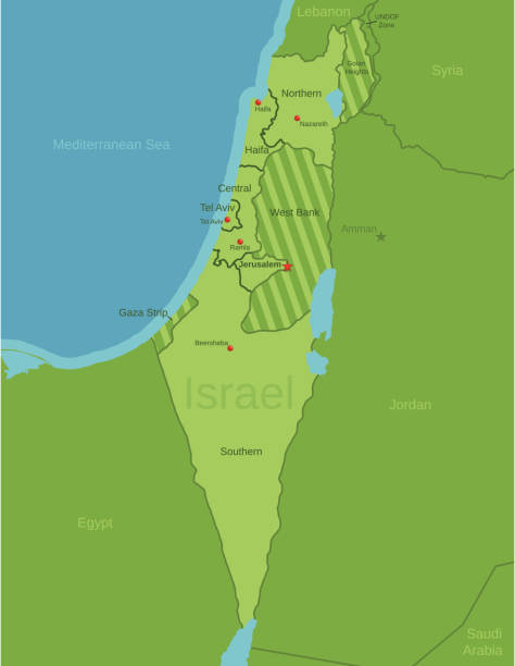
This file is a map highlighting Israel as well as it's districts and capital cities. This map also shows surrounding countries and capital cities if present. This map has text labels for the countries, districts, capital cities and major bodies of water. ZOOM IN on this highly detailed map, it is a great addition to the collection. This file will work well for your print or web based project. This file is layered and grouped (labeled in ai v10 file), making it a very easy file to work with. This download contains an editable ai v10 and eps file, as well as a large JPG file.

Apostle Paul's Missionary Journeys: 1st (green); 2nd (red); 3rd (blue); last to Rome (yellow). Lithograph, published in 1886.

From Young People's Bible History - 1873


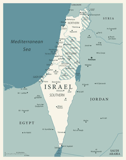
Political map of Israel with national borders, cities and rivers
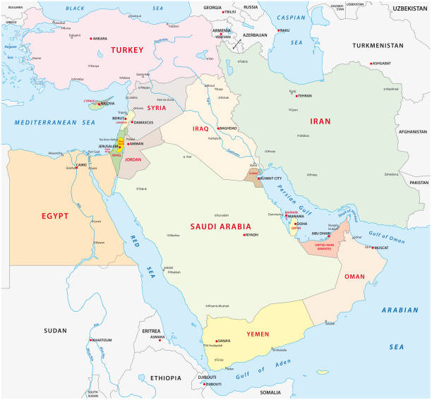
Near east vector map

World Countries vector maps series. Spiral fingerprint series

Ancient topographic map of Palestine and seperate map of Jerusalem in three eras: 1) Judges 2) Juda and Israel, 3) Maccabees to Titus (70 AD). A further separate card shows the largest expansion of the Jewish kingdom under David and Solomon (top left). Legend in Latin language. Steel engraving with hand colored borderlines, published in 1861.

Ancient Jerusalem from an original drawing (Rare) by W. Hughes,engraved and published (1845)by Charles Knight & Co in the Pictorial sunday-Book.

Israel political map of administrative divisions - districts, Gaza Strip and Judea and Samaria Area. Solid blue blank vector map with white borders.

Map of Israel - Infographic Vector illustration

Three versions of the World Map with the enlarged map of Israel with flag. Europe, Asia, and America centered world maps.

Engraved illustration of Ancient and Modern Jerusalem Map Engraving from The Popular Pictorial Bible, Containing the Old and New Testaments, Published in 1862. Copyright has expired on this artwork. Digitally restored.

3D Render of a Topographic Map of Jerusalem, Israel.

Detailed Israel administrative map with country flag and location on a blue globe. Vector illustration
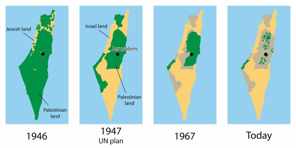
Vector map of the Palestine and Israel territories over the years
Map of Israel - Vintage Vector illustration
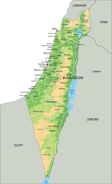
High detailed Israel physical map with labeling. Organized vector illustration on seprated layers.


west bank administrative and political vector map.

Topographic / Road map of Jerusalem, Israel. Original map data is open data via © OpenStreetMap contributors. All maps are layered and easy to edit. Roads are editable stroke.

A grunge map of Israel on a scroll with compass rose. Hires JPEG (5000x5000 pixels) and EPS10 file included.

Antique Canadian classroom map from 1920, depicting Jerusalem/Palestine Mandate and its location within the Levant.

Poster Style Topographic / Road map of Jerusalem, Israel. Original map data is open data via © OpenStreetMap contributors. All maps are layered and easy to edit. Roads are editable stroke.
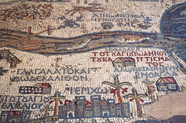
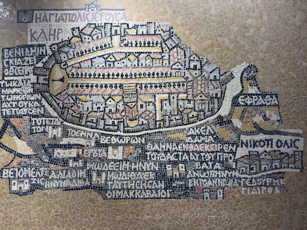
Madaba, Jordan - September, 30, 2013: the Madaba Mosaic Map, a map with hills, valleys and towns in Palestine and the Nile Delta dating from the 6th century on the floor of the Greek Orthodox Basilica of Saint George
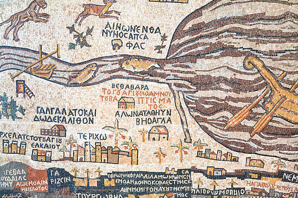
mosaic replica of antique Madaba map of Holy Land

Part of the Southern District of Israel, political map, with the Gaza Strip, bottom half of West Bank, Dead Sea, and with borders and most important cities in this region. Illustration. Vector.

"Grunge world map, with a red sign on a conflict area"
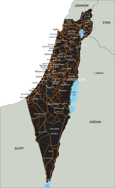
High detailed Israel road map with labeling. Organized vector illustration on seprated layers.

Set Hanukkah dreidel Jewish wine bottle Star of David sweet bakery necklace on chain and Torah scroll icon. Vector.

Antique map of the Holy lands and Jerusalem. Published by the Dutch cartographer Willem Blaeu in Atlas Novus (Amsterdam 1635). Photo by N. Staykov (2007)

Topographic / Road map of Tel Aviv-Yafo, Israel. Original map data is open data via © OpenStreetMap contributors. All maps are layered and easy to edit. Roads are editable stroke.

3d isometric map of Middle East region, isolated with shadow vector illustration

3D map of Israel with topographic relief, borders. Detailed isometric physical map of the Israel-Palestine with Gaza strip, West Bank areas, big cities.

A dark Israel map. Hires JPEG (5000 x 5000 pixels) and EPS10 file included. File contains gradient mesh EPS10.
Vector isolated simplified illustration icon with silhouette of Israel map. National flag. White background

Engraved illustration of the Travels of The Apostle Paul Map Engraving from The Popular Pictorial Bible, Containing the Old and New Testaments, Published in 1862. Copyright has expired on this artwork. Digitally restored.

Israel administrative blue-green map with country flag and location on a globe. Vector illustration

A partial view of a world globe with the spotlight on Israel and her neighbors.

3D Illustration of a waving flag of Israel
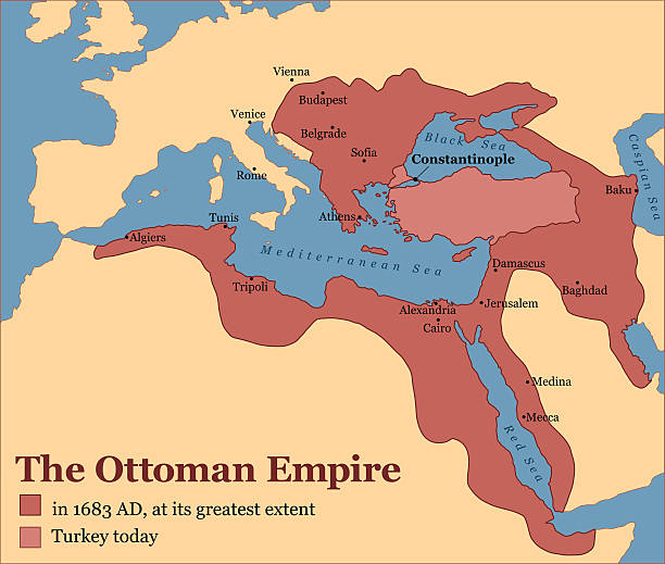
The Ottoman Empire at its greatest extent in 1683, and Turkey today. Vector illustration.
Madaba Map, a mural in the Church of the Holy Sepulcher
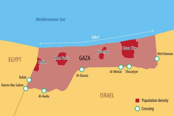
Vector map of the Gaza Strip with the main cities and border crossings

Previous
of 46Next