Jerusalem Map Pictures, Images and Stock Photos
Browse 2,600+ jerusalem map stock photos and images available, or search for israel or jerusalem old city to find more great stock photos and pictures.
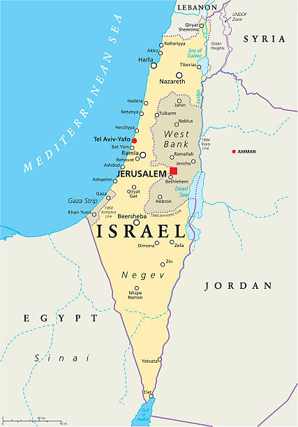
Israel political map with capital Jerusalem, national borders, important cities, rivers and lakes. English labeling and scaling. Illustration.

Map of the ancient Jerusalem. Copperplate engraving, published in 1774.

Jerusalem on an old 1810's map. Selective focus and Canon EOS 5D Mark II with MP-E 65mm macro lens.

Vector art.

"Antique map of the ancient city of Jerusalem, from a bible published in 1783, showing many historical features, eg. the Mount of Olives, the walled city, Calvary (Golgotha), Temple Mount etc."
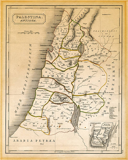
"An old 19th century map, engraved and printed in England in 1845, depicting ancient Palestine ('Antiqua Palestina' as it's written on the map itself) at the times of Jesus Christ, from Damascus in the north down to the land south of the Dead Sea in the south. On the bottom right corner there's an enlargement of the old city of Jerusalem."

Vintage biblical map from 1879 showing Ancient Jerusalem

Plan of the ancient city of Jerusalem - 1844 color Map
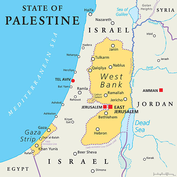
State of Palestine with designated capital East Jerusalem, claiming West Bank and Gaza Strip. Political map with borders and important places. Most areas are occupied by Israel. English labeling.

"Part of an old 19th century map, engraved and printed in England in 1845, depicting ancient Jerusalem at the times of Jesus Christ."
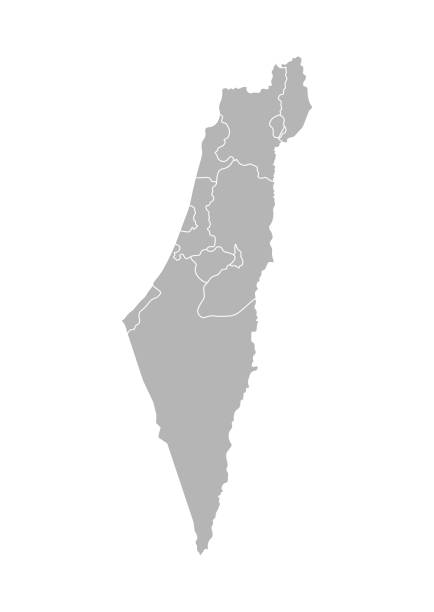
Vector isolated illustration of simplified administrative map of Israel. Borders of the districts (regions). Grey silhouettes. White outline.
A close-up/macro photograph of Israel and surrounding area from a desktop globe. Adobe RGB color profile.

Vintage engraving of showing a map of Jerusalem in the time of Jesus. 1841

Vintage illustration of Antique plan of Ancient Jerusalem

Vintage engraving of a Plan of Jerusalem at the Tine of King Herod

Eastern Mediterranean Political Map with capitals national borders, important cities, rivers and lakes. English labeling and scaling. Illustration.


3D Render of a Topographic Map of the Middle East region including Jordan and Syria. Version with Country Boundaries and Cities. All source data is in the public domain. Color texture: Made with Natural Earth. http://www.naturalearthdata.com/downloads/10m-raster-data/10m-cross-blend-hypso/ Relief texture: NASADEM data courtesy of NASA JPL (2020). URL of source image: https://doi.org/10.5067/MEaSUREs/NASADEM/NASADEM_HGT.001 Water texture: SRTM Water Body SWDB: https://dds.cr.usgs.gov/srtm/version2_1/SWBD/ Boundaries Level 0: Humanitarian Information Unit HIU, U.S. Department of State (database: LSIB) http://geonode.state.gov/layers/geonode%3ALSIB7a_Gen

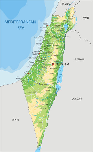
Detailed vector map of State of Israel with border states, administrative districts and main cities.

Red map pointer stuck into of Jerusalem

Israel - vintage map of the country in brown-green colors. Vector illustration

Vintage map from 1879 showing Jerusalem

Engraved illustration of the Travels of Our Savior Map Engraving from The Popular Pictorial Bible, Containing the Old and New Testaments, Published in 1862. Copyright has expired on this artwork. Digitally restored.
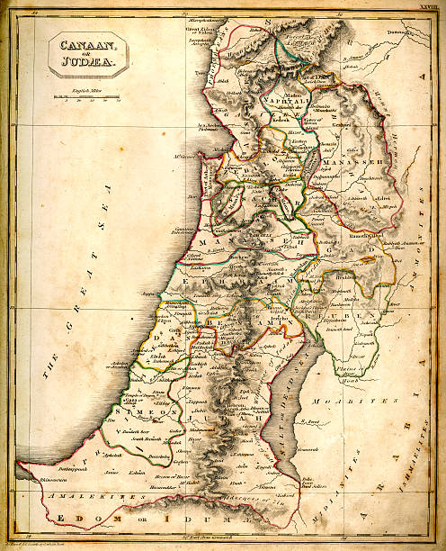
Vintage chart of ancient Canaan or Judaea from 1837

The cardo street mosaic in Jerusalem old city

Series of 4 maps taken from an antique bible

Vintage illustration of Antique map of Ancient Palestine, with detail of Jerusalem, Atlas of Ancient Geography. By Samuel Butler
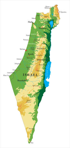
Highly detailed physical map of Israel,in vector format,with all the relief forms,regions and big cities.

The journey of Jesus Christ from Galilee to Jerusalem

Map of Israel with a retro style, a vintage effect on an old textured paper.
High detailed Israel physical map with labeling. Organized vector illustration on seprated layers.

Poster Style Topographic / Road map of Tel Aviv-Yafo, Israel. Original map data is open data via © OpenStreetMap contributors. All maps are layered and easy to edit. Roads are editable stroke.
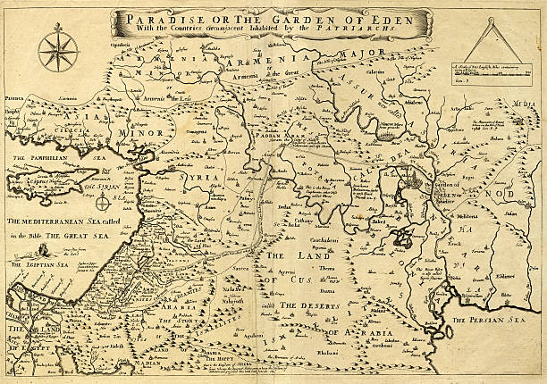
This may appear to be a straightforward map of the Middle East. However, closer inspection will reveal some extraordinary details, a number of descriptions on the map refer to stories from the Bible.

Engraved illustration of Ancient and Modern Jerusalem Map Engraving from The Popular Pictorial Bible, Containing the Old and New Testaments, Published in 1862. Copyright has expired on this artwork. Digitally restored.
Vector Illustration of a Drawning Hand Traced Map of Israel and Flag
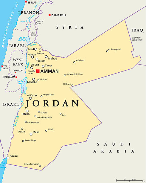
Jordan political map with capital Amman, national borders, important cities, rivers and lakes. English labeling and scaling. Illustration.

Blue tack on map of the world with magnifying glass looking in Jerusalem, Israel in the Middle East, Asia

Detailed map of Palestine with the main cities names written in Arabic. Isolated vector file.


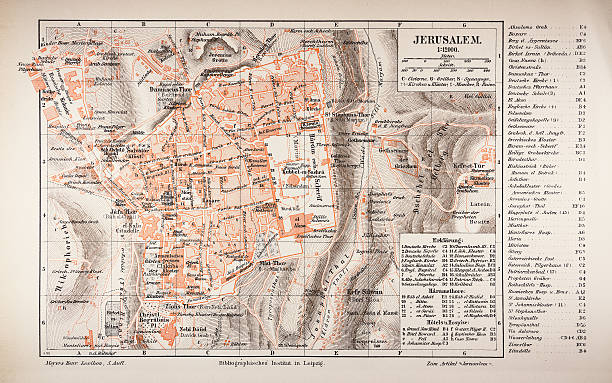
Topographic map of Jerusalem. Lithograph, published in 1897.

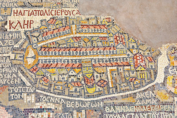
Jordan. Madaba (biblical Medeba) - St. George's Church. Fragment of the oldest floor mosaic map of the Holy Land - the Holy City Jerusalem. There are clearly visible surrounded walls, north-south Cardo street (with colonnade), the Damascus Gate plaza and the church of the Holy Sepulcher (big yellow cupola)

Jerusalem, Israel - October 12, 2017: Specimen model of ancient Holy City and Temple Mount exposed in Tower Of David citadel in Jerusalem

I took an old map created in 1716

Antique Map from 1862 of Ancient Palestine. Showing Palestine before exile; Palestine and Lower Egypt; Jerusalem; and the Kingdom of David and Solomon. Maps text is written in Latin.
State of Israel - vector map.
Israel vector map with flag

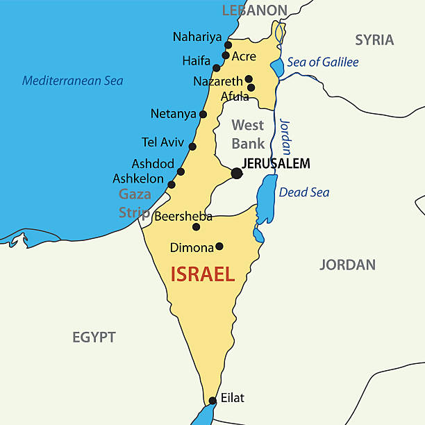
Israel political map with capital Jerusalem and neighbors. State of Israel, a country in Middle East with Palestinian territories West Bank and Gaza Strip. Illustration with English labeling. Vector.
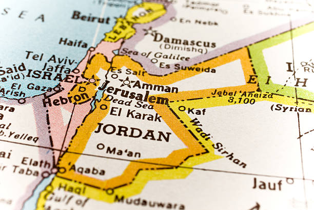
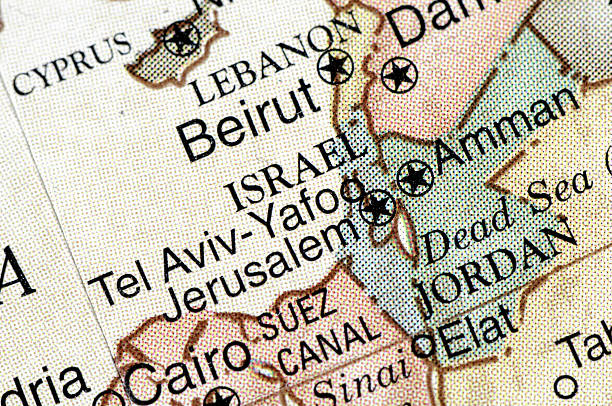
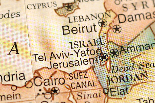
"Map of Israel, Jordan, JerusalemShot taken with 5D Mark II, 24-70 canon lens, selective focus."

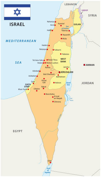
Stylized vector Israel map showing big cities, capital Jerusalem, administrative divisions and country borders

Map of Israel - Vintage Vector illustration

Historical city map of Jerusalem at the time of the kings. Wood engraving, published in 1862.

Blue-green detailed map of Israel administrative divisions with country flag and location on the globe. Vector illustration
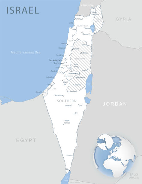
Blue-gray detailed map of Israel and administrative divisions and location on the globe. Vector illustration

Historical plan of Solomon's Temple in Jerusalem (Designations in German). Wood engraving, published in 1862.
Next