
Kentucky Road Pictures, Images and Stock Photos
Browse 2,400+ kentucky road stock photos and images available, or search for kentucky road trip or kentucky road map to find more great stock photos and pictures.
Most popular
Web banner of a scenic byway in Kentucky's famed bluegrass horse county just out side of Lexington. The scene depicts a tree-lined, two-lane road with wooden rail fences on either side.

Aerial view of Jacobson Park Lake and Richmond Road in Lexington, Kentucky
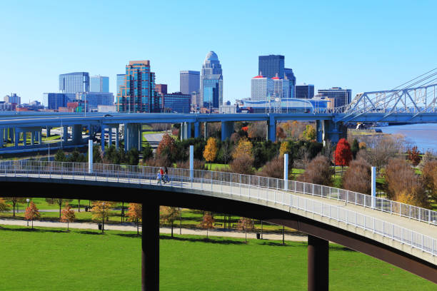
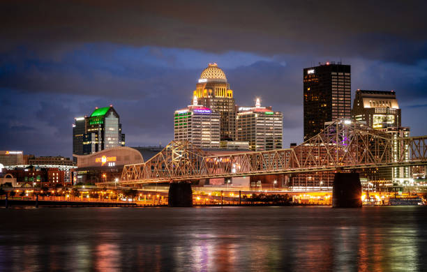
The Louisville, Kentucky skyline with pedestrian walkway in front

Drone shot of eight shaped crossroad traffic
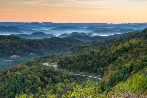
Bits of fall color are seen amongst the trees as a road winds through the mountain in this deciduous forest.

Aerial view of Elizabethtown, KY, looking west in the afternoon, across a residential neighborhood into commercial buildings.
Drone shot of downtown Lexington, Kentucky with view of the south side of the city
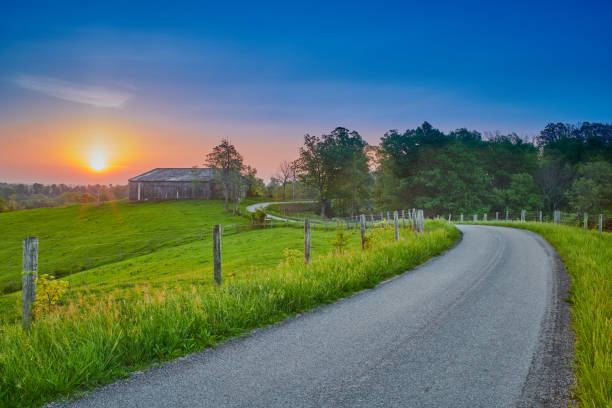
Dirt road leading to a barn in the distance with wooden rail fences on either side with a sunset in the background
Country road through farm land on a sunny morning, a rural highway near Lexington, Kentucky, KY, USA.
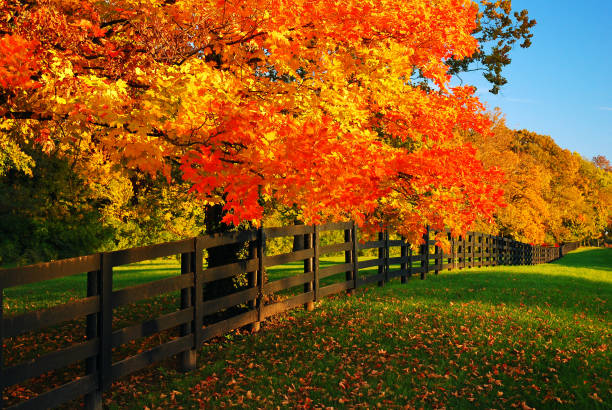
Maple trees glow in a vibrant autumn hue lining a farm road.

Motorycle speeding down highway toward the sunset

Bluegrass country

Stretch of Interstate 75 near exit 129, Georgetown, Kentucky

Frankfort, Kentucky, USA downtown city streets at night.

Walkway in a park lined with painted in black wooden fences

Road leading up to the Hensley Settlement at the Cumberland Gap national Historical Park.

Louisville, KY skyline with a highway with sparse traffic towards bridges over Kentucky river on the foreground.

Perspective toward horizon of bicycle trail between horse farm fences near city of Lexington, Kentucky, USA


Kentucky Horse Farm with Beautiful White Fences, Autumn Trees and Blue Sky

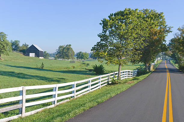
Road between horse farms in rural Kentucky


The Abraham Lincoln Bridge and John F. Kennedy Memorial Bridge crossing the Ohio River from Kentucky to Indiana. Long exposure sky and water movement.
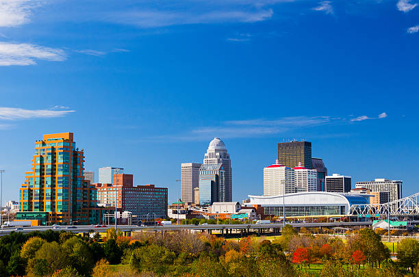
Louisville downtown skyline view with a park with trees in the foreground. Picture taken during autumn.

Maysville, KY, July 16, 2016. View of Simon Kenton Memorial Bridge from Downtown Maysville.
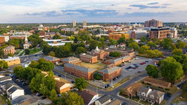
Aerial view university campus area looking into the city suburbs in Lexington KY
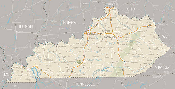
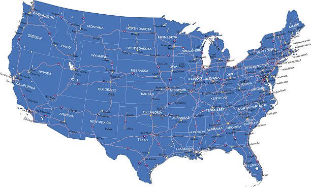
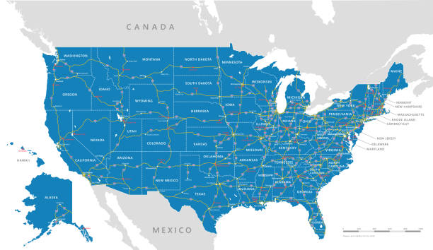
A detailed map of Kentucky state with cities, roads, major rivers, and lakes plus National Forests. Includes neighboring states and surrounding water.

Aerial view from Louisville, KY looking over the interstate and the Ohio River toward Jeffersonville, IN. The Big Four Bridge, Kennedy Bridge, Lincoln Bridge, and George Rogers Clark Memorial Bridges are visible.
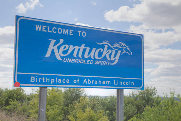
Welcome to Kentucky road sign at the state border

Scarce traffic on Main Street in downtown Woodford county's Versailles, KY during sunrise

Ohio road vector map with flag

Traffic crossing an interstate highway four lane on a bridge over the Ohio River, Louisville, Kentucky, USA.

John A. Roebling Suspension Bridge with sunset and clouds at Cincinnati, Ohio.
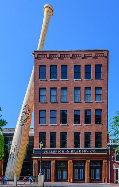
Louisville, Kentucky, USA - May 15, 2016: A 6 story tall bat leans against the Louisville Slugger Museum & Factory in downtown Louisville Kentucky. The bat is billed as the largest in the world but is actually made of metal and is hollow.
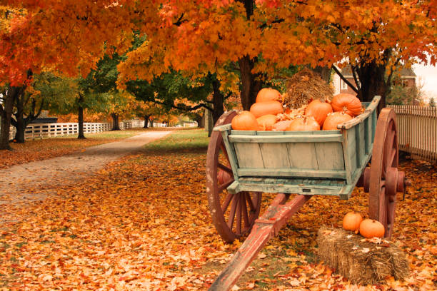
Fall Scenic View. Cart with Pumpkins
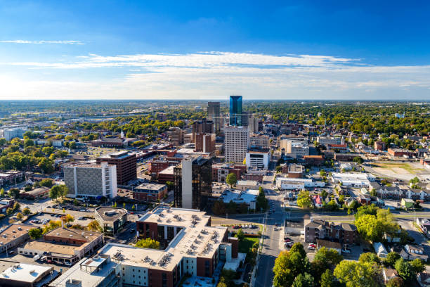
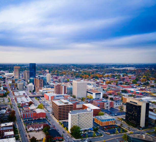
Aerial view of Downtown Lexington, Kentucky with a blue sky with clouds and the metropolitan area cityscape in the background.

Louisville is the largest city in the U.S. state of Kentucky, and the county seat of Jefferson County.

Poster Style Topographic / Road map of Louisville, KY, USA. Original map data is open data via © OpenStreetMap contributors. All maps are layered and easy to edit. Roads have editable stroke.

Aerial panorama of University of Kentucky campus with the football stadium parking lot on the foreground

Old historic city downtown of Lexington, Kentucky, USA

Scenic nighttime image of an old farm barn and a country road in moonlight

Intersection of highways in downtown Louisville, KY leading to bridges to Indiana crossing Kentucky river with sparse midday traffic

Dry stack stone wall on side of road in rural Kentucky

Foggy Road in rural Kentucky

kentucky road vector map
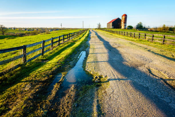
Poorly maintained country road through a farm in Central Kentucky

Driving In The Mountains. Narrow and winding Appalachian Mountain road with slippery conditions after a rain storm in the scenic Red River Gorge of Kentucky
Detailed map of United States of America.
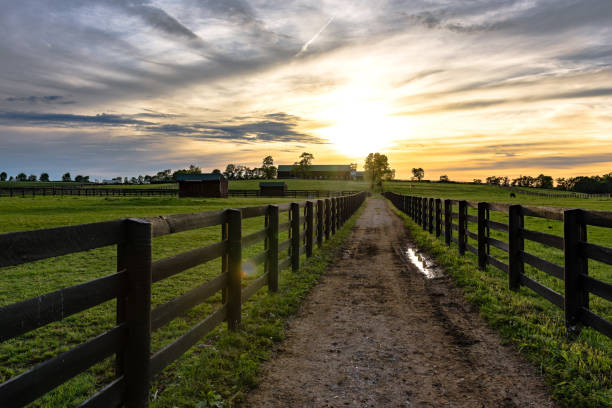
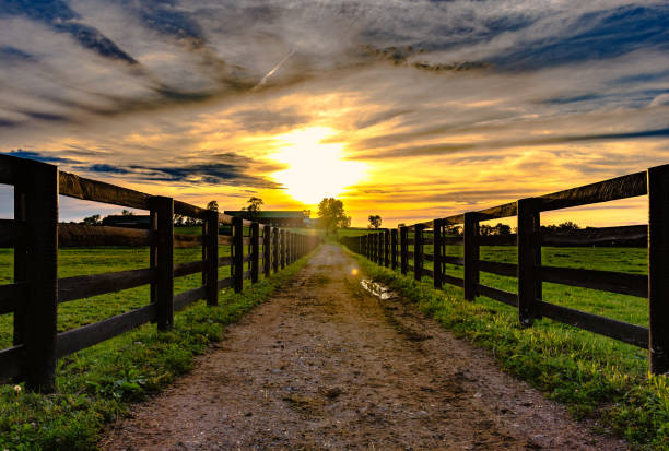
Country lane between pastures on a Kentucky horse farm at sunset with lens flare
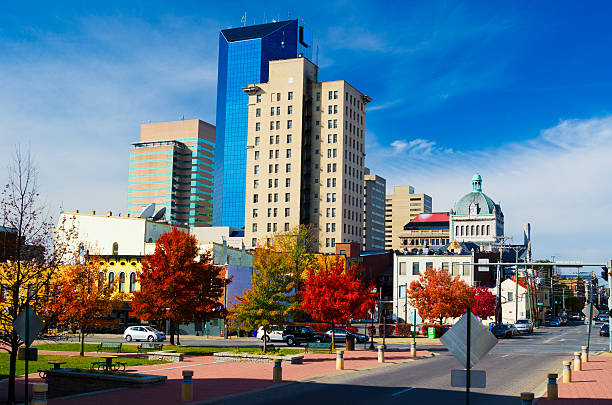
Downtown Lexington Skyline. Lexington is the second largest city in Kentucky, and most famous for the Kentucky Derby Race, and is known as "The Horse Capitol of the World."

Louisville, KY, USA June 26, 2008 Fourth Street Live in Louisville, Kentucky, has become a destination for shopping, dining and entertainment.

An abandoned railroad tracks in Hopkinsville, Kentucky

The road leading up to Pinnacle Point in Cumberland Gap National Historical Park at the border of three states: Virginia, Tennessee, and Kentucky.
High detailed USA interstate road map vector

An old fashioned log farm home on a rural country road in a rustic setting in the mountains of Kentucky.
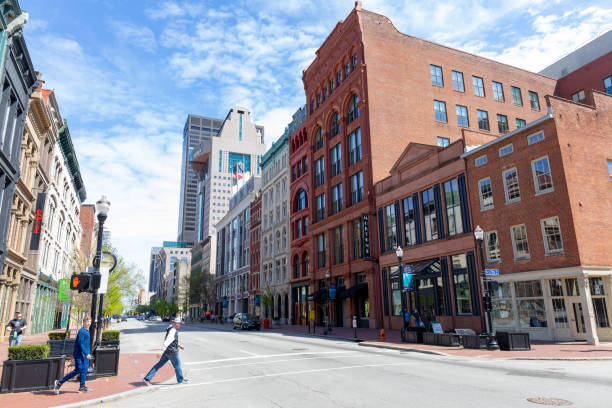
Louisville, Kentucky, USA - April 13, 2019: People walking on West Main Street, among the old buildings at downtown
Downtown Louisville Kentucky
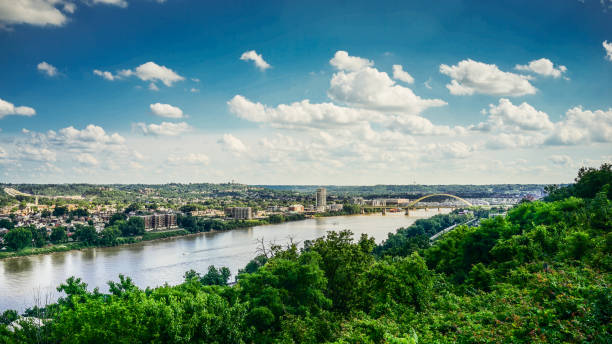
Kentucky and Ohio River with blue sky and clouds

Next