Labeled Map Of South America Pictures, Images and Stock Photos
Browse 330+ labeled map of south america stock photos and images available, or start a new search to explore more stock photos and images.
Most popular
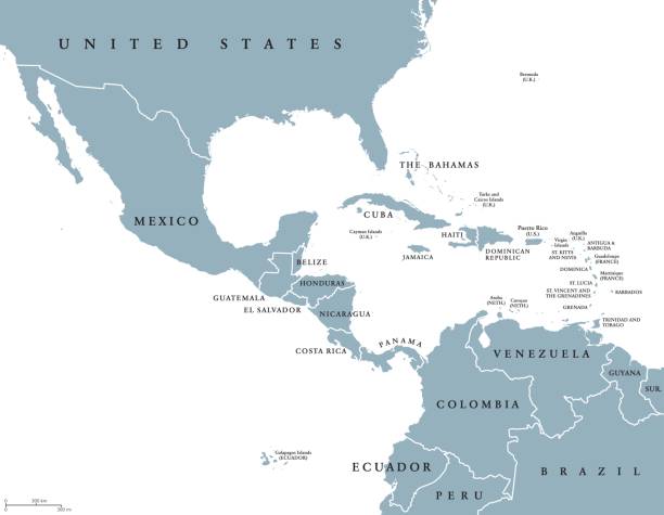
Middle America political map with borders and English labeling. Countries of southern North America, the nations of Central America and the Caribbean. Gray illustration on white background. Vector.

Hight detailed divided and labeled world map.
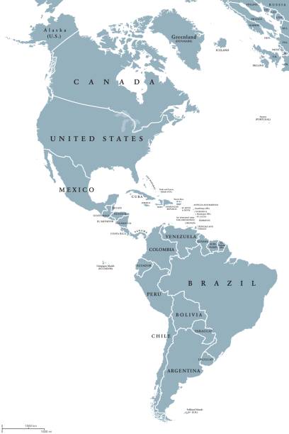
The Americas political map with countries and borders of the two continents North and South America. English labeling. Gray illustration on white background. Vector.

The Americas, North and South America, political map with countries and international borders of two continents. New World and western hemisphere. The Caribbean. Illustration. English labeling. Vector

This vector map of Brazil country has been accurately made by a graphic designer who has a postgraduate degree in GIS and remote sensing. You can use this map to show your study site of a project.
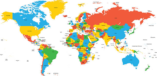
Hight detailed divided and labeled world map.
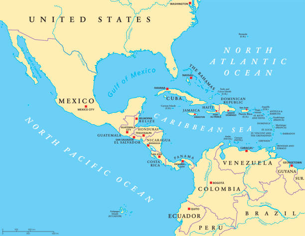
Middle America political map with capitals and borders. Mid-latitudes of the Americas region. Mexico, Central America, the Caribbean and northern South America. Illustration. English labeling. Vector.

South America map - green hue colored on dark background. High detailed political map South American continent with country, capital, ocean and sea names labeling.

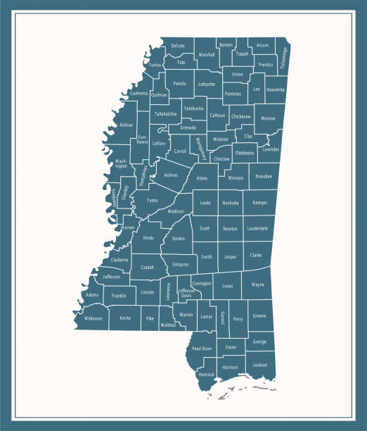
Downloadable county map of Mississippi state of United States of America. The map is accurately prepared by a map expert.
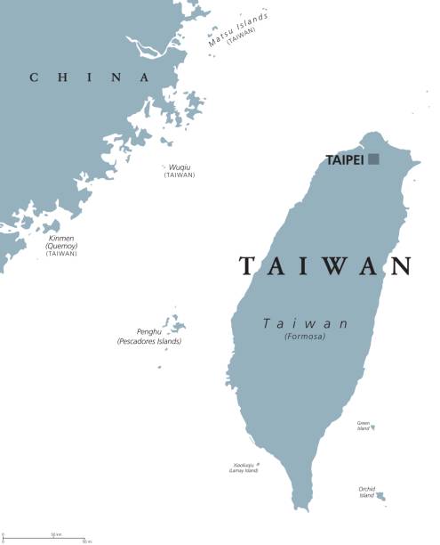
Taiwan political map with capital Taipei. English labeling. Officially the Republic of China, ROC, a state in East Asia on the island of Taiwan, formerly known as Formosa. Gray illustration. Vector.


Current and potential Superpowers, political map. Current superpower United States and the potential superpowers Brazil, China, European Union, India and Russia. English labeling. Illustration. Vector

Bahia - Piaui - Ceara - Sergipe - Pernambuco - Alagoas - Paraiba - Rio Grande Do Norte Map Brazil illustration

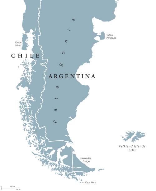
Patagonia political map. The southern end of continent South America, shared by Chile and Argentina. With Falkland Islands, a British overseas territory. English labeling. Gray illustration. Vector.
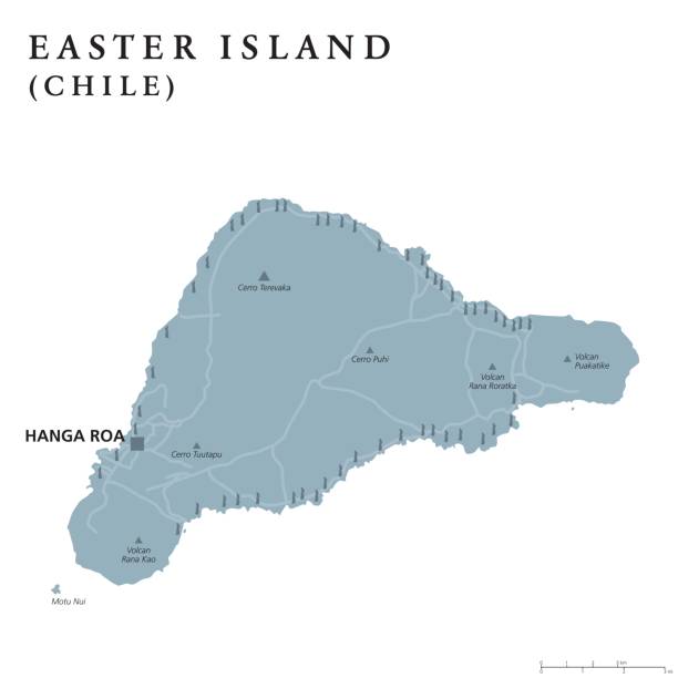
Easter Island political map with capital Hanga Roa, streets and monumental Moai statues. Chilean island in southeastern Pacific Ocean. Gray illustration on white background. English labeling. Vector.


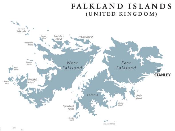
Falkland Islands political map with capital Stanley. British overseas territory. Archipelago in South Atlantic Ocean on Patagonian Shelf. Gray illustration. White background. English labeling. Vector.

Gray map of Florida with the main cities labels


Political map of Central Amercia. Simlified schematic flat vector map in shades of turquoise blue.

Colombia political map with capital Bogota, national borders and neighbors. Republic and transcontinental country in Central and South America. Gray illustration over white. English labeling. Vector.

South America Region. Map of countries in southern America. Vector illustration.
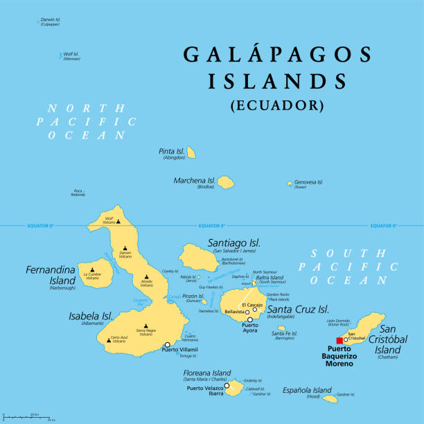
Galapagos Islands, Ecuador, political map, with capital Puerto Baquerizo Moreno. Archipelago of volcanic islands on either side of equator in Pacific Ocean known for a large number of endemic species.

Hight detailed divided and labeled world map with navigation icons.


Guyana, Suriname and French Guiana political map with capitals Georgetown, Paramaribo and Cayenne. English labeling. Also the Guayanas, a region in northern South America. Gray illustration. Vector.

Panama political map with capital Panama City, national borders, neighbor countries and the Panama Canal. Republic in North and Central America. Gray illustration, English labeling, over white. Vector

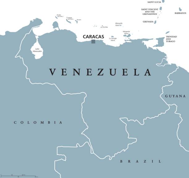
Venezuela political map with capital Caracas and national borders. Bolivarian and federal republic, a country on northern coast of South America. Gray illustration over white. English labeling. Vector


Brazil country map outline vector illustration with scales of miles and kilometers, borders of states or provinces and their names, and capital location and name, Brasilia


Brazil political map with capital Brasilia, national borders and neighbors. Federal republic and country in South America. Gray illustration isolated on white background. English labeling. Vector.

Colorful map of the Texas region in the USA

Isolated colored map of Chile with borders of the regions

Colorful map of the Florida region in the USA

South America map. High detailed political map South American continent with country, capital, ocean and sea names labeling.

Chile political map with capital Santiago, national borders and neighbors. Republic and country in South America. Long, narrow strip of land. Gray illustration over white. English labeling. Vector.

Americas map - white lands and grey water. High detailed political map of North and South America continent with country, capital, ocean and sea names labeling.
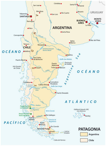
Vector map of Patagonia, the southern part of south America, Chile and Argentina.

Hight detailed divided and labeled world map with navigation icons.

Highly detailed downloadable map of New Mexico county state of United States of America for web banner, mobile, smartphone, iPhone, iPad applications and educational use. The map is accurately prepared by a map expert.

Colorful map of Florida with the main cities labels


South America Map and infographic elements. Detailed vector illustration of map.


South America Region. Map of countries in southern America. Vector illustration.


Ceara - Rio Grande Do Norte - Paraiba - Pernambuco - Alagoas - Sergipe Map Brazil illustration


Trinidad and Tobago political map with capital Port of Spain. Republic and Caribbean twin island country in the north of Venezuela. Gray illustration on white background. English labeling. Vector.

Next