Vector isolated illustration of simplified administrative map of Canada. Borders of the provinces (regions). Grey silhouettes. White outline.
Browse 3,500+ labrador canada stock photos and images available, or search for newfoundland or newfoundland and labrador to find more great stock photos and pictures.
Vector isolated illustration of simplified administrative map of Canada. Borders of the provinces (regions). Grey silhouettes. White outline.
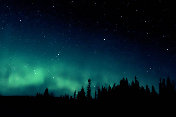
Northern Lights (Aurora Borealis) silhouetted by a skyline of spruce trees.

Battle Harbour - historic fishing willage at Labrador, Newfoundland, Canada

In Labrador the landscapes are grandiose, the air is pure and you feel a bit like being at the end of the world. Land of giants
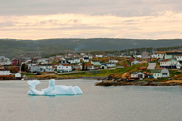
Boats and sheds in coastal fishing village during sunset in Newfoundland, Canada

Stairs with view on the water at Tracey Hill Trail in Red Bay, Labrador

scenery of tyre tracks through the tundra at Nain, Labradors most northern settlement
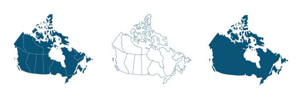
Simple map of Canada vector drawing. Mercator projection. Filled and outline version.

snowcapped mountains shot from the water, Torngat Mountains

Houses overhanging the Saint Johns bay, the easternmost settlement on the American continent.

Ramah Bay, Canadian arctic with bright red and orange tundra in foreground
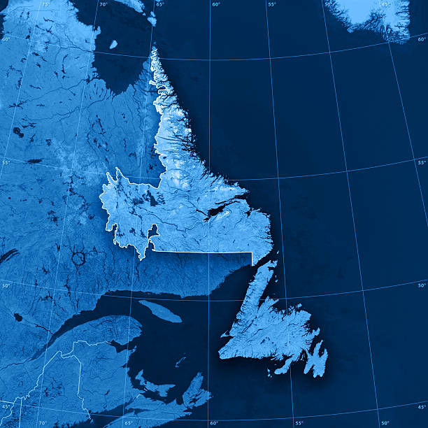
"3D render and image composing: Topographic Map of Newfoundland and Labrador, Canada. Including state borders, rivers and accurate longitude/latitude lines. High quality relief structure!Relief texture and satellite images courtesy of NASA. Further data source courtesy of CIA World Data Bank II database.Related images:"

Group of five people crossing the bridge in the nature

At left, an inukshuk, a stone figurine often seen in Canada's Inuit communties, marks a Postville property near the harbor.

The remote and very treacherous Pinware River in Labrador.

The remote Pinware River in Labrador viewed from high above.

Labrador and Newfoundland, Canada Early Morning View

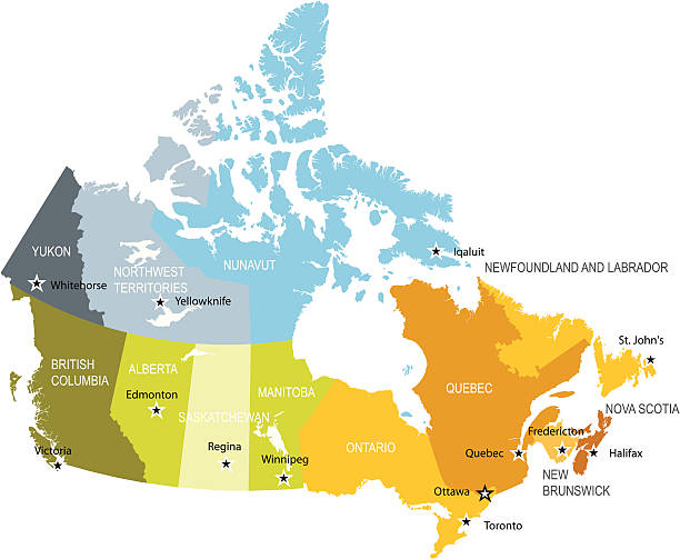
Canada, administrative divisions, political map. The ten provinces and three territories of Canada, with their borders and capitals. Country in North America, and second largest country of the world.

The rugged Pinware River in Labrador.

Newfoundland, Labrador - abandoned fishing village of Battle Cove

A Portrait of teenage girl petting golden retriever outside in sunset
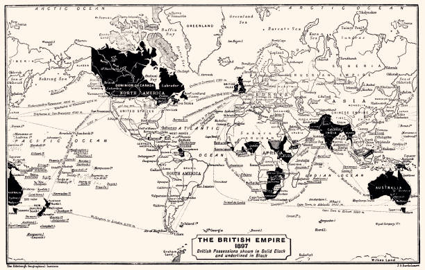
1897: The British Empire. British Possessions shown in Solid Black and underlined in Black. Vintage illustration circa late 19th century. Digital restoration by Pictore.

Aerial view of mountains in a winter landscape in Labrador, Canada.

Map of Canada divided into 10 provinces and 3 territories. Administrative regions of Canada. Blank multicolored map. Vector illustration.
Boat on the shoreline of the coast of Bonavista, Newfoundland, Canada

Sun sets in winter over tundra of Labrador.

Old boat and old Viking shield at the Viking settlers in L'Anse aux Meadows national historic site on the island of Newfoundland, Canada
The Provincial flags of Canada. All elements are grouped, layered and clearly labelled.
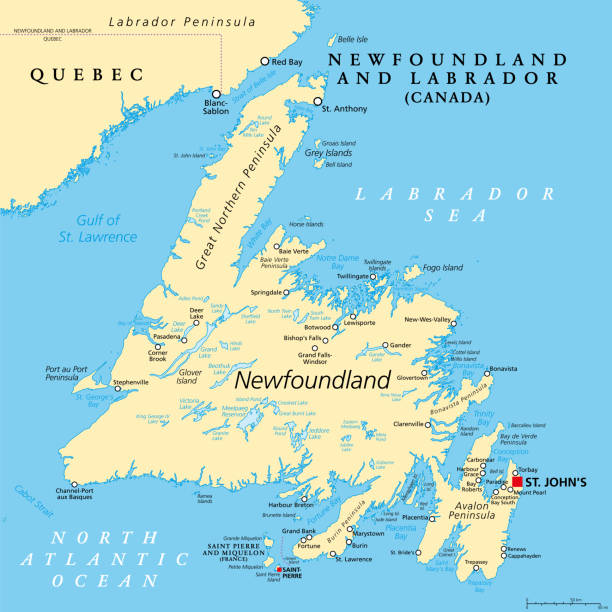
Island of Newfoundland, political map. Part of Canadian province of Newfoundland and Labrador with capital St. John's. Large island off the coast of mainland North America southwest of Labrador Sea.

A portrait of a mature woman outside on a wet spring day with her dog

A purebred golden retriever dog is showing the importance of animal dental health. In this frame the dog is holding a toothbrush in his mouth.

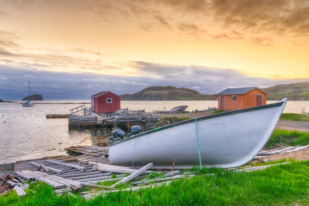
Fishing shack on the shore in foggy weather

A pet owner throws a stick in the lake & his dog jumps in.

A scenic view of a tranquil body of water with houses dotting the landscape. Battle Harbour, Labrador

An inukshuk, a traditional stone sculptures made by indigenous people in Labrador, Canada

Inuit town of cartwright labrador

Lonely road through wild lakes and woods
Detailed map of administrative divisions of Canada;

Quebec, largest province in the eastern part of Canada, political map. Largest province, located in Central Canada, with capital Quebec City and largest city Montreal, along the St. Lawrence River.

Vector Vintage Map of Canada with borders, cities and national flag.All elements are separated in editable layers

Lonely village on a remote island in rainy weather

Hopedale on a 1880's map. Hopedale is a town located in the North of Labrador, the mainland portion of the Canadian province of Newfoundland and Labrador. Selective focus and Canon EOS 5D Mark II with MP-E 65mm macro lens.

Canada map vector outline with borders and names of provinces and trritories, water bodies, capital location and name, Ottawa, and scales of miles and kilometers.

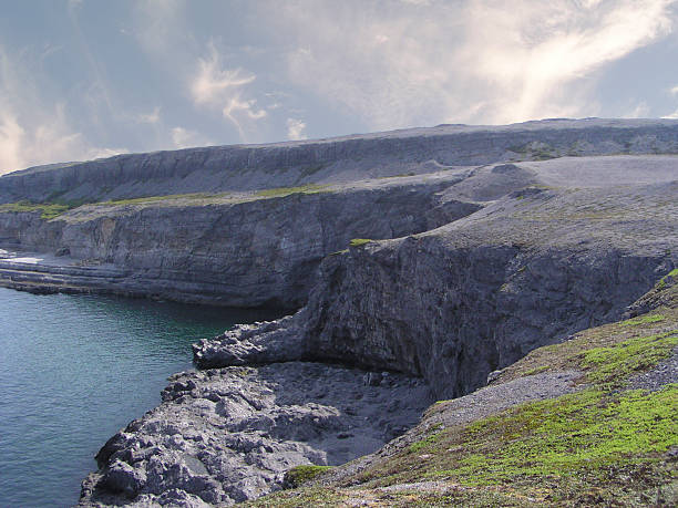
Rocky shore in rainy weather

Map of Canada divided into 10 provinces and 3 territories. Administrative regions of Canada with labels. Vector illustration.
© 2024 iStockphoto LP. The iStock design is a trademark of iStockphoto LP. Browse millions of high-quality stock photos, illustrations, and videos.
Do Not Sell or Share