Lake Ontario Aerial Pictures, Images and Stock Photos
Browse 4,800+ lake ontario aerial stock photos and images available, or start a new search to explore more stock photos and images.
Most popular
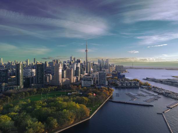
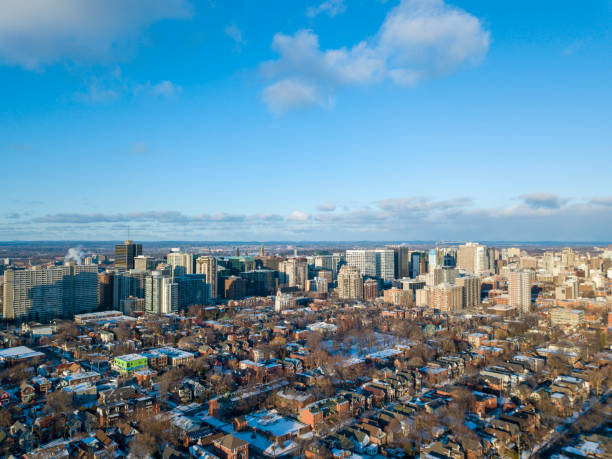
An aerial of Toronto city skyline, Ontario, Canada.
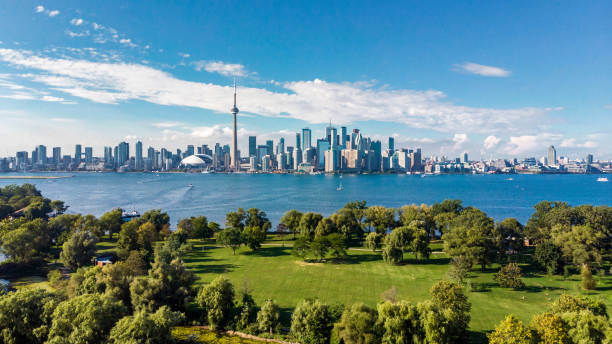
Toronto skyline and Lake Ontario aerial view, Toronto, Ontario, Canada.

3D Render of a Topographic Map of New England, North America. All source data is in the public domain. Color texture and Rivers: Made with Natural Earth. http://www.naturalearthdata.com/downloads/10m-raster-data/10m-cross-blend-hypso/ http://www.naturalearthdata.com/downloads/10m-physical-vectors/ Relief texture: SRTM data courtesy of USGS. URL of source image: https://e4ftl01.cr.usgs.gov//MODV6_Dal_D/SRTM/SRTMGL1.003/2000.02.11/ Water texture: HIU World Water Body Limits: http://geonode.state.gov/layers/?limit=100&offset=0&title__icontains=World%20Water%20Body%20Limits%20Detailed%202017Mar30


Wide Angle View looking south from the observation deck of the CN Tower. Visible is Centre Island and the Toronto City Centre Airport.
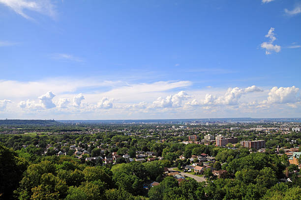
Pickering, Ontario, Canada.
Burlington, Canada.
St. Catharines, Canada.


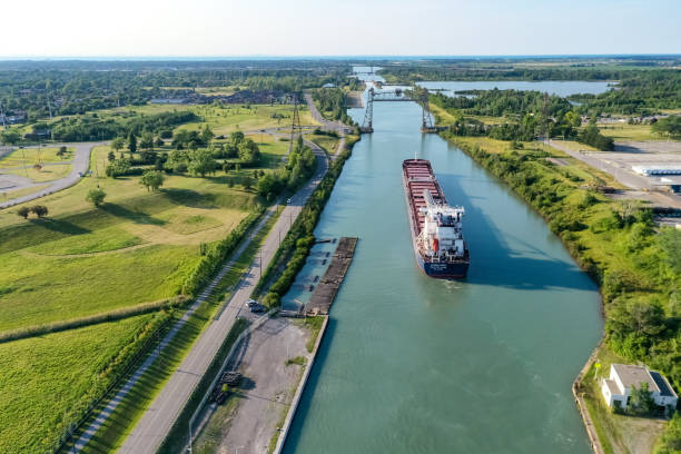
Clarkson Wastewater Treatment Plant, Petro-Canada Lubricants and Ash Grove Mississauga Cement Plant at Lake Ontario, Mississauga, Ontario, Canada.

3D Render of a Topographic Map of New England, North America. All source data is in the public domain. Color texture and Rivers: Made with Natural Earth. http://www.naturalearthdata.com/downloads/10m-raster-data/10m-cross-blend-hypso/ http://www.naturalearthdata.com/downloads/10m-physical-vectors/ Relief texture: SRTM data courtesy of USGS. URL of source image: https://e4ftl01.cr.usgs.gov//MODV6_Dal_D/SRTM/SRTMGL1.003/2000.02.11/ Water texture: HIU World Water Body Limits: http://geonode.state.gov/layers/?limit=100&offset=0&title__icontains=World%20Water%20Body%20Limits%20Detailed%202017Mar30
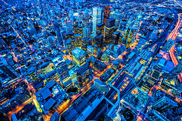
Toronto financial district cityscape at dusk, Ontario, Canada. View from CN tower. Selective focus in the middle of image. Check details on zoomed image.
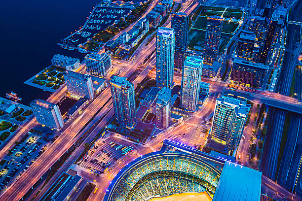
Toronto cityscape with baseball stadium at dusk, Ontario, Canada.

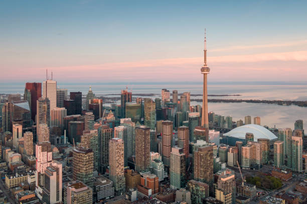
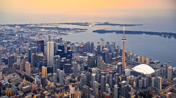
Aerial view of Toronto Financial District at sunset, Ontario, Canada.


Toronto, Canada.

"View from the top of the CN Tower looking over Centre Island, Skydome, and Lake Ontario."

Aerial photograph of white sand beaches and Lake Ontario in Sandbanks Provincial Park in Prince Edward County, Ontario

Aerial view of Toronto. .Toronto, Ontario, Canada
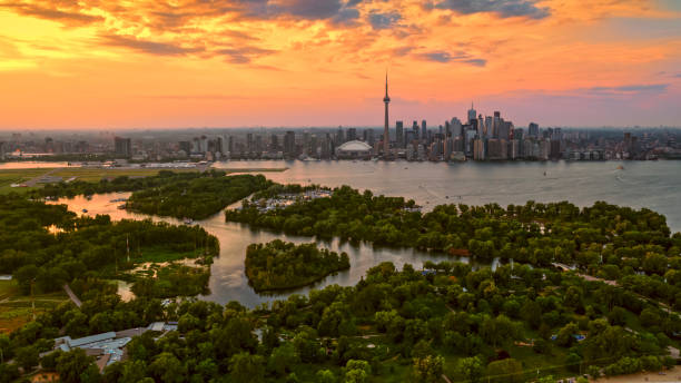
Aerial view of Toronto skyline from Toronto Island at sunset, Toronto, Ontario, Canada.
Aerial view of Colonel Sam Smith Park and harbour with Condominium towers in background, Etobicoke, Toronto, Ontario, Canada.
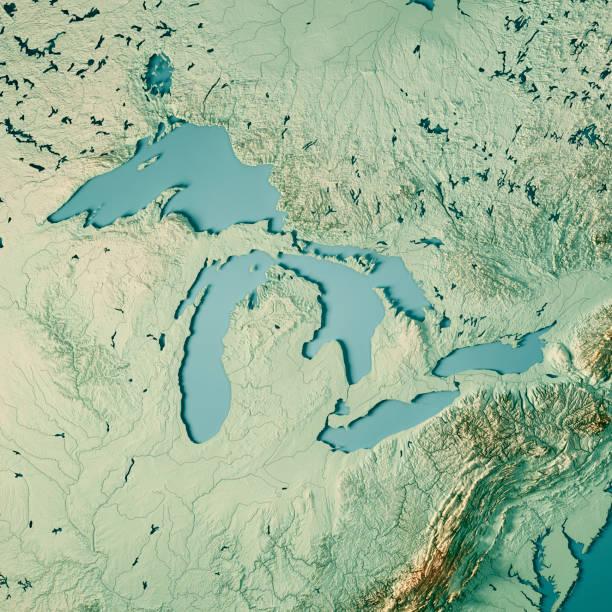
3D Render of a Topographic Map of the Great Lakes, USA and Canada. All source data is in the public domain. Color texture and Rivers: Made with Natural Earth. http://www.naturalearthdata.com/downloads/10m-raster-data/10m-cross-blend-hypso/ http://www.naturalearthdata.com/downloads/10m-physical-vectors/ Relief texture: SRTM data courtesy of USGS. URL of source image: https://e4ftl01.cr.usgs.gov//MODV6_Dal_D/SRTM/SRTMGL1.003/2000.02.11/ Water texture: HIU World Water Body Limits: http://geonode.state.gov/layers/?limit=100&offset=0&title__icontains=World%20Water%20Body%20Limits%20Detailed%202017Mar30

aerial view of the Pickering Nuclear Generating Station in Ontario Canada

St. Catharines, Canada.

aerial view of the Windsor bay park area along lake Ontario in Oshawa Ontario Canada
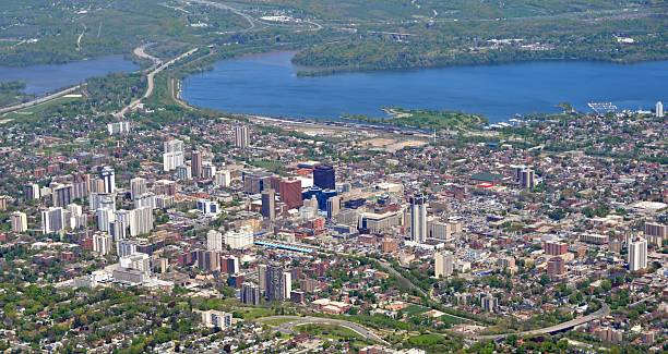
"panorama aerial view of downtown Hamilton, Ontario Canada"

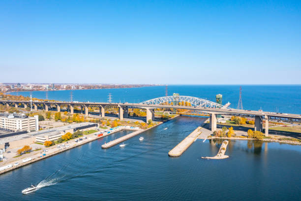
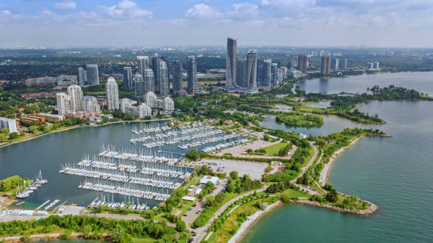
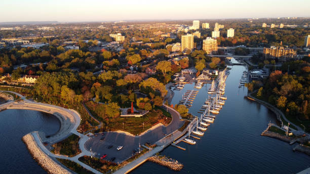
aerial view of the Harbour and marina in Oakville, Ontario Canada


Aerial view of Ontario city in California with mountains in the background, California, USA
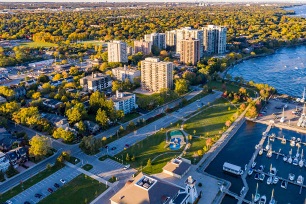
Oakville, Canada

3D Render of a Topographic Map of the Great Lakes, USA and Canada. All source data is in the public domain. Color texture and Rivers: Made with Natural Earth. http://www.naturalearthdata.com/downloads/10m-raster-data/10m-cross-blend-hypso/ http://www.naturalearthdata.com/downloads/10m-physical-vectors/ Relief texture: SRTM data courtesy of USGS. URL of source image: https://e4ftl01.cr.usgs.gov//MODV6_Dal_D/SRTM/SRTMGL1.003/2000.02.11/ Water texture: HIU World Water Body Limits: http://geonode.state.gov/layers/?limit=100&offset=0&title__icontains=World%20Water%20Body%20Limits%20Detailed%202017Mar30


Toronto cityscape with CN Tower and baseball stadium at dusk, Ontario, Canada.
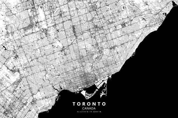
Poster Style Topographic / Road map of Toronto, Ontario, Canada. Original map data is open data via © OpenStreetMap contributors. All maps are layered and easy to edit. Roads are editable stroke.

Aerial view of modern cityscape with CN Tower and Rogers Centre stadium at sunset, Toronto, Ontario, Canada.

3D Render of a Topographic Map of Toronto, Canada. Contains modified Copernicus Sentinel data (2016) courtesy of ESA. URL of source image: https://scihub.copernicus.eu/dhus/#/home. Relief texture SRTM data courtesy of NASA. URL of source image: http://reverb.echo.nasa.gov The source data is in the public domain.
Aerial view of modern cityscape with CN Tower and Rogers Centre stadium at sunset, Toronto, Ontario, Canada.

Ontario, Canada.

Ontario,Canada.

Oakville, Canada
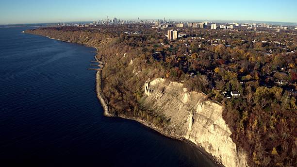
Aerial view of Scarborough Bluffer's Park with Toronto downtown as far away background.

Ontario, Canada.
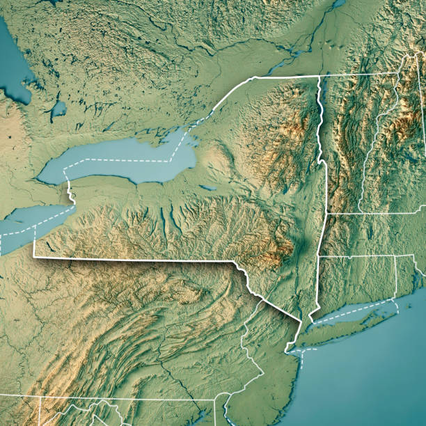
3D Render of a Topographic Map of the State of New York, USA. All source data is in the public domain. Color texture: Made with Natural Earth. http://www.naturalearthdata.com/downloads/10m-raster-data/10m-cross-blend-hypso/ Boundaries Level 1: USGS, National Map, National Boundary Data. https://viewer.nationalmap.gov/basic/#productSearch Relief texture and Rivers: SRTM data courtesy of USGS. URL of source image: https://e4ftl01.cr.usgs.gov//MODV6_Dal_D/SRTM/SRTMGL1.003/2000.02.11/ Water texture: SRTM Water Body SWDB: https://dds.cr.usgs.gov/srtm/version2_1/SWBD/

An aerial view of Lake Ontario and the beaches with Ashbridges Bay and downtown Toronto visible.


aerial view of the Hospital along the shore of Lake Ontario, Burlington Ontario Canada

Aerial view of the City of Hamilton including Stoney Creek with Niagara Escarpment on the left and Lake Ontario on the right

Next